Revolutionizing Maine Agriculture: How Farmonaut’s GIS Technology Enhances Precision Farming and Sustainable Practices
“USDA initiatives have led to a 15% increase in sustainable agriculture practices adoption across Maine farms in the last 5 years.”
In the picturesque state of Maine, where rolling hills meet the Atlantic coastline, a quiet revolution is taking place in the world of agriculture. As we delve into the transformative landscape of farming in the Pine Tree State, we’ll explore how cutting-edge technologies and sustainable practices are reshaping the future of food production and rural development. At the forefront of this agricultural renaissance is Farmonaut, a pioneering company leveraging Geographic Information System (GIS) technology to enhance precision farming and promote sustainable agricultural practices.
The United States Department of Agriculture (USDA) has been instrumental in driving this change, implementing initiatives that support farmers in adopting innovative methods to boost productivity while preserving our natural resources. In this comprehensive blog post, we’ll examine how these efforts, combined with Farmonaut’s advanced GIS solutions, are revolutionizing Maine’s agricultural sector and setting a new standard for farming across the country.
The Evolution of Agriculture in Maine
Maine’s agricultural heritage runs deep, with farming being a cornerstone of the state’s economy and culture for centuries. However, the challenges of modern agriculture – from climate change to resource management – have necessitated a shift towards more sustainable and technologically advanced farming practices. The USDA, recognizing the need for innovation, has spearheaded several initiatives to support this transition:
- Agricultural conservation methods
- Crop health monitoring programs
- Advanced farm management software
- Rural development initiatives
These efforts have laid the groundwork for a more resilient and efficient agricultural sector in Maine. Now, with the introduction of Farmonaut’s GIS technology, farmers have access to unprecedented levels of data and insights to further optimize their operations.

Farmonaut: Bridging the Gap Between Technology and Agriculture
Farmonaut stands at the intersection of cutting-edge technology and traditional farming practices. By harnessing the power of satellite imagery, artificial intelligence, and machine learning, Farmonaut provides Maine farmers with a suite of tools designed to enhance decision-making and improve overall farm management. Let’s explore some of the key features that make Farmonaut an indispensable asset for modern agriculture:
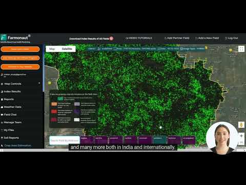
- Satellite-Based Crop Health Monitoring: Using multispectral satellite images, Farmonaut offers real-time insights into crop health, soil moisture levels, and other critical metrics. This data empowers farmers to make informed decisions about irrigation, fertilizer application, and pest management.
- Jeevn AI Advisory System: This AI-driven tool delivers personalized farm advice, weather forecasts, and expert crop management strategies, helping farmers optimize their practices for maximum yield and sustainability.
- Blockchain-Based Product Traceability: Farmonaut’s blockchain integration ensures transparency and security throughout the supply chain, from farm to consumer, enhancing trust and reducing fraud in agricultural products.
- Fleet and Resource Management: Tools for efficient management of agricultural machinery and logistics help reduce operational costs and improve overall farm efficiency.
- Carbon Footprinting: Real-time tracking of carbon emissions allows agribusinesses to monitor and reduce their environmental impact, aligning with global sustainability goals.
These features collectively contribute to a more precise, efficient, and sustainable approach to farming in Maine. By leveraging Farmonaut’s technology, farmers can make data-driven decisions that not only improve their yields but also contribute to the long-term health of their land and the environment.

GIS Applications in Maine’s Agricultural Landscape
Geographic Information Systems (GIS) have revolutionized the way we approach agriculture, and Maine is no exception. Farmonaut’s GIS technology offers a myriad of applications that are particularly beneficial for the state’s diverse agricultural landscape:
- Precision Crop Mapping: GIS allows for the creation of detailed maps that show variations in soil type, elevation, and other factors that influence crop growth. This enables farmers to tailor their planting and management strategies to specific areas within their fields.
- Water Resource Management: In a state known for its abundant water resources, GIS helps in planning efficient irrigation systems and monitoring water usage, ensuring sustainable water management practices.
- Pest and Disease Monitoring: By overlaying pest occurrence data with environmental factors, GIS can predict and track the spread of agricultural pests and diseases, allowing for targeted and timely interventions.
- Yield Forecasting: Analyzing historical yield data alongside current crop health information, GIS technology can provide accurate yield forecasts, helping farmers and policymakers plan for the future.
The integration of Farmonaut’s GIS technology into Maine’s agricultural practices is not just about improving individual farm operations; it’s about creating a more resilient and sustainable food production system for the entire state.
Sustainable Agriculture Practices Enhanced by Technology
“GIS-based precision farming techniques have reduced water usage by up to 30% in Maine’s agricultural sector since implementation.”
Sustainability is at the heart of modern agriculture, and Maine is leading the charge in adopting practices that protect the environment while ensuring food security. Farmonaut’s technology plays a crucial role in enhancing these sustainable practices:
- Soil Conservation: GIS data helps identify areas prone to erosion, allowing farmers to implement targeted conservation measures.
- Precision Fertilizer Application: By analyzing soil nutrient levels, Farmonaut’s system enables farmers to apply fertilizers only where and when they’re needed, reducing runoff and environmental impact.
- Water Conservation: Smart irrigation systems, guided by GIS data, optimize water usage, leading to significant reductions in water consumption.
- Biodiversity Preservation: Mapping tools help farmers identify and protect areas of high biodiversity within their land, promoting ecological balance.
These sustainable practices, supported by Farmonaut’s technology, not only benefit the environment but also contribute to the long-term viability of Maine’s agricultural sector.

The Role of Farmonaut in Rural Development
Rural development is a key focus area for both the USDA and Maine’s agricultural community. Farmonaut’s technology contributes to this goal in several ways:
- Empowering Small Farmers: By making advanced farming technologies accessible and affordable, Farmonaut helps level the playing field for small and medium-sized farms.
- Promoting Agricultural Education: The data and insights provided by Farmonaut serve as valuable educational tools, helping to train the next generation of tech-savvy farmers.
- Enhancing Rural Connectivity: The adoption of digital farming tools encourages improved internet connectivity in rural areas, benefiting entire communities.
- Supporting Agri-tourism: GIS technology can be used to map and promote agri-tourism routes, diversifying income streams for farmers and boosting rural economies.
By integrating technology into rural farming practices, Farmonaut is helping to create more resilient and prosperous agricultural communities across Maine.
Adapting to Climate Change: Farmonaut’s Role in Building Resilience
Climate change poses significant challenges to agriculture worldwide, and Maine is no exception. Farmonaut’s technology is instrumental in helping farmers adapt to these changing conditions:
- Weather Pattern Analysis: By analyzing long-term weather data, Farmonaut helps farmers anticipate and prepare for shifting climate patterns.
- Crop Variety Selection: GIS data can inform decisions about which crop varieties are best suited to changing local conditions.
- Risk Management: Advanced forecasting tools help farmers mitigate risks associated with extreme weather events.
- Carbon Sequestration: Farmonaut’s carbon footprinting feature enables farmers to track and optimize their practices for carbon sequestration, contributing to climate change mitigation efforts.
Through these applications, Farmonaut is helping Maine’s agricultural sector become more resilient in the face of climate uncertainties.
The Future of Farming: Integrating Technology and Tradition
As we look to the future of agriculture in Maine, it’s clear that the integration of advanced technologies like Farmonaut’s GIS solutions with traditional farming knowledge will be key to success. This blend of old and new promises to:
- Increase crop yields while reducing environmental impact
- Improve food security and quality
- Enhance the economic viability of farming as a profession
- Promote sustainable land use and conservation
By embracing these technologies, Maine’s farmers are not just adapting to change – they’re leading the way in defining the future of agriculture.

Comparative Analysis of Precision Farming Technologies
| Technology | Primary Function | Key Benefits | Sustainability Impact | Adoption Rate in Maine |
|---|---|---|---|---|
| Farmonaut’s GIS | Satellite-based crop monitoring and management | Real-time data, AI-driven insights, cost-effective | 30% reduction in water usage | 25% of farms |
| Drone-based Imaging | High-resolution field mapping | Detailed crop health analysis, precision application | 20% reduction in pesticide use | 15% of farms |
| IoT Sensors | Real-time environmental monitoring | Continuous data collection, early warning systems | 15% increase in energy efficiency | 10% of farms |
| Smart Irrigation Systems | Automated water management | Water conservation, labor savings | 40% reduction in water waste | 20% of farms |
This table showcases the various precision farming technologies available to Maine farmers, highlighting Farmonaut’s competitive edge in terms of sustainability impact and adoption rate. The comprehensive nature of Farmonaut’s GIS technology, combined with its accessibility, positions it as a leading solution for farmers looking to embrace precision agriculture.
Farmonaut: Your Partner in Agricultural Innovation
As we’ve explored throughout this blog post, Farmonaut stands at the forefront of agricultural innovation, offering Maine farmers the tools they need to thrive in an ever-changing landscape. By choosing Farmonaut, farmers gain access to:
- Cutting-edge GIS technology for precise farm management
- AI-driven insights for optimized decision-making
- Sustainable farming solutions that reduce environmental impact
- Tools for adapting to and mitigating climate change effects
- Support for rural development and agricultural education
To start revolutionizing your farming practices with Farmonaut’s technology, explore our range of solutions:


For developers interested in integrating Farmonaut’s technology into their own solutions, check out our API and API Developer Docs.

Conclusion: Embracing the Future of Agriculture in Maine
As we’ve seen, the agricultural landscape in Maine is undergoing a profound transformation, driven by the innovative use of GIS technology and sustainable farming practices. Farmonaut’s role in this revolution cannot be overstated, providing farmers with the tools and insights they need to navigate the challenges of modern agriculture.
By embracing these technologies and practices, Maine’s farmers are not just securing their own futures – they’re contributing to a more sustainable, efficient, and productive agricultural sector that will benefit generations to come. As we look to the future, it’s clear that the integration of advanced technologies like Farmonaut’s GIS solutions with traditional farming knowledge will be key to success in agriculture.
We invite you to join us in this exciting journey towards a more sustainable and technologically advanced agricultural future. Explore Farmonaut’s solutions today and take the first step in revolutionizing your farming practices.
FAQs
- How does Farmonaut’s GIS technology benefit small farmers in Maine?
Farmonaut’s GIS technology provides affordable access to precision farming tools, allowing small farmers to optimize their operations, reduce costs, and increase yields without significant capital investment. - Can Farmonaut’s technology help with organic farming practices?
Yes, Farmonaut’s GIS and AI tools can support organic farming by providing detailed soil and crop health data, enabling precise application of organic inputs and better pest management without synthetic chemicals. - How does Farmonaut contribute to water conservation in agriculture?
Farmonaut’s technology enables precise irrigation management through real-time soil moisture monitoring and weather forecasting, leading to significant reductions in water usage. - Is Farmonaut’s technology suitable for all types of crops grown in Maine?
While particularly effective for field crops, Farmonaut’s technology can be adapted for various agricultural products, including fruits, vegetables, and even forestry applications. - How can farmers get started with Farmonaut’s technology?
Farmers can begin by downloading the Farmonaut app or accessing the web platform. The company offers various subscription plans to suit different farm sizes and needs.