May 2023

Farmonaut is Digitizing Plantation with Godrej Agrovet

DIGITIZING PLANTATION WITH Farmonaut, in collaboration with Godrej Agrovet, has been using its advanced technologies to offer technological plantation services aimed at mapping over 15,000 farmer fields and gathering farm-level data for these fields. This initiative has allowed Godrej Agrovet to enhance its agricultural practices, resulting in improved crop yields, reduced costs, and increased profitability. Farmonaut, a leading provider of advanced agricultural technologies, has been collaborating with Godrej Agrovet for over two years. Godrej Agrovet is a part of the Godrej Group, one of India’s largest diversified conglomerates. Farmonaut’s collaboration with Godrej Agrovet has resulted in significant improvements in crop yields and overall agricultural efficiency. Over the course of the two-year collaboration, Farmonaut has helped Godrej Agrovet digitize its farming operations, resulting in the digitization of over 160,000 farms. This has helped to streamline operations, reduce errors, and increase productivity, ultimately leading to increased profitability for Godrej Agrovet. Adopting Farmonaut’s mapping and monitoring services allowed Agrovet to successfully map and monitor over 100,000 acres of farmland with utmost scalability and effectiveness. In addition, Farmonaut could also assist Agrovet, in achieving a total tree count over 200,000. The company’s technology-driven approach has allowed for the precise counting of trees across vast areas, providing accurate data on tree density and distribution. Farmonaut’s technologies have also helped Godrej Agrovet to adopt more sustainable farming practices. By leveraging data on soil quality and weather conditions, for example, Godrej Agrovet has been able to optimize its use of fertilizers and pesticides, reducing the overall amount of chemicals used and improving the environmental sustainability of its operations. Overall, Farmonaut’s collaboration with Godrej Agrovet is a testament to the power of advanced agricultural technologies in transforming the agricultural industry. With its cutting-edge Farmonaut® technologies, Farmonaut is also helping farmers to improve crop yields, reduce costs, and adopt more sustainable farming practices, ultimately leading to a more prosperous and sustainable agricultural industry. Farmonaut earns high plaudits to have witnessed the favorable outcomes of their services on Godrej Agrovet’s operations and to have influenced the corelative expansion.

Potato Farming Mapping in Madhya Pradesh by Farmonaut

POTATO MAPPING IN MADHYA PRADESH by Farmonaut Potatoes are a staple crop in India and are grown extensively across the country. Madhya Pradesh, a state in central India, is one of the leading potato-producing states in the country with a total potato cultivation area of over 85,000 hectares. To ensure optimal potato farming and yield, it is important to have accurate information about the potato farms, including their location, size, and crop health. Keeping track of potato farms in Madhya Pradesh can be a challenging task, but with the help of advanced technology, it is now possible to map potato farms accurately. This is where the Farmonaut potato farm mapping service comes in. Farmonaut is a digital agriculture company that offers a range of mapping services for farmers. The company uses satellite imagery and machine learning algorithms to provide farmers with accurate and up-to-date information about their crops, allowing them to make more informed decisions about planting, fertilizing, and harvesting. Farmonaut has developed a potato farm mapping service that is tailored for the potato farmers of Madhya Pradesh. The service relies on high-quality satellite imagery to produce precise maps of potato fields, which encompass details about the condition of the soil, crop density, and overall health of the plants. These maps are further scrutinized by advanced machine learning algorithms to generate practical recommendations that farmers can use to enhance their potato cultivation procedures. MERITS: Improved crop management Increased yields Enhanced sustainability Reduced costs Better decision making “Potato farm mapping is a process of creating a visual representation of a potato farm, including the location of fields, soil types, water sources, drainage systems, and other features that can affect potato farming. This mapping is done using geographic information systems (GIS) and other mapping technologies that can help farmers make informed decisions about their production.” Assets of Farmonaut’s Potato Farm mapping Services A significant advantage of the Farmonaut potato farm mapping service is that it furnishes farmers with current data about their crops. This empowers farmers to make well-informed decisions regarding planting, fertilization, and harvesting based on the latest details about the health and growth of their potato plants. As a result, farmers can enhance their crop yields and augment their profitability by leveraging this data to make critical decisions. Moreover, the Farmonaut potato farm mapping service not only provides real-time information but also assists farmers in spotting any underperforming areas in their fields. Through analysis of data about soil health, crop density, and overall plant health, the service helps farmers to identify areas where crops may not be thriving and offers advice on how to tackle these concerns. The purpose of potato farm mapping is to help farmers and other stakeholders make more informed decisions about potato production. By visualizing the layout and characteristics of a potato farm, farmers can identify areas where improvements can be made, optimize planting and irrigation strategies, and reduce the risk of crop loss due to factors such as pests, disease, or weather. In other words, Potato farm mapping can be used to: track the progress of a crop over time monitor changes in soil or water quality identify areas of the farm that require maintenance or repair Overall, the Farmonaut potato farm mapping service is a powerful tool for potato farmers in Madhya Pradesh. By providing real-time information and actionable insights, the service helps farmers to optimize their potato cultivation process, improve crop yields, and increase their profitability. As potato farming becomes increasingly competitive, services like this will be essential for farmers who want to stay ahead of the curve and succeed in this challenging industry. Steps involved in the process of potato farm mapping and collecting ground truthing data for potato area estimation in Madhya Pradesh. 1. Planning and preparation This step involves identifying the potato farming areas in Madhya Pradesh that need to be mapped. It may require coordination between agricultural departments, research institutions, and farmers’ associations. The necessary resources and personnel are allocated for the mapping project. 2. Field Visit and Data Collection Trained personnel visit the potato farms in the identified areas. They carry out detailed field visits to collect data on various aspects of the farms. This includes using GPS devices or other accurate measurement tools to mark the boundaries of the potato fields. 3. Boundary marking and Field mapping The personnel mark the boundaries of the potato fields using GPS coordinates or other precise measurements. This helps create an accurate representation of the fields on the map. The size and shape of each field are recorded, along with any distinguishing features or characteristics. 4. Data Recording During the field visits, data on various farm features are recorded. This includes information on soil types, water sources, irrigation systems, drainage patterns, and any other relevant factors that can impact potato farming. The data is recorded systematically and in a standardized format to ensure consistency. 5. Data Analysis and Mapping Once the field data is collected, it is compiled and analyzed. The collected data is then combined with remote sensing data, such as satellite imagery, to create detailed maps of each potato farm. GIS software or other mapping tools are used to process and visualize the data accurately. 6. Ground truthing validation The ground truthing data collected during the field visits is compared and validated with the remote sensing data. This step helps ensure the accuracy and reliability of the mapping results. Any discrepancies or errors are identified and corrected to improve the quality of the potato farm maps. 7. Area Estimation The accurate boundaries and features of the potato fields, along with the ground truthing data, are used to estimate the total area under potato cultivation in Madhya Pradesh. Statistical analysis or modeling techniques may be employed to extrapolate the data and provide reliable estimates of the potato crop’s area. 8. Utilization of mapping data The generated potato farm maps and area estimation data are used by farmers, policymakers, researchers, and other stakeholders. Farmers can use the maps to make

Blockchain based Traceability Solution by Farmonaut

BLOCKCHAIN BASED TRACEABILITY SOLUTION by Farmonaut The Blockchain-based traceability solution provided by Farmonaut® is a novel strategy for supply chain traceability powered by Hyperledger Fabric, ensuring a secure and transparent network for tracking the movement and origin of goods or product. This can be administered in a multitude of sectors including agriculture, textiles, automotive , pharmaceutical, luxury goods, and many more. A blockchain-based traceability solution is a system that uses blockchain technology to track and record the movement of goods and services from their point of origin to their final destination. This solution offers a way to increase transparency, trust, and accountability in supply chains and other industries. Farmonaut® has developed the traceability solution in such a way that, it outsmarts the conventional methods of tracking and recording the movement of a product. Farmonaut® stipulates a plethora of benefits viz, increased transparency, improved efficiency, enhanced security, better risk management, compliance with regulations and increased sustainability. SECURED AND MOST TRUSTED FORM OF TRACEABILITY Farmonaut® has been propelling in the arena of Blockchain based traceability over an year, providing coherent solutions to enable business efficacy. The traceability solution developed by Farmonaut® works by perfectly curating each and every stage of supply chain right from the point of origin to the point of consumption. Benefits of Farmonaut’s blockchain based traceability? Traceability is essential for businesses because it provides a way to track the movement of goods and services throughout the supply chain. This can help businesses to improve efficiency, reduce costs, and increase customer satisfaction. Additionally, it can help them to comply with regulations, improve quality control, better manage risk, and improve transparency. By implementing traceability solutions, businesses can gain a competitive edge in today’s fast-paced and demanding marketplace. How does Farmonaut®’s Blockchain based Traceability Solution System Works? A blockchain-based traceability system works by using blockchain technology. It typically works by : Collecting data about the movement of goods and services, including information such as, the date and time of their movement, and the parties involved in the transaction. Followed by Data encrytion, where the data is encrypted using advanced cryptographic algorithms, ensuring that it cannot be tampered with or altered in any way. The encrypted data is then stored on a distributed and decentralized blockchain network, where it is maintained by a network of nodes. Further the system may use smart contracts to automate the tracking and recording of data. Smart contracts are self-executing contracts that can be programmed to trigger certain actions when certain conditions are met. Finally, The system may provide a user interface that enables stakeholders to access and analyze the data in real-time, providing complete transparency throughout the supply chain. “This traceability solution that can be adopted in various supply chains, including food, dairy, textile, automotive, pharmaceutical, luxury goods, and many more.” Farmonaut®’s History with Traceability Solutions to Fashion Industry: Once an year, Farmonaut® has been offering blockchain based traceability solutions to the fashion industry with utmost potency with emphasis on bio-diversity. This technology is powered by Hyperledger Fabric, which is a permissioned blockchain platform designed for enterprise use. It is one of the projects under the Hyperledger umbrella, which is an open-source community led by the Linux Foundation focused on developing blockchain technologies for various industries. This particular scientific advancement has been widely appreciated by the clients for its ubiquitous application, reliability, security, and convenient usage. This resolution offered by Farmonaut®, permits real-time visibility into your supply chain, enabling you to make informed decisions about your business operations. For a German Textile Industry which deals majorly with cotton and cotton farms, in order to provide a reliable and trusted solution, Farmonaut is providing 3 services since May 2021 as a solution to solve problems faced by the textile industry: Satellite based Crop Health Monitoring, Blockchain based Traceability and Land Use Land Classification. Therefore why wait? Join the Farmonaut® community and experience the power of blockchain-based traceability! Explore, the robust and flexible blockchain blockchain performance with Farmonaut® integrated with Hyperledger Fabric, that can be used for various enterprise use cases, such as supply chain management, digital identity, and trade finance. Farmonaut®, assures the most secured and trusted form of traceability +91 6366026267 [email protected] www.farmonaut.com

Farmonaut is Digitizing Businesses in NIGERIA with LinxAg

DIGITIZING BUSINESSES IN NIGERIA Farmonaut® and LinxAg, two companies with expertise in digitization and spatial analysis, have joined forces to computerize businesses in Nigeria. The partnership aims to improve the efficiency and productivity of enterprises in various sectors, including agriculture, real estate, logistics and many more.   LinxAg, is a Nigerian firm that offers geospatial solutions to businesses. The company leverages geographic information systems (GIS) and remote sensing technologies to provide location-based insights and decision-making support. The partnership between Farmonaut® and LinxAg brings together their respective strengths and creates new opportunities for businesses in Nigeria. The joint venture aims to provide comprehensive solutions that integrate remote sensing, GIS, and AI-based analytics. By combining these technologies, the partnership can offer businesses a more complete view of their operations and help them identify areas for optimization. HOW THIS TASK IS ACCOMPLISHED? – Bizterrain APP A mobile app and web application named “Bizterrain” has been created by LinxAg to serve both small and large businesses. Using the mobile application, the app can gather data such as: Boundaries of the business location Details of the shop Information about the owner Contact details These data can be easily accessed by the users of the application. Furthermore, if any modifications occur, such as a change in the business’s location or other details, the information can be conveniently edited. The mobile application is versatile and can perform all tasks, including data capture, access, and editing. On the other hand, the web application cannot capture data but can easily access and edit existing data. The Bizterrain App The application includes four main tabs, which are the Dashboard, Analytics, Report, and Profile sections. Dashboard The Dashboard is the main tab of the application, providing users with a bird’s eye view of their businesses. It displays essential information about the business, including the total number of registered businesses, registered users, and the total revenue generated. Analytics The Analytics tab provides businesses with valuable insights and data-driven analysis of their business activities. This tab includes detailed reports on various aspects of the business, such as sales, customers, inventory, and marketing campaigns. Report The Report tab allows users to generate customized reports based on their specific business needs. The reports can be tailored to include specific data fields, such as sales figures, customer demographics, or inventory data. Profile The user’s profile can be accessed on this page, allowing them to modify their password and update their information. This tab enables users to change their login credentials and submit their profile information. This app can be deployed by: Government: One of the primary use cases of Bizterrain by the Nigerian government is in the area of land administration. The application allows government officials to capture detailed information about land boundaries, ownership, and usage. This information can then be used to manage land ownership disputes and to facilitate the distribution of land to farmers and other stakeholders. By using Bizterrain, the government can improve its land management practices and ensure that land is used more efficiently. If the government decides to launch a program and establish eligibility criteria, the Bizterrain application can be utilized to identify individuals’ profiles and estimate the number of eligible individuals for the program. For instance, if the government plans to introduce a scheme for women, they can utilize the application to estimate the number of eligible women in a specific region. Large Company Owners: Big corporations can reap significant advantages by utilizing the application as it enables them to engage with small business owners at a reasonable cost. For instance, if a prominent clothing brand wishes to collaborate with tailors in a specific region, they can easily acquire tailor contacts through the application and initiate local collaborations at reasonable prices. The filter feature of the application enhances user convenience by enabling them to find the necessary contacts effortlessly. Additionally, the map view displaying the location information is useful for storing excess inventory in warehouses located in different regions. Small Business: Small businesses have the option to create their profiles on the application, which can provide them with opportunities to collaborate with prominent corporations. This collaboration can enable them to generate passive income at a better cost. +91 6366026267 [email protected] www.farmonaut.com

Farmonaut: Among top 10 Agricultural Input Trends (2023) by StartUs Insights

Farmonaut is one among the top game changers Farmonaut is a rapidly growing startup that specializes in using satellite imagery and data analytics to provide farmers with valuable insights into their crops and soil health. Their innovative approach to agriculture has caught the attention of industry experts, investors, and now, leading startup publication StartUs Insights. StartUs Insights is a leading startup publication and innovation network based in Austria. The company provides news, insights, and analysis on the latest trends and developments in the startup ecosystem, with a focus on emerging technologies and industries Recently, StartUs Insights conducted a survey to examine how newly emerging agritech startups are enhancing agricultural inputs. This research, which was data-driven, focused on 1,678 startups and scaleups advancing agricultural inputs, provides insights into the technological solutions featured on the Agricultural Inputs Innovation Map. These include digital agriculture, nanotechnology, biologicals, variable rate technology, and other related solutions. In this report, they covered Farmonaut as one of the leaders in Satellite Driven Agriculture. Technological advancements in agricultural inputs have revolutionized the way farmers grow crops, increasing yields and efficiency while reducing the use of harmful chemicals and environmental impact. Moreover, it has also helped to improve global food security and sustainability. In this contemporary epoch, startups emerging with sophisticated technology to upgarde agricultural practices can certainly bring a paradigm shift. This research by StartUs was conducted to provide an overview about the agricultural inputs that can metamorphose farming sector. Farmonaut was noted for its contribution to agriculture sector, incorporating Satellite based inputs. StartUs features Farmonaut as an Indian Startup, that provides a platform that monitors farmlands and offers farmers access to satellite data directly. By integrating with existing systems via an application programming interface (API), the startup can receive satellite data, which enables farmers to access satellite-based crop health monitoring and field mapping services. The platform also aids in identifying locations where plant water stress and soil moisture are low. Moreover, farmers can use the startup’s platform to track farm inputs, including seeds, fertilizers, and plant protection products. Top 10 Agricultural Inputs Trends in 2023 Digital Agriculture Nanotechnology Biologicals Drones Agricultural Sensors Variable Rate Technology Genomics Satellite-based Inputs Agricultural Robotics Agricultural Analytics The coverage from StartUs Insights is a testament to Farmonaut’s commitment to revolutionizing the agriculture industry through the use of cutting-edge technology. With its user-friendly platform and advanced analytics, Farmonaut has quickly become a go-to resource for farmers who want to optimize their crop yields while minimizing their environmental impact. Farmonaut’s success is due in no small part to its team of dedicated and talented individuals who are passionate about using technology to solve real-world problems. The company’s founders, have a deep understanding of the challenges facing farmers today, having grown up in families that relied on agriculture for their livelihoods.

Farmonaut Joins ABI-ICRISAT

Farmonaut Joins ABI-ICRISAT Farmonaut, has recently become a member of the Agri-Business Incubator of ICRISAT. This membership will undoubtedly bring many benefits to the company, including access to funding, mentorship, and technical support. ICRISAT The International Crops Research Institute for the Semi-Arid Tropics (ICRISAT) is a non-profit, non-political organization that aims to improve the livelihoods of smallholder farmers in the semi-arid tropics through agricultural research for development. ABI-ICRISAT The Agri-Business Incubator of ICRISAT (ABI-ICRISAT) is a platform established by the International Crops Research Institute for the Semi-Arid Tropics (ICRISAT) in collaboration with the National Science & Technology Entrepreneurship Development Board (NSTEDB) of the Indian government, in the year 2003. The ABI-ICRISAT is located at the ICRISAT headquarters in Patancheru, Hyderabad, India, and operates as a not-for-profit incubator. The ABI-ICRISAT is headed by a Chief Operating Officer (COO) and is governed by a Board of Advisors consisting of experienced entrepreneurs, investors, and industry experts. The COO is responsible for overseeing the day-to-day operations of the ABI-ICRISAT, while the Board of Advisors provides strategic guidance and support to the incubator. The primary aim of the ABI-ICRISAT is to support innovative agri-entrepreneurs by providing them with a range of services, including: mentorship technical support access to funding business incubation facilities. The ABI-ICRISAT helps start-ups develop and scale up their businesses, with a focus on addressing challenges in the agricultural sector and improving the livelihoods of smallholder farmers in the semi-arid tropics.  Becoming a member of the Agri-Business Incubator is a significant milestone for Farmonaut. This partnership will provide the company with the support it needs to scale up its operations and reach more farmers. The ABI will help Farmonaut access funding, mentorship, and technical support, which will be critical in developing and launching new products and services. The ABI provides support to start-ups that are focused on addressing challenges in the agricultural sector. What Perks are waiting for Farmonaut? One of the most significant benefits of joining the ABI is access to funding. The ABI provides start-ups with access to seed funding, which can help them cover their initial costs and develop their products. Farmonaut can use this funding to hire more staff, develop new products, and expand its operations. Additionally, the ABI provides start-ups with access to investors, which can help them secure additional funding in the future. Secondly, ABI-ICRISAT provides start-ups with access to business incubation facilities. These facilities include co-working spaces, laboratories, and testing facilities that can help start-ups develop, test, and refine their products and services. These facilities are equipped with state-of-the-art equipment and are designed to support the unique needs of agri-entrepreneurs. Mentorship is another significant benefit of joining the ABI. Start-ups that join the ABI have access to a network of experienced mentors who can provide guidance and advice on various aspects of running a business. Farmonaut can benefit from the mentorship program by receiving guidance on product development, marketing, and sales. The ABI’s mentors can also provide valuable connections to potential partners, customers, and investors. Overall, becoming a member of the Agri-Business Incubator of ICRISAT provides Farmonaut with a range of benefits that can help them accelerate their growth and achieve their goals. The access to mentorship, technical support, funding opportunities, and business incubation facilities can provide Farmonaut with a competitive advantage and position them for long-term success in the agri-tech industry. Driving Technology for Leading Brands

Empowering Farmers with Comprehensive GIS Resources for Modern Agriculture

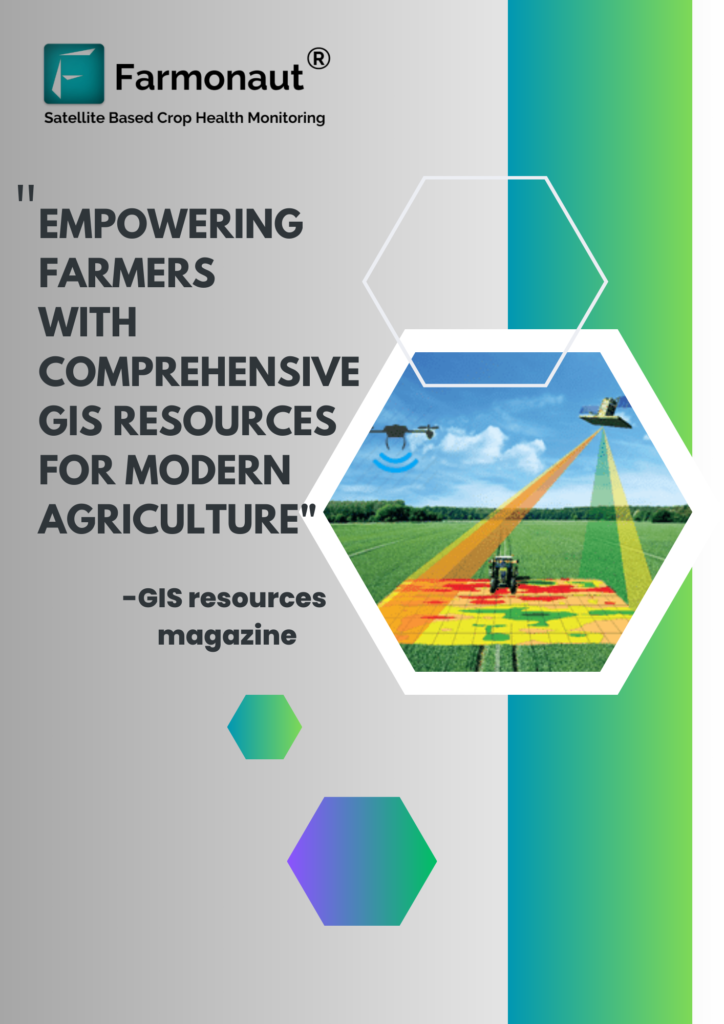
Empowering Farmers with Comprehensive GIS Resources for Modern Agriculture The GIS Resources magazine has recently published an article on Farmonaut , taking into account its immense role in bringing sophisticated solutions to existing problems in agriculture. The edition is named “Geospatial Technologies for Crop Damage and Compensation Estimation”, which outlines that the conventional approach to crop damage and compensation estimation is a time-consuming and labor-intensive process. Introduction In today’s rapidly evolving world, the agriculture industry faces numerous challenges that require innovative solutions. The advent of Geographic Information System (GIS) technology has significantly transformed the way farmers manage their operations. Among the leading players in this field is Farmonaut, a groundbreaking platform that harnesses the power of GIS to revolutionize agriculture. In this article, we explore the remarkable features and benefits of Farmonaut, as highlighted in a recent edition of GIS Resources magazine. “Farmonaut®: Making Crop Damage and Compensation Estimation Easier” The GIS Magazine covered the article on Farmonaut under the concept of managing crop damage with Satellite induced technological solutions. The feature highlighted the approaches adopted by Farmonaut to ensure a seamless management of their farms and agriculture related businesses via the application of Satellite based monitoring systems and an advanced as well as a user-friendly mobile application. What can be done eradicate the occurance of lesser yields?​ Extreme weather events, such as fluctuations in temperatures, can result in crop damage and subsequent losses in yields and profits. Geospatial technologies play a crucial role in mitigating some of the adverse effects caused by diseases, pest infestations, and water stress through manual intervention. By promptly identifying and addressing these issues, the extent of crop damage can be minimized. However, certain forms of crop damage are unavoidable and cannot be mitigated manually. In such cases, geospatial technology serves the primary purpose of estimating the magnitude of the damage inflicted on the crops. Understanding Farmonaut: The Ultimate Farming Companion​ Farmonaut’s satellite-based crop health monitoring system aims to make satellite technology accessible and affordable for all farmers. The primary goal of Farmonaut is to eliminate cost barriers and democratize remote sensing within the farming community. It achieves this by offering a user-friendly platform that enables field monitoring through satellites, which can be accessed via web, Android, and iOS apps. Through Farmonaut, farmers have the capability to remotely monitor their fields using satellite data, receiving comprehensive insights into crop health, vegetation water stress, and soil organic carbon content. Our platforms, including the Android, iOS, and web applications, empower farmers and business partners to select fields and identify specific regions where crop growth is abnormal. Additionally, they have the option to utilize our API to provide satellite data to their own users. In addition to weather forecast data from the nearest weather station, our platform delivers essential information such as vegetation water stress, evapotranspiration, and soil organic carbon data. How does Farmonaut helps in reducing the crop Yield losses? Crop yield loss estimation by Farmonaut involves the utilization of various vegetation indices and synthetic aperture radar (SAR) data. Statistical models are constructed to calculate the yields based on these indices. Commonly used indices include NDVI, EVI, SAVI, NDRE, VARI, SIPI, leaf chlorophyll index, and advanced indices, along with SAR data. Although standard statistical techniques are available for each crop, adjustments must be made based on factors such as crop location, type, variety, and duration. This process requires collaboration between remote sensing, GIS, statistical, and agronomy teams. Market intelligence companies, government agencies, research companies, and historical data on prices can also contribute to reducing the time, improving accuracy, and minimizing costs associated with yield estimation. Accurate estimations rely on the expertise of industry professionals, along with the collaborative efforts mentioned above. Over time, as AI programs advance, the margin of error or variation in yield estimations is expected to decrease Irrespective of the weather conditions, Farmonaut’s radar sensors ensure uninterrupted access to satellite data. By leveraging geospatial technology, we aim to assist farmers in reducing their investment in on-farm inputs while simultaneously increasing crop yield. By delving into the features showcased in the GIS Resources magazine, this comprehensive article provides an in-depth overview of Farmonaut and its contribution to the agricultural sector. With its advanced capabilities in real-time crop monitoring, precision farming, efficient irrigation management, weather integration, and seamless data analysis, Farmonaut empowers farmers to make data-driven decisions, optimize productivity, and ensure sustainable farming practices. Additionally, it addresses the importance of organic carbon in soil for sustainable agriculture, provides insights on how to become a farmer in India, and highlights the agritech imagery companies in Delhi NCR that are leveraging GIS technology for agricultural advancements. As the agriculture industry continues to evolve, Farmonaut stands at the forefront, bridging the gap between technology and farming, and ushering in a new era of smart agriculture. +91 6366026267 [email protected] www.farmonaut.com

Farmonaut Expands Fleet Management Capabilities in heavy duty vehicles

Farmonaut Expands Fleet Management Capabilities in heavy duty vehicles Farmonaut, a leading provider of precision agriculture technology and services, has expanded its fleet management capabilities in Uzbekistan. The company’s fleet management solutions are designed to help organizations optimize the usage and maintenance of their heavy-duty machinery, such as excavators, cranes, road rollers, and more. Real-Time Vehicle Monitoring with Farmonaut’s Fleet Management System One of the key features of Farmonaut’s fleet management system is its ability to provide real-time monitoring of vehicle performance. The system features a dashboard that displays key information such as the path of the vehicle traveled, vehicle model, plate number, vehicle type, device serial number, and other data such as speed, total vehicle distance, engine speed, today’s distance, drive time, and idle time.  The ability to monitor vehicles in real-time provides organizations with valuable insights into the performance of their fleet. This information can be used to identify inefficiencies and areas for improvement, leading to increased productivity and reduced costs. Customizable Fleet Management System with User-Friendly Dashboard Farmonaut’s fleet management system is designed to be customizable to the specific needs of each organization. The system can be accessed through a user-friendly dashboard that provides real-time data on the performance of each vehicle in the fleet. The system can also be configured to send alerts to managers and other stakeholders when certain events occur, such as a vehicle traveling outside of a designated area or exceeding a certain speed limit. Valuable Data on Vehicle and Driver Performance In addition to monitoring vehicle performance, Farmonaut’s fleet management system provides organizations with valuable data on driver behavior. This information can be used to identify areas where drivers may be wasting fuel or driving inefficiently. By addressing these issues, organizations can reduce fuel costs and improve the overall efficiency of their fleet. The system also allows organizations to monitor the performance of their vehicles’ engines. This feature provides valuable data on the health of the engine and can help organizations identify issues before they become major problems. By identifying issues early, organizations can reduce the likelihood of costly breakdowns and extend the lifespan of their vehicles. Conclusion Overall, Farmonaut’s fleet management system provides organizations with a powerful tool for optimizing the performance of their heavy-duty machinery. By providing real-time data on vehicle performance, the system enables organizations to make informed decisions that can increase productivity, reduce costs, and extend the lifespan of their vehicles. With its user-friendly dashboard and customizable features, Farmonaut’s fleet management system is an ideal solution. Contact Farmonaut today for fleet management services

Unleashing the Power of Agriculture: The Farmonaut-Coromandel Partnership

Unleashing the Power of Agriculture:The Farmonaut-Coromandel Partnership My Gromor app, created by Coromandel International, which is the second-largest producer of Phosphatic fertilizers in India, in collaboration with Farmonaut, has achieved a significant milestone in its efforts to enhance the prosperity of farmers by implementing satellite-based farm advisory services. This cutting-edge technology is aimed at improving the quality of guidance provided to farmers.   My Gromor is a distinctive mobile application that can provide customized technical information to both agricultural and non-agricultural users. The app offers a comprehensive range of farming and agriculture-related information, including guidance on crop cultivation, soil and nutrient management, pest control, and many other topics. It incorporates advanced technologies such as Artificial Intelligence and the Internet of Things to provide precise and accurate advice to farmers. MY GROMOR LET’S YOU: Geotag your farmland Unlock the wealth of benefits including monitoring crop, and soil health. Precise navigation to underperforming areas, Water stress mapping, and Smart automated crop health analysis at regular interval MyGromor, has simplified the time-consuming purchasing process for farmers, allowing them to buy products of their choice from the convenience of their homes. The app also enables farmers to easily track the status of their orders and obtain advice from technical experts on how to effectively use the purchased products. By eliminating the audit issues caused by the previous manual processes, MyGromor provides real-time visibility to the management regarding the status of orders. Coromandel International’s my Gromor app is the perfect application for farmers in the digital era. My Gromor app with Precision advisory provides farmers with valuable insights that have been developed by Farmonaut’s API. Tools and Services offered by MY GROMOR APP Weather Forecasting Tool This tool provides farmers with accurate and up-to-date information about weather conditions in their area, including temperature, rainfall, and humidity levels. Soil Testing Services Soil testing is an essential part of farming, as it helps farmers determine the quality of their soil and identify any deficiencies that may be affecting their crop yield. Crop Advisory Services These services provide farmers with expert advice on a range of topics, including crop selection, fertilization, pest control, and disease management. Facilities Provided: The app assists farmers in selecting and purchasing their preferred products without having to leave their homes. Farmers have access to expert advice and can obtain any necessary technical assistance directly through the app. The app provides farmers with real-time updates on the status of their orders through notifications. The app automates the process of adding or updating item prices for clients, thereby saving their valuable time that would have been spent manually updating excel spreadsheets. “My Gromor also provides farmers with market updates. This feature helps farmers stay up-to-date with the latest market trends and prices for their crops, enabling them to make informed decisions about when to sell their produce for the best price.” Contact us for customized app solution for satellite services

Oil Palm Plantation by Farmonaut

Farmonaut’s technological advancements facilitate: 1. Tree Number Estimation By estimating the number of trees in a farm, we can determine if the acreage has been planted with the ideal number of trees. If the estimation reveals a lower count, it is necessary to inform the concerned parties to address the issue by planting more trees. 2. Tree Age Estimation Knowing the age of oil palm trees in different areas beforehand can assist us in determining the appropriate care needed for each location. Moreover, it aids in predicting the potential high-yield areas. 3. Crop Performance Farmers can choose their field and pinpoint the areas where the crop growth is abnormal Once the problematic region is identified, farmers can visit that area to determine if the issue has already arisen. If it hasn’t, they can take proactive measures such as applying additional fertilizers, plant growth regulators, and so on, to prevent the problem from occurring. The satellite imagery is refreshed every 2-5 days and provides a resolution of 10 meters, which is twice as good as that of Google Maps in rural India. 4. Large Scale Traceability Farmonaut’s traceability solutions provide complete visibility into the entire supply chain of the oil palm industry, from the plantation to the final product. offer numerous benefits for oil palm plantations, including increased transparency, efficiency, environmental responsibility, quality control, and market access. Why Farmonaut For Oil Palm Plantation? Though Oil palm plantations are a vital source of income for farmers managing an oil palm plantation comes with its challenges, such as optimizing yield outcomes, monitoring crop health, and ensuring sustainability. This is where Farmonaut comes into action. Farmonaut’s technology provides various benefits such as : Results with a high level of precision. Performs estimations at a faster pace. Capable of estimating these results for an unlimited number of fields. Using this approach, we conducted an estimation of the age of the plantation to gain insights into its potential yield. Who are the beneficiaries? At Farmonaut, we performed Oil Palm Plantation analysis for Godrej Agrovet for more than 800 farmlands totaling 1000+ hectares in area. Corporate entities and large businesses that trade in oil palms can utilize our technology to elevate their business operations. By using our system, they can monitor their farms to detect vegetation and water stress and take proactive measures to save their crops before it’s too late. Our system provides detailed PDF reports that help redirect ground efforts to areas that need attention, thereby preventing any potential crop damage. By identifying the exact locations with stress, businesses can save money on farm inputs. To get started, all they need to do is upload their farm data and start receiving insights. Farmonaut helps you with: Recording Farm Level Data Records farm details such as: inputs used during various stages of the crop cycle. disease or infestation occurrences and geo-tagged images of the affected crops in the field. Mapping Farms in Large Quantity Using GPS on the field perimeters, your team can map the fields. You will be given admin rights to approve the palm fields uploaded by your team. The input field includes data of farmers and other relevant parameters. The data is available for further studies. Oil Palm Area Detection Maps the oil palm fields using GPS coordinates of a specific area with the help of Google Maps and Sentinel 2. These data which are then downloaded are utilized as a training set for object identification. The system then identifies the palm fields using the object identification method based on the training set. Once identified, the total area of each field perimeter is calculated. These results are further utilized to improve the accuracy of the training set for better results in the next iteration until the final results are achieved. Study of Crop Health & Water Deficiency Your ground team can use Farmonaut platform to map the oil palm fields, which can be viewed in different wavelengths of light captured by satellites. On the platform, studies can be conducted on crop health using Vegetation Indexes such as NDVI, EVI, SAVI, and NDRE, while water stress can be evaluated using NDWI, NDMI, and Evapotranspiration. More advanced studies can be carried out using VARI, AVI, BSI, and SI, and Digital Elevation Model studies can also be done. Additionally, studies can be conducted during the cloudy season using Synthetic Aperture Radar (using Sentinel 1). The platform provides access to various Index databases, and weather data is available for viewing, with the ability to download historical data for advanced studies. Furthermore, maps of various Indexes can be compared in parallel for different dates. +91 6366026267 [email protected] www.farmonaut.com

Scroll to Top