Porphyry Copper Gold Project: 3 Powerful Nevada Exploration Zones
“Over 1,200 soil samples were analyzed in Nevada’s Porphyry Copper Gold Project, revealing three high-potential exploration zones.”
Table of Contents
- Introduction: The New Era of Mineral Exploration in Nevada
- Project Overview: Porphyry Copper Gold Project in Nevada
- Comparative Exploration Summary Table
- Pilot Mountain Porphyry Copper-Gold Prospect
- Confusion Hills Porphyry-Epithermal Gold-Copper Prospect
- Red Ring Porphyry-Epithermal Gold-Copper Prospect
- Modern Technologies in Mineral Exploration: A New Landscape
- Drill Permit Approval and Regulatory Considerations
- Farmonaut’s Value for the Mining and Agriculture Intersection
- Frequently Asked Questions

Introduction: The New Era of Mineral Exploration in Nevada
As mineral exploration enters a new era, Nevada establishes itself as a strategic mining jurisdiction, particularly for copper and gold projects. Our focus on the Porphyry Copper Gold Project marks a significant development, exemplified by the confluence of advanced soil sampling, robust geophysical surveys in mining, and hydrothermal alteration mapping.
This blog presents a comprehensive analysis of three core exploration zones—Pilot, Confusion Hills, and Red Ring—in Nevada’s fast-evolving mineral landscape. We examine the soil sampling survey results, drill permit approval status, and insights from hydrothermal mapping and preliminary rock sampling with a view towards future discoveries.
Throughout, we highlight how new technologies and thorough field studies converge to uncover mineral resources, inform drilling strategies, and support sound mineral exploration and mining decisions.

Project Overview: Porphyry Copper Gold Project in Nevada
In May 2025, Azucar Minerals Ltd. entered a game-changing exploration agreement with Almadex Minerals Ltd. This move reshapes our approach to mineral exploration in Nevada, leveraging three critical project zones: Pilot, Confusion Hills, and Red Ring.
- Pilot: Targeting hydrothermal alteration zones hosted in sedimentary rocks intruded by tonalite porphyry, this block features recent soil and geophysical survey work and newly approved drill permits.
- Confusion Hills: A major high sulphidation alteration zone in volcanic rocks, recognized by its distinctive lithocap, vuggy quartz, and strong gold surface enrichment evidenced by grab samples.
- Red Ring: Defined by its extensive lithocap and pyrophyllite footprint, it boasts promising trace elements analysis and soil chemistry, identifying it as a priority for further rock and geophysical studies.
These high-potential exploration zones not only offer attractive geological characteristics but are supported by a rigorous program of soil sampling survey, detailed mapping, and modern geophysical surveys in mining.


“Recent hydrothermal mapping and rock sampling led to the approval of new drill permits across all three Nevada zones.”
Comparative Exploration Summary Table: Porphyry Copper Gold Project Zones
| Exploration Zone Name | Soil Survey Coverage (sq km, estimated) |
Drill Permit Status | Hydrothermal Mapping Findings | Rock Sampling Results (Estimated Gold/Copper Grade) |
Key Exploration Insight |
|---|---|---|---|---|---|
| Pilot Mountain | ~2.5 | Approved | Dominant pyrophyllite & white mica; classic porphyry vectors | Strongly anomalous Cu, Mo, Au in soils; veining evident | Broad chargeability anomaly; high potential porphyry core identified |
| Confusion Hills | ~1.7 | Approved | High-sulphidation lithocap (1.6 x 0.5 km) with vuggy quartz & alunite | Grab samples: up to 7.1g/t Au; avg. 1.6g/t Au in select samples | Surface gold aligned with alunite; chargeability high below alteration |
| Red Ring | ~3.0 | Approved | Porphyry lithocap (2.8 x 1 km); strong pyrophyllite surface zone | Pathfinder trace elements (Au, Mo, Cu) anomalous in soils | Major lithocap discovery; next steps: advanced sampling/geophysics |

Pilot Mountain: Flagship of the Nevada Porphyry Copper Gold Project
The Pilot Mountain zone sits at the forefront of the Porphyry Copper Gold Project, distinguished by systematic soil survey work, a rich sequence of hydrothermal alteration, and critical drill permit approval. Located within a belt of sedimentary rocks intruded by tonalite porphyry, the area is defined by classic porphyry-style elements, including veining and alteration.
1. Hydrothermal Alteration Mapping
Our hydrothermal alteration mapping at Pilot reveals robust pyrophyllite and white mica alteration zones—textbook indicators of porphyry systems. Several outcrops demonstrate early magnetite veining, A-type and syntaxial B-veins, and late-stage D-type quartz-sericite-pyrite veining, signifying proximity to mineralized porphyry cores.
2. Soil Sampling Survey and Geochemical Insights
An extensive soil sampling survey has outlined large areas of anomalous copper, molybdenum, and gold. The multi-element enrichment is accompanied by a pronounced chargeability high from the induced polarization (IP) survey and a distinct magnetic anomaly. The geochemical footprint closely overlaps with classic porphyry system indicators, validating the use of soil and geophysical surveys in mining as powerful exploration tools.
3. Geophysics and Magnetic Surveys
Drone-based magnetic surveys have mapped key structures, with subtleties in magnetic highs providing another layer of targeting confidence. The IP study supports the notion of strong chargeability proximal to porphyry veining and mineralisation.
4. Drill Permit Approval and Strategic Next Steps
A drill permit approval was recently secured for this area, setting the stage for first-pass drilling programs in 2025. These activities will focus on collating all soil sampling, alteration, and geophysical datasets to design targeted drill holes with maximum discovery potential.
Notably, parts of the Pilot block with historic and active turquoise mining add further complexity and discovery potential.

5. Key Outcomes from the Pilot Zone
- Presence of textbook porphyry veining types (A, B, D-type quartz veins).
- Wide zone of anomalous trace elements (Cu, Mo, Au) defined by soil sampling.
- High overlap between chargeability, magnetic, and geochemical anomalies.
- Drill permit approval and first-pass drill planning underway for 2025.
Confusion Hills: High Sulphidation Alteration Zone & Gold-Rich Opportunity
The Confusion Hills zone in Nevada is an exemplary porphyry-epithermal system with a distinct high sulphidation alteration zone. Confusion Hills presents a compelling case study for mineralisation links between porphyry intrusions and epithermal surface expressions.
1. Lithocap and Hydrothermal Mapping
Confusion Hills is marked by a large lithocap—spanning 1.6 km x 0.5 km—featuring:
- Central zones of vuggy quartz and alunite.
- Massive pyrophyllite footprints extending across the mapped area.
Our hydrothermal mapping demonstrates textbook lithocap alteration, which often overlies porphyry systems at depth, boosting the exploration potential at Confusion Hills.
2. Preliminary Rock Sampling and Gold Assay Results
We completed extensive preliminary rock sampling, collecting 107 grab samples from surface, subcrop, and float. Six samples returned over 0.1 g/t gold (Au), with three exceeding 0.5 g/t Au—one giving a high of 7.1 g/t Au. The average for these gold-rich grabs was 1.6 g/t, underscoring robust surface enrichment and favorable gold assay results.
- High-grade gold in surface samples directly correlates with the alunite alteration core.
- Soil sampling has confirmed anomalous Au, Mo, and Cu concentrations in the immediate area.
3. Geophysics and Chargeability Trends
Targeted IP lines indicate a high-chargeability feature below the quartz-alunite alteration zone—a classic indicator of sulphide development linked to concealed mineralisation in porphyry-epithermal systems. Modern drone-based magnetic surveys further define the structural architecture underpinning mineralisation trends.
4. Drill Permit Approval and New Exploration Focus
Secured drill permit approval enables immediate work at Confusion Hills. The forthcoming program centers on:
- Additional detailed rock sampling (to improve confidence and expand on initial encouraging results).
- Expanded induced polarization surveys to map deeper sulphide targets.
These efforts aim to confirm and expand the mineralized zone, setting up optimal drill targets for upcoming campaigns.
Red Ring: Porphyry Lithocap and Pathfinder Element Discovery
Red Ring is the third major porphyry-epithermal gold-copper prospect in Nevada, noted for its extensive alteration zones and pathfinder element geochemistry. Red Ring’s geology provides an archetype for porphyry exploration, enabling modern geophysical studies and detailed soil and rock sampling programs.
1. Lithocap Footprint and Surface Alteration
- The lithocap zone spans over 2.8 km NW-SE by at least 1 km NE-SW—demonstrating significant alteration intensity.
- Strong pyrophyllite zones cover an area about 1 km (NW-SE) x 0.5 km (NE-SW), providing compelling vectors for mineralisation at depth.
This surface alteration suite is consistent with proximity to a concealed porphyry centre.
2. Trace Elements and Soil Sampling Survey
Extensive 2024 soil surveys and trace elements analysis highlight anomalous Au, Mo, and Cu across the block. This, combined with elevated pathfinder elements in rock samples, reinforces the high-sulphidation setting.
Planned work for 2025 will expand the sample grid and apply geophysical surveys in mining to detect deeper mineralized trends, seeking a porphyry system below the lithocap.
3. Geophysics and Future Exploration Strategy
- Integrating soil, trace element, and alteration mapping data to focus test geophysical studies for deeper exploration.
- Further rock sampling will refine targets for first-pass drilling, leveraging recent advances in drone-based and ground geophysical techniques.
These steps are crucial for progressing from surface geochemistry to subsurface definition in a modern porphyry copper gold project.
Modern Technologies in Mineral Exploration: A New Landscape
As we embrace next-generation exploration, integrating advanced geochemical surveys, drone-based magnetics, hydrothermal alteration mapping, and multi-dimensional geophysical studies is crucial. This synergy increases the probability of discovery and guides environmentally responsible drilling.
-
Blockchain-Based Product Traceability:
For operations seeking robust mineral provenance and transparency, Farmonaut’s Product Traceability Solution leverages blockchain to track every stage from extraction through supply chain. This enhances consumer trust and meets the strict documentation requirements of global markets. -
Fleet & Resource Management:
Streamline logistics, manage vehicles, and optimize resource allocation during remote exploration using Farmonaut’s Fleet Management tools. The platform helps reduce operational costs while ensuring on-site safety, especially on large mineral projects. -
Carbon Footprinting:
Mining operations in Nevada can benefit from Farmonaut’s Carbon Footprinting service. Real-time carbon emission tracking enables companies to align with global sustainability goals and regulatory requirements.
For organizations looking to build or enhance custom satellite data workflows and integrate up-to-the-minute weather, soil, and surface metrics, Farmonaut’s API and Developer Docs provide robust entry points for scalable, data-driven decision-making in mineral exploration.
Drill Permit Approval and Regulatory Considerations
Navigating regulatory frameworks is pivotal for any porphyry copper gold project. In Nevada, timely drill permit approval reflects proactive stakeholder engagement and strong environmental compliance.
- All three exploration zones—Pilot, Confusion Hills, and Red Ring—recently received approved drill permits.
- This facilitates the transition from surface data collection to subsurface exploration and resource evaluation.
- Comprehensively documented soil survey, alteration mapping, and trace elements analysis are required in the permitting process, reducing timeline risks.
Coupled with Nevada’s mining-friendly jurisdiction, these regulatory achievements underscore why the state remains an attractive area for major mineral exploration investments.
Farmonaut’s Value for the Mining and Agriculture Intersection
The Porphyry Copper Gold Project in Nevada demonstrates how modern precision agriculture technologies can support mineral exploration. Farmonaut offers advanced, satellite-based monitoring of major land assets, unlocking new efficiencies and insights for both agricultural and mining stakeholders.
-
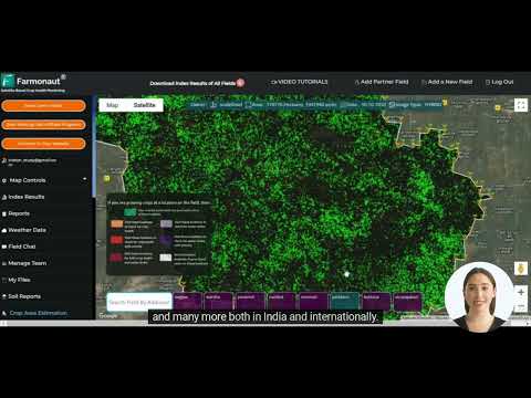
Satellite-Based Crop & Surface Monitoring:
Farmonaut delivers real-time vegetation, soil moisture, and terrain analytics, ensuring that teams understand on-site conditions—vital for planning access, logistics, and reclamation in mining projects. -
Jeevn AI Advisory System:
Farmonaut’s AI-based system provides real-time insights and weather trends, assisting geologists and field crews in scheduling safe, efficient operations aligned with weather and land surface conditions. -
Scalable Analytics:
Whether monitoring a single prospect area or multiple blocks, Farmonaut’s large-scale land management solutions allow users to quickly scale up data collection and reporting, enabling investors, teams, and regulators to stay informed as projects expand. -
Financing & Insurance:
With satellite-based verification for financing and insurance, Farmonaut provides evidentiary support for land use, disturbance, or reclamation claims—vital for risk management in both agriculture and mining.
By leveraging satellite, AI, and blockchain innovations, Farmonaut enables smarter resource management, better stakeholder engagement, and improved compliance for organizations navigating today’s multi-dimensional land use challenges.
Frequently Asked Questions: Porphyry Copper Gold Project & Mineral Exploration in Nevada
What is a porphyry copper gold project and why is Nevada significant?
A porphyry copper gold project targets large, disseminated copper and gold resources associated with porphyry intrusions. Nevada is globally recognized for its favorable geology, mining-friendly regulations, and mature infrastructure, making it ideal for both large-scale exploration and eventual production.
How do soil sampling surveys impact mineral exploration?
Soil sampling surveys identify geochemical anomalies—especially for copper, molybdenum, and gold—that mark mineralization trends and help define drill targets, especially in areas with limited rock exposure.
What is the role of hydrothermal alteration mapping in exploring for porphyry deposits?
Hydrothermal alteration mapping systematically identifies minerals such as pyrophyllite, white mica, quartz, and alunite, which are spatially related to ore-forming processes. Mapping these zones accurately directs drilling and resource estimation.
Why is drill permit approval important before initiating an exploration drilling program?
Drill permit approval is legally required to safeguard environmental and community interests. Permits ensure that exploration proceeds responsibly, aligns with best practice, and avoids unnecessary operational delays.
How are modern geophysical surveys in mining used alongside traditional rock and soil sampling?
Geophysical surveys—like IP chargeability and drone-based magnetics—provide subsurface data that complement surface soil sampling and rock assay results. This integrated approach delineates the geometry and depth of mineralized targets more accurately.
How can Farmonaut services benefit exploration projects?
Through advanced satellite and AI analytics, Farmonaut empowers exploration teams to monitor vegetation, surface change, soil moisture, and environmental impacts, optimizing operations and maintaining compliance throughout the project lifecycle.
Conclusion: Nevada’s Porphyry Copper Gold Exploration Enters a New Epoch
The Porphyry Copper Gold Project in Nevada brings together the best of modern mineral exploration: diligent soil sampling survey, high-resolution hydrothermal alteration mapping, state-of-the-art geophysical surveys, and robust drill permit approval across three powerful zones—Pilot, Confusion Hills, and Red Ring. Each offers unique geological advantages and supports a pipeline of discovery and development.
Supported by innovative technology platforms like Farmonaut and underpinned by strict adherence to regulatory best practices, Nevada remains at the forefront of global copper-gold exploration. Our collective efforts unlock new potential while balancing economic opportunity with sustainability and transparency.
For professionals, investors, and stakeholders, this marks the beginning of a new chapter for mineral exploration in Nevada—where data-driven insights, rigorous science, and strategic vision drive success.