Santa Rosa County Farmland: 7 Powerful Steps for Rural Protection
- Introduction: Santa Rosa Farmland at a Crossroads
- The Importance of Protecting Santa Rosa County Farmland
- Urban Sprawl and the Challenges Facing Rural & Farming Communities
- Understanding the Rural Protection Zone in Santa Rosa County
- 7 Powerful Steps for Rural Protection in Santa Rosa County
- Step 1: Strategic Expansion of the Rural Protection Zone Boundary
- Step 2: Enforcing Smart Zoning for Farmland Protection
- Step 3: Sustainable Land Use Planning & Transition Zones
- Step 4: Prioritizing Conservation of Natural Resources
- Step 5: Establishing Frameworks with Enforcement & ‘Teeth’
- Step 6: Economic Incentives & Sustainable Development
- Step 7: Technology-Driven Approaches to Conservation & Monitoring
- Comparative Overview of Farmland Protection Strategies
- How Farmonaut Empowers Santa Rosa’s Farmland Protection
- Access Farmonaut Apps & Solutions
- Frequently Asked Questions
Introduction: Santa Rosa Farmland at a Crossroads
Santa Rosa County stands at a pivotal moment in its agricultural land development journey. Situated in the heart of Northwest Florida, the county’s farming community produces over $90 million worth of crops and livestock annually, underpinned by vast acres of rich, productive farmland. Yet, with urban sprawl mounting along key roads and into established districts, precious cropland increasingly faces the pressure of residential development.
We must now ask: How do we protect this essential resource? How can rural protection zone strategies, smart zoning for farmland protection, and innovative technologies create a sustainable future for Santa Rosa County farmland—preserving both our agricultural economy and cherished rural character for the years ahead?


The Importance of Protecting Santa Rosa County Farmland
At the core of Santa Rosa County’s economy is its agricultural land: 752 farms covering thousands of acres, family-run farmland passed down through generations, and two of the state’s four cotton gins, all contributing to a powerful economic engine. The value of this production is clear:
- Over $90 million annual revenue from livestock and crop production.
- Row crops—especially cotton (17,485 acres; $8.9M) and peanuts (24,406 tons; $12.8M)—power Santa Rosa’s market position.
- The community directly employs more than 9,500 people in agriculture-related businesses.
Preserving this foundation goes beyond economics. Protecting rural land ensures food security, supports local culture, conserves natural resources such as watersheds and wildlife habitats, and maintains the heritage and identity of our communities.


Ready to unlock advanced crop monitoring for your Santa Rosa farm? Try Farmonaut’s web & mobile apps—improve yields, reduce costs, and protect your land with real-time satellite data.
Urban Sprawl and the Challenges Facing Rural & Farming Communities
In recent years, the scale and speed of urban development have accelerated in Santa Rosa County. What was once peaceful rural district is now on the frontline of a battle between farmers and developers—a contest over acreage that defines the future of our community.
- Farmland is being lost: Each year, significant acres are rezoned or sold for residential development, reducing the land available for farming and diminishing the rural landscape.
- Traffic and infrastructure pressures: Narrow roads once used by tractors and farm equipment are now crowded by suburban commuters, disrupting agricultural production and farmers’ access.
- Economic challenges: Developers offer lucrative deals for land; meanwhile, volatile crop prices and increasing costs make farming less attractive for future generations.
Without decisive action from our county commissioners and the board, we risk losing not only production acreage but also the unique agricultural identity that defines Santa Rosa. The rise of “urban sprawl and farming” pressures highlights a community at a crossroads—will we preserve our rural life or be overtaken by uncontrolled development?

Understanding the Rural Protection Zone in Santa Rosa County
The Santa Rosa County Rural Protection Zone is central to our region’s efforts at protecting agricultural resources. First established in 2007 and evolved across subsequent years, this zone has drawn an official boundary line between rural areas and urbanizing districts—delimiting where large-scale farming is prioritized and unchecked residential development restricted.
The plan currently on the table expands the rural protection zone by approximately 70,000 to 100,000 acres, moving the southern border four miles southward. This measure aims to include regions “on the fringe” of urban growth, such as Allentown and areas near 10 Mile Road in Chumuckla, where scattered development already threatens farming operations.
The updated rural protection zone will feature:
- A clear, defined boundary for rural protection using fire district lines.
- A transition zone—one mile wide—buffering urban and rural districts for gradual, smarter land use planning.
- Non-arbitrary zoning provisions to support both smart growth and farm protection.
This balanced approach reflects the “land use planning in rural counties” many communities aspire to, recognizing the dual goals of supporting an agricultural economy and managing inevitable growth.
Managing large crop acreage? Farmonaut’s Large Scale Farm Management Platform combines satellite and AI for streamlined field insight, record-keeping, and resource consumption tracking across all your parcels. Perfect for agri-businesses and serious producers.

7 Powerful Steps for Rural Protection in Santa Rosa County
Ensuring the future of Santa Rosa County farmland requires decisive, multifaceted action. Let’s explore the seven core strategies—each grounded in local context and national best practices—that, if implemented, will bolster our commitment toward protection of agricultural resources and sustainable farmland development.
Step 1: Strategic Expansion of the Rural Protection Zone Boundary
The expansion of the rural protection zone boundary is the first—and foundational—step. By incorporating an additional 70,000–100,000 acres currently under threat from urban encroachment, the commission provides breathing room for farmers and space for smart growth planning.
To maximize impact, this step should:
- Align new boundary lines with fire district borders for clear, easily enforced protection.
- Capture currently rural but “at-risk” areas before scattered residential development becomes irreversible.
- Communicate transparently with all community stakeholders about the vision and reasons for expansion.
This proactive approach allows leadership to manage future growth without sacrificing our agricultural backbone.
Step 2: Enforcing Smart Zoning for Farmland Protection
Effective zoning for farmland protection is more than drawing lines—it’s about the rules within those lines. The most pressing needs:
- Lot sizing that supports real farming: Transitioning minimum lot widths from 70 feet to 125–150 feet within protected zones preserves acreage for viable crops and prevents unnecessary fragmentation.
- Maintain 50% land conservation in higher-density developments: For new projects, require that at least half of the site remains allocated for agriculture or conservation.
- Protect “crossroad communities” without halting smart growth: Zoning can enable limited, well-designed housing while keeping heritage areas intact.
Firm but adaptive zoning is the difference between temporary reprieve and long-lasting protection.
Step 3: Sustainable Land Use Planning & Transition Zones
True rural protection includes well-mapped transition zones—buffering urban and rural districts. These allow:
- Gradual changes in land use intensity, reducing conflict at the urban fringe.
- Room for “urban village” or conservation subdivisions with standards that favor open space, agri-tourism, and small-scale farming.
- Future land development in rural areas that is strategic, not reactionary.
Designating these zones on the official land development plan gives the board and commissioners new tools to balance market demand with the values of our rural communities.
For policy planners: Integrate Farmonaut’s Carbon Footprinting to monitor the environmental impact of land use decisions, supporting compliance with Florida’s regulatory requirements and sustainability goals.

Step 4: Prioritizing Conservation of Natural Resources
The protection of agricultural resources goes hand-in-hand with preserving natural resources: waterways such as Blackwater River and Pond Creek, local aquifers, and biodiversity corridors.
Key conservation strategies should include:
- Zoning overlays for water body buffers: Mandate protection zones around rivers and creeks integral to the farming ecosystem.
- Support for conservation easements: Voluntary legal agreements that keep land in ag use or natural state, providing both ecological and financial returns.
- Annual monitoring of soil, water, and habitat health leveraging new technologies and partnerships.
Enshrining these priorities within the land development code ensures that future zoning decisions align with long-term stewardship of the county’s natural assets.
Step 5: Establishing Frameworks with Enforcement & ‘Teeth’
Santa Rosa’s rural protection zone will only succeed if its principles are binding. Historically, lack of enforcement (“no real teeth”) has limited the zone’s effectiveness.
- Embed the zone into binding ordinances: Make compliance mandatory, with clear processes for appeals and reviews.
- Define lot and land use standards: Clarify minimum lot width, open space ratios, and allowable types of development to reduce confusion and legal disputes.
- Coordinate county-wide enforcement: Create inter-district taskforces and leverage GIS systems for oversight of compliance.
A robust, enforceable document forms the backbone of any effective rural protection strategy.
Want to track rural protection with effortless precision? Farmonaut’s AI-powered Fleet and Resource Management tool ensures agri-businesses and local authorities can oversee farming machinery and conservation taskforces for seamless, cost-effective field monitoring.
Step 6: Economic Incentives & Sustainable Development
To keep farming viable, economic incentives are essential—but these must align with sustainable land development and zoning for farmland protection.
- Property tax breaks and grant support: Reward farmers who maintain their land in agriculture, particularly in targeted rural zones.
- Encourage value-added production: Incentivize direct-to-consumer agri-businesses and on-farm processing, strengthening the rural economy.
- Balance compensation for landowners: Provide fair financial options for land that cannot be developed, so selling to developers is not always the most attractive route.
Integrated incentives help address the “If I can make a heck of a lot out of selling it, why not?” dilemma that farmers often face.
Safeguard your operation with Farmonaut’s satellite-based crop loan and insurance verification solutions. This reduces financial risks for farmers and lenders, improving access to capital for sustainable farm improvements.
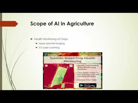
Step 7: Technology-Driven Approaches to Conservation & Monitoring
Modern rural protection zone strategies harness technology—especially satellite imagery, AI, and blockchain—to support agricultural preservation at scale. With Farmonaut, Santa Rosa County can leverage:
- Satellite-based real-time crop and land health monitoring: Identify stress points, boundary encroachments, soil moisture trends, and plan resource management more effectively.
- AI-driven advisory systems: Provide tailored best practices for crop management and yield optimization, ensuring that production increases without unsustainable pressure.
- Blockchain-based traceability: Create transparent, secure records for local agricultural products, boosting consumer confidence and supporting local branding.
Visit Farmonaut’s Product Traceability page to learn how blockchain-powered supply chain solutions are enhancing transparency and trust for agricultural and food sector clients.
For county governments, conservationists, and the entire community, these tools deliver actionable intelligence, enforceable transparency, and scalable gains—all while advancing the goals of the rural protection zone.
Comparative Overview of Farmland Protection Strategies
| Strategy | Description | Estimated Protected Acreage (Yearly) | Implementation Cost ($/Acre) | Reduction in Urban Encroachment (%) | Sustainability Rating (1–5 Stars) |
|---|---|---|---|---|---|
| Agricultural Zoning | Restricts non-farm uses within designated rural protection zones by establishing minimum lot sizes and permitted land uses. | 60,000–80,000 | $8–12 | 50–60% | ⭐⭐⭐⭐ |
| Conservation Easements | Legal agreements to permanently restrict development on private farmland, incentivizing conservation through compensation or tax relief. | 10,000–15,000 | $400–600 (upfront) | 30–40% | ⭐⭐⭐⭐⭐ |
| Urban Growth Boundaries | Defines a fixed boundary for urban expansion, concentrating development and preserving outlying agricultural areas. | 30,000–50,000 | $20–25 | 40–50% | ⭐⭐⭐⭐ |
| Incentive-based Programs | Provides financial incentives to keep land in agriculture, including tax reductions and grants for sustainable practices. | 5,000–8,000 | $10–18 (ongoing) | 20–25% | ⭐⭐⭐ |
| Technology-led Monitoring | Uses remote sensing, AI, and blockchain for continuous monitoring, compliance, and resource optimization. | 40,000–70,000 | $3–5 | 35–45% | ⭐⭐⭐⭐⭐ |
This table underscores the multi-pronged approach required for effective farmland protection in Santa Rosa County. Combining land use regulations, conservation, incentives, and technology yields the most robust, enduring results.
How Farmonaut Empowers Santa Rosa’s Farmland Protection
In the face of rising urban development risks, farmers, county officials, and ag organizations alike must harness every available tool for farmland protection. Farmonaut stands apart as the accessible, affordable technology partner for precision agriculture and conservation in Santa Rosa County:
- Satellite monitoring delivers on-the-ground visibility over thousands of acres, tracking boundaries, land use changes, and crop health in real time.
- AI-based advisory provides farmers and agri-businesses with up-to-date, customized recommendations to boost yields while conserving essential resources.
- Blockchain traceability ensures every crop’s journey from field to table is tracked—supporting local branding and consumer trust for Santa Rosa-grown products.
- Fleet/resource management tools simplify oversight for large-scale farms, coops, and conservation crews—helping the community do more with less.
- Carbon footprint tracking aligns with Florida and national sustainability requirements for future farming and land management.
Farmonaut’s flexible API and developer documentation allow integration of these insights into county or agency software—paving the way for scalable, community-wide conservation.
Remember: You do not need to invest in expensive hardware. Farmonaut brings precision agricultural tools to your phone or desktop, enabling small, medium, and large producers to monitor, manage, and protect their land investment—anywhere, anytime.
Access Farmonaut Apps & Solutions
Start optimizing your Santa Rosa county farm and join the movement for sustainable, protected agriculture now. Download the web, Android, or iOS app today.
Farmonaut Subscription Options
Discover affordable subscription tiers tailored for individual farmers, agribusinesses, and government agencies. Unlock all features including crop health, advisory, fleet, and carbon footprint management.
Frequently Asked Questions (FAQ)
What is the Santa Rosa County Rural Protection Zone?
The Rural Protection Zone is a specially designated area defined by county boundaries and fire district lines. It is intended to restrict high-density urban development and promote the long-term protection of agricultural land, ensuring the sustainability of local farming.
Why is it critical to expand and enforce rural protection zoning now?
With escalating urban pressures—over 60% of farmland is at risk—acting now prevents permanent loss of Santa Rosa’s agricultural base and rural character. Expansion and stronger enforcement support local farmers, maintain food production, and preserve the community’s natural assets for future generations.
How does the rural protection zone affect current and future development?
Current properties within the expanded zone remain under their existing zoning. For new projects, stricter lot sizes, conservation mandates, and land use standards prevent haphazard subdivisions, protecting both the farm economy and rural scenery.
What role does technology play in sustaining rural farmland?
Tools like those offered by Farmonaut empower farmers and officials with real-time data on crop status, resource use, and land health. This ensures more precise, data-driven management and makes it easier to catch issues—like unauthorized land development or declining soil quality—before irreversible damage occurs.
How can farmers, planners, and businesses access Farmonaut’s solutions?
Download the web and mobile apps, utilize the API, or visit the developer documentation for integration. Subscription plans are flexible depending on acreage and features required.
Summary
Santa Rosa County’s agricultural sector faces enormous development pressures, with over 60% of farmland at risk from urban sprawl. The expansion and enforcement of rural protection zones, alongside strategic zoning for farmland, represent foundational strategies for preserving this billion-dollar industry. By integrating technology such as satellite monitoring and AI advisories through accessible platforms like Farmonaut, we can empower local farmers, planners, and communities to defend their livelihoods and environment. Farmonaut is not a regulatory body or online marketplace—it is an agri-technology platform providing farmers and stakeholders with the insights and tools needed for smart, sustainable farmland management in the face of increasing urbanization.