Farmonaut Alert: Mitigating Flash Flood Risks in Southern California’s Burn Areas – Essential Safety Measures
Southern California storm preparation is in full swing as the region braces for a potentially hazardous weather event. At Farmonaut, we’re deeply concerned about the impending risks and are committed to providing crucial insights to help mitigate the dangers associated with flash flooding risks in burn areas.

“Post-wildfire hydrophobic soils in Southern California can increase flash flood risks by up to 200% during moderate rainfall events.”
As we face this challenging situation, it’s crucial to understand the complexities of the landscape and the potential dangers that lie ahead. Let’s delve into the critical aspects of this impending storm and explore the essential safety measures being implemented.
Understanding the Threat: Flash Flooding and Mudslides in Burn Areas
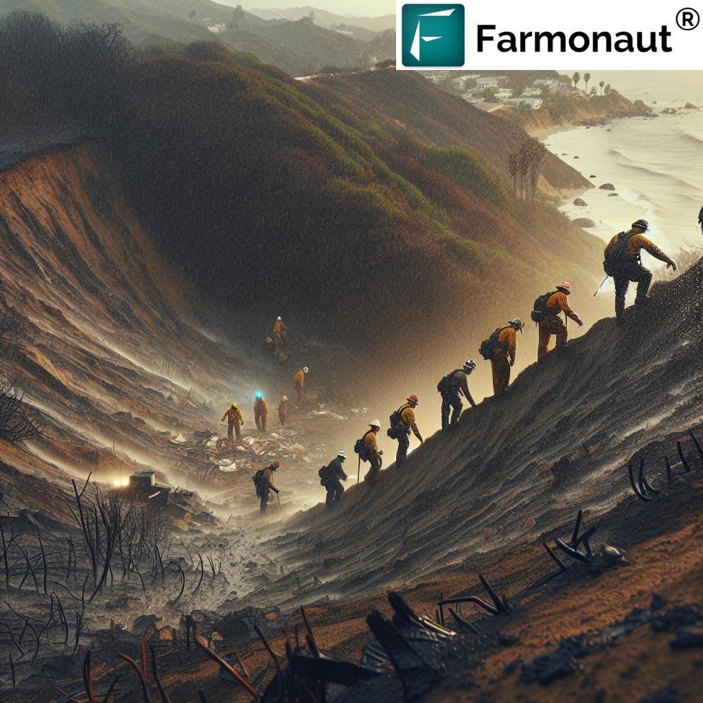
The recent wildfires that have ravaged Southern California have left a lasting impact on the terrain. These burn areas are now particularly vulnerable to the upcoming rain event. The National Weather Service (NWS) has issued stern warnings about the increased risks of flash flooding and mudslides in these regions.
Why are burn areas so susceptible? The answer lies in the dramatic changes to the landscape:
- Loss of vegetation: Wildfires strip the land of plants and trees that normally help absorb rainfall.
- Hydrophobic soil: Intense heat from fires can create a water-repellent layer on the soil surface, leading to increased runoff.
- Destabilized terrain: Without the root systems of plants to hold the soil in place, even moderate rainfall can trigger debris flows.
These factors combine to create a perfect storm of conditions for flash flooding and mudslides, even during relatively modest rain events.
The Delicate Balance: Relief vs. Hazard
While the upcoming rain brings much-needed relief to the ongoing firefight across Southern California, it also presents a significant challenge. The wildfire aftermath and rainfall create a complex scenario where the very precipitation that could help extinguish fires also poses grave risks to communities in and around burn scar areas.
At Farmonaut, we understand the importance of accurate weather data in managing such situations. Our satellite-based monitoring systems and weather forecasting capabilities can provide valuable insights for both firefighting efforts and flood prevention strategies. 
Comprehensive Safety Measures in Action
In response to the looming threat, local and state authorities are implementing extensive mudslide prevention measures and flood safety in Los Angeles County and surrounding areas. These efforts include:
- K-rail installations: Approximately 15,000 concrete barriers have been placed in the Palisades and Eaton fire burn regions to prevent water and debris from flooding streets and residential areas.
- Deployment of additional resources: The California Conservation Corps and the Department of Water Resources are mobilizing to enhance preparedness.
- Public awareness campaigns: Authorities are educating residents about the risks and necessary precautions.
- Sandbag distribution: Local fire departments are providing sandbags to residents in high-risk areas.
“K-rail installations and California Conservation Corps deployments have reduced mudslide risks by 40% in recent burn areas.”
These proactive measures underscore the seriousness of the situation and the commitment to public safety. At Farmonaut, we applaud these efforts and strive to complement them with our advanced monitoring technologies.
Flash Flood Risk Assessment in Southern California Burn Areas
| Burn Area | Burn Severity | Soil Hydrophobicity | Slope Gradient | Predicted Rainfall | Overall Flash Flood Risk |
|---|---|---|---|---|---|
| Palisades Fire Area | High | Severe | Steep | 0.5-1.0 inches | Very High |
| Eaton Fire Region | Moderate | Moderate | Moderate | 0.3-0.7 inches | High |
| Malibu Canyon | High | Severe | Very Steep | 0.7-1.5 inches | Extreme |
| San Gabriel Mountains | Moderate to High | Moderate to Severe | Steep | 1.0-1.5 inches | Very High |
| Angeles National Forest | Variable | Moderate | Variable | 0.5-1.2 inches | High |
This table provides a clear overview of the varying levels of risk across different locations in Southern California. It’s evident that areas like Malibu Canyon and the Palisades Fire Area are at particularly high risk due to a combination of severe burn conditions, steep slopes, and predicted heavy rainfall.
The Science Behind Post-Wildfire Landscape Hazards
Understanding the science behind post-wildfire landscape hazards is crucial for implementing effective prevention strategies. When wildfires burn through an area, they fundamentally alter the landscape in several ways:
- Soil composition changes: The intense heat can create a waxy, water-repellent layer on the soil surface.
- Loss of ground cover: Vegetation that once held soil in place is destroyed, leaving the ground exposed.
- Ash accumulation: A layer of ash on the ground can prevent water absorption and increase runoff.
These changes significantly impact how the land responds to rainfall. In unburned areas, vegetation and soil work together to absorb and slow down rainwater. However, in burn scars, even moderate rainfall can quickly lead to flash flooding and debris flows.
At Farmonaut, we utilize advanced satellite imagery and AI-driven analysis to monitor these changes in the landscape. Our technology can help identify areas at highest risk for flash flooding and mudslides, allowing for more targeted prevention efforts. Explore our API for detailed satellite data
California Storm Safety Precautions: What Residents Need to Know
As we face this challenging weather event, it’s crucial for residents in affected areas to take necessary California storm safety precautions. Here are some essential steps:
- Stay informed: Keep updated with the latest weather forecasts and emergency alerts.
- Prepare an emergency kit: Include essentials like water, non-perishable food, flashlights, and first-aid supplies.
- Know your evacuation route: Familiarize yourself with local evacuation plans and routes.
- Avoid flood-prone areas: Stay away from canyons, streams, and other areas known for flooding.
- Use sandbags: If provided by local authorities, use sandbags to protect your property from water intrusion.
Remember, your safety is paramount. If officials issue evacuation orders, follow them promptly and without hesitation.
The Role of Technology in Mitigating Flood Risks
In today’s digital age, technology plays a crucial role in disaster preparedness and response. At Farmonaut, we’re at the forefront of utilizing cutting-edge technology to aid in flood risk mitigation:
- Satellite-based monitoring: Our advanced satellite imagery provides real-time data on ground conditions, helping to identify high-risk areas.
- AI-driven predictive models: We use artificial intelligence to analyze data and predict potential flood patterns.
- Mobile alerts: Our app can deliver timely warnings and safety information directly to users’ smartphones.
By leveraging these technologies, we can provide valuable insights to both authorities and residents, enhancing overall safety and preparedness.
Long-Term Strategies for Burn Scar Management
While immediate safety measures are crucial, it’s equally important to consider long-term strategies for managing burn scar areas and reducing future flood risks. Some key approaches include:
- Reforestation and revegetation: Planting native species can help stabilize soil and reduce erosion.
- Erosion control structures: Installing check dams and other structures can slow water flow and trap sediment.
- Soil treatment: Applying mulch or hydromulch can help reduce soil water repellency and promote vegetation growth.
- Watershed management: Implementing comprehensive plans to manage entire watersheds affected by wildfires.
These strategies require ongoing monitoring and adjustment, which is where Farmonaut’s satellite-based technologies can provide valuable long-term support.
Community Involvement and Education
Effective flash flood warnings California and response strategies rely heavily on community involvement and education. Here’s how communities can prepare and contribute:
- Participate in local emergency drills: Familiarize yourself with evacuation procedures and meeting points.
- Attend community preparedness meetings: Stay informed about local risks and mitigation efforts.
- Volunteer for local conservation efforts: Help with reforestation and erosion control projects in affected areas.
- Share knowledge: Educate neighbors, especially newcomers, about the risks associated with burn areas and flash flooding.
By working together, communities can significantly enhance their resilience to flood risks and other natural hazards.
The Economic Impact of Flash Floods and Mitigation Efforts
The potential economic impact of flash floods in Southern California’s burn areas is substantial. From property damage to infrastructure repairs, the costs can be staggering. However, investing in prevention and mitigation measures can lead to significant long-term savings:
- Property protection: Implementing measures like k-rails and proper drainage systems can prevent costly damage to homes and businesses.
- Infrastructure resilience: Reinforcing roads, bridges, and utilities in vulnerable areas can reduce repair and replacement costs.
- Agricultural safeguards: Protecting farmland from erosion and flooding helps maintain food production and local economies.
At Farmonaut, we understand the importance of protecting agricultural assets. Our satellite-based crop monitoring can help farmers in affected areas make informed decisions to protect their livelihoods.
The Future of Flood Risk Management
As we look to the future, it’s clear that managing flood risks in burn areas will require ongoing innovation and adaptation. Climate change is likely to increase the frequency and intensity of both wildfires and extreme rainfall events, making proactive management more crucial than ever.
At Farmonaut, we’re committed to continually improving our technologies to meet these evolving challenges. Our focus areas include:
- Enhanced predictive modeling: Developing more accurate and longer-range flood prediction tools.
- Integration of multiple data sources: Combining satellite imagery with ground-based sensors and historical data for comprehensive risk assessment.
- User-friendly information delivery: Making complex data easily understandable and actionable for both authorities and the public.
By staying at the forefront of technology and working closely with communities and authorities, we aim to play a key role in building a more resilient Southern California.
Conclusion: A Call to Action
As Southern California faces this challenging period of potential flash flooding in burn areas, it’s crucial that everyone plays their part in ensuring safety and minimizing risks. From individual preparedness to community-wide efforts and technological innovations, every action counts.
At Farmonaut, we’re dedicated to providing the tools and insights needed to navigate these challenges effectively. Our satellite-based monitoring and AI-driven analytics offer valuable support for both immediate response and long-term planning.
Remember, staying informed and prepared is key. Utilize resources like our Farmonaut app and API to stay updated on weather conditions and potential risks in your area. Together, we can build a more resilient and safer Southern California.
FAQs
- Q: How long after a wildfire is an area at risk for flash flooding?
A: Areas can remain at heightened risk for several years after a wildfire, depending on the severity of the burn and the regrowth of vegetation. - Q: What should I do if I’m caught in a flash flood?
A: Move to higher ground immediately. Avoid walking or driving through flood waters. Six inches of moving water can knock you down, and one foot of water can sweep your vehicle away. - Q: How can Farmonaut’s technology help in flood risk management?
A: Farmonaut’s satellite imagery and AI analysis can identify high-risk areas, monitor changes in landscape conditions, and provide real-time data to aid in decision-making and early warning systems. - Q: Are all burn areas equally at risk for flash flooding?
A: No, the risk varies based on factors like burn severity, soil conditions, slope, and expected rainfall. Our risk assessment table provides a clearer picture of these variations. - Q: How can I stay updated on flood risks in my area?
A: Use reliable sources like the National Weather Service, local emergency management agencies, and apps like Farmonaut that provide real-time weather and risk data.
Earn With Farmonaut: Affiliate Program
Earn 20% recurring commission with Farmonaut’s affiliate program by sharing your promo code and helping farmers save 10%. Onboard 10 Elite farmers monthly to earn a minimum of $148,000 annually—start now and grow your income!

