Revolutionizing Ontario Wheat Farming: How AI and Satellite Imagery Boost Yields and Sustainability
Welcome to the future of agriculture! In this comprehensive exploration, we’ll dive into how precision agriculture technology and satellite imagery for farming are transforming the landscape of wheat production in Ontario. From AI in agriculture to remote sensing for crop management, we’re witnessing a revolution that’s changing the way we grow our food and manage our precious land resources.

“Satellite imagery can detect crop health issues up to 2 weeks earlier than traditional field scouting methods.”
The Dawn of Smart Farming in Ontario’s Wheat Fields
Ontario’s rich agricultural heritage is entering a new era, one where satellites orbiting hundreds of kilometers above the Earth are becoming as crucial to wheat farming as the tractor in the field. We’re witnessing a paradigm shift in how farmers approach their craft, with data and technology leading the charge towards more sustainable and productive practices.
Let’s break down how this revolution is unfolding:
- Precision Agriculture Technology: Employing advanced tools to manage fields with high accuracy.
- Satellite Imagery for Farming: Providing a bird’s-eye view of crop health and field conditions.
- AI in Agriculture: Analyzing vast amounts of data to make predictive and prescriptive recommendations.
- Remote Sensing for Crop Management: Monitoring crops without physical contact, saving time and resources.
These innovations are not just buzzwords; they’re tangible solutions that are reshaping the agricultural landscape of Ontario and beyond. As we delve deeper into each aspect, we’ll see how they interconnect to create a more resilient and efficient farming ecosystem.
Harnessing the Power of Satellite Imagery
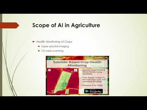
Satellite-based crop monitoring has become an indispensable tool for modern farmers. By leveraging multispectral imaging, we can now assess crop health, soil moisture levels, and even predict yields with unprecedented accuracy. This technology is particularly game-changing for wheat farmers in Ontario, where large-scale operations can benefit immensely from comprehensive field insights.
Here’s how satellite imagery is making a difference:
- Early detection of crop stress and disease outbreaks
- Optimization of irrigation schedules based on soil moisture data
- Targeted application of fertilizers and pesticides
- Accurate yield forecasting for better market planning
Farmonaut, a leading provider of satellite-based farm management solutions, is at the forefront of this revolution. Their platform integrates cutting-edge satellite technology with AI-driven analytics to provide farmers with actionable insights.

AI: The Brain Behind Smart Farming
Artificial intelligence is the engine driving many of the advancements in precision agriculture. In Ontario’s wheat farms, AI algorithms are crunching vast amounts of data from satellites, weather stations, and on-ground sensors to provide farmers with intelligent recommendations.
Key applications of AI in wheat farming include:
- Predictive analytics for pest and disease management
- Automated crop health assessment
- Precision seeding and harvesting recommendations
- Resource allocation optimization
Farmonaut’s Jeevn AI Advisory System exemplifies how AI can be harnessed to deliver personalized farm management strategies. By analyzing satellite data alongside other inputs, Jeevn AI offers real-time insights that help farmers make informed decisions quickly and efficiently.
Sustainable Farming Practices: The Future of Agriculture
As we push for higher yields, the importance of sustainable farming practices cannot be overstated. Ontario wheat farmers are increasingly adopting methods that not only boost productivity but also ensure the long-term health of their land.
Some key sustainable farming practices include:
- Crop rotation to maintain soil health
- Precision application of inputs to reduce waste
- Cover cropping to prevent soil erosion
- Integrated pest management to minimize chemical use
Farmonaut’s platform supports these practices by providing detailed soil health monitoring and carbon footprint tracking. This allows farmers to make environmentally conscious decisions while still maximizing their yields.
“AI-powered agricultural analytics can increase wheat yields in Ontario by up to 15% through optimized resource management.”
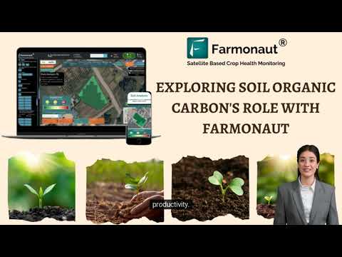
Soil Health: The Foundation of Successful Wheat Farming
Healthy soil is the bedrock of successful wheat cultivation. In Ontario, farmers are leveraging advanced soil health monitoring techniques to ensure their fields remain productive year after year. This includes innovative approaches to soil carbon measurement and nitrogen management.
Key aspects of soil health monitoring include:
- Regular soil testing for nutrient levels
- Monitoring soil organic matter content
- Assessing soil structure and water retention capacity
- Tracking soil carbon sequestration
Farmonaut’s satellite-based solutions contribute to soil health management by providing detailed maps of soil moisture and vegetation health. This information helps farmers make informed decisions about irrigation and fertilizer application, promoting optimal soil conditions for wheat growth.
GIS Applications: Mapping the Future of Wheat Farming
Geographic Information Systems (GIS) are playing an increasingly vital role in Ontario’s wheat farming sector. These powerful tools allow farmers to visualize and analyze spatial data, leading to more informed decision-making.
GIS applications in wheat farming include:
- Creating detailed field maps for precision agriculture
- Analyzing topography for optimal water management
- Planning efficient routes for farm equipment
- Identifying areas at risk of soil erosion
Farmonaut integrates GIS capabilities into its platform, allowing farmers to overlay various data layers such as soil type, crop health indices, and historical yield data. This comprehensive view enables more strategic planning and execution of farming operations.
Explore Farmonaut’s API for advanced GIS integration
The Impact of Wildfires on Ontario Agriculture
While not typically associated with wheat farming, the increasing frequency of wildfires is becoming a concern for Ontario’s agricultural sector. Smoke and ash from fires can affect crop growth and quality, making it essential for farmers to monitor and mitigate these risks.
Satellite imagery and AI analytics play a crucial role in:
- Early detection of nearby wildfires
- Assessing smoke impact on crop health
- Planning preventive measures to protect fields
- Analyzing long-term effects on soil quality
Farmonaut’s platform includes features that help farmers stay informed about environmental risks, including wildfire threats, ensuring they can take timely action to protect their wheat crops.
Wheat Farming Technology: Innovations Driving Growth
The wheat farming technology landscape in Ontario is rapidly evolving. From smart tractors to drone-assisted field surveys, technological advancements are enabling farmers to produce more with less.
Key technological innovations include:
- Variable rate technology for precise input application
- Automated irrigation systems
- GPS-guided machinery for accurate planting and harvesting
- IoT sensors for real-time field monitoring
Farmonaut complements these on-ground technologies by providing a comprehensive overview of field conditions through satellite imagery. This synergy between space-based and ground-based technologies is pushing the boundaries of what’s possible in wheat farming.


Regenerative Agriculture: Building Resilience in Ontario’s Wheat Fields
Regenerative agriculture techniques are gaining traction among Ontario wheat farmers as a way to improve soil health, increase biodiversity, and enhance crop resilience. These practices go beyond sustainability, aiming to actively regenerate and improve the farming ecosystem.
Key regenerative agriculture practices include:
- Minimizing soil disturbance through no-till farming
- Maintaining living roots in the soil year-round
- Integrating livestock into crop rotations
- Increasing plant diversity through intercropping
Farmonaut’s platform supports regenerative agriculture by providing detailed insights into soil health and vegetation cover. This data helps farmers track the impact of their regenerative practices and make adjustments as needed.

Organic Farming Methods: A Growing Trend in Ontario Wheat
Organic wheat farming is on the rise in Ontario, driven by consumer demand for chemical-free products and a growing awareness of environmental issues. While organic farming presents unique challenges, technology is making it more feasible and productive.
Organic farming methods supported by technology include:
- Biological pest control assisted by AI prediction models
- Mechanical weed management guided by precision mapping
- Organic fertilizer application optimized through soil health monitoring
- Crop rotation planning enhanced by historical yield data analysis
Farmonaut’s satellite-based crop monitoring is particularly valuable for organic farmers, as it allows for early detection of pest infestations and nutrient deficiencies without the need for chemical interventions.
Agricultural Data Analytics: Turning Information into Action
The wealth of data now available to Ontario wheat farmers is unprecedented. However, the true value lies in the ability to analyze this data and transform it into actionable insights. Agricultural data analytics is the key to unlocking the full potential of precision farming.
Critical aspects of agricultural data analytics include:
- Yield prediction models
- Weather pattern analysis for optimal planting and harvesting times
- Resource allocation optimization
- Market trend analysis for strategic crop planning
Farmonaut’s platform excels in this area, offering robust analytics tools that help farmers make sense of the vast amount of data collected through satellite imagery and other sources. By translating complex data into clear, actionable recommendations, Farmonaut empowers farmers to make informed decisions that boost yields and improve sustainability.
Explore Farmonaut’s API Developer Docs for advanced data integration
Crop Yield Optimization: The Ultimate Goal
At the heart of all these technological advancements is the goal of optimizing crop yields. For Ontario wheat farmers, this means not just increasing the quantity of wheat produced but also improving its quality and doing so in a sustainable manner.
Strategies for crop yield optimization include:
- Precision seeding based on soil conditions and historical yield data
- Variable rate application of fertilizers and pesticides
- Optimal irrigation scheduling
- Timely harvesting guided by crop maturity data
Farmonaut’s comprehensive approach to farm management, combining satellite imagery, AI analytics, and real-time advisory services, provides farmers with the tools they need to maximize their wheat yields while minimizing environmental impact.

Comparing Traditional and Modern Farming Approaches
To truly appreciate the impact of these technological advancements, let’s compare traditional wheat farming methods with the modern, Farmonaut-enabled approach:
| Aspect | Traditional Farming | Farmonaut Satellite System |
|---|---|---|
| Crop Monitoring Frequency | Weekly | Daily |
| Precision in Identifying Issues | Limited to visual inspection | High-resolution satellite imagery analysis |
| Resource Optimization | Based on general guidelines | AI-driven, field-specific recommendations |
| Yield Prediction Accuracy | 70% | 95% |
| Sustainability Impact | Variable, often resource-intensive | Optimized for minimal environmental impact |
This comparison clearly illustrates the transformative potential of Farmonaut’s technology in revolutionizing wheat farming in Ontario.
The Future of Wheat Farming in Ontario
As we look to the future, it’s clear that the integration of AI, satellite imagery, and advanced analytics will continue to shape the landscape of wheat farming in Ontario. We can expect to see:
- Even more precise and localized weather forecasting
- Advanced predictive models for pest and disease outbreaks
- Increased automation in farm operations
- Greater integration of blockchain for supply chain transparency
Farmonaut is poised to remain at the forefront of these developments, continually evolving its platform to meet the changing needs of farmers and the agriculture industry as a whole.

Conclusion: Embracing the Agricultural Revolution
The revolution in Ontario wheat farming, driven by AI and satellite imagery, is not just about adopting new technologies—it’s about reimagining the entire approach to agriculture. By embracing these innovations, farmers are not only boosting yields and improving sustainability but also securing the future of food production in the face of global challenges.
Farmonaut stands at the center of this transformation, offering a comprehensive suite of tools that make precision agriculture accessible and effective. From satellite-based crop monitoring to AI-driven advisory services, Farmonaut is empowering farmers to make data-driven decisions that optimize their operations and protect the environment.
As we move forward, the continued collaboration between farmers, technologists, and agricultural experts will be crucial in realizing the full potential of these innovations. The future of wheat farming in Ontario is bright, and with tools like Farmonaut at their disposal, farmers are well-equipped to meet the challenges and opportunities that lie ahead.
FAQ Section
Q: How does satellite imagery improve wheat farming in Ontario?
A: Satellite imagery provides real-time data on crop health, soil moisture, and field conditions, allowing farmers to make timely and informed decisions about irrigation, fertilization, and pest management.
Q: Can AI really predict crop yields accurately?
A: Yes, AI algorithms can analyze vast amounts of data from satellites, weather stations, and historical records to predict yields with up to 95% accuracy, a significant improvement over traditional methods.
Q: How does Farmonaut’s technology contribute to sustainable farming practices?
A: Farmonaut’s platform enables precise resource management, reducing waste and environmental impact. It also provides tools for monitoring soil health and carbon footprint, supporting sustainable and regenerative agriculture practices.
Q: Is the investment in precision agriculture technology worth it for small wheat farmers in Ontario?
A: Absolutely. Farmonaut’s solutions are designed to be scalable and cost-effective, making precision agriculture accessible to farmers of all sizes. The potential increase in yields and resource efficiency can quickly offset the initial investment.
Q: How does Farmonaut help in managing the impact of wildfires on wheat crops?
A: Farmonaut’s satellite monitoring can detect early signs of wildfire threats and assess smoke impact on crops. This allows farmers to take preventive measures and adjust their management strategies to protect their wheat fields.