Revolutionizing Queensland Farms: How Precision Agriculture and Satellite Crop Monitoring Boost Productivity

“Precision agriculture and satellite crop monitoring can increase farm productivity by up to 20% in Queensland.”
Welcome to our comprehensive exploration of the digital agriculture revolution that’s transforming Queensland’s farms. In this blog post, we’ll delve into the fascinating world of precision agriculture and smart farming technology, uncovering how these innovations are reshaping traditional farming practices into data-driven powerhouses of productivity.
As we navigate the evolving landscape of modern farming, we’ll examine cutting-edge agtech solutions, from weather forecasts tailored for farmers to innovative livestock management software. We’ll also uncover the potential of agricultural drone mapping and remote sensing in optimizing crop yields and managing resources efficiently.
The Digital Agriculture Revolution in Queensland
Queensland, known for its vast agricultural lands and diverse farming operations, is at the forefront of embracing digital agriculture. This revolution is not just about adopting new technologies; it’s about fundamentally changing how we approach farming to meet the challenges of the 21st century.
- Increased efficiency in resource management
- Enhanced decision-making through real-time data
- Improved sustainability and environmental stewardship
- Greater productivity and profitability for farmers
At the heart of this transformation is precision agriculture, a farming management concept that uses digital techniques to monitor and optimize agricultural production processes. By leveraging technologies such as satellite imagery, GPS, and IoT sensors, farmers can make more informed decisions about every aspect of their operations.
Satellite Crop Monitoring: A Game-Changer for Queensland Farmers
One of the most significant advancements in precision agriculture is the use of satellite crop monitoring. This technology allows farmers to observe their fields from space, providing unprecedented insights into crop health, soil conditions, and potential issues.

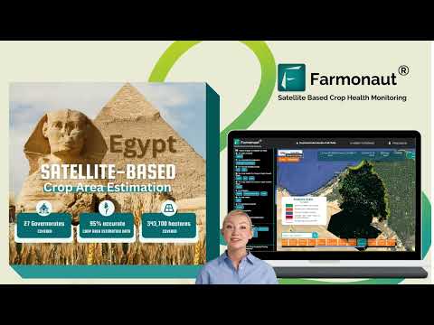
Farmonaut, a pioneering agricultural technology company, is at the forefront of this revolution. Their satellite-based farm management solutions are making precision agriculture accessible and affordable for farmers across Queensland and beyond.
Key Benefits of Satellite Crop Monitoring:
- Early detection of crop stress and diseases
- Optimization of irrigation and fertilizer application
- Accurate yield predictions and harvest planning
- Monitoring of crop growth stages and development
By utilizing multispectral satellite images, Farmonaut provides farmers with critical insights into vegetation health (NDVI), soil moisture levels, and other vital metrics. This data empowers farmers to make informed decisions about irrigation, fertilizer usage, and pest management, ultimately optimizing crop yields and reducing resource wastage.
Agricultural GIS: Mapping the Future of Farming
Agricultural Geographic Information Systems (GIS) are revolutionizing how farmers visualize and analyze their land. These powerful tools combine layers of spatial and temporal data to create comprehensive maps that guide decision-making processes.
“Agricultural GIS technology has been adopted by over 65% of large-scale farms in Australia for improved decision-making.”
In Queensland, the adoption of agricultural GIS has been particularly impactful, allowing farmers to:
- Analyze soil composition and fertility across their properties
- Plan efficient crop rotations and field layouts
- Identify areas prone to erosion or water logging
- Optimize the placement of irrigation systems and other infrastructure
Farmonaut’s platform integrates GIS technology with satellite imagery, providing a powerful tool for farm management. This integration allows for precise mapping of field boundaries, crop types, and even individual plants, enabling micro-management of large agricultural areas.
Weather Forecasts for Farmers: Precision in Prediction
In the unpredictable climate of Queensland, accurate weather forecasting is crucial for agricultural success. Advanced weather forecasting systems tailored for farmers are now an integral part of precision agriculture.
These systems go beyond general weather predictions, offering:
- Hyperlocal forecasts for specific farm locations
- Precipitation predictions with hourly accuracy
- Soil temperature and moisture forecasts
- Frost and heat stress warnings
Farmonaut’s platform incorporates these advanced weather forecasting capabilities, allowing farmers to plan their activities with greater confidence. Whether it’s deciding the optimal time for planting, scheduling irrigation, or planning harvest operations, precise weather data is invaluable.
Livestock Management Software: Digital Shepherding
The digital agriculture revolution isn’t limited to crop farming. Queensland’s extensive livestock industry is also benefiting from innovative technologies. Livestock management software is transforming how farmers monitor and care for their animals.
Key features of modern livestock management systems include:
- Real-time tracking of animal location and movement patterns
- Health monitoring through wearable sensors
- Automated feeding systems and nutritional management
- Breeding and genetics tracking for herd improvement
While Farmonaut primarily focuses on crop monitoring, their satellite and GIS technologies can be integrated with livestock management systems to provide a comprehensive farm management solution.
Agricultural Drone Mapping: A Bird’s Eye View of Farm Health
Drones have become an indispensable tool in precision agriculture, offering high-resolution imagery and data collection capabilities that complement satellite monitoring. In Queensland, agricultural drone mapping is being used for:
- Detailed crop health assessment
- Plant counting and yield estimation
- Identifying areas of pest infestation or disease
- Creating 3D models of terrain for drainage planning
The integration of drone data with satellite imagery and GIS systems, as offered by platforms like Farmonaut, provides farmers with a multi-layered view of their operations, enabling precise and timely interventions.
Remote Sensing in Farming: Beyond the Visible Spectrum
Remote sensing technologies are pushing the boundaries of what’s possible in agriculture. By capturing data across multiple spectral bands, farmers can gain insights that are invisible to the naked eye.
Applications of remote sensing in Queensland farming include:
- Early detection of plant stress before visible symptoms appear
- Mapping of soil properties and nutrient levels
- Identification of water-stressed areas for targeted irrigation
- Monitoring of carbon sequestration in soils and vegetation
Farmonaut’s satellite-based remote sensing capabilities provide farmers with these advanced insights, enabling proactive management of crops and resources.
Irrigation Optimization: Precision Watering for a Dry Continent
In a country as dry as Australia, efficient water use is critical. Precision irrigation systems, guided by data from satellites, soil sensors, and weather forecasts, are revolutionizing water management in Queensland farms.
Benefits of precision irrigation include:
- Reduced water consumption and costs
- Improved crop yields through optimal watering
- Prevention of over-watering and associated issues like nutrient leaching
- Adaptation to changing weather patterns and drought conditions
Farmonaut’s platform contributes to irrigation optimization by providing accurate soil moisture data and crop water stress information derived from satellite imagery.
Pest Control in Agriculture: Targeted and Timely Interventions
Pest management is a critical aspect of farming, and precision agriculture is transforming how we approach this challenge. In Queensland, farmers are using advanced technologies to implement more effective and environmentally friendly pest control strategies.
Modern pest control approaches in precision agriculture include:
- Early detection of pest infestations through satellite and drone imagery
- Precision application of pesticides using GPS-guided equipment
- Use of biological control agents informed by real-time pest population data
- Implementation of integrated pest management strategies based on comprehensive field data
Farmonaut’s crop monitoring capabilities play a crucial role in pest management by allowing farmers to identify potential problem areas quickly and track the effectiveness of control measures.
Agricultural Carbon Credits: A New Frontier for Farm Productivity
As the world grapples with climate change, agricultural carbon credits are emerging as a new opportunity for farmers. In Queensland, farmers are exploring ways to generate additional income by implementing practices that sequester carbon or reduce greenhouse gas emissions.
Key aspects of agricultural carbon credits include:
- Adoption of no-till farming practices
- Implementation of cover cropping and crop rotation
- Improved livestock management to reduce methane emissions
- Reforestation and agroforestry projects
Farmonaut’s platform supports these initiatives by providing accurate land use data and monitoring vegetation health, which are crucial for verifying carbon sequestration efforts.
The Role of Farmonaut in Queensland’s Agricultural Revolution
Farmonaut is playing a pivotal role in driving the adoption of precision agriculture in Queensland. Their satellite-based farm management solutions are making advanced technologies accessible to farmers of all scales.
Key features of Farmonaut’s platform include:
- Real-time crop health monitoring using satellite imagery
- AI-driven advisory system for personalized farm management
- Integration with weather forecasting and GIS technologies
- Support for sustainable farming practices and carbon credit initiatives
By providing affordable access to these technologies, Farmonaut is helping Queensland farmers increase productivity, reduce costs, and implement more sustainable farming practices.
Comparative Analysis: Traditional vs. Precision Agriculture in Queensland
| Farming Aspect | Traditional Method | Precision Agriculture Method | Estimated Productivity Increase |
|---|---|---|---|
| Crop Monitoring | Manual field inspections | Satellite and drone imagery analysis | 15-25% |
| Irrigation | Scheduled watering | Soil moisture sensor-based precision irrigation | 20-30% |
| Fertilizer Application | Uniform application across fields | Variable rate application based on soil nutrient maps | 10-20% |
| Pest Management | Routine pesticide applications | Targeted applications based on early detection | 15-25% |
| Yield Prediction | Historical data and visual estimation | AI-powered prediction using multi-source data | 5-15% |
The Future of Digital Agriculture in Queensland
As we look to the future, the potential for digital agriculture in Queensland is immense. Emerging technologies like artificial intelligence, blockchain, and the Internet of Things (IoT) are set to further revolutionize farming practices.
Some exciting developments on the horizon include:
- AI-powered autonomous farm machinery
- Blockchain-based traceability systems for food supply chains
- Advanced crop breeding using genetic data and AI
- Integration of precision agriculture with renewable energy systems
Farmonaut is at the forefront of these advancements, continuously evolving their platform to incorporate new technologies and meet the changing needs of farmers.
Conclusion: Embracing the Digital Agriculture Revolution
The digital agriculture revolution is transforming Queensland’s farms, offering unprecedented opportunities for increased productivity, sustainability, and profitability. From satellite crop monitoring to precision livestock management, these technologies are reshaping every aspect of farming.
As we’ve explored in this blog post, companies like Farmonaut are making these advanced technologies accessible to farmers of all sizes, democratizing access to precision agriculture. By embracing these innovations, Queensland’s farmers are not just adapting to the future of agriculture – they’re actively shaping it.
Whether you’re a rural landowner, an agribusiness professional, or simply interested in the future of food production, the digital agriculture revolution offers exciting possibilities. As we continue to face challenges like climate change and growing global food demand, these technologies will play a crucial role in ensuring a sustainable and productive agricultural sector in Queensland and beyond.
FAQs
- What is precision agriculture?
Precision agriculture is a farming management concept that uses digital techniques to monitor and optimize agricultural production processes. It involves technologies like satellite imagery, GPS, and IoT sensors to make more informed decisions about farming practices. - How does satellite crop monitoring benefit farmers?
Satellite crop monitoring provides farmers with real-time insights into crop health, soil conditions, and potential issues. It enables early detection of problems, optimization of resource use, and more accurate yield predictions. - What is agricultural GIS and how is it used in farming?
Agricultural GIS (Geographic Information Systems) combines spatial and temporal data to create comprehensive maps of farmland. It’s used for analyzing soil composition, planning crop rotations, identifying problem areas, and optimizing farm infrastructure placement. - How are drones used in precision agriculture?
Drones are used for high-resolution imagery and data collection, complementing satellite monitoring. They’re valuable for detailed crop health assessment, plant counting, pest detection, and creating 3D terrain models. - What role does Farmonaut play in precision agriculture?
Farmonaut provides satellite-based farm management solutions that make precision agriculture accessible and affordable. Their platform offers real-time crop health monitoring, AI-driven advisory systems, and integration with weather forecasting and GIS technologies.


For more information on Farmonaut’s API and developer resources, visit our API page and API Developer Docs.