Sustainable Satellite Solutions: Revolutionizing Water Management for Queensland Farmers
“Queensland’s Great Artesian Basin covers 1.7 million square kilometers, making it one of the world’s largest underground water reservoirs.”
Welcome to the fascinating world of sustainable agriculture technology in Queensland! We’re excited to take you on a journey through the Great Artesian Basin (GAB), where innovative satellite farming solutions are transforming water management practices and revolutionizing the agricultural landscape. In this comprehensive exploration, we’ll delve into how precision agriculture and cutting-edge agtech are empowering farmers to optimize their operations while preserving our precious natural resources.
The Great Artesian Basin: A Vital Resource for Queensland
The Great Artesian Basin is a vast underground water resource that spans across Queensland, New South Wales, South Australia, and the Northern Territory. For Queensland farmers, this basin has been a lifeline, providing water for agriculture, livestock, and communities in some of the driest parts of the state. However, traditional bore systems have led to significant water loss and environmental concerns over the years.

The Evolution of Water Management in Queensland
To address these challenges, the Queensland government, in collaboration with landholders, has implemented bore capping and piping schemes. These initiatives aim to reduce water waste and preserve the natural artesian springs that are crucial to the region’s ecosystem. Let’s explore how these schemes, combined with advanced satellite technology, are making a significant impact:
- Bore Capping: By sealing uncontrolled artesian bores, we prevent unnecessary water loss through evaporation and seepage.
- Piping Schemes: Replacing open earth channels with closed pipeline systems drastically reduces water loss during distribution.
- Satellite Monitoring: Advanced remote sensing technology allows for precise tracking of water usage and crop health.
Precision Agriculture: A Game-Changer for Water Management
Precision agriculture is at the forefront of this revolution, offering farmers unprecedented control over their water resources. By leveraging satellite data and advanced analytics, farmers can now make informed decisions about irrigation, crop selection, and land use. Here’s how precision agriculture is making a difference:
- Soil Moisture Monitoring: Satellite imagery helps farmers assess soil moisture levels across their fields, enabling targeted irrigation.
- Crop Health Analysis: Vegetation indices derived from satellite data provide insights into crop health, allowing for early intervention.
- Water Stress Detection: Advanced algorithms can detect signs of water stress in crops before they become visible to the naked eye.
“Satellite-based crop monitoring can increase farm productivity by up to 20% through precise resource management and early issue detection.”
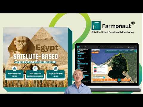
Farmonaut: Empowering Queensland Farmers with Cutting-Edge Technology
At the forefront of this agricultural revolution is Farmonaut, a pioneering agtech company offering advanced satellite-based farm management solutions. Farmonaut’s platform integrates seamlessly with the needs of Queensland farmers, providing valuable tools for water management, crop monitoring, and decision-making support.
Explore Farmonaut’s innovative solutions:


Remote Sensing in Agriculture: A Closer Look
Remote sensing technology is transforming the way Queensland farmers manage their land and water resources. By utilizing satellite imagery and advanced sensors, we can now gather crucial data about crop health, soil conditions, and water availability without setting foot in the field. Here’s how remote sensing is benefiting agriculture in the Great Artesian Basin:
- Vegetation Indices: Normalized Difference Vegetation Index (NDVI) and other indices help assess crop health and productivity.
- Thermal Imaging: Detect water stress and irrigation issues by analyzing temperature variations across fields.
- Multispectral Analysis: Identify pest infestations, nutrient deficiencies, and other crop health issues early on.

Farm Data Analytics: Turning Insights into Action
The power of satellite technology truly shines when combined with advanced data analytics. Queensland farmers are now leveraging big data to make informed decisions about their operations. Here’s how farm data analytics is revolutionizing agriculture in the region:
- Yield Prediction: Analyze historical data and current crop conditions to forecast yields accurately.
- Resource Optimization: Identify areas of inefficiency in water and nutrient use to maximize productivity.
- Risk Management: Assess potential threats from pests, diseases, and extreme weather events.
Harness the power of data with Farmonaut’s API: Farmonaut Satellite API
For developers looking to integrate Farmonaut’s powerful satellite and weather data into their own applications, check out our comprehensive API Developer Docs.
Livestock Management in the Digital Age
The benefits of satellite technology extend beyond crop farming. Queensland’s livestock industry, particularly in regions like Barcaldine and Blackall, is also reaping the rewards of these innovative solutions. Here’s how agtech is improving livestock management:
- Pasture Monitoring: Satellite imagery helps assess pasture quality and availability, optimizing grazing patterns.
- Water Point Mapping: Identify and monitor water sources for livestock across vast properties.
- Herd Tracking: GPS-enabled collars combined with satellite data allow for efficient herd management.
Smart Farming Techniques: The Future of Agriculture
Smart farming is rapidly gaining traction in Queensland, integrating technology into every aspect of agricultural operations. These techniques are proving invaluable in the efficient management of water resources in the Great Artesian Basin:
- IoT Sensors: Deploy sensors across fields to collect real-time data on soil moisture, temperature, and other crucial parameters.
- Automated Irrigation Systems: Use data-driven insights to optimize irrigation schedules and reduce water waste.
- Drone Technology: Complement satellite data with high-resolution drone imagery for detailed field analysis.
Agricultural Weather Monitoring: Staying One Step Ahead
In a region as vast and climatically diverse as Queensland, accurate weather monitoring is crucial for successful farming. Satellite-based weather monitoring systems are providing farmers with unprecedented insights:
- Localized Forecasts: Access highly accurate, field-specific weather predictions.
- Extreme Weather Alerts: Receive early warnings for events like heatwaves, frosts, or heavy rainfall.
- Historical Weather Data: Analyze long-term weather patterns to inform crop selection and planting schedules.
Carbon Farming Technology: A Sustainable Future
As the world focuses on combating climate change, carbon farming technology is gaining importance in Queensland’s agricultural sector. Here’s how satellite technology is supporting carbon farming initiatives:
- Carbon Sequestration Monitoring: Track the carbon storage potential of different land management practices.
- Vegetation Cover Analysis: Assess the impact of reforestation and land restoration projects.
- Emissions Tracking: Monitor and reduce greenhouse gas emissions from agricultural activities.

Crop Monitoring Through Satellite Imagery: A Closer Look
The ability to monitor crops from space has revolutionized farming in Queensland. Let’s delve deeper into how satellite imagery is enhancing crop management:
- Growth Stage Monitoring: Track crop development throughout the growing season.
- Yield Estimation: Use vegetation indices to predict crop yields accurately.
- Pest and Disease Detection: Identify potential outbreaks early for targeted interventions.
The Impact on Rural Development and Tourism
The adoption of sustainable satellite solutions in Queensland’s agricultural sector is having a ripple effect on rural development and tourism:
- Economic Growth: Increased agricultural productivity is boosting local economies in regions like Barcaldine and Blackall.
- Eco-Tourism Opportunities: Preserved artesian springs are attracting nature enthusiasts and tourists.
- Educational Initiatives: Agtech innovations are inspiring new educational programs and research opportunities in rural areas.
Comparative Analysis: Traditional vs. Satellite-Based Water Management
To better understand the impact of sustainable satellite solutions on water management in Queensland, let’s compare traditional methods with modern approaches:
| Water Management Technique | Water Conservation Impact | Artesian Spring Preservation | Livestock Management Efficiency | Crop Yield Improvement | Carbon Footprint Reduction | Implementation Cost | Long-term Sustainability |
|---|---|---|---|---|---|---|---|
| Traditional Bore Systems | Low (10-20%) | Low | Low | Low (0-5%) | Low (0-5%) | Low | Low |
| Bore Capping and Piping Schemes | High (60-80%) | High | Medium | Medium (10-15%) | Medium (10-20%) | Medium | High |
| Satellite-based Precision Agriculture | Very High (70-90%) | High | High | High (15-25%) | High (20-30%) | Medium | Very High |
| Remote Sensing and Farm Data Analytics | High (65-85%) | High | Very High | Very High (20-30%) | High (25-35%) | Medium-High | Very High |
| Smart Farming Techniques | Very High (75-95%) | Very High | Very High | Very High (25-35%) | Very High (30-40%) | High | Very High |
This comparison clearly demonstrates the superiority of satellite-based and smart farming techniques in terms of water conservation, productivity improvement, and overall sustainability.
The Role of Farmonaut in Queensland’s Agricultural Revolution
Farmonaut’s advanced satellite-based farm management solutions are playing a crucial role in transforming Queensland’s agricultural landscape. By providing affordable and accessible precision agriculture tools, Farmonaut is empowering farmers of all scales to optimize their operations and embrace sustainable practices.
Key features of Farmonaut’s platform that benefit Queensland farmers include:
- Real-time Crop Health Monitoring: Utilize multispectral satellite imagery to assess vegetation health and soil moisture levels.
- AI-driven Advisory System: Receive personalized recommendations for crop management based on real-time data and expert insights.
- Weather Forecasting: Access accurate, localized weather predictions to inform critical farming decisions.
- Resource Optimization: Identify areas of inefficiency in water and input usage to maximize productivity while minimizing waste.
- Carbon Footprint Tracking: Monitor and reduce environmental impact through data-driven sustainability practices.

The Future of Farming in Queensland
As we look to the future, the integration of sustainable satellite solutions in Queensland’s agricultural sector promises continued growth and innovation. Here are some trends we anticipate:
- Increased Adoption of AI and Machine Learning: More sophisticated algorithms will provide even more accurate predictions and recommendations.
- Integration with Blockchain Technology: Enhance traceability and transparency in the agricultural supply chain.
- Expansion of Carbon Farming Initiatives: Greater focus on carbon sequestration and emissions reduction in agriculture.
- Advanced Drought Prediction and Management: Improved long-term forecasting to help farmers prepare for and mitigate the impacts of drought.
Frequently Asked Questions
Q: How does satellite-based crop monitoring improve water management in Queensland?
A: Satellite-based crop monitoring provides real-time data on soil moisture levels, crop health, and water stress, allowing farmers to optimize irrigation schedules and reduce water waste. This precision approach ensures that crops receive exactly the amount of water they need, when they need it, leading to significant water conservation in the Great Artesian Basin region.
Q: What are the benefits of bore capping and piping schemes for artesian springs?
A: Bore capping and piping schemes help preserve artesian springs by reducing water wastage from uncontrolled bores. This conservation effort maintains water pressure in the Great Artesian Basin, ensuring the long-term sustainability of these unique ecosystems and the wildlife they support.
Q: How does Farmonaut’s technology benefit Queensland farmers?
A: Farmonaut’s satellite-based farm management solutions provide Queensland farmers with affordable access to precision agriculture tools. These include real-time crop health monitoring, AI-driven advisory systems, and resource optimization features, all of which help farmers make data-driven decisions to improve productivity and sustainability.
Q: Can small-scale farmers in Queensland benefit from these satellite solutions?
A: Absolutely. Farmonaut’s platform is designed to be accessible and affordable for farmers of all scales. Small-scale farmers can leverage these tools to optimize their operations, reduce input costs, and increase yields, leveling the playing field with larger agricultural enterprises.
Q: How does carbon farming technology contribute to sustainable agriculture in Queensland?
A: Carbon farming technology, supported by satellite data, helps Queensland farmers monitor and enhance carbon sequestration in their soil and vegetation. This not only contributes to climate change mitigation but also improves soil health, potentially leading to better crop yields and more resilient farming systems.
Conclusion
The integration of sustainable satellite solutions in Queensland’s agricultural sector marks a new era of efficient water management and sustainable farming practices. From the preservation of artesian springs to the optimization of crop yields, these innovative technologies are transforming the landscape of the Great Artesian Basin. As we continue to face challenges such as climate change and resource scarcity, the adoption of precision agriculture and smart farming techniques will be crucial in ensuring the long-term viability of Queensland’s agricultural industry.
By embracing these advanced technologies, Queensland farmers are not only improving their productivity and profitability but also contributing to the conservation of one of the world’s most precious water resources. The future of farming in Queensland looks bright, with satellite-based solutions paving the way for a more sustainable and prosperous agricultural sector.
To experience the power of satellite-based farm management firsthand, we invite you to explore Farmonaut’s innovative platform:
Join us in revolutionizing agriculture and water management in Queensland. Together, we can build a more sustainable and productive future for our farmers and our planet.