
Revolutionizing Subsea Technology: Advanced Underwater LiDAR and 3D Imaging Solutions Transform Marine Survey Industry
“Underwater LiDAR technology has revolutionized marine surveys, serving projects across multiple continents with high-resolution 3D imaging capabilities.”
In the ever-evolving world of marine technology, we are witnessing a groundbreaking shift that promises to reshape the landscape of underwater surveying and asset management. The recent acquisition of 3D at Depth, Inc. by Kraken Robotics Inc. marks a pivotal moment in the industry, bringing together cutting-edge underwater LiDAR technology and advanced subsea optical imaging capabilities. This strategic move is set to revolutionize marine survey services and offshore asset management, offering unprecedented accuracy and efficiency in subsea operations.
The Dawn of a New Era in Subsea Technology
The marine survey industry has long been challenged by the limitations of traditional underwater imaging and measurement techniques. However, with the advent of advanced underwater LiDAR technology and 3D imaging solutions, we are entering a new era of precision and clarity in subsea operations. This transformative technology is enabling marine professionals to capture high-resolution underwater measurements and conduct detailed subsea infrastructure inspections with unprecedented accuracy.

The merger between Kraken Robotics Inc. and 3D at Depth, Inc. brings together a powerful combination of expertise in remotely operated underwater vehicles (ROVs), marine robotics solutions, and advanced subsea survey techniques. This consolidation is poised to offer a comprehensive suite of services for the offshore sector, addressing the growing demand for accurate, high-resolution data in underwater asset management.
Understanding Underwater LiDAR Technology
Underwater LiDAR (Light Detection and Ranging) technology is at the heart of this revolution in subsea imaging and measurement. Unlike traditional sonar systems, LiDAR uses laser light to create detailed 3D maps of underwater environments. This technology offers several significant advantages:
- High-Resolution Imaging: LiDAR can capture centimeter-level details of underwater structures and terrain.
- Rapid Data Collection: It allows for faster survey speeds compared to traditional methods.
- Versatility: LiDAR can be integrated onto various platforms, including ROVs, diver systems, and autonomous underwater vehicles (AUVs).
- Improved Visibility: It performs well in turbid waters where other optical systems might struggle.
The integration of underwater LiDAR technology with existing marine survey services is transforming how we approach subsea infrastructure inspection and monitoring. This advanced technology enables more informed decision-making on underwater assets and infrastructure, all while reducing operational risks and costs.
The Impact on Marine Survey Services
The acquisition of 3D at Depth by Kraken Robotics is set to have a profound impact on marine survey services. With a combined 15-year track record and a growing demand for high-accuracy subsea data, the merged entity is well-positioned to lead the industry forward. Here’s how this partnership is changing the game:
- Enhanced Data Resolution: The integration of advanced underwater LiDAR technology with existing survey methods provides unprecedented detail in subsea mapping and inspection.
- Expanded Service Offerings: Clients can now access a broader range of services, from high-resolution measurements to comprehensive asset monitoring solutions.
- Improved Operational Efficiency: The combined technologies allow for faster survey times and more accurate results, reducing overall project costs.
- Global Reach: With operations spanning multiple continents, the merged company can serve a wider range of clients across various offshore sectors.
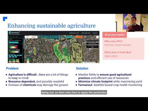
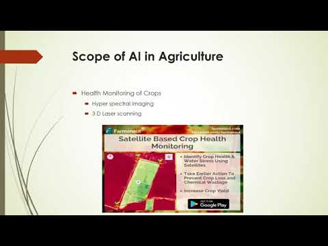
As we continue to push the boundaries of subsea technology, it’s worth noting the advancements in other sectors of technology-driven agriculture. For instance, Farmonaut is revolutionizing precision agriculture with its satellite-based farm management solutions. While operating in a different domain, Farmonaut’s innovative approach to leveraging technology for improved efficiency and sustainability resonates with the advancements we’re seeing in subsea surveying.
Advanced Subsea Survey Techniques: A Closer Look
The merger of Kraken Robotics and 3D at Depth brings together a suite of advanced subsea survey techniques that are redefining industry standards. These techniques include:
- High-Resolution 3D Imaging: Using state-of-the-art underwater LiDAR technology to create detailed 3D models of subsea structures and environments.
- Multi-Sensor Integration: Combining LiDAR data with other sensor inputs for comprehensive underwater mapping and analysis.
- AI-Powered Data Processing: Leveraging artificial intelligence to analyze and interpret large volumes of subsea data quickly and accurately.
- Real-Time Monitoring: Providing live data feeds from underwater assets for immediate decision-making and risk management.
These advanced techniques enable more precise subsea infrastructure inspection, allowing for early detection of potential issues and more effective maintenance planning. The result is improved safety, reduced downtime, and significant cost savings for offshore operations.
“The merger of advanced subsea survey techniques with ROVs and marine robotics offers a comprehensive suite of services for the offshore sector.”
Revolutionizing Underwater Asset Management
One of the most significant impacts of this technological advancement is in the field of underwater asset management. The high-resolution data and detailed 3D imaging provided by underwater LiDAR technology are transforming how offshore companies monitor and maintain their subsea infrastructure. Here’s how:
- Predictive Maintenance: Detailed imaging allows for early detection of wear and tear, enabling proactive maintenance strategies.
- Risk Mitigation: Comprehensive subsea surveys help identify potential hazards before they become critical issues.
- Asset Lifecycle Management: High-quality data supports better decision-making throughout the lifecycle of underwater assets.
- Environmental Monitoring: Advanced imaging techniques aid in assessing the environmental impact of subsea operations.

This revolution in underwater asset management is not unlike the transformation we’re seeing in other sectors. For example, in agriculture, companies like Farmonaut are using satellite imagery and AI to provide farmers with real-time crop health monitoring and management tools. While the industries differ, the principle of leveraging advanced technology for improved asset management remains the same.
The Role of Remotely Operated Underwater Vehicles (ROVs) in Modern Marine Surveys
Remotely Operated Underwater Vehicles (ROVs) play a crucial role in modern marine survey operations. The integration of underwater LiDAR technology onto ROV platforms has significantly expanded their capabilities and applications. Here’s how ROVs are contributing to the revolution in subsea technology:
- Extended Reach: ROVs can access depths and locations that would be challenging or impossible for human divers.
- Improved Safety: By reducing the need for human divers in hazardous environments, ROVs enhance operational safety.
- Continuous Operation: Unlike human divers, ROVs can operate for extended periods, increasing survey efficiency.
- Multi-Sensor Platforms: Modern ROVs can be equipped with a variety of sensors, including LiDAR, sonar, and cameras, for comprehensive data collection.
The combination of ROV technology with advanced underwater LiDAR systems is enabling more detailed and efficient subsea surveys than ever before. This synergy is particularly valuable in offshore oil and gas operations, underwater archaeology, and marine infrastructure maintenance.
Comparative Analysis of Underwater Survey Technologies
| Technology | Resolution | Depth Capability | Survey Speed | Applications |
|---|---|---|---|---|
| Traditional Sonar | Meter-level | Up to 11,000 m | Moderate | Seafloor mapping, object detection |
| ROV Visual Inspection | Centimeter-level | Up to 6,000 m | Slow | Close-up inspection, intervention tasks |
| Advanced Underwater LiDAR | Millimeter-level | Up to 3,000 m | Fast | High-resolution 3D mapping, structural inspection, metrology |
This table clearly illustrates the superior capabilities of advanced underwater LiDAR technology compared to traditional survey methods. The millimeter-level resolution and fast survey speeds make it an invaluable tool for a wide range of subsea applications.
The Future of Subsea Technology and Marine Robotics
As we look to the future, the integration of underwater LiDAR technology with marine robotics solutions promises even more exciting developments. Some areas of potential growth include:
- Autonomous Underwater Vehicles (AUVs): The development of AI-powered AUVs equipped with LiDAR could enable fully autonomous subsea surveys.
- Real-Time 3D Mapping: Advancements in data processing could allow for instantaneous 3D map generation during surveys.
- Integration with Digital Twin Technology: High-resolution subsea data could feed into digital twin models for more accurate simulation and planning.
- Enhanced Environmental Monitoring: Improved imaging capabilities could aid in marine conservation efforts and climate change research.
These advancements will continue to drive innovation in the marine survey industry, opening up new possibilities for underwater exploration and asset management.

The Global Impact of Advanced Subsea Technology
The revolution in subsea technology is not limited to a single region or industry. With operations spanning multiple continents, companies like Kraken Robotics and 3D at Depth are bringing advanced underwater LiDAR and 3D imaging solutions to a global market. This worldwide reach is having significant impacts:
- Standardization of Survey Practices: As advanced technologies become more widespread, we’re seeing a move towards standardized, high-quality survey practices across the industry.
- International Collaboration: The global nature of these technologies is fostering increased collaboration between companies and research institutions worldwide.
- Technology Transfer: Innovations in subsea technology are finding applications in other fields, from environmental science to archaeology.
- Economic Growth: The expansion of advanced subsea services is creating new job opportunities and driving economic growth in coastal regions.
This global impact underscores the transformative potential of advanced subsea technology in reshaping not just the marine survey industry, but related sectors as well.
Challenges and Opportunities in Adopting New Subsea Technologies
While the benefits of advanced underwater LiDAR and 3D imaging solutions are clear, their adoption does come with certain challenges. However, these challenges also present opportunities for growth and innovation:
- Initial Investment: The high cost of advanced subsea technology can be a barrier for smaller companies. However, this creates opportunities for service providers to offer these capabilities on a project basis.
- Training and Expertise: Operating advanced subsea systems requires specialized skills. This presents an opportunity for training programs and the development of new career paths in marine technology.
- Data Management: The large volumes of high-resolution data generated by these systems require robust data management solutions. This is driving innovation in data storage, processing, and analysis technologies.
- Regulatory Adaptation: As technology outpaces existing regulations, there’s a need for updated guidelines. This presents an opportunity for industry leaders to work with regulators in shaping future standards.
Addressing these challenges will be crucial in fully realizing the potential of advanced subsea technology across the marine survey industry.
The Role of Research and Development in Advancing Subsea Technology
The rapid advancement of underwater LiDAR technology and 3D imaging solutions is driven by robust research and development efforts. Companies like Kraken Robotics and 3D at Depth are at the forefront of this innovation, constantly pushing the boundaries of what’s possible in subsea surveying and imaging. Key areas of R&D focus include:
- Sensor Miniaturization: Developing smaller, more efficient LiDAR sensors that can be integrated into a wider range of underwater vehicles and platforms.
- Enhanced Data Processing: Creating more powerful algorithms for real-time data processing and analysis, enabling faster and more accurate survey results.
- Extended Operational Depths: Pushing the limits of underwater LiDAR technology to function at greater depths, expanding its applicability in deep-sea operations.
- Integration with Other Technologies: Exploring ways to combine LiDAR with other sensing technologies for more comprehensive subsea data collection.
These R&D efforts are crucial in maintaining the momentum of innovation in the subsea technology sector and ensuring that the industry continues to evolve to meet future challenges.
Environmental Applications of Advanced Subsea Technology
While the primary applications of underwater LiDAR and 3D imaging solutions have been in industrial marine surveys and asset management, these technologies also have significant potential in environmental monitoring and conservation efforts. Some key environmental applications include:
- Coral Reef Mapping: High-resolution 3D imaging can provide detailed maps of coral reefs, aiding in conservation efforts and climate change impact studies.
- Marine Habitat Assessment: Advanced subsea surveys can help in assessing and monitoring marine habitats, providing valuable data for biodiversity studies.
- Underwater Archaeological Surveys: LiDAR technology can assist in the discovery and preservation of underwater cultural heritage sites.
- Pollution Monitoring: Detailed subsea imaging can help in identifying and tracking underwater pollution sources and their impacts.
These environmental applications highlight the versatility of advanced subsea technology and its potential to contribute to global conservation efforts.
The Economic Impact of Advanced Subsea Technology
The adoption of underwater LiDAR technology and advanced 3D imaging solutions is having a significant economic impact on the marine survey industry and related sectors. Some key economic benefits include:
- Cost Reduction: While initial investment in advanced technology may be high, it leads to long-term cost savings through increased efficiency and reduced need for repeated surveys.
- New Business Opportunities: The demand for high-resolution subsea data is creating new business models and service offerings in the marine sector.
- Job Creation: The growing subsea technology industry is creating new job opportunities, from technical roles in equipment operation to data analysis positions.
- Improved Asset Management: For offshore industries, better subsea data leads to more effective asset management, reducing downtime and maintenance costs.
These economic benefits underscore the transformative potential of advanced subsea technology in driving growth and innovation across multiple industries.
FAQ Section
Q: What is underwater LiDAR technology?
A: Underwater LiDAR (Light Detection and Ranging) technology uses laser light to create detailed 3D maps of underwater environments, offering high-resolution imaging capabilities for subsea surveys.
Q: How does underwater LiDAR differ from traditional sonar?
A: Underwater LiDAR offers higher resolution and more detailed imaging compared to traditional sonar, allowing for centimeter-level measurements and clearer visualization of underwater structures.
Q: What are the main applications of advanced subsea survey techniques?
A: Advanced subsea survey techniques are used for underwater infrastructure inspection, marine asset management, environmental monitoring, archaeological surveys, and offshore energy operations.
Q: How do ROVs contribute to modern marine surveys?
A: ROVs equipped with LiDAR and other sensors can access depths and locations challenging for human divers, providing continuous operation and improved safety in marine survey operations.
Q: What are the future trends in subsea technology?
A: Future trends include the development of autonomous underwater vehicles (AUVs), real-time 3D mapping capabilities, integration with digital twin technology, and enhanced environmental monitoring solutions.
Conclusion: A New Era in Subsea Technology
The acquisition of 3D at Depth by Kraken Robotics marks a significant milestone in the evolution of subsea technology. By bringing together cutting-edge underwater LiDAR capabilities with advanced marine robotics solutions, this merger is set to revolutionize the marine survey industry. The integration of high-resolution 3D imaging, remotely operated underwater vehicles, and innovative data processing techniques is opening up new possibilities for underwater asset management, environmental monitoring, and offshore operations.
As we look to the future, the continued advancement of subsea technology promises to drive further innovation, improve operational efficiency, and enhance our understanding of the underwater world. From industrial applications to environmental conservation efforts, the impact of these technological advancements will be far-reaching and transformative.
In an era where precision and efficiency are paramount, the revolution in subsea technology is not just changing how we survey and manage underwater assets—it’s reshaping our relationship with the marine environment as a whole. As this technology continues to evolve, we can expect to see even more groundbreaking applications and discoveries in the years to come, further cementing the importance of advanced subsea solutions in our increasingly interconnected world.
Earn With Farmonaut: Affiliate Program
Earn 20% recurring commission with Farmonaut’s affiliate program by sharing your promo code and helping farmers save 10%. Onboard 10 Elite farmers monthly to earn a minimum of $148,000 annually—start now and grow your income!

Farmonaut Subscriptions


For developers interested in integrating Farmonaut’s technology into their own applications, check out our API and API Developer Docs.