Revolutionizing European Agriculture: How Satellite Imagery and GIS Drive Sustainable Farming with Farmonaut
“Satellite imagery can detect crop health variations with up to 98% accuracy, revolutionizing precision farming techniques.”
In the heart of Europe’s agricultural landscape, a technological revolution is unfolding. At Farmonaut, we’re proud to be at the forefront of this transformation, harnessing the power of satellite imagery and Geographic Information Systems (GIS) to drive sustainable farming practices across the continent. Our innovative solutions are changing the face of agriculture, empowering farmers with data-driven insights and precision farming technologies that were once the stuff of science fiction.

As we delve into the world of satellite-based agriculture, we’ll explore how these cutting-edge technologies are not just improving crop yields and resource management, but also contributing to the broader goals of sustainable agriculture and environmental conservation. From the rolling hills of Tuscany to the vast plains of Ukraine, Farmonaut’s solutions are helping farmers make smarter decisions, reduce their environmental impact, and secure the future of food production in Europe and beyond.
The Power of Satellite Imagery in Agriculture
Satellite imagery has become an indispensable tool in modern agriculture, offering a bird’s-eye view of farmlands that was previously unimaginable. At Farmonaut, we leverage this technology to provide farmers with unprecedented insights into their fields. Here’s how satellite imagery is transforming European agriculture:
- Crop Health Monitoring: Our advanced satellite-based crop health monitoring system uses multispectral imagery to assess vegetation health through NDVI (Normalized Difference Vegetation Index) analysis. This allows farmers to detect issues such as pest infestations, disease outbreaks, or nutrient deficiencies early on, enabling timely interventions.
- Precision Farming: By analyzing satellite data, we help farmers implement precision farming techniques, optimizing the use of water, fertilizers, and pesticides. This not only reduces costs but also minimizes environmental impact.
- Yield Prediction: Our satellite imagery analysis, combined with machine learning algorithms, provides accurate yield predictions, helping farmers and agribusinesses make informed decisions about harvesting, storage, and market strategies.
- Land Use Mapping: We use satellite data to create detailed agricultural land use maps, aiding in crop rotation planning, biodiversity conservation, and policy-making at regional and national levels.
The integration of satellite imagery into agricultural practices is not just about technology; it’s about empowering farmers with the knowledge they need to make sustainable choices. With Farmonaut’s solutions, European farmers are gaining a competitive edge while contributing to the global effort to create a more sustainable food system.

GIS: The Backbone of Smart Farming
Geographic Information Systems (GIS) form the backbone of our smart farming solutions at Farmonaut. By integrating multiple layers of data – from satellite imagery to soil maps and weather patterns – GIS provides a comprehensive view of agricultural landscapes. Here’s how we’re leveraging GIS to drive sustainable farming practices:
- Spatial Analysis: Our GIS tools enable farmers to perform complex spatial analyses, identifying patterns and relationships in their fields that would be impossible to detect from the ground.
- Resource Management: By overlaying various data layers, we help farmers optimize resource allocation, ensuring that water, fertilizers, and other inputs are used efficiently and sustainably.
- Risk Assessment: GIS allows us to create risk maps for various threats such as frost, drought, or pest outbreaks, enabling proactive management strategies.
- Ecosystem Preservation: Our GIS solutions help in identifying and preserving critical ecosystems within agricultural landscapes, promoting biodiversity and sustainable land use.
The power of GIS in agriculture extends beyond individual farms. At Farmonaut, we’re using this technology to contribute to broader initiatives in sustainable agriculture, disaster management, and environmental monitoring across Europe.
Precision Farming Technologies: A Game-Changer for European Agriculture
Precision farming technologies are revolutionizing agriculture in Europe, and at Farmonaut, we’re proud to be driving this change. By combining satellite imagery, GIS, and advanced analytics, we’re enabling farmers to make data-driven decisions with unprecedented accuracy. Here’s how our precision farming technologies are making a difference:
- Variable Rate Application: Our technology allows for the precise application of inputs like fertilizers and pesticides, reducing waste and environmental impact while optimizing crop yields.
- Automated Machinery Guidance: By integrating our satellite data with farm equipment, we enable automated guidance systems that improve efficiency and reduce operator fatigue.
- Crop Monitoring with Remote Sensing: Our advanced remote sensing capabilities provide real-time insights into crop health, growth stages, and potential issues, allowing for timely interventions.
- Smart Irrigation Systems: By analyzing satellite data on soil moisture and crop water needs, we help farmers implement smart irrigation strategies, conserving water and improving crop quality.
These precision farming technologies are not just improving productivity; they’re also contributing to more sustainable agricultural practices across Europe. By optimizing resource use and reducing environmental impact, Farmonaut is helping to create a more resilient and sustainable food system for future generations.

Sustainable Agriculture Data Solutions: The Farmonaut Approach
At Farmonaut, we believe that sustainable agriculture is the key to securing our food future while preserving our planet. Our sustainable agriculture data solutions are designed to help farmers make environmentally conscious decisions without compromising productivity. Here’s how we’re making this possible:
- Soil Health Monitoring: Our satellite-based soil analysis helps farmers maintain optimal soil health, reducing the need for chemical interventions and promoting long-term sustainability.
- Carbon Footprint Tracking: We provide tools for farmers to monitor and reduce their carbon footprint, contributing to global efforts to mitigate climate change.
- Biodiversity Conservation: Our land use mapping and ecosystem analysis help in identifying and protecting areas of high biodiversity within agricultural landscapes.
- Water Conservation: By providing accurate data on crop water needs and soil moisture levels, we help farmers implement water-saving irrigation strategies.
These sustainable agriculture data solutions are not just good for the environment; they also make economic sense for farmers. By optimizing resource use and promoting long-term soil health, we’re helping European farmers build more resilient and profitable operations.
“Farmonaut’s GIS-based solutions have helped reduce water usage in agriculture by up to 30% across European farms.”
Digital Agriculture Innovations: The Future of Farming
The future of agriculture is digital, and at Farmonaut, we’re leading the charge with our innovative digital agriculture solutions. By harnessing the power of big data, artificial intelligence, and machine learning, we’re creating tools that are transforming the way European farmers work. Here’s a look at some of our cutting-edge digital agriculture innovations:
- AI-Powered Crop Analytics: Our advanced AI algorithms analyze satellite imagery and other data sources to provide actionable insights on crop health, yield potential, and optimal management practices.
- Blockchain-Based Traceability: We’re implementing blockchain technology to ensure transparency and traceability in agricultural supply chains, building trust between farmers, processors, and consumers.
- IoT Integration: Our platform integrates with IoT devices in the field, providing real-time data on soil conditions, weather, and crop status for more informed decision-making.
- Predictive Analytics: By analyzing historical data and current conditions, our predictive analytics tools help farmers anticipate and prepare for potential challenges, from weather events to market fluctuations.
These digital agriculture innovations are not just improving efficiency; they’re also opening up new possibilities for sustainable and profitable farming practices across Europe. With Farmonaut’s solutions, farmers are better equipped to face the challenges of the 21st century while producing high-quality, sustainable food for a growing population.
Farm Management Software: Streamlining Operations
Efficient farm management is crucial for success in modern agriculture, and at Farmonaut, we’ve developed comprehensive farm management software to streamline operations for European farmers. Our user-friendly platform integrates seamlessly with our satellite imagery and GIS solutions, providing a one-stop-shop for all farm management needs. Here’s what our software offers:
- Crop Planning and Rotation: Our software helps farmers plan optimal crop rotations based on soil health, market demands, and environmental factors.
- Resource Tracking: Farmers can easily track and manage resources such as seeds, fertilizers, and pesticides, ensuring efficient use and minimizing waste.
- Financial Management: Integrated financial tools help farmers track expenses, revenues, and profitability, making informed business decisions easier.
- Compliance Management: Our software helps farmers stay compliant with European agricultural regulations and sustainability standards, simplifying reporting and documentation processes.
By centralizing farm management tasks and integrating them with our advanced satellite and GIS data, we’re helping European farmers save time, reduce errors, and make more informed decisions. This comprehensive approach to farm management is key to building more sustainable and profitable agricultural operations across the continent.
Geospatial Analytics in Agriculture: Unlocking New Insights
Geospatial analytics is at the core of Farmonaut’s innovative approach to agriculture. By analyzing spatial data from various sources, we’re able to provide European farmers with unprecedented insights into their operations. Here’s how we’re leveraging geospatial analytics to drive agricultural innovation:
- Yield Variability Analysis: Our geospatial tools help identify and analyze yield variability within fields, allowing for targeted interventions to improve overall productivity.
- Pest and Disease Mapping: By analyzing spatial patterns of pest infestations and disease outbreaks, we help farmers implement more effective and targeted pest management strategies.
- Climate Risk Assessment: Our geospatial analytics tools assess climate-related risks specific to different regions, helping farmers adapt their practices to changing environmental conditions.
- Market Analysis: We use geospatial data to analyze market trends and logistics, helping farmers make informed decisions about crop selection and distribution strategies.
Geospatial analytics is not just about collecting data; it’s about turning that data into actionable insights. At Farmonaut, we’re committed to making these powerful analytical tools accessible to farmers of all sizes across Europe, driving a new era of data-driven, sustainable agriculture.
Smart Farming Techniques: Enhancing Efficiency and Sustainability
Smart farming techniques are revolutionizing agriculture in Europe, and Farmonaut is at the forefront of this transformation. By integrating advanced technologies with traditional farming practices, we’re helping farmers enhance both efficiency and sustainability. Here’s a look at some of the smart farming techniques we’re promoting:
- Precision Seeding: Our satellite-based soil analysis helps farmers optimize seed placement and density, improving germination rates and overall crop performance.
- Smart Spraying: By using our detailed crop health maps, farmers can implement targeted spraying techniques, reducing chemical use and minimizing environmental impact.
- Automated Harvesting: Our yield prediction tools and field mapping capabilities support automated harvesting systems, improving efficiency and reducing post-harvest losses.
- Livestock Monitoring: While our focus is on crop farming, we also provide solutions for smart livestock management, including pasture optimization and herd health monitoring.
These smart farming techniques are not just about technology; they’re about creating a more sustainable and efficient agricultural system. By adopting these practices, European farmers can reduce their environmental footprint while improving productivity and profitability.

The Role of Hyperspectral Imaging in Modern Agriculture
Hyperspectral imaging is an advanced technology that’s opening up new possibilities in agricultural monitoring and analysis. At Farmonaut, we’re exploring the potential of this cutting-edge technology to provide even more detailed insights for European farmers. Here’s how hyperspectral imaging is enhancing our agricultural solutions:
- Crop Stress Detection: Hyperspectral imaging allows for early detection of crop stress, even before visible signs appear, enabling proactive management.
- Nutrient Content Analysis: By analyzing the spectral signatures of crops, we can assess nutrient content more accurately, helping farmers fine-tune their fertilization strategies.
- Weed Identification: Hyperspectral data helps in identifying specific weed species, allowing for more targeted and efficient weed management practices.
- Soil Composition Mapping: This technology enables detailed mapping of soil composition, helping farmers make more informed decisions about crop selection and management practices.
While hyperspectral imaging is still an emerging technology in agriculture, its potential is immense. At Farmonaut, we’re committed to staying at the forefront of these technological advancements, ensuring that European farmers have access to the most advanced and effective tools for sustainable agriculture.
Satellite-Based Crop Health Analysis: A Closer Look
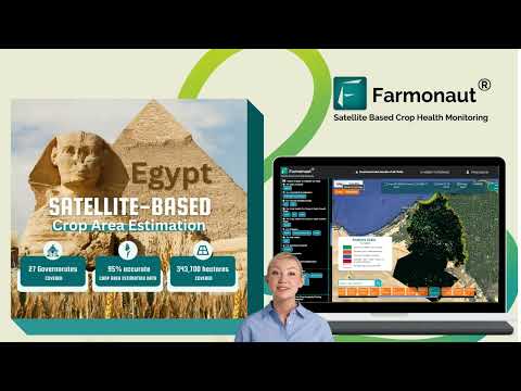
Satellite-based crop health analysis is a cornerstone of Farmonaut’s agricultural solutions. This technology allows us to provide European farmers with detailed, timely information about the health and vigor of their crops. Here’s a deeper look at how we use satellite data for crop health analysis:
- Vegetation Indices: We use various vegetation indices, including NDVI, EVI, and SAVI, to assess crop health and vigor across large areas.
- Temporal Analysis: By analyzing satellite imagery over time, we can track crop development and identify any deviations from expected growth patterns.
- Stress Detection: Our advanced algorithms can detect various types of crop stress, including water stress, nutrient deficiencies, and pest infestations.
- Yield Estimation: By correlating crop health data with historical yield information, we provide accurate yield estimates to help farmers plan their harvests and market strategies.
This satellite-based crop health analysis not only helps farmers respond quickly to issues but also enables them to make proactive decisions that optimize crop performance and resource use. It’s a powerful tool in our mission to promote sustainable and efficient agriculture across Europe.
Agricultural Land Use Mapping: Planning for Sustainability
Agricultural land use mapping is a crucial tool for sustainable farm management and regional planning. At Farmonaut, we use advanced satellite imagery and GIS techniques to create detailed, up-to-date land use maps for European agricultural regions. Here’s how our agricultural land use mapping contributes to sustainable farming practices:
- Crop Type Identification: Our mapping technology can identify different crop types across large areas, aiding in regional crop diversity planning and market analysis.
- Land Use Change Detection: By comparing maps over time, we can detect and analyze changes in land use, helping policymakers and farmers make informed decisions about land management.
- Soil Conservation Planning: Our land use maps, combined with soil data, help in identifying areas at risk of erosion or degradation, enabling targeted conservation efforts.
- Biodiversity Corridor Planning: By mapping agricultural lands and natural habitats, we assist in planning biodiversity corridors that support wildlife while coexisting with productive farmland.
Agricultural land use mapping is more than just creating pretty pictures; it’s about providing a comprehensive view of the agricultural landscape that informs better decision-making at all levels, from individual farms to national agricultural policies.
Disaster Management and Environmental Monitoring in Agriculture
In an era of climate change and increasing environmental challenges, disaster management and environmental monitoring have become crucial aspects of sustainable agriculture. At Farmonaut, we’re leveraging our satellite imagery and GIS capabilities to support these critical functions:
- Flood Risk Assessment: Our satellite-based flood risk maps help farmers and authorities prepare for and respond to potential flooding events.
- Drought Monitoring: By analyzing vegetation health and soil moisture data, we provide early warnings for drought conditions, allowing for timely interventions.
- Wildfire Risk Mapping: In fire-prone regions, our technology helps identify high-risk areas and monitor vegetation conditions that could contribute to wildfire spread.
- Ecosystem Health Tracking: We monitor the health of ecosystems surrounding agricultural lands, helping to maintain the delicate balance between farming and nature conservation.
These disaster management and environmental monitoring capabilities are essential for building resilience in European agriculture. By providing timely information and risk assessments, we’re helping farmers and policymakers make informed decisions that protect both agricultural productivity and the natural environment.
The Future of European Agriculture with Farmonaut
As we look to the future of European agriculture, Farmonaut is committed to driving innovation and sustainability through our advanced satellite imagery and GIS solutions. We envision a future where:
- Every farmer has access to real-time, actionable data about their crops and land.
- Precision farming techniques are the norm, optimizing resource use and minimizing environmental impact.
- Agricultural practices are fully integrated with ecosystem conservation efforts.
- Data-driven decision-making leads to more resilient and profitable farming operations.
- European agriculture leads the world in sustainability and innovation.
To achieve this vision, we’re continuously innovating and expanding our services. We invite European farmers, agribusinesses, and policymakers to join us in this journey towards a more sustainable and productive agricultural future.
Farmonaut’s Solutions: Empowering European Farmers
At Farmonaut, we’re proud to offer a comprehensive suite of solutions designed to empower European farmers with the latest in agricultural technology. Our platform is accessible through various channels to suit different needs and preferences:
- Web Application: Our powerful web app provides full access to our satellite imagery, GIS tools, and farm management features.
- Mobile Apps: For farmers on the go, our Android and iOS apps offer essential features and real-time updates right in the palm of your hand.
- API Access: For developers and businesses looking to integrate our data into their own systems, we offer robust API solutions.
Explore our solutions and start revolutionizing your farming practices today:


For developers interested in integrating our satellite and weather data into their applications, check out our API and API Developer Docs.
Farmonaut Subscriptions
Frequently Asked Questions
Q: How accurate is satellite imagery for crop monitoring?
A: Satellite imagery can provide crop health assessments with up to 98% accuracy, depending on factors such as image resolution and frequency of data collection.
Q: Can Farmonaut’s solutions be used for small farms?
A: Absolutely! Our solutions are scalable and can be tailored to farms of all sizes, from small family operations to large industrial farms.
Q: How often is satellite data updated?
A: The frequency of updates depends on the specific service package, but we typically provide updates every 3-5 days for most regions in Europe.
Q: Is training required to use Farmonaut’s tools?
A: While our platform is designed to be user-friendly, we provide comprehensive training resources and customer support to ensure you can make the most of our tools.
Q: How does Farmonaut contribute to sustainable agriculture?
A: Our solutions promote sustainable practices by optimizing resource use, reducing chemical inputs, and supporting biodiversity conservation through precise land management.
Conclusion: Embracing the Future of Agriculture with Farmonaut
As we’ve explored throughout this blog, the integration of satellite imagery and GIS technologies is revolutionizing European agriculture. At Farmonaut, we’re proud to be at the forefront of this transformation, providing innovative solutions that empower farmers, promote sustainability, and drive the future of food production.
From precision farming and crop health monitoring to environmental conservation and disaster management, our comprehensive suite of tools is designed to address the complex challenges facing modern agriculture. By harnessing the power of data and technology, we’re helping European farmers make more informed decisions, optimize their operations, and contribute to a more sustainable food system.
As we look to the future, we remain committed to innovation and continuous improvement. We invite farmers, agribusinesses, and policymakers across Europe to join us in this exciting journey. Together, we can create a more resilient, productive, and sustainable agricultural sector that meets the needs of today while safeguarding our resources for tomorrow.
Explore Farmonaut’s solutions today and take the first step towards revolutionizing your farming practices. The future of agriculture is here, and it’s powered by satellite imagery, GIS, and the innovative spirit of European farmers.