Taking Precision Agriculture to the Next Level: Revolutionizing Field Management with Farmonaut
In the ever-evolving world of agriculture, precision farming has become more than just a buzzword—it’s a necessity. At Farmonaut, we’re pushing the boundaries of what’s possible in smart farming, and we’re excited to share our latest innovation that’s set to transform the way you manage your fields.
The Next Frontier in Precision Agriculture
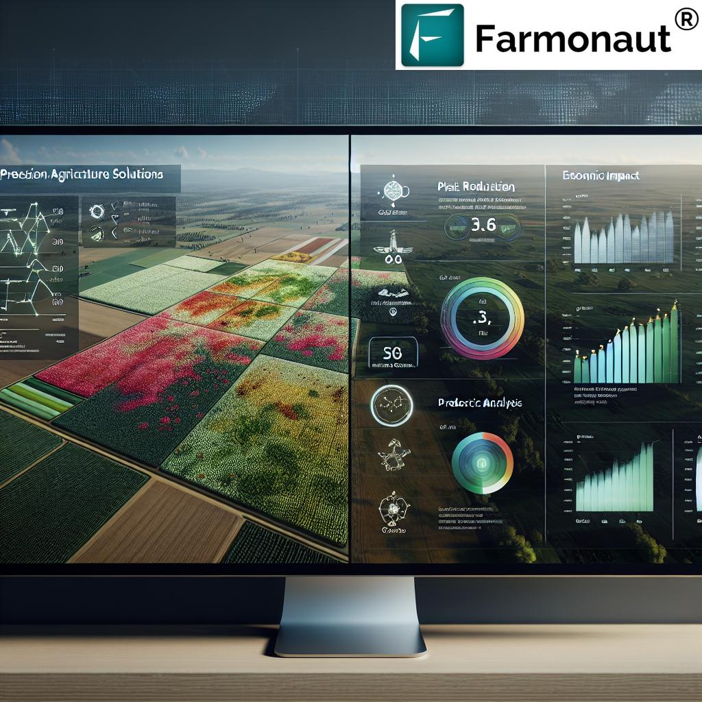
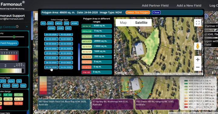
We’ve always been at the forefront of agricultural technology, but our newest feature takes precision agriculture to unprecedented heights. Now, you can select smaller fields within your already selected field and get minute crop performance details of any smaller patch of land within your selected field. This level of granularity in field management is a game-changer for farmers and agronomists alike.
Why Polygon Selection Matters
Traditional field management often treats entire fields as uniform entities. However, we at Farmonaut understand that each field is a complex ecosystem with varying soil conditions, moisture levels, and crop health. Our new polygon selection feature addresses this complexity head-on. Here’s why it’s crucial:
- Micro-management of Resources: By analyzing smaller sections of your field, you can allocate resources like water and fertilizers more efficiently.
- Early Problem Detection: Identify issues in specific areas before they spread to the entire field.
- Optimized Yield: Tailor your farming practices to the unique needs of each section of your field, potentially increasing overall yield.
- Cost-Effective Farming: Reduce waste by applying treatments only where they’re needed most.
How It Works: A Deep Dive into Polygon Selection
Our innovative polygon selection feature is designed with user-friendliness in mind. Here’s a step-by-step guide on how to leverage this powerful tool:
- Access Your Field: Log into your Farmonaut account and navigate to your field view.
- Activate Polygon Selection: Look for the new polygon selection tool in your toolbar.
- Draw Your Polygons: Click and drag to create polygons of any shape within your field. You can create as many as you need.
- Instant Analysis: Once you’ve drawn your polygons, our system will immediately begin analyzing the selected areas.
- Review Detailed Reports: Access comprehensive reports for each polygon, including soil health metrics, crop performance indicators, and more.
This feature integrates seamlessly with our existing remote sensing and satellite imaging capabilities, providing you with the most up-to-date and accurate information possible.
The Science Behind the Scenes: Remote Sensing and GIS in Action
At the heart of our polygon selection feature lies advanced remote sensing technology and Geographic Information Systems (GIS). These technologies work in tandem to provide you with unparalleled insights into your field’s health and performance.
Remote Sensing: Your Eyes in the Sky
Our remote sensing capabilities leverage multi-spectral satellite imagery to capture a wealth of data about your fields. This includes:
- Normalized Difference Vegetation Index (NDVI): Measures the health and vigor of your crops.
- Soil Moisture Content: Helps you optimize irrigation strategies.
- Temperature Variations: Identify potential stress zones in your field.
- Chlorophyll Content: Gauge the nutrient uptake of your crops.
By applying these remote sensing techniques to smaller polygons within your field, we can provide you with incredibly detailed and localized insights.
GIS: Turning Data into Actionable Insights
Once the remote sensing data is collected, our advanced GIS algorithms go to work. They process and analyze the data, correlating it with other factors such as historical weather patterns, soil type, and topography. The result is a comprehensive, easy-to-understand report for each polygon you’ve selected.
Practical Applications: Transforming Data into Results
The polygon selection feature isn’t just about collecting data—it’s about turning that data into tangible improvements in your farming practices. Here are some ways you can put this feature to work:
1. Precision Irrigation
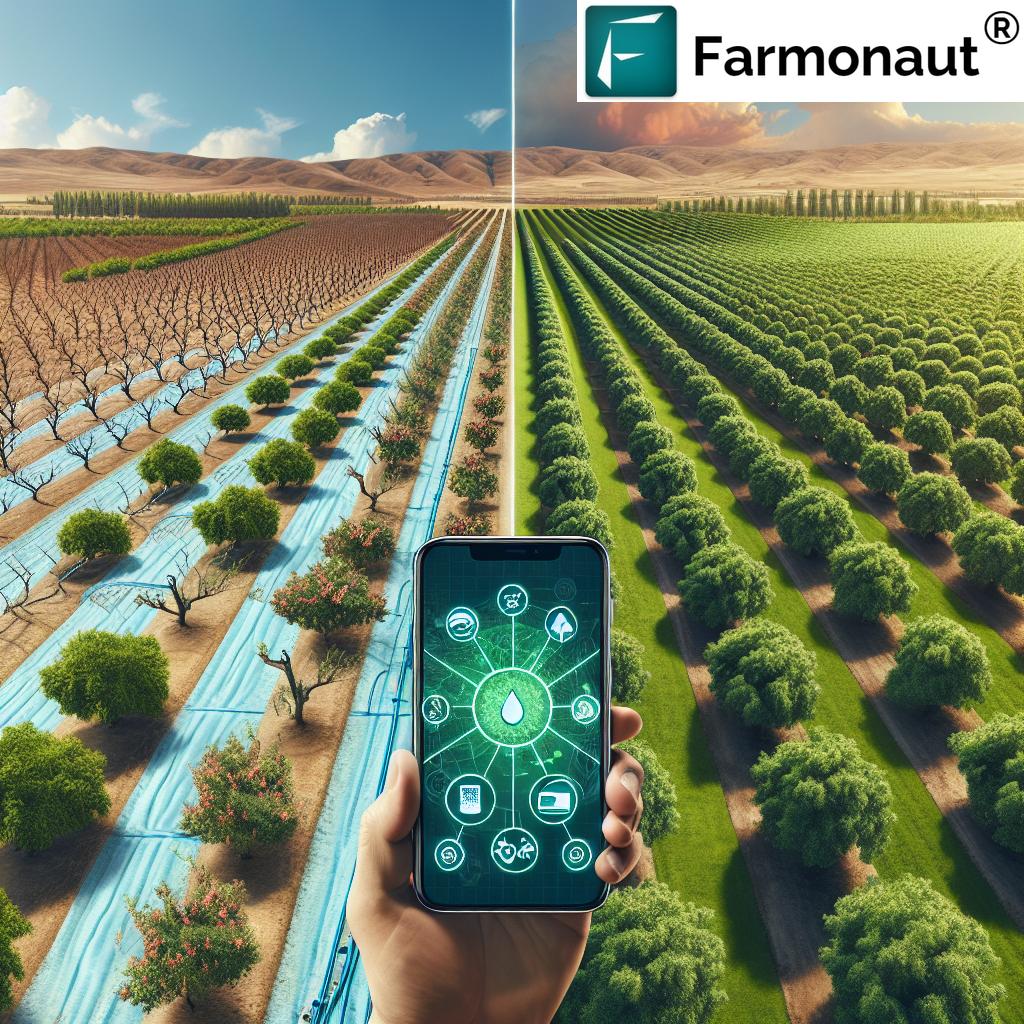
By analyzing soil moisture content in specific polygons, you can:
- Identify areas that need more or less water
- Adjust your irrigation system to deliver water only where it’s needed
- Reduce water waste and potentially lower your water bills
2. Targeted Fertilizer Application
Use NDVI data from your polygons to:
- Pinpoint areas with nutrient deficiencies
- Apply fertilizers only to the areas that need them
- Reduce overall fertilizer use, saving money and protecting the environment
3. Early Pest and Disease Detection
By monitoring subtle changes in crop health across your polygons, you can:
- Spot the early signs of pest infestations or disease outbreaks
- Take targeted action before the problem spreads
- Minimize crop losses and reduce the need for broad-spectrum pesticides
4. Yield Forecasting and Optimization
Analyze historical and current data from your polygons to:
- Predict yields with greater accuracy
- Identify high-performing and underperforming areas of your field
- Make data-driven decisions about crop rotation and variety selection
The Farmonaut Advantage: Why Our System Stands Out
While there are various farm monitoring systems available, Farmonaut’s satellite-based approach offers distinct advantages over drone and IoT-based systems. Here’s a comparison:
| Feature | Farmonaut Satellite System | Drone-based Systems | IoT-based Systems |
|---|---|---|---|
| Coverage Area | Unlimited | Limited by flight time and regulations | Limited by sensor placement |
| Frequency of Data Collection | Regular and consistent | Dependent on manual flights | Continuous but localized |
| Initial Setup Cost | Low | High (drone purchase, training) | Medium to High (sensors, network) |
| Maintenance | Minimal | Regular (battery, repairs) | Regular (sensor calibration, replacements) |
| Data Processing | Automated and cloud-based | Often requires manual processing | Automated but may require local servers |
| Scalability | Highly scalable | Limited by equipment and personnel | Requires additional hardware for scaling |
Integrating Polygon Selection with Other Farmonaut Features
The polygon selection feature doesn’t exist in isolation. It’s designed to work seamlessly with our other cutting-edge tools to provide you with a comprehensive farm management solution. Here’s how it integrates with some of our key features:
1. Jeevn AI Advisory System
Our AI-driven advisory system now becomes even more powerful when combined with polygon selection. Jeevn AI can provide tailored advice for each polygon, taking into account its unique characteristics and needs. This means you get hyper-localized recommendations for:
- Optimal planting dates
- Pest control strategies
- Fertilizer application schedules
- Harvest timing
2. Weather Forecasting
By integrating polygon selection with our weather forecasting tools, you can:
- Predict how different areas of your field might respond to upcoming weather events
- Plan field operations with greater precision
- Mitigate weather-related risks more effectively
3. Blockchain-Based Traceability
For those using our blockchain traceability features, polygon selection adds another layer of detail. You can now track the journey of your produce not just to the field level, but to specific sections within each field. This enhanced traceability can:
- Boost consumer confidence in your products
- Help you command premium prices for high-quality produce
- Simplify compliance with food safety regulations
The Future of Precision Agriculture: What’s Next for Farmonaut?
At Farmonaut, we’re always looking ahead. The polygon selection feature is just the beginning of a new era in precision agriculture. Here’s a glimpse of what we’re working on for the future:
1. AI-Powered Autonomous Polygon Creation
We’re developing algorithms that will automatically identify and create polygons based on spectral signatures, saving you time and ensuring no area of your field is overlooked.
2. Integration with Farm Equipment
Soon, you’ll be able to send polygon-specific instructions directly to your smart farm equipment, enabling truly automated precision farming.
3. Predictive Modeling
By analyzing historical data from your polygons, we’ll be able to predict future crop performance and potential issues with even greater accuracy.
4. Enhanced 3D Modeling
We’re working on incorporating elevation data into our polygon analysis, providing insights into how topography affects crop performance within each section of your field.
Getting Started with Polygon Selection
Ready to take your farming to the next level with polygon selection? Here’s how to get started:
- Sign Up or Log In: If you’re not already a Farmonaut user, sign up here. Existing users can simply log in to their accounts.
- Update Your App: Ensure you have the latest version of the Farmonaut app. Download it from the Google Play Store or the Apple App Store.
- Explore the Feature: Once logged in, navigate to your field view and look for the new polygon selection tool.
- Watch Our Tutorial: We’ve created a comprehensive video tutorial to guide you through using the polygon selection feature effectively.
- Start Analyzing: Begin by creating a few polygons in areas of interest and explore the detailed reports generated for each.
Subscribing to Farmonaut
Ready to revolutionize your farming practices? Subscribe to Farmonaut and gain access to our full suite of precision agriculture tools, including the new polygon selection feature.
For Developers: Integrating Farmonaut’s Technology
Are you a developer looking to integrate Farmonaut’s powerful satellite and weather data into your own agricultural applications? We offer robust APIs that give you access to our cutting-edge technology. Check out our API documentation to learn more about how you can leverage our data for your projects.
Frequently Asked Questions (FAQ)
Here are some common questions about our new polygon selection feature and precision agriculture in general:
Q: How often is the satellite data updated for my polygons?
A: Our satellite data is typically updated every 3-5 days, depending on weather conditions and satellite availability.
Q: Is there a limit to how many polygons I can create in a field?
A: There’s no hard limit, but we recommend creating polygons that are meaningful for your specific farming needs. Generally, polygons shouldn’t be smaller than 10×10 meters for accurate analysis.
Q: Can I export the data from my polygons?
A: Yes, you can export data in various formats, including CSV and shapefile formats, for use in other farm management software.
Q: How does polygon selection improve soil health monitoring?
A: Polygon selection allows for more precise soil health monitoring by enabling you to track specific areas of concern. You can monitor changes in soil organic matter, pH levels, and nutrient content more accurately within each polygon.
Q: Is the polygon selection feature available on mobile devices?
A: Yes, the feature is fully supported on our mobile apps for both iOS and Android devices, allowing you to perform field scouting and analysis on the go.
Q: How does Farmonaut ensure the accuracy of its satellite data?
A: We use a combination of multiple satellite sources, ground-truthing, and advanced AI algorithms to ensure the highest possible accuracy of our data.
Q: Can I integrate Farmonaut’s polygon data with my existing farm management software?
A: Yes, we offer API access that allows for seamless integration with many popular farm management platforms. Check our API documentation for more details.
Conclusion: Embracing the Future of Farming
The introduction of polygon selection to Farmonaut’s suite of tools marks a significant leap forward in precision agriculture. By providing farmers with the ability to analyze and manage their fields at an unprecedented level of detail, we’re not just improving farm productivity—we’re revolutionizing the very nature of agriculture.
This technology empowers farmers to make more informed decisions, reduce waste, increase yields, and ultimately, farm more sustainably. It’s a testament to our commitment at Farmonaut to push the boundaries of what’s possible in agricultural technology.
As we continue to innovate and refine our tools, we remain dedicated to our core mission: making precision agriculture accessible and affordable for farmers worldwide. The polygon selection feature is just the latest step in this ongoing journey.
We invite you to join us in this agricultural revolution. Whether you’re a small family farm or a large agricultural corporation, Farmonaut’s precision agriculture tools, including our new polygon selection feature, can help you farm smarter, not harder.
Ready to take your farming to the next level? Sign up for Farmonaut today and experience the future of agriculture firsthand. Together, we can create a more efficient, productive, and sustainable future for farming.
Happy Farming!


