Revolutionary Satellite Technology: 5 Ways Precision Farming is Transforming Agriculture in Brno
Welcome to Farmonaut’s innovative blog, where we explore the cutting-edge world of precision farming and satellite technology in agriculture. Today, we’re diving into how these revolutionary techniques are reshaping farming practices in Brno, Czech Republic. Join us as we uncover the game-changing potential of satellite-powered solutions in addressing key challenges in modern agriculture.

“Satellite-powered NDVI technology can detect crop health issues up to 2 weeks earlier than traditional methods.”
1. NDVI: The Game-Changer in Crop Health Assessment
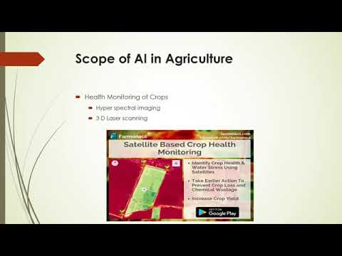
The Normalized Difference Vegetation Index (NDVI) has revolutionized the way we monitor crop health in Brno’s agricultural landscape. This powerful tool leverages satellite technology to provide farmers with invaluable insights into their crops’ condition.
How NDVI Works
NDVI utilizes the unique spectral signatures of healthy and stressed vegetation to create a comprehensive picture of crop health. Here’s a breakdown of the process:
- Satellites capture multispectral images of agricultural fields
- The images are analyzed using specific wavelengths of light (red and near-infrared)
- An NDVI value between -1 and 1 is calculated, with higher values indicating healthier vegetation
By employing NDVI technology, farmers in Brno can:
- Detect early signs of crop stress
- Identify areas of poor growth or potential disease outbreaks
- Optimize irrigation and fertilizer application
- Make data-driven decisions to improve overall crop yield
At Farmonaut, we’ve integrated NDVI analysis into our satellite-based farm management solutions, providing Brno’s farmers with real-time insights into their crops’ health.

2. Water Availability Assessment: Inspired by Nature
Water management is crucial for sustainable agriculture, especially in regions like Brno that face varying precipitation patterns. Our innovative water availability assessment technology draws inspiration from an unlikely source: bat echolocation.
Bat-Inspired Technology
Just as bats use sound waves to navigate and locate prey, our satellite-based system employs advanced sensors to:
- Measure soil moisture levels with unprecedented accuracy
- Detect underground water sources
- Identify areas prone to water stress or flooding
This cutting-edge technology enables Brno’s farmers to:
- Implement precise irrigation schedules
- Conserve water resources
- Mitigate the impacts of drought or excessive rainfall
- Improve crop resilience and yield stability
By integrating this water availability assessment into our Farmonaut API, we’re empowering farmers with the tools they need to make informed decisions about water management.

3. Crop Monitoring: Eyes in the Sky
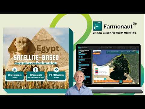
Satellite-based crop monitoring has transformed the way Brno’s farmers keep track of their fields. This technology provides a bird’s-eye view of entire agricultural landscapes, offering insights that were previously impossible to obtain.
Benefits of Satellite Crop Monitoring
- Real-time updates on crop growth and development
- Early detection of pest infestations and diseases
- Accurate yield predictions
- Identification of areas requiring immediate attention
Our Farmonaut platform leverages this technology to provide Brno’s farmers with:
- Regular satellite imagery updates
- AI-powered analysis of crop health and growth patterns
- Customized alerts for potential issues
- Historical data for year-over-year comparisons
Access these features and more through our Android app or iOS app.
“Precision farming using satellite data can reduce water usage in agriculture by up to 30%.”
4. Field Scouting: Precision on the Ground
While satellite technology provides invaluable insights from above, field scouting remains a crucial component of precision agriculture. In Brno, farmers are combining the power of satellite data with on-the-ground observations to optimize their farming practices.
Enhancing Field Scouting with Satellite Data
Our Farmonaut platform enhances traditional field scouting by:
- Identifying priority areas for in-person inspection
- Providing GPS-guided navigation to specific field locations
- Allowing real-time data input and synchronization with satellite observations
- Generating comprehensive reports for informed decision-making
This integrated approach enables Brno’s farmers to:
- Save time and resources by focusing on areas that need attention
- Improve the accuracy of pest and disease management
- Make data-driven decisions about crop treatments and interventions
- Maintain detailed records for regulatory compliance and quality assurance
Experience the benefits of enhanced field scouting by signing up for our Farmonaut web app.

5. Sustainable Farming Methods: A Greener Future
Sustainability is at the forefront of agricultural innovation in Brno. Satellite technology is playing a crucial role in promoting and implementing sustainable farming practices across the region.
Satellite-Powered Sustainability
Our Farmonaut platform supports sustainable agriculture through:
- Precision application of fertilizers and pesticides
- Optimization of water usage
- Monitoring of soil health and erosion
- Tracking of carbon sequestration in agricultural lands
These technologies enable Brno’s farmers to:
- Reduce their environmental impact
- Improve soil health and biodiversity
- Increase crop resilience to climate change
- Meet growing consumer demand for sustainably produced food
Learn more about our sustainable farming solutions in our API Developer Docs.
Comparison of Precision Farming Techniques in Brno
| Precision Farming Technique | Satellite Technology Used | Primary Application | Key Benefits for Farmers | Estimated Adoption Rate in Brno (%) |
|---|---|---|---|---|
| NDVI Analysis | Multispectral Imaging | Crop Health Assessment | Early stress detection, optimized resource application | 65 |
| Water Availability Assessment | Microwave Sensors | Irrigation Management | Water conservation, drought mitigation | 40 |
| Crop Health Monitoring | High-Resolution Imagery | Disease and Pest Management | Reduced crop losses, targeted interventions | 55 |
| Field Scouting Optimization | GPS and Satellite Mapping | Precision Agriculture | Time savings, improved accuracy of interventions | 50 |
| Sustainable Farming Methods | Multi-sensor Integration | Environmental Impact Reduction | Reduced input costs, improved soil health | 35 |
The Future of Agriculture in Brno
As we look to the future, it’s clear that satellite technology and precision farming techniques will continue to play a pivotal role in shaping Brno’s agricultural landscape. At Farmonaut, we’re committed to staying at the forefront of these innovations, providing farmers with the tools they need to thrive in an ever-changing world.
Some emerging trends we’re excited about include:
- Integration of artificial intelligence for predictive crop modeling
- Development of hyperspectral imaging for even more detailed crop analysis
- Expansion of IoT (Internet of Things) devices for real-time field monitoring
- Advanced weather forecasting for improved risk management
By embracing these technologies, Brno’s agricultural sector is poised to become a model of efficiency, sustainability, and productivity for the rest of the world.
Conclusion
The transformation of agriculture in Brno through satellite technology and precision farming techniques is nothing short of revolutionary. From NDVI analysis to sustainable farming methods, these innovations are empowering farmers to make data-driven decisions, optimize resource use, and increase crop yields while minimizing environmental impact.
At Farmonaut, we’re proud to be at the forefront of this agricultural revolution, providing cutting-edge solutions that make precision farming accessible and affordable for farmers of all sizes. As we continue to innovate and expand our services, we remain committed to our mission of transforming agriculture for a more sustainable and productive future.
Ready to experience the benefits of satellite-powered precision farming for yourself? Explore our range of solutions and start your journey towards smarter, more efficient agriculture today.


Farmonaut Subscriptions
Frequently Asked Questions
Q: How accurate is satellite-based crop monitoring?
A: Satellite-based crop monitoring can be highly accurate, with precision levels often exceeding 90% for many applications. Factors such as image resolution, frequency of data collection, and the specific technology used can influence accuracy. At Farmonaut, we use advanced algorithms and multiple data sources to ensure the highest possible accuracy for our users.
Q: Can small-scale farmers benefit from precision farming techniques?
A: Absolutely! While precision farming was once associated primarily with large-scale operations, advancements in technology and decreasing costs have made these techniques accessible to farmers of all sizes. Farmonaut’s solutions are designed to be scalable and affordable, allowing small-scale farmers to reap the benefits of satellite technology and precision agriculture.
Q: How often is satellite data updated?
A: The frequency of satellite data updates can vary depending on the specific satellite system and service provider. At Farmonaut, we typically offer updates every 3-5 days, with some premium services providing even more frequent updates. This ensures that farmers have access to timely and relevant information for decision-making.
Q: Is internet connectivity required to use Farmonaut’s services?
A: While an internet connection is needed to receive real-time updates and access the full range of Farmonaut’s features, our mobile apps are designed to work offline as well. Users can download data when connected and access it later in the field, ensuring that lack of connectivity doesn’t hinder farm management.
Q: How does Farmonaut’s technology integrate with existing farm management systems?
A: Farmonaut offers API integration options that allow our satellite data and analytics to be seamlessly incorporated into existing farm management systems. This flexibility ensures that farmers can leverage our cutting-edge technology without disrupting their current workflows.