Revolutionizing Agriculture: How Farmonaut’s Satellite Imagery API Transforms Precision Farming
“Farmonaut’s satellite imagery API integrates data from Sentinel satellites, providing agricultural insights from over 700 km above Earth.”

In the ever-evolving world of agriculture, precision farming has emerged as a game-changer, revolutionizing the way we approach crop management and resource utilization. At the forefront of this agricultural revolution is Farmonaut, a pioneering company that’s transforming the landscape with its cutting-edge satellite imagery API and remote sensing technology. In this comprehensive guide, we’ll explore how Farmonaut is reshaping the future of farming, making precision agriculture more accessible and efficient than ever before.
The Power of Satellite Imagery in Agriculture
Satellite imagery for agriculture has become an indispensable tool in modern farming practices. By harnessing the power of space technology, we can now gain unprecedented insights into crop health, soil conditions, and environmental factors that influence agricultural productivity. Farmonaut’s satellite-based field analysis techniques provide farmers with a bird’s-eye view of their lands, enabling them to make data-driven decisions that optimize yield and reduce resource wastage.
- Real-time crop monitoring
- Precise field mapping
- Early detection of crop stress
- Optimized resource allocation
Our agricultural data API integrates seamlessly with existing farm management systems, allowing for easy access to critical information. This integration is key to unlocking the full potential of precision agriculture solutions, as it enables farmers to act on insights quickly and effectively.
Farmonaut’s Satellite Imagery API: A Deep Dive
At the heart of Farmonaut’s offerings is our robust satellite imagery API. This powerful tool provides developers and agribusinesses with direct access to high-quality satellite data, processed and analyzed to deliver actionable agricultural insights. Here’s what makes our API stand out:
- High-resolution multispectral imaging for crops
- Frequent data updates for timely decision-making
- Advanced atmospheric correction algorithms
- Efficient cloud filtering for clear imagery
- Easy integration with existing agricultural software
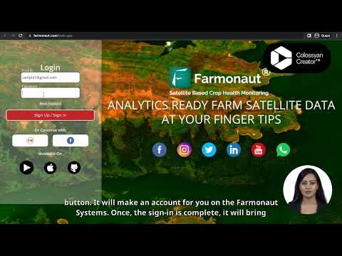
To get started with our API, simply visit our API portal and sign up for an account. Our comprehensive API documentation provides all the information you need to integrate our services into your applications seamlessly.

Remote Sensing in Farming: A Game-Changer
Remote sensing technology has revolutionized the way we monitor and manage agricultural lands. By utilizing various sensors on satellites, we can collect a wealth of data about crop health, soil moisture, and even predict yields with remarkable accuracy. Farmonaut’s advanced remote sensing capabilities include:
- Vegetation health indices (e.g., NDVI)
- Soil moisture measurement
- Crop stress detection
- Yield estimation models
These remote sensing applications in agriculture allow farmers to identify problems early, optimize irrigation, and make informed decisions about fertilizer application and pest control measures.
Precision Agriculture Solutions: The Farmonaut Advantage
Precision agriculture is all about doing more with less – maximizing yields while minimizing resource use. Farmonaut’s suite of precision agriculture solutions is designed to give farmers the tools they need to achieve this delicate balance. Our technology enables:
- Variable rate application of inputs
- Targeted pest and disease management
- Optimized irrigation scheduling
- Precise harvest timing
By leveraging our satellite imagery API and agricultural GIS applications, farmers can create detailed, actionable maps of their fields, identifying areas that need attention and allocating resources with pinpoint accuracy.

Agritech Data Integration: Connecting the Dots
In the modern agricultural landscape, data is king. Farmonaut’s agritech data integration capabilities allow farmers to combine satellite imagery with other crucial data sources, such as weather information, soil tests, and historical yield data. This holistic approach to data management enables:
- Comprehensive farm analytics
- Predictive modeling for crop performance
- Risk assessment and management
- Informed decision-making across all aspects of farm operations
Our API makes it easy to integrate this valuable data into existing farm management software, creating a seamless flow of information from satellite to field.
“Multispectral imaging used in Farmonaut’s technology can capture data across 5-7 different spectral bands for comprehensive crop analysis.”
Multispectral Imaging: Seeing Beyond the Visible
One of the key technologies powering Farmonaut’s satellite imagery API is multispectral imaging. This advanced technique allows us to capture information across multiple bands of the electromagnetic spectrum, revealing insights that are invisible to the naked eye. The benefits of multispectral imaging in agriculture include:
- Early detection of plant stress
- Identification of nutrient deficiencies
- Monitoring of crop maturity
- Assessment of water use efficiency
By analyzing these different spectral bands, we can provide farmers with a wealth of information about their crops’ health and development, enabling more precise and timely interventions.
Soil Moisture Measurement: The Foundation of Healthy Crops
Water management is crucial in agriculture, and accurate soil moisture measurement is key to efficient irrigation practices. Farmonaut’s satellite-based soil moisture measurement capabilities offer several advantages:
- Large-scale coverage without the need for in-field sensors
- Regular updates to track changes over time
- Integration with weather forecasts for predictive irrigation planning
- Identification of areas prone to water stress or oversaturation
By providing this critical information, we empower farmers to make informed decisions about when and where to irrigate, leading to water conservation and improved crop health.
Agricultural GIS Applications: Mapping the Future of Farming
Geographic Information Systems (GIS) have become an integral part of modern agriculture. Farmonaut’s agricultural GIS applications combine satellite imagery with other geospatial data to create powerful tools for farm management. These applications enable:
- Precise field boundary mapping
- Crop rotation planning
- Yield mapping and analysis
- Identification of problem areas within fields
By visualizing farm data in a spatial context, farmers can gain new insights into their operations and make more informed decisions about land use and crop management strategies.
The Sentinel Satellites: Eyes in the Sky for Agriculture
Farmonaut’s satellite imagery API leverages data from the Sentinel satellites, part of the Copernicus program. These advanced Earth observation satellites provide high-quality, frequent imagery that is invaluable for agricultural monitoring. Key features of Sentinel data include:
- High temporal resolution (revisit time of 5 days at the equator)
- Wide swath width for broad coverage
- Multiple spectral bands for diverse applications
- Free and open data policy, making it accessible to all
By processing and analyzing Sentinel data, we can provide farmers with up-to-date, accurate information about their crops and fields, enabling timely interventions and informed decision-making.
Atmospheric Corrections and Cloud Filtering: Ensuring Data Quality
To provide the most accurate and reliable satellite imagery for agriculture, Farmonaut employs sophisticated atmospheric correction and cloud filtering techniques. These processes are crucial for:
- Removing atmospheric interference that can distort satellite data
- Eliminating cloud cover that obscures ground features
- Ensuring consistency in data quality across different dates and locations
- Providing clear, actionable insights to farmers
Our advanced algorithms work tirelessly to deliver the highest quality data possible, giving farmers confidence in the information they use to make critical decisions.
Accessing Farmonaut’s Satellite Imagery API: A Step-by-Step Guide
Getting started with Farmonaut’s satellite imagery API is straightforward. Here’s a simple guide to help you begin:
- Registration: Sign up for an account on our API portal.
- API Key: Once registered, you’ll receive an API key for authentication.
- Documentation: Review our comprehensive API documentation to understand available endpoints and parameters.
- Integration: Use our OpenAPI specification to integrate the API into your existing software.
- Testing: Start with our free trial to test the API’s capabilities.
- Subscription: Choose a pricing plan that fits your needs and scale your usage accordingly.
Our support team is always available to help with any questions or issues you may encounter during the integration process.
Pricing and Plans: Flexible Options for Every Need
Farmonaut offers a range of pricing options to suit different needs and scales of operation. Our plans include:
- Free trial for initial testing and evaluation
- Pay-as-you-go options for flexible usage
- Subscription plans for consistent, high-volume users
- Custom enterprise solutions for large-scale operations
We believe in making our technology accessible to farmers and agribusinesses of all sizes, ensuring that the benefits of precision agriculture are available to everyone.
Global Service Availability: Precision Farming for the World
Farmonaut’s satellite imagery API is available globally, enabling farmers and agribusinesses around the world to benefit from our advanced technology. Our service offers:
- Worldwide coverage with consistent data quality
- Support for multiple languages and regions
- Localized weather data integration
- Compatibility with various crop types and farming practices
No matter where you are in the world, Farmonaut is committed to providing the tools and insights you need to optimize your agricultural operations.
The Future of Precision Agriculture with Farmonaut
As we look to the future, the role of satellite imagery and remote sensing in agriculture will only continue to grow. Farmonaut is at the forefront of this revolution, constantly innovating and improving our technology to meet the evolving needs of farmers and agribusinesses. Some exciting developments on the horizon include:
- Integration of AI and machine learning for even more accurate predictions
- Enhanced crop-specific models for tailored insights
- Improved integration with IoT devices for real-time, on-the-ground data
- Expansion of our service offerings to cover more aspects of agricultural operations
By staying at the cutting edge of agritech, we aim to continue providing our users with the most advanced and effective tools for precision farming.
Comparison of Satellite Imagery Solutions for Precision Agriculture
| Features | Farmonaut API | Competitor A | Competitor B |
|---|---|---|---|
| Data Resolution | 10m | 30m | 20m |
| Update Frequency | Every 5 days | Every 16 days | Every 10 days |
| Supported Crop Types | Wide range | Limited | Moderate range |
| Integration Ease | High | Moderate | Moderate |
| Atmospheric Correction | Advanced | Basic | Advanced |
| Cloud Filtering | Sophisticated | Basic | Moderate |
| Pricing Model | Flexible | Fixed | Tiered |
FAQ: Your Questions Answered
Q: How often is the satellite imagery updated?
A: Our satellite imagery is typically updated every 5 days, thanks to the frequent revisit times of the Sentinel satellites.
Q: Can Farmonaut’s API be integrated with my existing farm management software?
A: Yes, our API is designed for easy integration with a wide range of farm management systems. We provide comprehensive documentation and support to ensure smooth integration.
Q: Is Farmonaut’s service available in my country?
A: Farmonaut offers global coverage, so our services are available worldwide. However, data quality may vary slightly depending on your specific location.
Q: How accurate is the soil moisture measurement?
A: Our soil moisture measurements are highly accurate, thanks to advanced satellite sensors and sophisticated data processing algorithms. However, for the most precise measurements, we recommend complementing satellite data with ground-based sensors.
Q: Do I need any special equipment to use Farmonaut’s services?
A: No special equipment is required. Our services are cloud-based and can be accessed through any internet-connected device.
Conclusion: Embracing the Future of Agriculture
As we’ve explored throughout this guide, Farmonaut’s satellite imagery API and remote sensing technology are revolutionizing the way we approach agriculture. By providing farmers and agribusinesses with unprecedented access to high-quality, timely data about their crops and fields, we’re enabling a new era of precision farming that’s more efficient, sustainable, and productive than ever before.
From satellite-based field analysis to advanced soil moisture measurement, from multispectral imaging to sophisticated agricultural GIS applications, Farmonaut is at the forefront of agricultural innovation. Our commitment to accessibility, affordability, and continuous improvement means that farmers of all sizes, anywhere in the world, can benefit from these cutting-edge technologies.
As we look to the future, the potential for satellite imagery and remote sensing in agriculture is boundless. With ongoing advancements in technology and data analysis, we’re excited to continue pushing the boundaries of what’s possible in precision farming.
Ready to transform your agricultural practices? Visit our website to learn more about our services, or sign up for a free trial to experience the power of Farmonaut’s satellite imagery API firsthand. Together, we can cultivate a more sustainable and productive future for agriculture.


