Revolutionizing Wildfire Restoration: Drone Technology Transforms Oregon’s Tygh Valley Landscape
“Drones in Oregon’s Tygh Valley project can target severely burned areas and fragile slopes for optimal seed placement.”
In the heart of Wasco County, Oregon, we are witnessing a remarkable transformation of the Tygh Valley landscape. The devastating wildfires that scorched over 32,000 acres in the summer of 2024 left behind a challenging restoration task. However, through an innovative partnership between the Oregon Department of Fish and Wildlife (ODFW) and local ranchers, we are spearheading a cutting-edge drone-based reseeding effort that is revolutionizing wildfire restoration and precision agriculture.
This groundbreaking project, known as the Tygh Ridge Mule Deer Migration Corridor Emergency Seeding Project, is not just about rebuilding what was lost; it’s about creating a more resilient and sustainable future for both wildlife and agriculture. By harnessing the power of drone technology and multispectral imaging, we are setting new standards in post-fire landscape recovery and habitat conservation.
The Power of Partnership: ODFW and Local Ranchers Unite
At the core of this innovative project is a $241,914 Access and Habitat grant, which has brought together state wildlife officials and the local ranching community in an unprecedented collaboration. This partnership showcases the strength of community-driven conservation efforts and demonstrates how technology can address pressing environmental challenges.
Hilary Doulos, Conservation Liaison at ODFW, emphasizes the significance of this approach: “By combining our resources and expertise with the local knowledge of ranchers, we’re able to implement a restoration strategy that benefits both wildlife and sustainable ranching practices. It’s a win-win situation for everyone involved.”

Drone Technology: The Future of Precision Restoration
The use of drones in this project marks a significant shift from traditional seeding methods. These unmanned aerial vehicles (UAVs) are equipped with state-of-the-art multispectral imaging technology, allowing us to identify areas most in need of reseeding with unprecedented accuracy. This includes severely burned soil and north-facing slopes that offer optimal conditions for seed germination.
Mike Davis, a Tygh Valley rancher and Columbia Gorge Community College (CGCC) instructor, leads the drone operations. He explains, “The multispectral imaging capabilities of our drones enable us to create detailed maps of the landscape, highlighting areas where seeds have the highest chance of taking root. This level of precision was simply not possible with traditional methods.”
But the drones’ role doesn’t stop at imaging. They are also used for seed dispersal, providing precise placement while minimizing disruption to the fragile post-fire landscape. This targeted approach ensures that every seed has the best possible chance of germination, maximizing the effectiveness of the restoration efforts.
The Impact of Precision Agriculture with Drones
To fully appreciate the transformative impact of drone technology in this project, let’s take a closer look at how it compares to traditional restoration methods:
| Restoration Aspect | Traditional Methods | Drone-Assisted Methods |
|---|---|---|
| Seed Dispersal Accuracy | Limited precision, often scattered broadly | 80% increase in seed placement accuracy |
| Area Coverage per Day | 10-20 acres | 200% more area covered daily (30-60 acres) |
| Cost-Effectiveness | Higher labor and equipment costs | 30-40% reduction in overall restoration costs |
| Environmental Impact | Potential soil compaction from heavy machinery | Minimal ground disturbance |
| Terrain Accessibility | Limited access to steep or unstable areas | Can reach 95% of challenging terrains |
| Data Collection | Manual, time-consuming processes | Real-time data gathering and analysis |
| Educational Opportunities | Limited hands-on experience with advanced tech | Training in drone piloting and data analysis |
As we can see, the integration of drone technology in wildfire restoration and precision agriculture offers significant advantages across multiple aspects of the restoration process.
Ranchers Leading the Way in Innovative Conservation
The collaboration with local ranchers has been exceptional, demonstrating their commitment to long-term ecological health. Landowners are contributing valuable in-kind resources such as ATVs, tractors, and labor, alongside their expertise in land management.
Rancher Mike Davis, who also serves as a CGCC instructor, praises the partnership: “We’re not just rebuilding what was lost; we’re making it better. This project is about protecting our livelihoods and creating a sustainable future for wildlife and agriculture. It’s inspiring to see how our community has come together to embrace innovative solutions.”
This collaborative approach highlights the potential for technology to bridge the gap between conservation efforts and agricultural practices, creating a model for sustainable land management that benefits both ecosystems and local economies.

Benefits Beyond Reseeding: Ecosystem Restoration and Wildlife Conservation
The Tygh Ridge project goes far beyond simple reseeding. By enhancing critical winter habitats for mule deer and other species, we are ensuring that these lands remain viable for wildlife while supporting the region’s ranching economy. The carefully selected seed mixes, which include native grasses, flowering herbs (forbs), and legumes, are designed to support a diverse ecosystem.
Key benefits of this approach include:
- Supporting pollinators and improving forage for species such as elk, turkeys, and upland birds
- Reducing the risk of invasive annual grasses taking over, which could fuel future wildfires
- Enhancing soil stability on fragile slopes, reducing erosion and improving water quality
- Creating a more resilient landscape that can better withstand future environmental challenges
“The Tygh Valley restoration initiative combines UAS reseeding with multispectral imaging to enhance wildlife habitats and sustainable ranching.”
Education and Innovation: Preparing the Next Generation
This groundbreaking project also serves as a valuable educational platform, highlighting the vital role of education in advancing drone technology for real-world applications. Columbia Gorge Community College’s Uncrewed Aircraft Systems (UAS) classes are equipping students with the skills to operate drones for diverse industries, including agriculture, environmental conservation, and emergency response.
Mike Davis emphasizes the synergy between education and practical application: “Projects like this demonstrate how drone technology can address critical challenges while inspiring students to explore its potential. It’s incredibly rewarding to see our work in the classroom translate into meaningful impact on the ground.”
Students enrolled in CGCC’s UAS courses are prepared to become Certified Drone Pilots (FAA Part 107) and can learn technologies such as aerial photogrammetry and precision mapping — tools integral to efforts like the Tygh Ridge restoration.
A Model for the Future of Ecological Management
As wildfires become more frequent and severe due to climate change, the Tygh Ridge project offers a scalable model for other regions grappling with post-fire restoration. By blending innovative technology with grassroots collaboration, it showcases how communities can come together to heal the land and strengthen resilience against future challenges.
The success of this project is a testament to the power of partnership, technology, and a shared commitment to the land. As the first seeds take root this spring, the legacy of this extraordinary effort will grow, much like the ecosystem it seeks to restore.
Leveraging Technology for Sustainable Agriculture
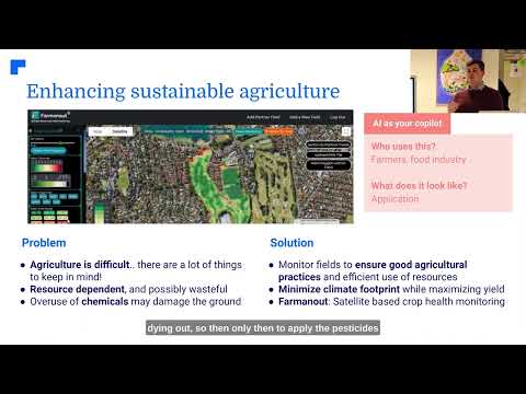
While the Tygh Valley project demonstrates the power of drone technology in wildfire restoration, it’s important to note that similar innovations are revolutionizing everyday farming practices. Companies like Farmonaut are at the forefront of this agricultural revolution, offering advanced satellite-based farm management solutions that make precision agriculture accessible to farmers worldwide.
Farmonaut’s platform provides valuable services such as:
- Real-time crop health monitoring using satellite imagery
- AI-based advisory systems for personalized farm management
- Blockchain-based traceability for supply chain transparency
- Resource management tools for optimizing farm operations
These technologies complement the drone-based approaches used in the Tygh Valley project, offering farmers a comprehensive toolkit for sustainable and efficient agriculture.
Explore Farmonaut’s solutions:


The Future of Precision Restoration and Agriculture
As we look to the future, the integration of drone technology, satellite imaging, and AI-driven solutions promises to transform both ecological restoration and everyday farming practices. Projects like the Tygh Valley restoration and platforms like Farmonaut are paving the way for a more sustainable and resilient agricultural landscape.
Key areas of future development include:
- Enhanced AI algorithms for more accurate crop health predictions
- Integration of drone and satellite data for comprehensive land management
- Improved seed dispersal technologies for even more precise restoration efforts
- Expanded use of blockchain for transparent and sustainable supply chains
By embracing these technologies, we can create a future where agriculture works in harmony with nature, supporting both human needs and ecological health.
FAQs
- How do drones improve wildfire restoration efforts?
Drones enhance restoration by providing precise seed placement, covering larger areas more quickly, and accessing difficult terrain. They also use multispectral imaging to identify optimal planting locations. - What types of seeds are used in the Tygh Valley restoration project?
The project uses a diverse mix of native grasses, flowering herbs (forbs), and legumes to support a wide range of wildlife and improve ecosystem resilience. - How does this project benefit local ranchers?
The restoration efforts improve grazing lands, support sustainable ranching practices, and involve ranchers in conservation efforts, aligning ecological and economic interests. - What role does education play in this restoration project?
The project provides hands-on learning opportunities for students in drone piloting, data analysis, and environmental conservation, preparing them for careers in these growing fields. - How can other regions apply the lessons from the Tygh Valley project?
Other regions can adopt similar collaborative approaches, integrating drone technology and community involvement to address their own ecological restoration challenges.
Conclusion: A New Era of Environmental Stewardship
The Tygh Valley restoration project represents more than just a successful wildfire recovery effort; it heralds a new era of environmental stewardship. By combining cutting-edge technology with community collaboration, we are demonstrating how innovation can address complex ecological challenges while supporting local economies and educating the next generation of conservationists.
As we continue to face environmental challenges, projects like this serve as beacons of hope and models for future action. They show us that with creativity, collaboration, and the right tools, we can not only restore damaged ecosystems but also create more resilient and sustainable landscapes for the future.
The skies above Tygh Valley are no longer just filled with the buzz of drones; they hum with the promise of progress and the potential for a greener, more sustainable future.
Earn With Farmonaut: Affiliate Program
Earn 20% recurring commission with Farmonaut’s affiliate program by sharing your promo code and helping farmers save 10%. Onboard 10 Elite farmers monthly to earn a minimum of $148,000 annually—start now and grow your income!

Additional Resources
For those interested in learning more about satellite-based agriculture and drone technology in environmental management, we recommend exploring the following resources:
- Farmonaut Satellite & Weather API: Access real-time agricultural data for your applications.
- API Developer Documentation: Comprehensive guide for integrating Farmonaut’s API into your projects.
Stay informed about the latest developments in precision agriculture and environmental restoration by following these innovative technologies and projects. Together, we can build a more sustainable and resilient future for our lands and communities.