Unlocking America’s Agricultural Potential: How Farmonaut’s GIS and Remote Sensing Revolutionize Farm Data Analytics
“Satellite-based crop monitoring can increase crop yields by up to 20% through optimized resource management and precision agriculture techniques.”
In the heart of America’s vast agricultural landscape, a revolution is taking place. As we step into an era where technology and farming intertwine, we at Farmonaut are proud to be at the forefront of this transformative journey. Our mission is to unlock the immense potential of America’s farmlands through cutting-edge Geographic Information Systems (GIS) and remote sensing technologies. In this comprehensive exploration, we’ll delve into how these innovative tools are reshaping the face of agriculture, empowering farmers, and paving the way for a more sustainable and productive future.

The Dawn of Precision Agriculture Technologies
Precision agriculture technologies have emerged as a game-changer in the farming industry. These advanced tools allow farmers to make data-driven decisions, optimize resource allocation, and enhance crop yields. At the heart of this revolution lies the integration of GIS and remote sensing technologies, which provide unprecedented insights into farm operations.
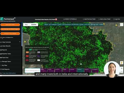
- Satellite Crop Monitoring: Our state-of-the-art satellite crop monitoring system offers real-time data on crop health, soil moisture, and growth patterns.
- Farm Data Analytics: We harness the power of big data to provide actionable insights, enabling farmers to make informed decisions quickly and efficiently.
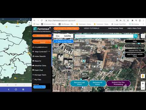
- Agricultural GIS Applications: Our GIS tools create detailed, interactive maps of farmlands, helping in better land use planning and resource management.
By leveraging these precision agriculture technologies, we’re not just improving farm productivity; we’re revolutionizing the entire agricultural landscape of America.
Harnessing the Power of Remote Sensing in Agriculture
Remote sensing in agriculture has opened up new avenues for monitoring and managing crops with unprecedented accuracy. Our advanced sensors and imaging technologies provide a bird’s-eye view of farmlands, offering insights that were previously impossible to obtain.
- Multispectral Imaging: We use multispectral cameras to capture data across various light spectrums, revealing crop health issues invisible to the naked eye.
- Thermal Imaging: Our thermal sensors help detect water stress in crops, allowing for more efficient irrigation practices.
- LIDAR Technology: Light Detection and Ranging (LIDAR) helps create detailed 3D models of farmlands, aiding in precision planting and harvesting.
These remote sensing technologies form the backbone of our farm data analytics platform, providing farmers with a comprehensive understanding of their land and crops.

Revolutionizing Farm Data Analytics
At Farmonaut, we believe that data is the new soil of agriculture. Our farm data analytics platform transforms raw data into actionable insights, empowering farmers to make informed decisions that boost productivity and sustainability.
- AI-Powered Analysis: Our artificial intelligence algorithms process vast amounts of data to identify patterns and trends invisible to the human eye.
- Predictive Modeling: We use advanced statistical models to forecast crop yields, pest outbreaks, and weather patterns.
- Real-Time Alerts: Our system provides timely notifications about potential issues, allowing farmers to take proactive measures.
By harnessing the power of farm data analytics, we’re helping American farmers stay ahead of the curve and maximize their yields while minimizing resource use.
Sustainable Farming Practices: A Data-Driven Approach
Sustainability is at the core of our mission. Our GIS and remote sensing technologies are designed to promote sustainable farming practices that benefit both the environment and the farmer’s bottom line.
- Precision Resource Management: Our tools help optimize the use of water, fertilizers, and pesticides, reducing waste and environmental impact.
- Soil Health Monitoring: We provide detailed insights into soil composition and health, enabling farmers to implement sustainable soil management practices.
- Biodiversity Preservation: Our mapping tools help identify and protect areas of high biodiversity within farmlands.
By adopting these sustainable farming practices, American farmers are not only improving their yields but also preserving their land for future generations.

Crop Yield Forecasting: Predicting the Future of Agriculture
One of the most powerful applications of our technology is crop yield forecasting. By analyzing historical data, current conditions, and predictive models, we provide accurate estimates of future crop yields.
- Weather Integration: Our system incorporates real-time weather data and long-term climate trends to refine yield predictions.
- Crop-Specific Models: We’ve developed specialized algorithms for different crop types, ensuring accurate forecasts across various agricultural sectors.
- Economic Impact Analysis: Our forecasts go beyond mere numbers, providing insights into potential economic impacts and market trends.
With our crop yield forecasting tools, farmers can make informed decisions about planting, harvesting, and market strategies, reducing risks and maximizing profits.
“GIS and remote sensing technologies in agriculture can reduce water usage by up to 30% while maintaining or improving crop productivity.”
Smart Farming Solutions: The Future of Agriculture
Our smart farming solutions represent the pinnacle of agricultural technology, integrating various data sources and technologies to create a comprehensive farm management system.
- IoT Integration: We incorporate data from Internet of Things (IoT) devices like soil sensors and weather stations for real-time monitoring.
- Automated Decision Support: Our AI-powered system provides automated recommendations for various farm operations.
- Mobile Accessibility: Farmers can access our platform on-the-go through our mobile app, ensuring they’re always connected to their farm data.
These smart farming solutions are transforming American agriculture, making it more efficient, productive, and sustainable than ever before.
Digital Agriculture Platforms: Bridging the Gap
Our digital agriculture platform serves as a central hub, connecting various aspects of farm management and providing a unified interface for farmers to access all their data and tools.
- Data Integration: We bring together data from various sources, including satellite imagery, weather stations, and farm equipment.
- User-Friendly Interface: Our platform is designed with the farmer in mind, offering intuitive navigation and clear data visualizations.
- Customizable Dashboards: Farmers can tailor their dashboard to focus on the metrics and information most relevant to their operations.
Through our digital agriculture platform, we’re bridging the gap between technology and practical farm management, making advanced tools accessible to farmers of all scales.
Agricultural Resource Management: Optimizing Inputs for Maximum Output
Efficient agricultural resource management is crucial for sustainable and profitable farming. Our GIS and remote sensing technologies provide invaluable insights for optimizing the use of various agricultural inputs.
- Water Management: Our soil moisture sensors and evapotranspiration models help farmers implement precise irrigation schedules.
- Fertilizer Optimization: By analyzing soil composition and crop health, we provide recommendations for targeted fertilizer application.
- Pest and Disease Control: Our early detection systems help farmers implement timely and targeted pest control measures.
By optimizing agricultural resource management, we’re helping American farmers reduce costs, minimize environmental impact, and maximize crop yields.

The Power of Geospatial Resources in Agriculture
Geospatial resources form the foundation of our agricultural GIS applications. These resources provide valuable context and data for various aspects of farm management and planning.
- Soil Maps: Detailed soil type and composition maps help in crop selection and soil management strategies.
- Topographic Data: Elevation and slope information aid in drainage planning and erosion control.
- Land Use History: Historical land use data helps in understanding long-term trends and planning crop rotations.
By leveraging these geospatial resources, we provide farmers with a comprehensive understanding of their land, enabling more informed decision-making.
Interactive Atlases: Visualizing Agricultural Data
Our interactive atlases bring agricultural data to life, offering dynamic visualizations of various farm-related metrics and trends.
- Crop Distribution Maps: Visualize the distribution of different crops across regions and over time.
- Yield Performance Maps: Compare yield performance across different fields and seasons.
- Resource Usage Heatmaps: Identify areas of high resource consumption for targeted optimization efforts.
These interactive atlases serve as powerful tools for both individual farm management and broader agricultural policy planning.
Comprehensive Datasets: The Backbone of Agricultural Intelligence
Our platform leverages a wide array of comprehensive datasets to provide in-depth insights into various aspects of agriculture.
- Climate Data: Historical and real-time climate information for accurate weather-related decision-making.
- Market Trends: Up-to-date information on crop prices and market demands to inform planting and selling decisions.
- Crop Phenology: Detailed data on crop growth stages for precise timing of various farm operations.
These comprehensive datasets form the backbone of our agricultural intelligence system, enabling data-driven decision-making at every level of farm management.
Empowering Rural Economies Through Technology
Our technologies don’t just benefit individual farmers; they have the potential to transform entire rural economies. By improving agricultural productivity and sustainability, we’re helping to create more resilient and prosperous rural communities.
- Job Creation: The adoption of new technologies creates opportunities for skilled jobs in rural areas.
- Economic Diversification: Improved farm productivity can lead to the development of related industries and services.
- Sustainable Development: Our focus on sustainable practices helps preserve natural resources, ensuring long-term economic viability.
Through our innovative solutions, we’re contributing to the revitalization of America’s rural economies, ensuring a bright future for agricultural communities.
Enhancing Food Access and Security
By optimizing agricultural production and resource use, our technologies play a crucial role in enhancing food access and security across the United States.
- Increased Yields: Our precision agriculture techniques help increase overall food production.
- Reduced Waste: Better forecasting and management reduce post-harvest losses.
- Local Food Systems: Our tools support the development of efficient local food production and distribution networks.
Through these efforts, we’re helping to ensure that all Americans have access to fresh, nutritious food, regardless of their location or economic status.
Environmental Factors in Modern Agriculture
Our platform places a strong emphasis on monitoring and managing environmental factors that affect agricultural production.
- Climate Change Adaptation: We provide tools to help farmers adapt to changing climate patterns.
- Biodiversity Monitoring: Our systems help track and preserve biodiversity in agricultural landscapes.
- Soil Health Management: We offer comprehensive soil health monitoring and management solutions.
By focusing on these environmental factors, we’re helping to create a more resilient and sustainable agricultural system for America.
ArcGIS Integration: Leveraging Industry-Standard Tools
Our platform seamlessly integrates with ArcGIS, the industry-standard GIS software, providing additional capabilities and ensuring compatibility with existing systems.
- Data Interoperability: Easy data exchange between our platform and ArcGIS.
- Advanced Spatial Analysis: Leverage ArcGIS’s powerful spatial analysis tools within our platform.
- Custom Map Creation: Create professional-quality maps for reports and presentations.
This ArcGIS integration ensures that our users have access to the full range of GIS capabilities, enhancing the power and flexibility of our platform.
Downloadable Shapefiles: Flexibility for Advanced Users
For users who require more control over their data, we offer downloadable shapefiles of various agricultural datasets.
- Custom Analysis: Perform advanced spatial analysis using your preferred GIS software.
- Data Integration: Easily integrate our data with your existing GIS projects.
- Offline Access: Work with the data even when you’re not connected to the internet.
These downloadable shapefiles provide the flexibility and control that advanced users need for specialized agricultural GIS applications.
Comparative Analysis: Traditional vs. GIS-Enhanced Farming Practices
| Agricultural Practice | Traditional Method | GIS-Enhanced Method |
|---|---|---|
| Crop Monitoring | Visual inspection, time-consuming field walks | Satellite imagery, real-time data, early problem detection |
| Resource Management | Uniform application, potential over/under use | Precision application, optimized resource use |
| Yield Forecasting | Based on historical averages, less accurate | AI-driven predictions, higher accuracy |
| Decision Making | Intuition-based, slower response to issues | Data-driven, rapid response to changing conditions |
| Soil Management | Periodic soil testing, generalized treatment | Continuous monitoring, targeted soil treatments |
The Future of Farming: Data-Driven Decision Making
As we look to the future, it’s clear that data-driven decision making will play an increasingly crucial role in agriculture. Our platform is at the forefront of this revolution, providing the tools and insights needed to navigate the challenges of modern farming.
- Predictive Analytics: Anticipate potential issues before they become problems.
- Scenario Planning: Model different strategies to find the optimal approach for your farm.
- Continuous Improvement: Learn from past seasons to constantly refine and improve your farming practices.
By embracing data-driven decision making, American farmers can ensure they stay competitive in an ever-changing global market.
Conclusion: Embracing the Agricultural Revolution
As we’ve explored throughout this article, the integration of GIS and remote sensing technologies is revolutionizing American agriculture. From precision farming techniques to comprehensive data analytics, these tools are empowering farmers to make more informed decisions, increase productivity, and promote sustainability.
At Farmonaut, we’re proud to be at the forefront of this agricultural revolution. Our platform combines cutting-edge technology with user-friendly interfaces, making advanced agricultural tools accessible to farmers of all scales. As we continue to innovate and expand our services, we remain committed to our mission of unlocking America’s agricultural potential.
The future of farming is here, and it’s data-driven, sustainable, and more productive than ever before. We invite you to join us on this exciting journey as we work together to shape the future of American agriculture.
FAQ Section
Q: How does Farmonaut’s technology improve crop yields?
A: Our technology improves crop yields through precision agriculture techniques, real-time crop monitoring, and data-driven decision making. By providing accurate, timely information about crop health, soil conditions, and weather patterns, we enable farmers to optimize their resource use and address potential issues before they impact yield.
Q: Is Farmonaut’s platform suitable for small-scale farmers?
A: Absolutely! Our platform is designed to be scalable and accessible to farmers of all sizes. We offer various subscription tiers to meet different needs and budgets, ensuring that even small-scale farmers can benefit from our advanced agricultural technologies.
Q: How does Farmonaut contribute to sustainable farming practices?
A: Farmonaut promotes sustainable farming practices by optimizing resource use, reducing waste, and providing tools for soil health management and biodiversity preservation. Our precision agriculture techniques help farmers use water, fertilizers, and pesticides more efficiently, minimizing environmental impact while maintaining or improving productivity.
Q: Can Farmonaut’s platform integrate with my existing farm management software?
A: Yes, our platform is designed with interoperability in mind. We offer API access and integration capabilities with various farm management software, including ArcGIS. Additionally, we provide downloadable shapefiles for users who prefer to work with data in their own GIS environments.
Q: How accurate are Farmonaut’s crop yield forecasts?
A: Our crop yield forecasts are highly accurate, thanks to our advanced AI algorithms, comprehensive datasets, and real-time monitoring capabilities. While exact accuracy can vary depending on factors like crop type and local conditions, our forecasts consistently outperform traditional prediction methods.
Access Farmonaut’s Services
Ready to revolutionize your farming practices? Access Farmonaut’s cutting-edge agricultural technologies through our various platforms:
Web Application:

Mobile Applications:


For Developers:
Integrate Farmonaut’s powerful agricultural data into your own applications:
API Access
API Developer Documentation
Farmonaut Subscriptions
Join the agricultural revolution today and unlock the full potential of your farmland with Farmonaut’s innovative GIS and remote sensing technologies. Together, we can build a more productive, sustainable, and prosperous future for American agriculture.