Revolutionizing Northwest Agriculture: How Precision Technology and Remote Sensing Are Transforming Disaster Management
“Remote sensing technology can improve disaster response time in agriculture by up to 70%.”
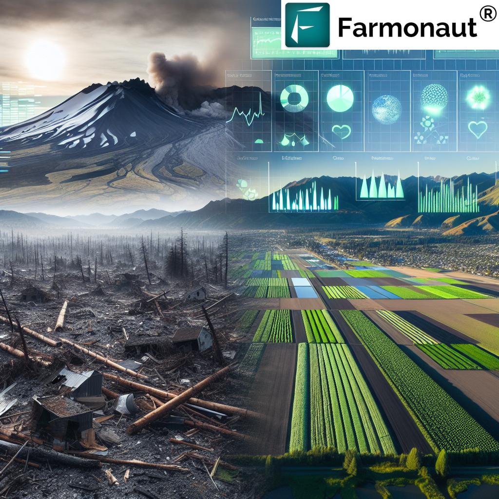
In the ever-evolving landscape of agriculture, we find ourselves at the cusp of a technological revolution that is reshaping how we approach farming, particularly in the face of natural disasters. The Pacific Northwest, with its rich agricultural heritage and diverse ecosystems, has long been a testament to the resilience of American farmers. However, the devastating eruption of Mount St. Helens in 1980 served as a stark reminder of nature’s power and the vulnerability of our agricultural systems.
As we delve into this exploration of how precision agriculture technology and remote sensing in agriculture are transforming disaster management, we’ll uncover the profound impact these innovations have on safeguarding our food supply and supporting farmers in times of crisis. From the ash-covered plains of Washington to the verdant fields of Oregon, we’ll witness how modern agritech solutions are writing a new chapter in agricultural disaster management.
The Mount St. Helens Eruption: A Catalyst for Change
On May 18, 1980, the serene landscape of the Pacific Northwest was forever altered when Mount St. Helens erupted with catastrophic force. The blast, equivalent to 500 atomic bombs, devastated an area of 230 square miles, claiming 57 lives and causing approximately $1.1 billion in property damage. The eruption sent a massive plume of ash and debris 80,000 feet into the air, blanketing the surrounding areas in a thick layer of volcanic ash.
The impact on agriculture was immediate and severe. Vast tracts of farmland were buried under ash, crops were destroyed, and livestock perished. The Columbia River, a vital waterway for the region’s agriculture, was choked with debris, disrupting irrigation and transportation systems. In the aftermath, farmers faced an unprecedented challenge: how to assess the damage, rehabilitate their land, and salvage what crops they could.

President Jimmy Carter’s visit to the disaster zone on May 22, 1980, underscored the national significance of the event. As he surveyed the “moon-like” landscape from the air, the need for better disaster preparedness and response became glaringly apparent. The eruption of Mount St. Helens became a turning point, not just for the region but for how we approach agricultural disaster management nationwide.
The Rise of Precision Agriculture and Remote Sensing
In the decades following the Mount St. Helens eruption, the agricultural sector has undergone a profound transformation. The advent of precision agriculture technology and remote sensing in agriculture has revolutionized how we monitor, manage, and protect our farmlands. These innovations have proven particularly valuable in the realm of agricultural disaster management.
Precision agriculture technology encompasses a range of tools and techniques that allow farmers to optimize their operations with unprecedented accuracy. From GPS-guided tractors to soil sensors and drone-based imaging, these technologies enable farmers to make data-driven decisions about planting, irrigation, and harvesting.
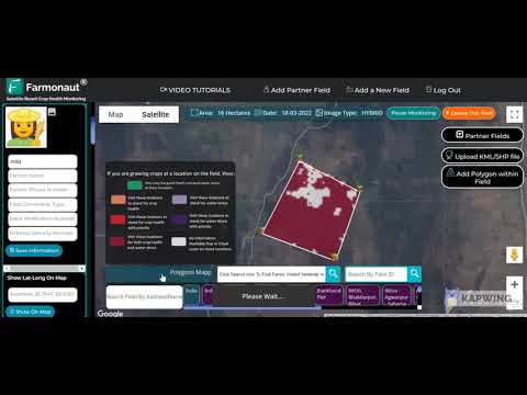
Remote sensing in agriculture takes this a step further by providing a bird’s-eye view of farmlands through satellite imagery and aerial surveys. This technology allows for real-time monitoring of crop health, soil moisture levels, and even early detection of pest infestations or disease outbreaks.
Companies like Farmonaut are at the forefront of this agricultural revolution, offering advanced, satellite-based farm management solutions that make precision agriculture accessible to farmers worldwide. Through their android, iOS, and web applications, as well as their API, Farmonaut is democratizing access to cutting-edge agricultural technology.
Transforming Disaster Response in Agriculture
The integration of precision agriculture technology and remote sensing has dramatically improved our ability to respond to and manage agricultural disasters. Here’s how these innovations are making a difference:
- Rapid Damage Assessment: In the aftermath of a disaster like the Mount St. Helens eruption, assessing the extent of damage to crops and farmland is crucial. Remote sensing technologies allow for quick, accurate surveys of affected areas, providing vital information to emergency responders and agricultural agencies.
- Real-time Monitoring: Crop monitoring systems powered by satellite imagery provide continuous updates on crop health and soil conditions. This enables early detection of issues caused by natural disasters, allowing for faster intervention.
- Precision Resource Allocation: With detailed data on crop and soil conditions, farmers and disaster response teams can allocate resources more efficiently, targeting areas that need the most urgent attention.
- Predictive Modeling: Advanced analytics and AI-driven systems can predict the potential impact of disasters on agricultural areas, enabling proactive measures to mitigate damage.
“Precision agriculture techniques can reduce post-disaster crop losses by approximately 40% in affected areas.”
The Role of Agricultural Drones in Disaster Management
Agricultural drone applications have emerged as a game-changer in disaster response and recovery efforts. These unmanned aerial vehicles offer several advantages:
- Accessibility: Drones can survey areas that may be inaccessible or dangerous for ground teams, providing crucial data on crop damage and soil conditions.
- High-Resolution Imaging: Equipped with advanced cameras and sensors, drones capture detailed images that can reveal subtle changes in crop health or soil composition.
- Rapid Deployment: In the critical hours and days following a disaster, drones can be quickly deployed to assess damage and guide immediate response efforts.
- Precision Application: For recovery efforts, drones can be used for targeted application of treatments or seeds, helping to rehabilitate damaged farmland more efficiently.

Smart Irrigation Systems: A Lifeline in Times of Crisis
In the face of natural disasters that can disrupt water supplies or alter soil conditions, smart irrigation systems play a crucial role in maintaining crop health and optimizing water usage. These systems leverage data from soil moisture sensors, weather forecasts, and crop health indicators to precisely control irrigation, ensuring that plants receive the right amount of water at the right time.
In scenarios like the aftermath of the Mount St. Helens eruption, where ash deposits could significantly alter soil composition and water retention, smart irrigation systems can be invaluable. They allow farmers to:
- Adjust watering schedules based on real-time soil moisture data
- Compensate for changes in soil composition due to ash or debris
- Conserve water resources in areas where supplies may be limited
- Prevent over-watering that could lead to erosion or nutrient leaching
Farmonaut’s platform integrates with these smart irrigation systems, providing farmers with a comprehensive view of their farm’s water needs and enabling data-driven decisions about irrigation management.
Soil Health Monitoring: The Foundation of Recovery
In the wake of a disaster like the Mount St. Helens eruption, understanding and managing soil health becomes paramount. Precision agriculture technology offers advanced soil health monitoring capabilities that are crucial for recovery efforts:
- Nutrient Analysis: Sensors and satellite imagery can provide detailed maps of soil nutrient levels, helping farmers adjust their fertilization strategies to compensate for changes caused by ash deposits or flooding.
- pH Monitoring: Volcanic ash can significantly alter soil pH. Continuous monitoring allows for timely interventions to maintain optimal growing conditions.
- Organic Matter Content: Tracking changes in organic matter helps assess the long-term impact of disasters on soil fertility and guides restoration efforts.
- Erosion Risk Assessment: Advanced modeling can identify areas at high risk of erosion, allowing for targeted soil conservation measures.
By leveraging these soil health monitoring technologies, farmers can accelerate the recovery of their land and make informed decisions about crop selection and management practices in the post-disaster landscape.
Farm Data Analytics: Turning Information into Action
The true power of precision agriculture technology lies in its ability to collect, analyze, and interpret vast amounts of data. Farm data analytics platforms, like those offered by Farmonaut, provide farmers and disaster management teams with actionable insights derived from multiple data sources:
- Historical Data: By analyzing past crop performance and weather patterns, these systems can help predict how different crops might respond to post-disaster conditions.
- Real-time Monitoring: Continuous data streams from satellites, weather stations, and on-farm sensors allow for immediate detection of issues and rapid response.
- Predictive Modeling: Advanced algorithms can forecast potential outcomes based on current conditions, helping farmers make proactive decisions about crop management.
- Benchmarking: Comparing farm performance against regional averages can help identify areas for improvement and guide resource allocation during recovery efforts.
These analytics capabilities are particularly valuable in disaster scenarios, where quick, data-driven decisions can make the difference between crop failure and recovery.
Climate-Smart Agriculture: Building Long-term Resilience
As we face increasing climate variability and the potential for more frequent natural disasters, the concept of climate-smart agriculture has gained prominence. This approach aims to increase agricultural productivity and incomes sustainably while adapting to and building resilience against climate change.
Precision agriculture technology and remote sensing play a crucial role in implementing climate-smart practices:
- Crop Selection: Data-driven insights help farmers choose crop varieties that are better suited to changing climate conditions or more resilient to potential disasters.
- Water Management: Smart irrigation systems and soil moisture monitoring enable more efficient water use, crucial in areas prone to drought or irregular rainfall patterns.
- Carbon Sequestration: Precision agriculture techniques can optimize practices that enhance soil carbon storage, contributing to climate change mitigation while improving soil health.
- Risk Management: Advanced forecasting and early warning systems help farmers prepare for and mitigate the impacts of extreme weather events.
By adopting these climate-smart approaches, farmers in the Pacific Northwest and beyond can build more resilient agricultural systems capable of withstanding and recovering from disasters like the Mount St. Helens eruption.
The Future of Agricultural Disaster Management
As we look to the future, the integration of precision agriculture technology and remote sensing in disaster management will only deepen. Emerging technologies such as artificial intelligence, blockchain, and the Internet of Things (IoT) promise to further revolutionize how we prepare for, respond to, and recover from agricultural disasters.
Some exciting developments on the horizon include:
- AI-powered Decision Support: Advanced AI systems will provide real-time recommendations for disaster response and recovery, drawing on vast datasets and complex modeling.
- Blockchain for Supply Chain Resilience: Blockchain technology can enhance traceability and transparency in agricultural supply chains, crucial for managing food security during and after disasters.
- Automated Farm Equipment: Self-driving tractors and robotic systems could be deployed to assist in recovery efforts, operating safely in hazardous post-disaster environments.
- Advanced Weather Forecasting: Improved long-range forecasting capabilities will allow for better preparation and proactive measures against potential disasters.
Companies like Farmonaut are at the forefront of these innovations, continually developing new tools and technologies to support farmers and agricultural communities in the face of environmental challenges.
Explore Farmonaut’s API for advanced agricultural data solutions
Disaster Impact and Precision Agriculture Solutions
| Agricultural Aspect | Pre-Precision Agriculture | Post-Precision Agriculture |
|---|---|---|
| Crop Damage Assessment Time | Weeks to months | Days to weeks |
| Soil Health Recovery | Years | Months to a year |
| Water Management Efficiency | 30-40% efficiency | 70-80% efficiency |
| Overall Economic Impact | 50-70% crop loss | 20-40% crop loss |
| Resource Allocation Accuracy | Low (based on estimates) | High (data-driven) |
| Early Warning System Effectiveness | Limited (hours to days) | Advanced (days to weeks) |
Conclusion: A Resilient Future for Northwest Agriculture
The eruption of Mount St. Helens in 1980 was a watershed moment for agricultural disaster management in the Pacific Northwest. In the decades since, the integration of precision agriculture technology and remote sensing has transformed how we approach farming in the face of natural disasters. From rapid damage assessment to climate-smart agriculture practices, these innovations are building a more resilient and sustainable agricultural sector.
As we continue to face environmental challenges, the role of companies like Farmonaut in providing accessible, advanced agricultural solutions becomes increasingly vital. By leveraging satellite imagery, AI, and data analytics, Farmonaut is empowering farmers to make informed decisions, optimize their operations, and better withstand the impacts of natural disasters.
The legacy of the Mount St. Helens eruption lives on, not just in the recovered landscapes of Washington and Oregon, but in the innovative spirit that drives agricultural technology forward. As we look to the future, we can be confident that the combination of human ingenuity and cutting-edge technology will continue to revolutionize Northwest agriculture, ensuring food security and economic stability for generations to come.
Access Farmonaut’s API Developer Docs for in-depth integration guidance
FAQs
- How does precision agriculture technology help in disaster management?
Precision agriculture technology aids in rapid damage assessment, real-time monitoring of crop and soil conditions, and efficient resource allocation during and after disasters. - What role do agricultural drones play in disaster response?
Agricultural drones provide quick, high-resolution imaging of affected areas, allowing for rapid assessment and targeted response in inaccessible or dangerous locations. - How can smart irrigation systems mitigate the impact of disasters on crops?
Smart irrigation systems optimize water usage based on real-time data, helping maintain crop health and conserve resources in post-disaster scenarios. - What is climate-smart agriculture, and how does it relate to disaster resilience?
Climate-smart agriculture involves practices that increase productivity while building resilience to climate change, including the use of data-driven decision-making and sustainable farming techniques. - How do farm data analytics contribute to disaster recovery efforts?
Farm data analytics provide actionable insights from various data sources, enabling farmers to make informed decisions about crop management and resource allocation during recovery.


