Farmonaut’s Guide: California Wildfire Updates and Drought-Resistant Farming Strategies for Southern California
“The Hughes fire in Angeles National Forest spread rapidly, highlighting the critical wildfire situation in Southern California.”
As we at Farmonaut closely monitor the evolving wildfire situation in Southern California, we recognize the urgent need for comprehensive information and sustainable solutions. Our mission to make precision agriculture accessible takes on new significance in the face of these environmental challenges. Let’s delve into the latest updates and explore how our satellite-based farm management solutions can contribute to more resilient farming practices in this fire-prone region.
California Wildfire Updates: A Region Under Siege
The recent eruption of the Hughes fire near Castaic, California, has brought the ongoing wildfire crisis into sharp focus. As of Wednesday, this blaze in the Angeles National Forest has rapidly expanded to over 100 acres, prompting evacuations around Lake Castaic and near Interstate 5. The California Department of Forestry and Fire Protection (Cal Fire) has been working tirelessly to contain the spread, deploying up to eight helicopters to combat the flames from above.
Simultaneously, another fire has ignited in San Diego County, scorching at least 7 acres and leading to evacuations of nearby residents and businesses. These incidents underscore the volatile nature of the Southern California fire season and the need for constant vigilance.

Weather Complications: A Double-Edged Sword
“Light rain forecasts for Southern California raise concerns about potential debris flows and landslides in recently burned areas.”
While the forecast of light rain might seem like welcome news for fire-fighting efforts, meteorologists warn that it’s not an unmitigated blessing. The National Weather Service has emphasized that the risk of debris flows and landslides in recently burned areas remains significant. This forecast highlights the complex interplay between wildfires and subsequent weather patterns, creating a challenging scenario for both residents and officials.
Public works departments across Southern California are preparing for the incoming storms by clearing drains, removing debris, and reinforcing flood defenses with sandbags. The potential for mudflows following wildfires is a serious concern, as noted by Los Angeles County Supervisor Kathryn Barger.
Drought Conditions and Fire Weather Warnings
The ongoing drought in California continues to exacerbate fire risks. The upcoming rain event, while potentially breaking a record for the longest dry spell in downtown Los Angeles, is expected to bring less than half an inch of precipitation. This modest rainfall is unlikely to significantly alleviate the dry conditions that have been fueling wildfires.
Red flag warnings remain in effect throughout Southern California, indicating a high risk of fire weather. Despite a slight lull in wind gusts, forecasts predict strong winds and low humidity, conditions that could rapidly spread any new fires that ignite.
Farmonaut’s Role in Wildfire Prevention and Drought Management
At Farmonaut, we understand the critical role that advanced agricultural technology can play in mitigating wildfire risks and managing drought conditions. Our satellite-based farm management solutions offer valuable tools for farmers and land managers in fire-prone regions:
- Real-time Vegetation Health Monitoring: Our NDVI (Normalized Difference Vegetation Index) analysis helps identify areas of dry or stressed vegetation that may pose increased fire risks.
- Soil Moisture Tracking: By monitoring soil moisture levels, we can help farmers optimize irrigation and reduce water waste, crucial in drought-prone areas.
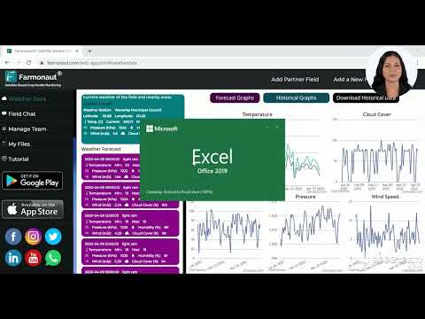
- Weather Forecasting: Our AI-powered Jeevn advisory system provides localized weather forecasts, helping farmers prepare for high-risk fire weather conditions.
To access these features and more, visit our web app or download our mobile apps:


Drought-Resistant Farming Strategies for Southern California
In light of the ongoing wildfire and drought challenges, implementing drought-resistant farming strategies is crucial for agricultural sustainability in Southern California. Here are some key approaches that farmers can adopt:
- Crop Selection: Choose drought-tolerant crops that require less water and are better suited to the region’s climate.
- Efficient Irrigation Systems: Implement precision irrigation techniques like drip irrigation to minimize water waste.
- Soil Health Management: Improve soil structure and water retention capacity through organic matter addition and conservation tillage practices.
- Cover Cropping: Utilize cover crops to protect soil, reduce evaporation, and improve water infiltration.
- Mulching: Apply mulch to conserve soil moisture and suppress weed growth.
Farmonaut’s satellite-based monitoring can assist in implementing these strategies by providing data-driven insights into crop health, soil moisture, and overall farm conditions.

Wildfire Risk and Mitigation Strategies in Southern California
| Region | Current Fire Risk Level | Recent Wildfire Activity (acres burned in last 30 days) | Drought Severity Index (0-4 scale) | Evacuation Preparedness | Drought-Resistant Farming Adoption Rate | Key Mitigation Strategies |
|---|---|---|---|---|---|---|
| San Diego County | High | 500 | 3 | Good | 45% | Controlled burns, firebreaks |
| Los Angeles County | Extreme | 2,000 | 4 | Excellent | 60% | Vegetation management, community education |
| Orange County | High | 300 | 3 | Good | 50% | Fuel reduction, improved water management |
| Ventura County | Moderate | 100 | 2 | Fair | 40% | Prescribed grazing, defensible space creation |
| Santa Barbara County | High | 750 | 3 | Good | 55% | Forest thinning, fire-resistant landscaping |
Evacuation Strategies and Community Preparedness
In light of the recent evacuations near Castaic and in San Diego County, it’s crucial for residents in fire-prone areas to be prepared. Here are some key evacuation strategies:
- Create an Emergency Kit: Include essentials like water, non-perishable food, first-aid supplies, and important documents.
- Develop an Evacuation Plan: Identify multiple evacuation routes and designate a meeting place for family members.
- Stay Informed: Follow local news and official social media channels for real-time updates.
- Prepare Your Property: Create defensible space around your home by clearing vegetation and flammable materials.
Farmonaut’s API can be integrated into local emergency management systems to provide real-time data on vegetation conditions, potentially aiding in evacuation decision-making. For more information on our API capabilities, check out our developer documentation.

Long-term Environmental Impacts and Adaptation Strategies
The ongoing wildfire crisis in Southern California is not just a short-term emergency but a long-term environmental challenge. Here are some of the lasting impacts and strategies for adaptation:
Soil Erosion and Watershed Management
Wildfires can lead to significant soil erosion, impacting water quality and increasing flood risks. To address this:
- Implement erosion control measures in burned areas
- Restore native vegetation to stabilize soils
- Develop watershed management plans to protect water resources
Air Quality and Public Health
Smoke from wildfires can severely impact air quality, leading to public health concerns. Strategies include:
- Improving air quality monitoring systems
- Developing public health response plans for poor air quality events
- Encouraging the use of air purifiers in homes and public buildings
Biodiversity and Ecosystem Resilience
Frequent wildfires can alter ecosystems and threaten biodiversity. To enhance resilience:
- Conduct ecological assessments of fire-impacted areas
- Implement habitat restoration projects
- Develop conservation strategies for fire-adapted species
Farmonaut’s satellite monitoring capabilities can assist in these long-term adaptation strategies by providing data on vegetation recovery, soil conditions, and land use changes over time.

Farmonaut’s Contribution to Sustainable Agriculture in Fire-Prone Regions
At Farmonaut, we’re committed to supporting farmers and land managers in fire-prone regions through our advanced agricultural technology. Our platform offers several key features that can aid in sustainable agriculture and wildfire risk reduction:
Precision Agriculture for Water Conservation
Our satellite-based crop health monitoring allows farmers to optimize irrigation, reducing water usage while maintaining crop health. This is crucial in drought-prone areas where efficient water management is essential for both agriculture and wildfire prevention.
Early Detection of Vegetation Stress
By analyzing multispectral satellite imagery, we can detect early signs of vegetation stress. This information can be used to identify areas at higher risk of fire and guide preventive measures.
AI-Powered Weather Forecasting
Our Jeevn AI advisory system provides localized weather forecasts, helping farmers prepare for high-risk fire weather conditions and make informed decisions about crop management and fire prevention strategies.
Carbon Footprint Tracking
Our carbon footprinting feature allows agribusinesses to monitor their environmental impact. By helping farmers reduce emissions and improve sustainability, we contribute to long-term efforts to mitigate climate change and reduce wildfire risks.
To learn more about how Farmonaut can support sustainable agriculture in your region, check out our comprehensive tutorial:
Community Engagement and Education
Addressing the wildfire crisis in Southern California requires a community-wide effort. Here are some ways that Farmonaut is supporting community engagement and education:
- Farmer Workshops: We organize virtual workshops to educate farmers on drought-resistant farming techniques and the use of satellite technology in agriculture.
- Data Sharing: We collaborate with local authorities to share relevant agricultural data that can aid in fire risk assessment and prevention strategies.
- Student Programs: We offer educational resources for schools to teach students about sustainable agriculture and its role in environmental conservation.
Earn With Farmonaut: Join our affiliate program and earn a 20% recurring commission while helping farmers save 10% on our services. By onboarding 10 Elite farmers monthly, you could earn a minimum of $148,000 annually. Start now and grow your income!

Farmonaut Subscriptions: Empowering Sustainable Agriculture
To support farmers in implementing sustainable practices and managing wildfire risks, we offer flexible subscription plans tailored to various needs and farm sizes:
FAQ: Wildfire Prevention and Sustainable Farming in Southern California
Q: How can Farmonaut’s technology help in wildfire prevention?
A: Farmonaut’s satellite monitoring can detect areas of dry vegetation, which are at higher risk of fire. Our AI-powered weather forecasts also help farmers prepare for high-risk fire weather conditions.
Q: What are some quick drought-resistant farming techniques?
A: Key techniques include choosing drought-tolerant crops, implementing efficient irrigation systems, improving soil health, and using mulch to conserve soil moisture.
Q: How often does Farmonaut update its satellite imagery?
A: Our satellite imagery is updated frequently, with options for daily, weekly, or monthly updates depending on the subscription plan.
Q: Can Farmonaut’s data be integrated with other farm management systems?
A: Yes, our API allows for easy integration with other farm management tools and systems.
Q: How can I get started with Farmonaut?
A: You can sign up for a free trial on our website or download our mobile app to explore our features. Our team is also available to provide personalized demos for larger operations.
Conclusion: A Unified Approach to Wildfire Management and Sustainable Agriculture
As we face the ongoing challenges of wildfires and drought in Southern California, it’s clear that a unified, technology-driven approach is essential. At Farmonaut, we’re committed to providing farmers and land managers with the tools they need to adapt to these challenging conditions and contribute to long-term environmental sustainability.
By leveraging satellite technology, AI-powered insights, and community engagement, we can work together to build a more resilient agricultural sector and reduce wildfire risks. We encourage all stakeholders in Southern California’s agricultural community to explore how precision agriculture and data-driven decision-making can contribute to a safer, more sustainable future.
Stay informed, stay prepared, and let’s work together towards a more fire-resistant and sustainable Southern California. For more information on how Farmonaut can support your agricultural operations, visit our website or contact our team today.
