FARMONAUT NEWSLETTER- SEPTEMBER 2022
NO MORE MANUALLY EXAMINING YOUR FARMS
GET YOUR HANDS ON KNOWLEDGE ABOUT EMERGING AGRI-TECH
Decrease in the crop yield when compared to the investment made by farmers is a major issue. To overcome the issues Remote Sensing technology has been emerging in the Agri-Tech world. Farmonaut Technologies is helping businesses as well as farmers. Know how we are helping them in the Newsletter.
Farmonaut started in 2018 with a vision to bridge the technological gap between farmers and bring the latest state-of-the-art technologies in the hands of each and every farmer in the most cost-effective way.
YOU WILL FIND HERE:
- Emerging technologies in Agriculture Sector by FARMONAUT
- What our clients/Farmers needs to know
- Know the technology you are using
- Providing Solution to the Businesses
- Managing Individual Farms
- Recognition and awards
- Conclusion
Our Clients and Partners 
EMERGING TECHNOLOGY IN AGRICULTURE SECTOR BY FARMONAUT 
With increase in the advance technologies, the agriculture domain is booming at a high pace. Agri-Tech boosting over the past few years have found the solutions for the problems faced by farmers all over the world. Geospatial technology used in agriculture collects, analyses and stores geographic information. Due to which, the agriculture sector has been growing substantially. Remote Sensing (RS), Geographic Information System (GIS) and Global positioning system (GPS) are a part of the Geospatial Technology used.
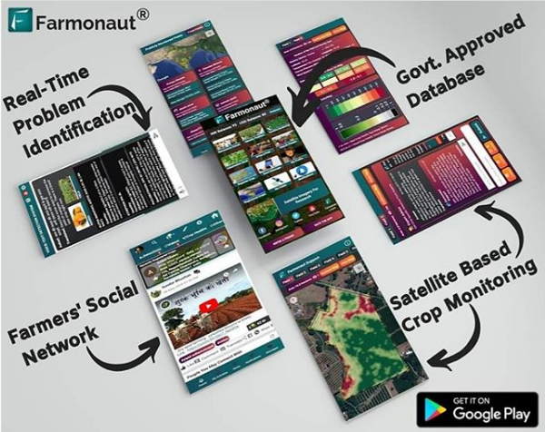
Farmonaut Technologies uses this technology to help farmers. It was started with the vision to provide technology to each and every farmer in the most cost-effective way. It has been providing Satellite based Crop health Monitoring System, Voice and Text based plant issue identification and database to over lakh of farmers and various businesses based in India as well as in other countries. The services are easily accessible through web, android and iOS apps. For the convenience of farmers, it is available in 50+ languages.
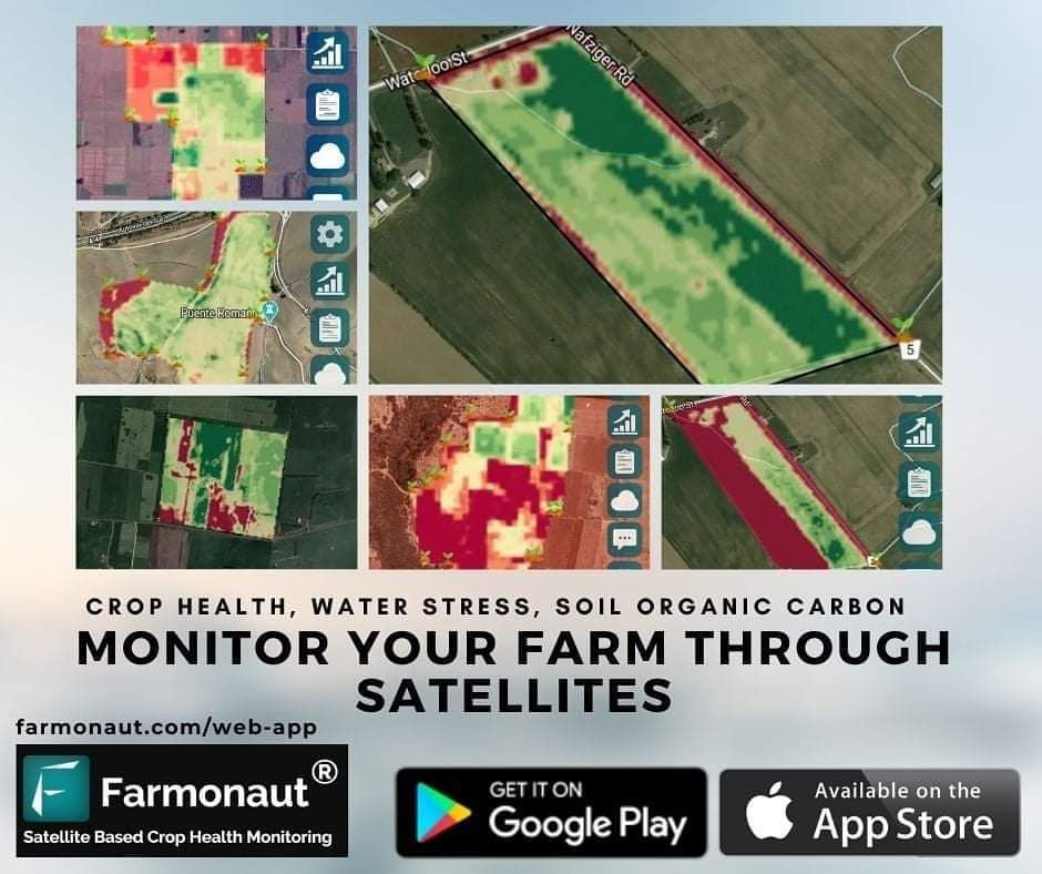
Remote Sensing is being widely used in agriculture to help farmers in monitoring the field through satellites. Farmonaut has come up with a cost-effective way to solve the farmers’ problems to a great extent without compromising on the quality of data. A detailed report is generated by the Farmonaut’s system does crop health monitoring of the field through the satellite data which gives away crop health, vegetation water stress and soil organic carbon. We have also been working with individual farm owners in different states of India.
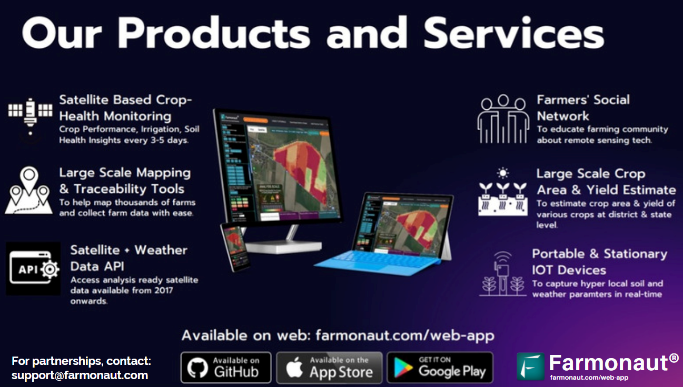
Farmonaut has also started providing various services to the businesses like providing database, GPS for fleet management, being API service provider, IOT devices for managing fields and Traceability of the product through block chain system. We have experience of working with International Corporates: Troforte Innovations, Textile Technologies Group Uzbekistan, Fair Climate Fund Netherlands, etc.
WHAT OUR CLIENTS/FARMERS NEEDS TO KNOW
With the emergence of Remote Sensing in agriculture, we are providing service to our clients and farmers for better crop yield and productivity in a cost-effective way.
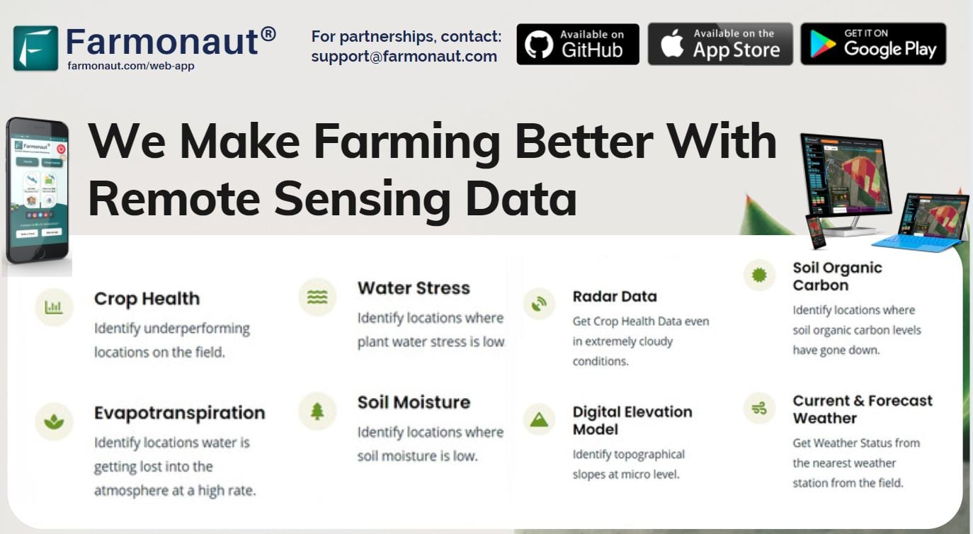
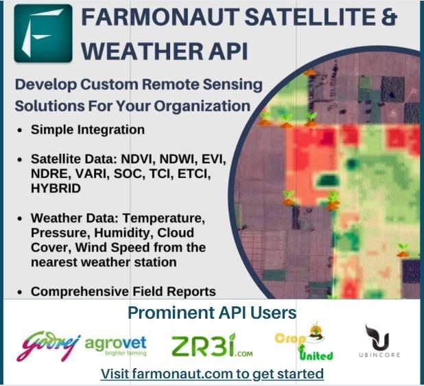
According to the research conducted, it has been seen that the productivity of crops has been decreasing over the years. This is caused due to improper management of the farmlands. The defects in the farmland and crops cannot be witnessed by the human eye and hence fail to take preventive measures.
Remote Sensing can be the key to the problems of farming. As it can be used for knowing the Crop Damage and Progress on a large scale as well as individual farmlands. Also, identifying the crop health through remote sensing would improve the production by controlling diseases and pests beforehand.
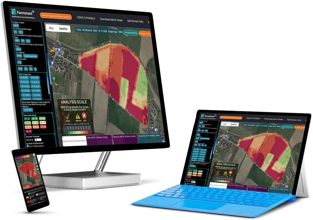
Apart from it, remote sensing can also be used for Crop Area and yield estimation which gives an upper hand in planning and resource allocation, evaluating prices and in decision making such as procurement, storage, etc. Soil Mapping is also possible with GPS.
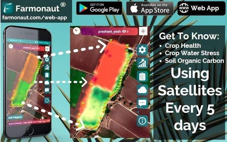
Farmonaut is not only providing solutions to the problem of farmers through remote sensing but also helping them to cut down on the investment. An Indian farmer, on an average, spends between Rs.47,000 (580 USD) to Rs.350000 (4300 USD) annually on each hectare of arable land. By using Remote sensing the cost of labour, chemicals, insecticides, pesticides, plant growth regulators, etc. can be reduced up to 30%.
KNOW THE TECHNOLOGY YOU ARE USING
Using the satellite data provided by Farmonaut in the form of comprehensible information, farmers can:
- Reduce chemical/Fertilizer consumption by applying it only at the locations where crop health is in bad condition.
- Reduce Labour costs by directing the labour only to the areas where crop health is low.
- Reduce irrigation water wastage by knowing the water stress.
- Increase the overall yield.
- Maintain nutrient composition by knowing the soil carbon content.
Some of the concepts most commonly used for high level analysis by Farmonaut are NDVI, NDRE, EVI, VARI, SOC, NDWI, etc according to the use cases of each parameter.
For Crop health of crop at early growth stage
NDVI (Normalized Difference Vegetation Index)
NDVI is used as a measure to identify the state of plant health based on the light reflected by the plant at certain frequencies. Though we cannot perceive it with our eyes, everything around us (including plants) reflects wavelengths of light in the visible and non-visible spectrum. Taking into account how much of a certain wavelength is reflected, we can access the current status of plants.
EVI (Enhanced Vegetation Index)
EVI is further an optimized index designed to enhance the vegetation signal with improved sensitivity in high biomass regions and improved vegetation monitoring through a decoupling of the canopy background signal and a reduction in atmosphere influences.
For Crop health of crop at later growth stage
NDRE (Normalized Difference Red Edge)
NDRE is a spectral index that helps in gathering the data at the later stages of a crop when chlorophyll content is relatively higher in the crop.
For irrigation:
NDWI (Normalised Difference Water Index)
NDWI index can help us control irrigation, significantly improving agriculture, especially in areas where meeting the need for water is difficult. The high NDWI values correspond to high plant water content and coating of high plant fraction, whereas the low NDWI values correspond to low vegetation content and cover with low vegetation. NDWI rate will decrease during periods of water stress.
Hence, through NDWI, the early detection of water stress can prevent many of the negative impacts on crops.
NDMI (Normalized Difference Moisture Index)
NDMI is used to know the moisture index / water stress in vegetation which helps in monitoring the drought condition of the areas. The kind of vegetation must be taken into account to further know the amount of water to use at particular growth stages of crops.
Evapotranspiration
Evapotranspiration measures the rate at which evaporation and transpiration occurs at multiple locations. Through evapotranspiration one can easily schedule the irrigation based on the indicators received by the data. Nevertheless, it can be ignored if NDWI and NDMI data result in a good condition.
For Advance Analysis
VARI (Visible Atmospherically Resistant Index)
VARI is minimally resistant to atmospheric effect, allowing vegetation to be estimated in a wide variety of environments. Hence, it is ideally recommended to be used for arm level decision making if TCI or ETCI images show visible atmospheric distortion such as mild clouds or haze above the field.
For Topography
DEM (Digital Elevation Model)
DEM is used to know the waterlogging prone areas in the field. During heavy rainfall or excess irrigation, the areas where the water logged or flood occurs can be identified through DEM. Hence, by knowing such areas the passage for the outsourcing of the water can be ensured by installing more motors in the area.
For Soil health:
SOC (Soil Organic Carbon)
SOC is a measurable component of the soil organic matter that indicates the better health and yield of any land once the cultivation process ends. Remote Sensing technology plays a vital role In enabling farmers to ensure high SOC content by taking the right measures at the right time and the right place. Farmonaut creates a SOC image with a colour map of the percentage of organic matter present in the selected field. The land area appears green in the colour map if SOC content is more than 5% and red if the SOC content is less than 1%. Once the locations with lesser SOC levels are identified by Farmonaut, farmers can get the soil testing done on specific regions, and the required actions can be taken.
For Crop health during Cloudy weather
RVI (Radar Vegetation Index)
RVI is measured by the backscattering which does not affect the data. The RVI data was designed to be the time series data which can be a great alternative to the NDVI. However, RVI can be obtained at extreme weather conditions when the satellite data could not be obtained due to cloudy or any other weather conditions. Hence, Farmonaut ensures the data at any conditions.
Farmonaut also provides RGB images of the field. (Coloured satellite images)
TCI (True Color Image): It is basically raw image of the field captured by satellite of a particular farm. This is not an index image, but a RGB representation of how the field looked like in human perceivable colors upon its last visit.
ETCI (Enhanced True Color Image): It is a TCI image processed by our own systems to enhance the land features which were not so explicitly visible in the raw TCI image.
PROVIDING SOLUTION TO THE BUSINESSES
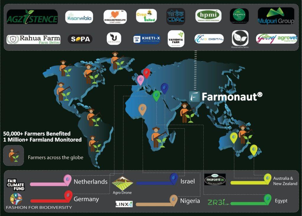
Large-scale companies holding large hectares of land have trouble in managing them since manual examination would be a tedious and not accurate way for dealing. Hence, to help the businesses manage and increase the vegetation Farmonaut provides major market players service to make the businesses more efficient and convenient. They have been dealing with organisations in India as well as other countries of the world namely, Australia, Nigeria, Israel, Netherlands, etc.
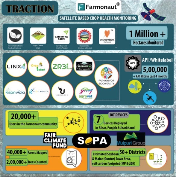
To understand the working of it, mentioned below are the companies Farmonaut is working with.
GODREJ AGROVET

Godrej Agrovet has been working with Farmonaut since February 2021 in one state i.e., Andhra Pradesh. Presently working in 3 states namely Andhra Pradesh, Tamil Nadu and Orissa. They have already managed to map over 30,000+ hectares contributing to over 23,000+ field pieces.
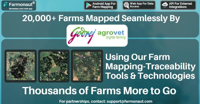
For the usage Godrej Agrovet needed to geotagged the farms in all the 3 states with Farmonaut’s field mapping platform for particular plantation. Using the Farmonaut admin application, the ground team managed to create the boundaries of the farms and also the KYC details of the farmers. Around 50 KYC parameters are captured such as Name, Phone No., Area, etc. They also capture the data points such as irrigation, survey no., taluka mandal, village, state, etc that helps to grade the farmers.
The geotagged areas can be monitored by the office team through web application. The farms can easily be monitored by the office team and help identify the gaps that indulge in the slow geo tagging process.
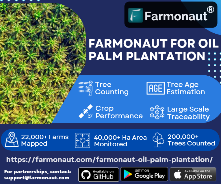
All of the system helps in knowing the number of trees in each and every farm. Counting of the trees or asking farmers doesn’t result in the accurate scenario and is a tedious task for large farmlands. There should be a certain number of trees per hectare. Hence to know the no. of trees in every farm, Farmonaut have their own system that uses high resolution satellite data.
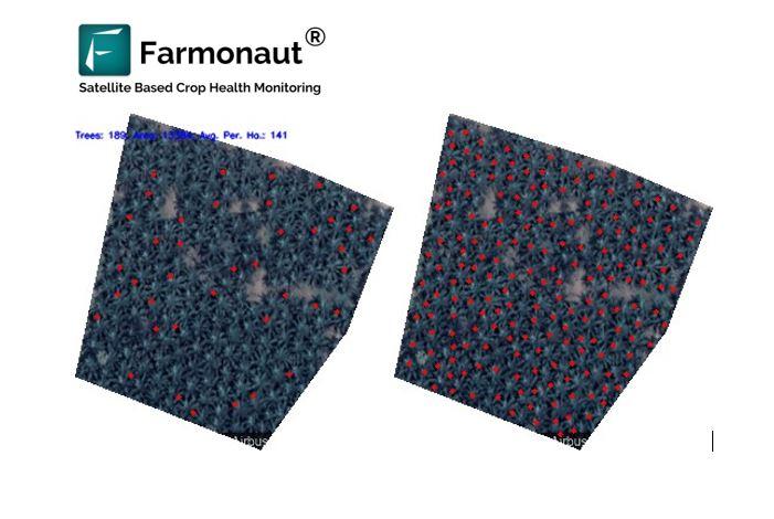
The above image shows the area in which plantation has been carried out and the before and after images. The left-side image shows that the no. of trees was less and after plantation the right-side image gives the result after the plantation. The information such as No. of trees, area and Average/ha are provided on the top left-corner of the image.
With this information the farmers can be informed about the areas where the plantation hasn’t been done. Due to which, the manual labour work reduces, increases the accuracy and ensures the data at faster rate.
To decide the care that should be given to the plantations majorly would depend upon the age of the plantations. Different age plantations such as young, nature, old, very old need different care. Using the Farmonaut high resolution satellite data up to 3 meters and 10 metres helps to identify at what farm what is the average tree age. Hence, the team can direct the farmers on what care should be given to the plantation.
Farmonaut platform also screens out geotagged fields where there are no palm plantations.
ITC LIMITED 
ITC started in 1910 as India’s foremost private sector company. It has diversified over years into different sectors from FMCG to agribusiness with 13 businesses in 5 segments. With different sectors, it has been dealing with farmers as well.
To initiate, recently Farmonaut have started assisting farmers for better improvement in farming practices. This has started as a pilot project for paddy fields for upcoming large scale projects for all farmers joined with ITC Limited. They have been assisting multiple FPOs (Farmers’ Producer Organisation) aligned with ITC. They have started to use the technology in the 4 states: Maharashtra, Madhya Pradesh, Uttar Pradesh and Rajasthan.
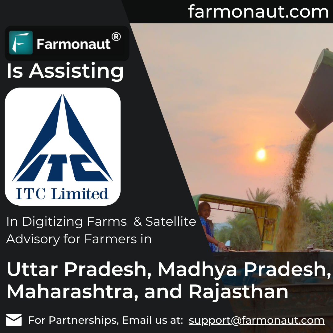
The ground team of FPOs visits the farms in order to capture the location of the field and geotag using the Admin application. The data such as farm area, Name of farmer, Contact, etc is also captured by the team.
Through this information and the field captured, the farms are monitored continuously for the crop health, soil health, crop irrigation, weather, etc. The system also generated reports constantly at regular satellite visits. The data captured are advantageous for advising the farmers for action to be taken. Hence, the prior actions would be beneficial to farmers in decreasing losses and increasing overall yield.
FASHION FOR BIODIVERSITY
Fashion for Biodiversity being the organization that deals in the cotton requires to track the data as well. In order to track the data of the field they procure, Farmonaut has been providing satellite crop health monitoring as a solution. The farms are first geotagged and submitted to the Farmonaut’s system. The data such as crop health, water stress and carbon content are obtained from the satellite. These data are generated automatically through the system, which helps to know the irrigation required, fertilizer applications and various other factors to take precautions for better crop yield. 
Farmonaut‘s manufactured IOT devices are installed in the farms that are managed by the Fashion for Biodiversity team. The IOT devices are capable of capturing various data of the farm areas. The data captures are weather parameters and soil parameters. The weather parameters such as leaf wetness, wind intensity, air temperature, air humidity, light intensity, CO2 and wind direction. The soil parameters that are useful are captured like Soil temperature, soil pH, and N, P, K electrochemical conductivity.
The data collected are sent at an interval of 5-15 minutes. The data gained are visualized on the dashboard of the Fashion for Biodiversity. Hence, being a company dealing specially Cotton helps them navigate the parameters through the crop cycle as well as know the defect areas. The satellite as well as IOT device data used in combination helps in getting the precise results that would be helpful in increasing the yield and productivity of the cotton over seasons.
Farmonaut has also been providing the Traceability of the entire Supply chain of cotton. Fashion for biodiversity goes through various steps after the harvest of cotton to obtain the finished product. The process by which the cotton is manufacture is as below:
Cotton is procured from the farmers
Sent to Ginning process
Sent to Spinning process to produce Yarn
Sent to Weaving process
CMT (Cut Make Trim)
Sorting of finished garments
Warehouse/Retailer with lot numbers
At every stage of the process mentioned above Farmonaut helps them to capture the details of the transportations. When a lot of cotton is sent to various stages it is tracked throughout the process and details such as from where the item was picked up, from where it was held and where it was dropped would be stored. The traceability is based on the block chain, which has potential to track the fake transactions, product origin and rectify the outbreaks. Due to this Blockchain based traceability has advantages of being flexible, track the back data and also maintain the authenticity of the data.
COROMANDEL INTERNATIONAL
Coromandal based in TamilNadu started in 1906 with a vision to be the leader in providing farm solutions with strong commitment towards sustainability. They have been providing various farm inputs such as fertilizers, nutrients, crop protection, seeds, farm implements, etc. Apart from this, they have also started farm services for farmers which includes Testing services for soil, crop advisory, Ag Tech, etc.
To deliver the crop advisory to farmers, Coromandal has adopted the services from Farmonaut through an API system. To enable the data for a particular farmland, the area of the farm must be submitted in the system through the geotagging feature provided. Coromandal has to map the farm boundaries of their farmers in order to obtain the data.
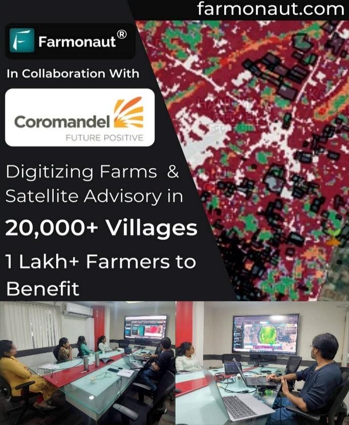
Once the area is geotagged, the system generates the data through satellite images that are obtained every 3-4 days. The data generated report of the farm contained various parameters (18 different satellite parameters) on weather, soil, etc. through this data the advisory to the farmers is given by the Coromandel team.
Soil organic carbon being the most important factor for the enhancement of the crop growth should be taken care of. Farmonaut is also providing soil organic carbon data in order to maintain the fertility of the soil. By knowing the time series data of soil organic carbon, the farmers can be advised on what nutrients are deficient in the soil which are required for better yield of crops.
KISANWALA
Kisanwala is a company based in Hyderabad, with a vision to help farmers with end-to-end solutions for all farm needs by providing technology, information, inputs and support. Their services range from advisory, agronomy, forecasting to providing support at input and output level. 
Using the API system from Farmonaut Technologies. Kishanwala has been providing Forecasting services in order to advise the farmers on weather conditions and better crop growth and yield. Farm area of farmers associated with Kishanwala are geotagged on the maps. The satellite data for the areas are generated automatically by the system. The data consist of various information such as temperature, humidity, soil pH, soil moisture, crop health, etc.
Based on the data received from the satellite the Farmers are advised what precaution or action that must be taken for better yield and crop growth.
FAIR CLIMATE FUND
Carbon Emission is the amount of CO2 that has been released in the atmosphere due to certain activities. Carbon Emission has been increasing tremendously in the past few years. Due to which immense impact on the environment and agriculture farms is seen. 
To control the emission and save the environment, international treaties have come up with a concept of carbon credits. Carbon credits are a kind of validation to release carbon upon permissible limits. When a company/business claims to release only a certain amount of carbon but due to several reasons want to release more than desire. In such cases the company purchases carbon credits. One carbon credit allows one tonne of CO2 or equivalent amount to greenhouse gases in the atmosphere. These exchanges in credits have encouraged carbon trading worldwide. These credits can be exchanged between businesses or bought and sold in international markets at usual market price at two exchanges, namely the Chicago Climate Exchange and the European Climate Exchange.
Carbon Emission can occur at any level, from the energy sector to agriculture sector as well. Soil has its own carbon content which has its importance for soil fertility and health. To know the soil carbon content would help to track the declining CO2 that has destroyed or gotten into the atmosphere.
Fair Climate Fund based in the Netherlands has initiated a contribution to the healthy environment. Hence, they have started mapping the field in North India to estimate the carbon emission and carbon content in the farms. The Farmonaut system helps to track the carbon content over the seasons. The Fair climate fund has reduced around 716 thousand tonnes of CO2. There are many ongoing projects in different parts of the world by the Fair Climate Fund.
TTG (TEXTILE TECHNOLOGIES GROUP), UZBEKISTAN
TTG being a company in Central Asia has been producing Yarn since 2014. They export yarn to many different countries in the world. TTG is providing benefits to its customers by excellent quality, fast shipping, affordable prices and Contract work.
TTG, Uzbekistan
Dealing with different situations towards farming, TTG either takes farms on lease from the government or acquires the farms from the farmers who have already been taken on lease. In some cases, TTG also helps farmers in farming practices or provides a team for carrying out the farming operations. However, the farmers are paid throughout the crop cycle.
Issue faced:
Farmers working for the company get paid based on the claims made regarding the requirement for farming. Due to which when the investment made by the company gives lower yield than expected indicates loose ends in the stages of the process.
WHAT CAN BE DONE?
To fix the loose ends and to provide solutions to the TTG company, Farmonaut Technologies have been working with them for a year now. Uzbekistan deals with regions and clusters similar to talukas and districts in India. Where every region has its own regional leader.
First, the farms under the TTG company are geotagged into the systems. The satellite data of the farms are generated frequently. The system creates a report for the farm which contains information on various parameters such as carbon content, irrigation, soil moisture, soil pH, temperature, humidity, etc. The report generated is in Uzbek, a language of Uzbekistan. Using the satellite, they can easily track and inspect at region level, cluster level or farm level.
To briefly describe, the information such as how much area requires irrigation, which area has enough moisture, area that is performing bad, the fertilizers requirements in the areas. Using the automatic generated reports, they can examine the areas. These parameters in the reports helps to know the defective areas and the problems faced can be informed to the region leader whomsoever the area belongs. To be precise the reports give information to close the loose ends and help TTG to save from the major capital losses.
Fleet management
In order to manage the machinery used in farming practices, GPS devices are installed with machines. GPS then is directly linked to the Farmonaut systems to motion track the machinery. The system also captures the information of the farmers such as Name, Phone number, farm area, etc. The system then creates the insights of the machinery.
The insights of machinery consist of:
- How much area was covered
- Distance travelled
- Total cumulative area machine visited
- Number of farms visited
- Time spent on each farm
- How much time the machine was working
Significance:
Knowing the insights of the machines, it can be effectively managed by decreasing the non-required activities. Also, any defect in the machine can be identified by the insights of the machines.
Due to this feature provided the mismanagement of the tracking fuel can easily be caught. The insights not only help in tracking fuel consumption but also in various aspects such as whether a farm visit is done or not, how much time was wasted in different activities, etc.
ZR3I
Zr3i started in 2020 with an objective to provide the modern technologies to the agricultural organization that would help in better managing of their fields. Zr3i has been providing their services to farmers, agribusinesses and workers who need the services. They have developed a website and an android application for Egypt and the Arab World which is provided in Arabic language for better understanding of local farmers. The application works on API between Zr3i and Farmonaut Technologies. 
The problems faced by farmers such as incognizance of weather parameters and soil parameters leads to decrease in yield as well as profits. The major problems faced are Water Stress, Carbon level and usage of chemicals.
To overcome the problems and help farmers, Zr3i users are provided detailed reports on their farm condition by Farmonaut. The reports are generated by the use of satellite images which contains information on crop health and weather conditions of farms. The satellite images are easy to interpret through the colours. As the red area represents barren land, the yellow area requires more attention as it can be affected more and the green area is in good health condition. The satellite images generated are NDVI, EVI, AVI, SAVI, NDRE. NDVI, EVI, SAVI and AVI images helps at the early growth stage of crops whereas NDRE images are used at the later stage of crop growth. The reports also contain NDWI images that monitor the water content and help control irrigation. To add upon the system also provides carbon content and time series data as well as precise information as per the data points provided by the user. Along with this it also gives field images based on longitudes and latitudes with the historical data of their field.
Zr3i has been reaching greater heights being the first SaaS digital platform in the Arab World. It has also been recognised at the regional level across the Arab World.
AGRO DRONE
AgroDrone is an Israel based company dealing in UAVs (Unmanned Aerial Vehicles commonly known as Drones). Specifically, it deals with drones in agriculture for farmers to know their farm better. For large farmers in Israel with land holding more than 100 hectares, AgroDrone has been working to help farmers through Drones and satellite images as well. 
Drones alone faces various disadvantages:
- Requires trained operators
- Less flight times
- Less range
- More featured drones
- Can cause accidents
- Difficult to operate
To overcome the disadvantages, Farmonaut Technologies has been providing the satellite data that captures farmland. With the help of this technology, the crop health parameters are known to farmers for better crop yield. The usage of drones in combination with satellite data for the farms is adopted by Agrodrone. This approach is called the Hybrid Approach.
The data collected from the drones were not enough to know the condition of crops due to its limitations. Instead of flying the drones over the whole field, the satellite images would indicate the areas that require focus and field visit to improve the conditions. After which the drones would only be flown over the infected/high risk areas which would be helpful in overcoming the major problems faced by drones.
TROFORTE INNOVATIONS
Since 2021, Troforte Innovations have started providing services with Farmonaut Technologies for farmers in Australia and NewZealand. Australia being the world’s major contributor to agriculture has farmers with large land ownership which varies from 100-1000 hectares. Supervising such large farms is tedious work and results in inaccuracy.
To manage the farmlands, Farmonaut is providing service to Troforte Innovations through API. The system provided is Crop health monitoring with Satellite. This system helps the farmers to know the condition of their crops and overall health of the soil and crops. The satellite data is obtained by the NDVI which uses red visible and infrared rays. The data obtained includes:
- Crop health
- Evapotranspiration
- Soil Moisture
- Water Stress
- Soil organic carbon
- Current & forecast Weather
The data obtained through this would help the farmers to know the sudden changes in the farm due to weather, temperature, etc. Soil Moisture data would direct the farmers to the areas that require irrigation and areas that are over irrigated. Further it would also indicate the high amount of fertilization used. The crop health data indicates towards the infections and diseases caused in crops to take precautions beforehand.
Farmers in Australia are more aware of soil health and hence Troforte Innovations does provide soil sampling services to farmers for better crop conditions. The soil testing goes through the following process which would help farmers in improvement of the crop yield and productivity.
1. COLLECTION OF SOIL: The farmer must collect the soil from his/her farm from different locations in the bags. The bags provided have barcodes with 8-10 digits on them for digital use.
2. FORWARD THE SAMPLES: The bags are sent to the soil testing Labs.
3. TESTING THE SOIL: Soil testing Labs performs multiple tests nearly 10-15 tests. The tests help to identify various parameters such as pH, EC (electric conductivity), Carbon content, Saturation percentage and Nutrients like Potassium, Nitrogen, Magnesium, Phosphorus, etc.
4. UPLOADING THE RESULTS: After testing the results are stored in a system created by Farmonaut Technologies. The Labs pushes the tested results to the Farmonaut’s internal system through an API system. The API system is used by the third party to upload data to provide them to the endpoint (in this case the endpoints are farmers).
5. EASY ACCESS TO RESULTS: The access to the soil tested data can be gained by scanning the barcodes on the bag. The results are on the farmers mobile for their convenience.
SOPA (SOYBEAN PROCESSORS ASSOCIATION OF INDIA)

SOPA has been performing Crop Area Estimation in 50 districts of Madhya Pradesh, Maharashtra and Rajasthan. Soybean being the high valued oilseed crop requires information on the crop production to understand the crop sown. For the estimation of crop area and yield, optical remote sensing data source was used. Crop leaves being sensitive to the visible and infrared regions helps to estimate accurately. With the help of optical satellite images and Synthetic Aperture Radar (SAR) the kharif season crop could be mapped. SAR has the ability of operating wavelengths that can access data during cloud cover too.
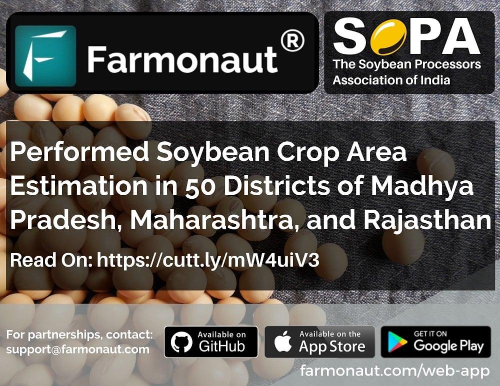
This estimation method helped SOPA to determine Crop Area Sown, Crop Identification, Tracking of Sowing and harvesting patterns of the producers. All this information helps them in suggesting the prices of soybean oilseeds, export/import decisions and storage and distribution of oilseeds.
LINXAG (LINX SPATIAL SYSTEMS)

The tremendous increase in the businesses have evolved in the past few years. LinxAg based in Nigeria has developed a web app and mobile application called as Bizterrain for the small scale as well as large scale businesses. 

The app is capable of capturing the data using the mobile application such as boundaries of the business location, shops, name of the owner, contact No, etc. the capture can be accessed by any user of the application very conveniently. In case of any changes taking place in location or any other details of the businesses the details can also be edited with ease.
The mobile application is flexible and is capable of doing all the activities i.e, capture, access and edit data.
The web application is not able to capture the data but can easily access the data and edit the data.
The application provides 4 tabs: Dashboard, Analytics, Report and Profile.
Use Cases of the Application:
Government:
In case the government wants to initiate a scheme and select the criteria for the scheme. This app will be useful to know the profiles of the people and hence will be helpful in estimation of the people eligible for the scheme. For example: if governments want to initiate a scheme for women, they can find the estimate on how many women are there in the region in particular eligible for the scheme.
Similarly, if the scheme is introduced for farming businesses, the app will be useful to know no. of businesses involved with farming/farmers.
Large Company Owners:
Large companies have major benefits using it as they can collaborate with small business owners at reasonable cost. For example, if a large clothing brand wants tailors in the region, they can easily get access to the contacts of tailors and initiate collaborations at local price points.
With the filter feature it becomes more convenient for the user to find the required contacts. The location shown on the map would be useful in case of excess inventory to store at the warehouses at different locations.
Small Business:
Small businesses can register their profile and get opportunities to collaborate with large businesses which would give them a passive income at better cost.
MULPURI POULTRY:
Mulpuri Poultry are the 2nd largest producer of eggs in India based in Guntur district of Andhra Pradesh. Poultry mainly requires two types of feed, soybean and maize. Due to the highest no. of poultry animals, the feed required would be in bulk and hence cost would be high. 
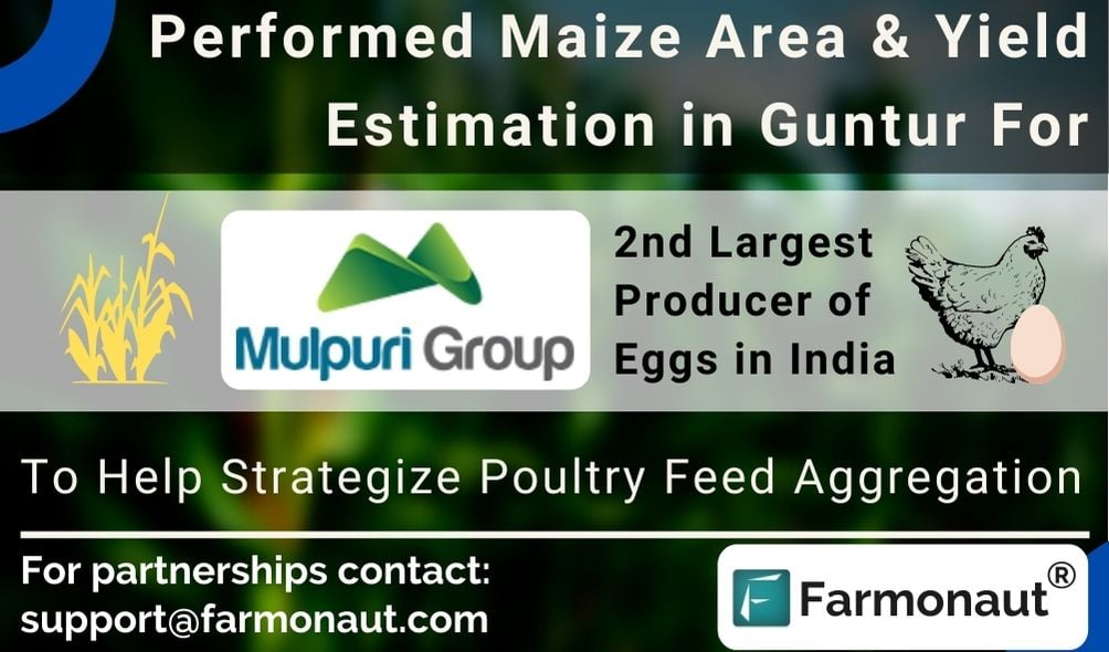
Farmonaut has been working on crop area and yield estimation for Mulpuri farms for an objective to strategize poultry feed aggregation. The estimation would help them to know the expected yield in the particular area for further estimation of prices. If the sowing area of maize is large, the supply of maize would be high and as result the prices would be low. Simultaneously, if the area sown is small, the supply of maize would be less and eventually results in high prices. Hence, the information helps them to decide which kind of feed would be fed for poultry.
Presently, the decision for feed is done for one feed, with a future objective to expand it to 18 feeds.
FARMER AMIGO
Farmer Amigo is an Agri-tech start-up which helps farmers by providing door-step deliveries of seed-to-market to millions of Indian farmers through technology. 
In collaboration with Farmonaut, Farmer Amigo is using the API system through Farmonaut in order to provide solutions to the farmers. The company uses the geotagging method to locate the farmland of farmers throughout Maharashtra. The data are received on the system and the system automatically generates the reports of the farms geotagged.
The reports generated are used to manage the farms of the farmers and also advise them on the crop health issues and irrigation practices. The reports contain many information parameters such as weather parameters, soil parameters, etc.
API USERS:

IVD Digital, Crop United and UBINCORE are companies working closely with farmers. For the betterment of farmers, they have been using the Farmonaut API system to provide solutions to the farmers in a cost effective way. The increasing investment in farming has caused a major issue for the farm owners.
The companies can locate the farmland of their users through the admin application provided by Farmonaut. After the geotagging is completed, the system automatically generates the report of the particular farms. The report is completely based on the satellite images collected from the high-resolution satellite.
There are various parameters that have been examined and also the historical data of the same are available to make the decision for the better yield and growth of crops. Crop health monitoring and soil monitoring gives the companies a better idea whether what care must be taken or what can be done to improve the vegetation.
MANAGE YOUR INDIVIDUAL FARMS
Individual farmers face some issues regarding the crop diseases, irrigations, etc. which cannot be identified beforehand. In order to manage farms and know the problem caused, visiting farms isn’t possible every time. To overcome it, Farmonaut is also providing their remote sensing technology to individual farmers as well.
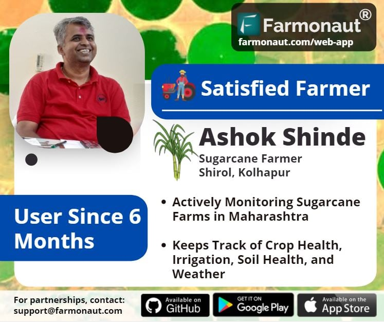
Some of the individual farms are mentioned below:
VISWAMATHA FARMS:
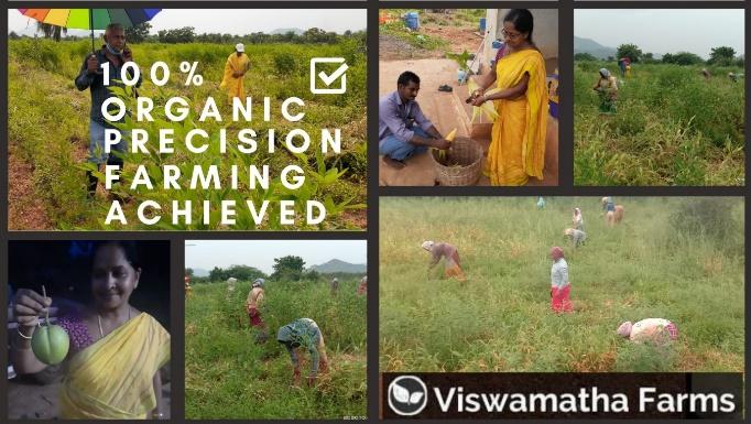
Viswamatha farms located in Andhra Pradesh, has been passionate about the zero-budget natural farming and natural farming techniques. This Natural farming is done without chemical usage which leads to no greenhouse gas emission. They believe that natural food tastes great, is of high quality and full of nutrients which eventually gives good health and environment. 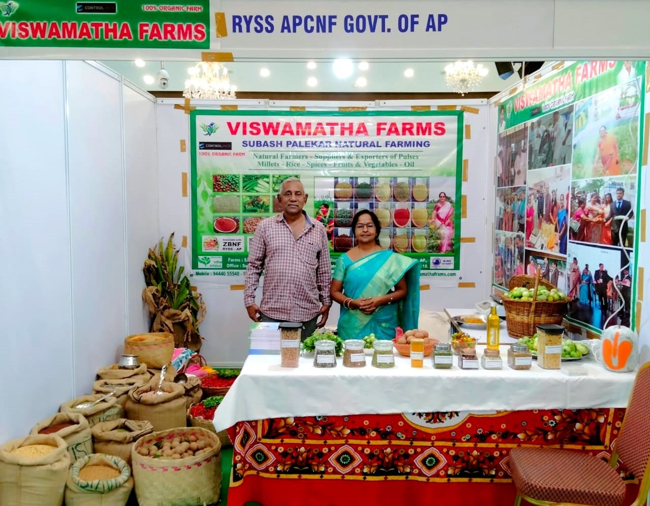

In parallel to the natural farming practices, Viswamatha farms has also been referring to the satellite data provided by Farmonaut through our platform (available on android, iOS as well as web app) to take field level actions and minimize the efforts even further, since 2019.
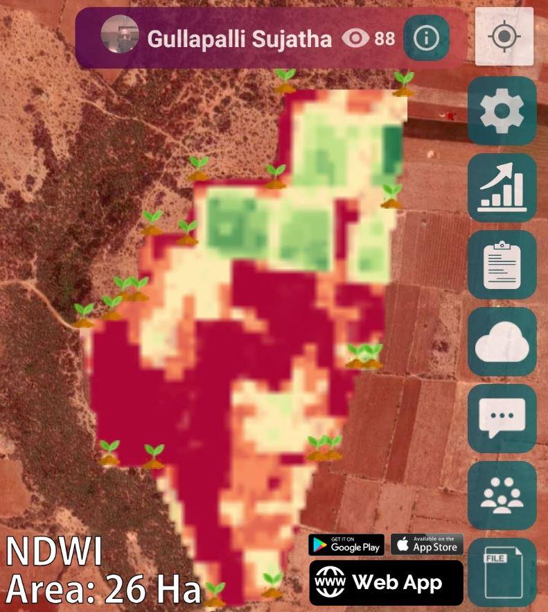
In the above image is of Viswamatha farms where the top portion of the field shows good water stress in vegetation. The yellowish or red region in the remaining field shows that the region must be irrigated by the farmers or at least requires a visit for cross-checking.
VAIVIDHYA FARMS
Vaividhya farms located in Andhra Pradesh have been using the Farmonaut satellite crop-based monitoring to enhance the growth of the crops. The system matches the location of the farm and satellite coordinates which helps in fetching the latest images. This image helps in identifying the regions of unhealthy growth and help the farms to take precautions beforehand. It also indicates the water stress and organic carbon content. Vaividhya farms have managed to better crop health in a period of 1 month by using the Farmonaut Services. 
DISEASE FREE LIFE
Ranga rajan, a farmer based out of South India has colorblindness which makes it difficult for him to identify the satellite images. The colour-blindness is faced by many farmers in India. Colour-blindness can be of many types. Farmers with this disease would have difficulty in interpretation of the satellite images. In this case, the farmer wasn’t able to differentiate between the colours such as green, pink, yellow, orange, etc. The colour-based depiction is the most recommended because it is found to be the easiest for farmers to differentiate areas aptly. The red represents danger and green for the areas in good condition. 
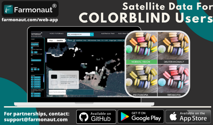
For colour-blind farmers, Farmonaut has built a unique system which is encoded to interpret the data to colour blind variation. The data of crop health and irrigation were combined and created as black and white images. No matter what type of colour blindness a person has, he/she can always differentiate the black and white colour. They may or may not be able to identify other colours. On the Farmonaut app the data are available under the Colour-blind Visualization.
The black and white images obtained represents:
- Black: the area requires a visit to the farm to check the crop health or irrigation issues.
- White: area has the irrigation issues only
- No colour: the area is in good condition

RECOGNITION AND AWARDS
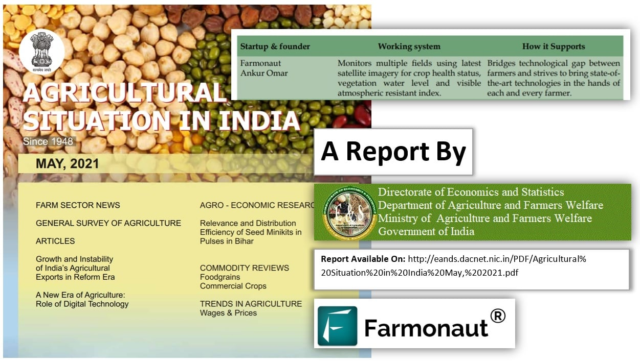
Farmonaut has been recognised by the Government itself as a startup for digital agriculture. The report “Agriculture situation in India” published in May 2021 by various government departments gave recognition to Farmonaut as a startup that is building bridges between the farmers and technologies that must strive with each and every farmer.

It is a pleasure to announce that Farmonaut is also recognised and selected to be the part of the Jiogennext ecosystem.
Farmonaut was introduced as a startup using the geospatial technology to help cut down on the investment on farm inputs, and enabling them to increase the yield.
Apart from recognition, Farmonaut has also received awards such as:
- “Most Admired & Preferred Agritech Emerging Unicorn Award for the Ground-Breaking & Innovative Technology” at 127th Conference.
- 2021 CEO Awards held on 27th August at Aloft Cessna Business Park, Bengaluru organized by CE Worldwide.
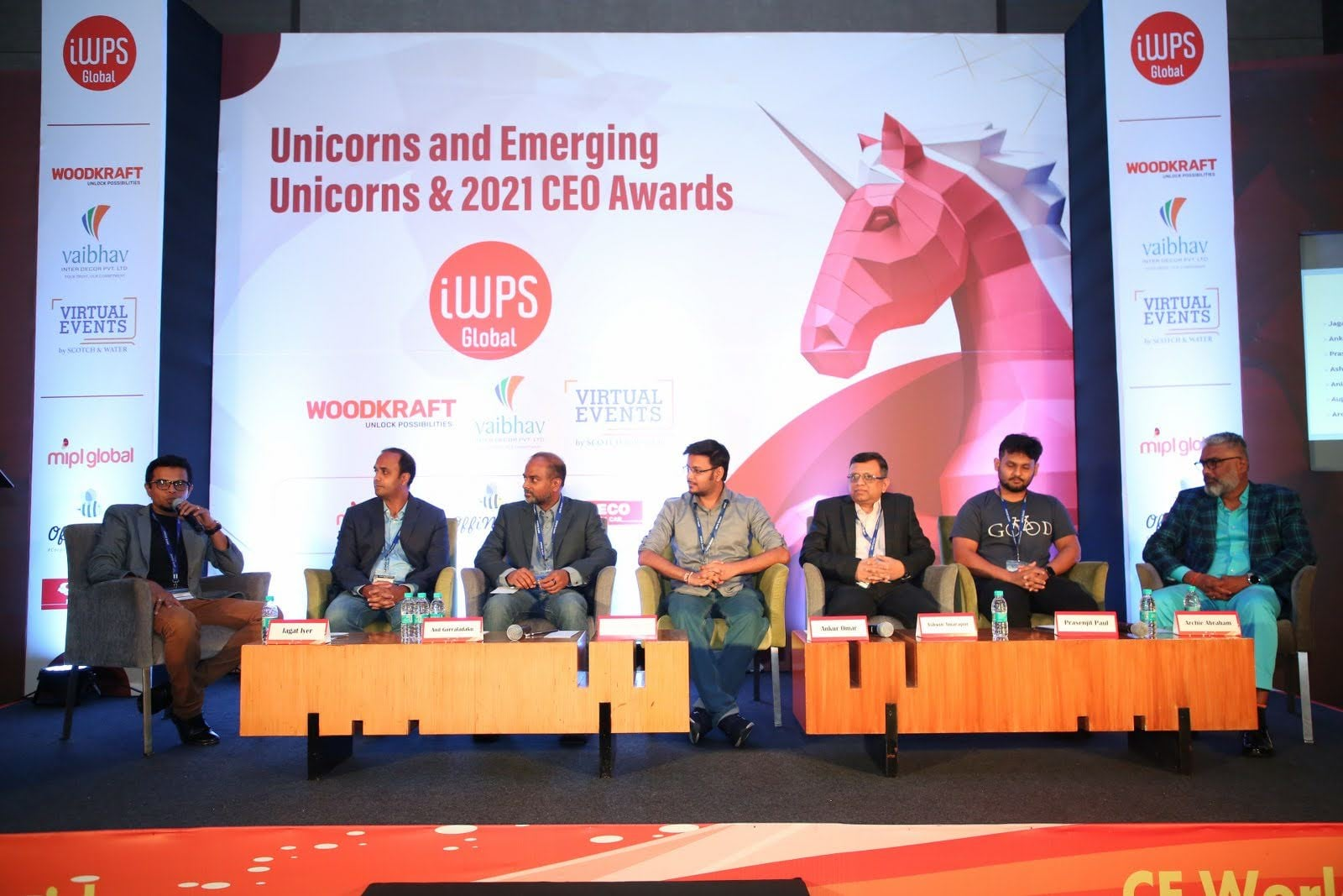
Farmonaut also participated in the panel discussion “Riding the Digital Wave…How high-speed Internet is changing the content that people are going to be consuming?” and share our thoughts on how the farming industry will change as a result of high-speed internet.
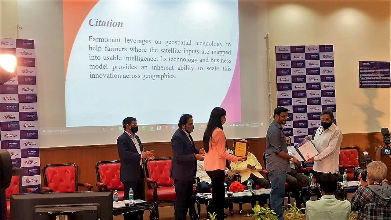
The Prestigious Ramaiah Evolute Star Startup Award was also received by Farmonaut for their recognition of the best cross-disciplinary start-ups using high technology and innovation which results in a significant impact on the society.
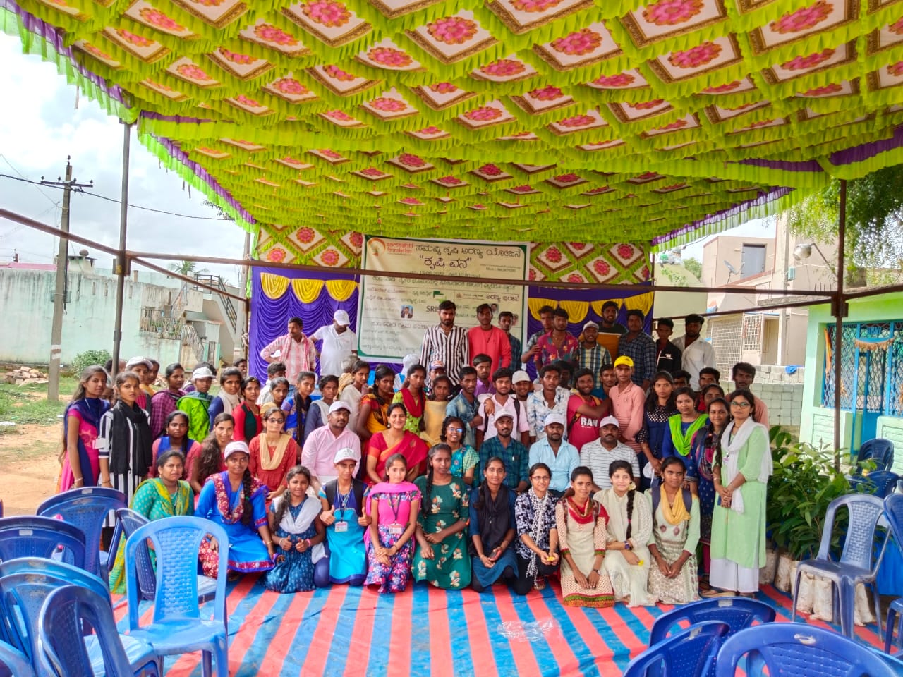
Samashti Foundation organised a tree plantation initiative at Hunasavadi on 15th June with over 5000+ trees planted.
For the smart care of the farms and plantation by farmers, Farmonaut will be monitoring the areas of plantation through satellite technology for their health by multiple parameters.
Farmonaut was pleased to be a part of it.
CONCLUSION
Evolving Agriculture with different technology has made farming hassle-free worldwide. With India ranking at 2nd in the world agricultural sector, it requires additional effort to make it easier for the farmers. Farmonaut is penetrating into the Indian market as well as international market with the remote sensing technology providing various services such as Crop health, Soil health, Traceability, API Access, Crop Area and yield estimation, Tree number and Age estimation, etc. making it accessible to small farmers as well.


