Revolutionizing Czech Agriculture: How NDVI Satellite Technology Enhances Crop Monitoring in Brno

“NDVI technology can detect up to 90% of crop stress before visible signs appear, enabling early intervention in Czech agriculture.”
Welcome to the future of agriculture in the Czech Republic! We’re excited to explore how NDVI satellite technology is transforming crop monitoring practices in Brno and beyond. As we delve into this revolutionary approach to farming, we’ll uncover the immense potential of precision agriculture technology and its impact on sustainable farming practices.
Understanding NDVI: The Foundation of Modern Crop Monitoring
NDVI, or Normalized Difference Vegetation Index, has become a cornerstone in the world of precision agriculture. But what exactly is NDVI, and why is it so crucial for crop monitoring?
NDVI is a simple yet powerful indicator that allows us to assess the health and vigor of vegetation from space. It works by analyzing the difference between the amount of visible red light and near-infrared (NIR) light reflected by plants. Healthy vegetation absorbs most of the visible light that hits it while reflecting a large portion of NIR light. In contrast, unhealthy or sparse vegetation reflects more visible light and less NIR light.
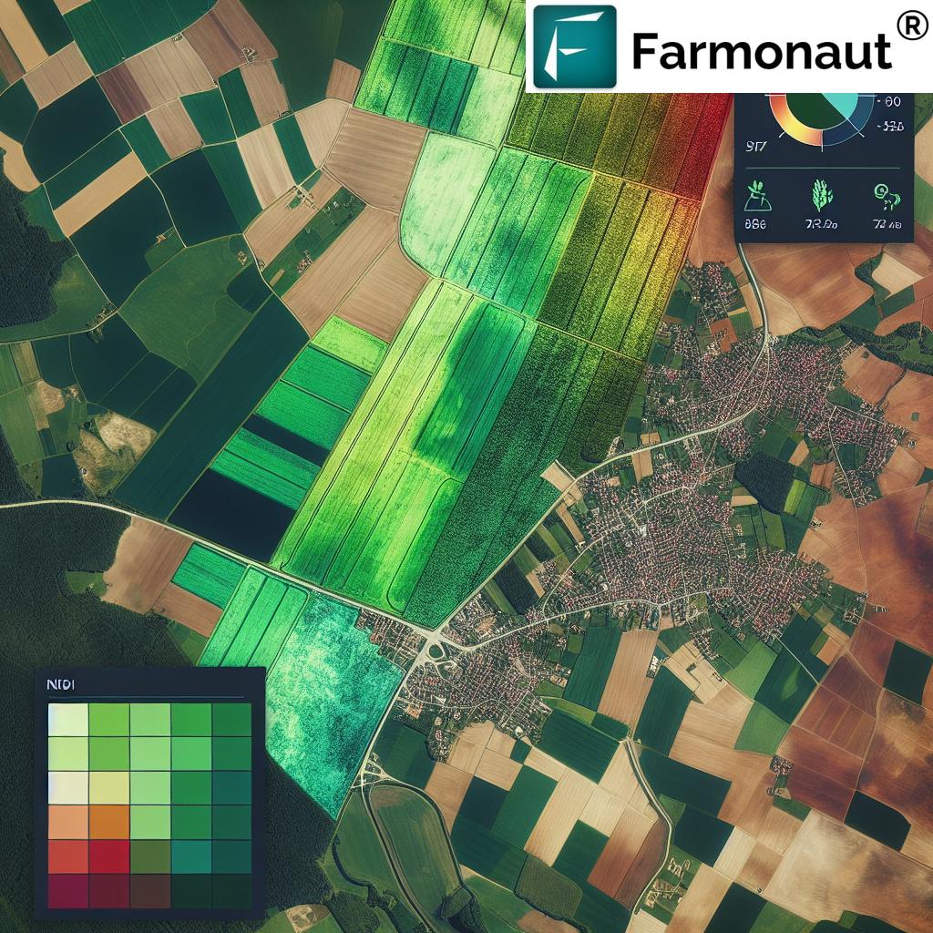
This unique spectral signature enables us to calculate NDVI values ranging from -1 to 1, where higher values indicate healthier and denser vegetation. For farmers in Brno and across the Czech Republic, this translates to a powerful tool for monitoring crop health, predicting yields, and making informed decisions throughout the growing season.
The Science Behind NDVI: Harnessing the Power of Light
To truly appreciate the revolutionary nature of NDVI technology, we need to understand the science that makes it possible. At its core, NDVI leverages the unique way plants interact with different wavelengths of light.
- Visible Red Light (VIS): Chlorophyll in healthy plants absorbs most of the visible red light for photosynthesis.
- Near-Infrared Light (NIR): The cellular structure of healthy leaves strongly reflects NIR light.
The NDVI calculation uses this difference to create a standardized index:
NDVI = (NIR – VIS) / (NIR + VIS)
This formula yields values between -1 and 1, where:
- -1 to 0: Indicates non-vegetated areas like water, bare soil, or artificial structures
- 0 to 0.33: Represents unhealthy or sparse vegetation
- 0.33 to 0.66: Indicates moderately healthy vegetation
- 0.66 to 1: Signifies very healthy, dense vegetation
By analyzing these values across different growth stages, farmers in Brno can gain invaluable insights into their crops’ development and health status.
NDVI in Action: Transforming Agriculture in Brno
Now that we understand the science behind NDVI, let’s explore how this technology is revolutionizing agriculture in Brno and the wider Czech Republic.

Brno, the second-largest city in the Czech Republic, is surrounded by fertile agricultural lands that have long been the backbone of the region’s economy. With the introduction of NDVI satellite technology, farmers in this area are experiencing a paradigm shift in how they monitor and manage their crops.
Real-time Crop Health Monitoring
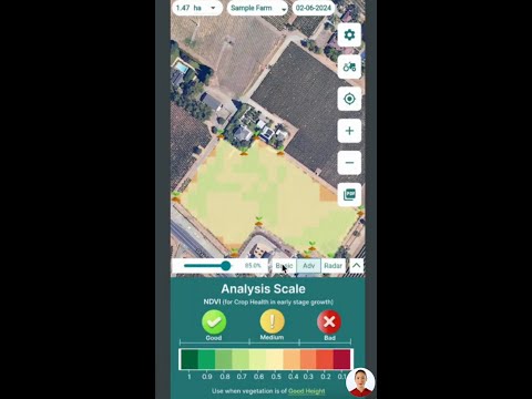
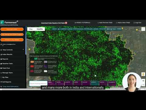
One of the most significant advantages of NDVI technology is its ability to provide real-time data on crop health. Farmers in Brno no longer need to rely solely on visual inspections or time-consuming field surveys. Instead, they can access up-to-date NDVI maps that highlight areas of concern across their fields.
This real-time monitoring allows for:
- Early detection of crop stress
- Identification of pest infestations or disease outbreaks
- Precise assessment of drought impact
- Evaluation of fertilizer effectiveness
By leveraging this information, farmers can take proactive measures to address issues before they escalate, potentially saving entire crops from failure.
Optimizing Resource Allocation
NDVI data empowers farmers to make data-driven decisions about resource allocation. By identifying areas of low NDVI values, farmers can target their interventions more precisely, whether it’s applying additional fertilizer, adjusting irrigation schedules, or implementing pest control measures.
This targeted approach not only improves crop yield but also contributes to more sustainable farming practices by reducing unnecessary inputs and minimizing environmental impact.
Tracking Phenological Stages
NDVI satellite technology allows farmers in Brno to track the phenological stages of their crops with unprecedented accuracy. By analyzing NDVI values over time, they can:
- Determine optimal planting and harvesting times
- Monitor crop development stages
- Predict yield potential
- Plan agricultural operations more effectively
This level of insight enables farmers to fine-tune their management practices and maximize productivity throughout the growing season.
NDVI and Precision Agriculture: A Perfect Partnership
The integration of NDVI satellite technology with precision agriculture practices is creating a powerful synergy that’s transforming farming in Brno and beyond. This partnership is driving innovation in several key areas:
Variable Rate Application
NDVI data is instrumental in creating variable rate application maps for fertilizers and other inputs. By analyzing NDVI values across a field, farmers can identify areas that require more or less attention, allowing for precise application of resources. This not only optimizes input use but also helps maintain a more uniform crop stand.
Irrigation Management
Water scarcity is a growing concern in many parts of the world, including the Czech Republic. NDVI technology helps farmers in Brno implement more efficient irrigation strategies by:
- Identifying areas of water stress
- Optimizing irrigation schedules
- Reducing water waste
- Improving overall water use efficiency
By combining NDVI data with soil moisture sensors and weather forecasts, farmers can make highly informed decisions about when and where to irrigate, ensuring optimal water usage across their fields.
Yield Prediction and Harvest Planning
NDVI values strongly correlate with biomass and can be used to predict crop yields with remarkable accuracy. For farmers in Brno, this means:
- Better harvest planning
- Improved resource allocation for harvesting operations
- More accurate crop insurance assessments
- Enhanced supply chain management
By leveraging NDVI data throughout the growing season, farmers can make more informed decisions about everything from storage needs to market strategies.
“Satellite-based NDVI monitoring in Brno can cover over 10,000 hectares of farmland in a single day, revolutionizing crop assessment.”
Interpreting NDVI Values: A Guide for Brno Farmers
Understanding how to interpret NDVI values is crucial for farmers looking to leverage this technology effectively. Let’s take a closer look at what different NDVI ranges mean for common crops grown in the Brno region:
| Crop Type | Early Growth NDVI | Mid-Season NDVI | Late Season NDVI |
|---|---|---|---|
| Wheat | 0.2 – 0.4 | 0.7 – 0.9 | 0.4 – 0.6 |
| Barley | 0.3 – 0.5 | 0.6 – 0.8 | 0.3 – 0.5 |
| Rapeseed | 0.2 – 0.4 | 0.6 – 0.8 | 0.3 – 0.5 |
| Sugar Beet | 0.3 – 0.5 | 0.7 – 0.9 | 0.5 – 0.7 |
Legend:
Red (0 – 0.33): Low NDVI
Yellow (0.33 – 0.66): Moderate NDVI
Green (0.66 – 1.0): High NDVI
It’s important to note that these values can vary depending on factors such as soil type, weather conditions, and specific crop varieties. Farmers should use this table as a general guide and combine it with their local knowledge and experience for the best results.
Leveraging NDVI Data: Practical Applications for Brno Farmers
Now that we understand how to interpret NDVI values, let’s explore some practical ways farmers in Brno can use this data to improve their operations:
1. Early Stress Detection
By regularly monitoring NDVI maps, farmers can spot areas of low values that may indicate crop stress. This early warning system allows for timely interventions, such as:
- Adjusting irrigation in water-stressed areas
- Applying targeted fertilizers to nutrient-deficient zones
- Investigating and treating potential pest or disease outbreaks
2. Precision Fertilizer Application
NDVI data can guide the creation of variable rate application maps for fertilizers. Areas with lower NDVI values may require additional nutrients, while high-value areas might need less. This precision approach helps optimize fertilizer use, reducing costs and environmental impact.
3. Crop Rotation Planning
By analyzing NDVI trends over multiple seasons, farmers can make informed decisions about crop rotation strategies. Areas consistently showing low NDVI values might benefit from a change in crop type or improved soil management practices.
4. Yield Estimation
NDVI values during key growth stages can be used to estimate potential yields. This information is valuable for:
- Planning harvest logistics
- Negotiating contracts with buyers
- Making informed marketing decisions
5. Insurance Claims and Compliance
In the event of crop damage due to weather events or other factors, NDVI data provides objective evidence of crop health and potential losses. This can be invaluable when filing insurance claims or demonstrating compliance with agricultural policies.
The Future of NDVI Technology in Czech Agriculture
As we look to the future, the potential for NDVI satellite technology in Czech agriculture is truly exciting. Here are some trends and developments we anticipate:
Integration with IoT and AI
The combination of NDVI data with Internet of Things (IoT) sensors and artificial intelligence (AI) algorithms will enable even more sophisticated farm management systems. These integrated solutions will provide highly accurate, real-time recommendations for every aspect of crop production.
Improved Satellite Resolution
Advancements in satellite technology are continually improving the resolution and frequency of NDVI data. This will allow for even more precise monitoring and management of crops, down to the individual plant level in some cases.
Climate Change Adaptation
As climate change continues to impact agriculture, NDVI technology will play a crucial role in helping farmers adapt. By providing detailed insights into crop responses to changing conditions, NDVI data will guide the development of more resilient farming practices.
Sustainable Agriculture Initiatives
NDVI technology will be instrumental in supporting sustainable agriculture initiatives in the Czech Republic. By optimizing resource use and reducing environmental impact, farmers can contribute to national and global sustainability goals.
Embracing NDVI Technology with Farmonaut
At Farmonaut, we’re committed to making NDVI satellite technology accessible and affordable for farmers in Brno and across the Czech Republic. Our platform provides:
- Real-time NDVI maps and analytics
- User-friendly mobile and web applications
- Integration with other precision agriculture tools
- Expert support and training
By leveraging Farmonaut’s advanced remote sensing technology, farmers can implement data-driven strategies for improved yield and resource efficiency. Our goal is to empower Czech farmers with the tools they need to thrive in an increasingly complex agricultural landscape.
Ready to revolutionize your farming practices with NDVI technology? Explore Farmonaut’s solutions today:
For developers interested in integrating NDVI data into their own applications, check out our API and API Developer Docs.
Conclusion: Embracing the NDVI Revolution in Brno
The adoption of NDVI satellite technology is transforming agriculture in Brno and the wider Czech Republic. By providing farmers with unprecedented insights into crop health and growth patterns, this innovative approach to crop monitoring is paving the way for more efficient, sustainable, and productive farming practices.
As we’ve explored in this blog post, the benefits of NDVI technology are far-reaching:
- Real-time crop health monitoring
- Optimized resource allocation
- Precise tracking of phenological stages
- Enhanced decision-making capabilities
- Improved yield prediction and harvest planning
By embracing NDVI satellite technology, farmers in Brno are not only improving their own operations but also contributing to the broader goals of sustainable agriculture and food security. As this technology continues to evolve and integrate with other precision farming tools, the future of Czech agriculture looks brighter than ever.
We encourage all farmers, agronomists, and agricultural professionals in the Brno region to explore the potential of NDVI technology. Whether you’re managing a small family farm or overseeing large-scale agricultural operations, the insights provided by NDVI data can help you make more informed decisions and achieve better results.
Together, let’s embrace this revolution in crop monitoring and usher in a new era of smart, sustainable farming in the Czech Republic.
Frequently Asked Questions (FAQ)
Q: What is NDVI and how does it work?
A: NDVI (Normalized Difference Vegetation Index) is a satellite-based measurement that assesses vegetation health by analyzing the difference between visible red and near-infrared light reflected by plants. Healthy vegetation absorbs more visible light and reflects more near-infrared light, resulting in higher NDVI values.
Q: How can NDVI technology benefit farmers in Brno?
A: NDVI technology provides real-time crop health monitoring, enables optimized resource allocation, helps track phenological stages, and improves decision-making for various agricultural operations. It allows farmers to detect issues early, apply inputs more precisely, and predict yields more accurately.
Q: What NDVI values indicate healthy vegetation?
A: Generally, NDVI values between 0.66 and 1.0 indicate very healthy, dense vegetation. Values between 0.33 and 0.66 suggest moderately healthy vegetation, while values below 0.33 may indicate stressed or sparse vegetation.
Q: How often should I monitor NDVI data for my crops?
A: The frequency of NDVI monitoring depends on your specific crops and management goals. However, weekly or bi-weekly monitoring during the growing season is often recommended to track changes effectively and respond to issues promptly.
Q: Can NDVI technology help with sustainable farming practices?
A: Yes, NDVI technology supports sustainable farming by enabling precise application of inputs, reducing waste, and optimizing resource use. It helps farmers make data-driven decisions that can minimize environmental impact while maintaining or improving crop yields.
Q: How does Farmonaut make NDVI technology accessible to farmers?
A: Farmonaut provides user-friendly web and mobile applications that offer real-time NDVI maps and analytics. Our platform integrates NDVI data with other precision agriculture tools and provides expert support to help farmers effectively implement this technology in their operations.


