Crop Yield Variability: How Farmonaut’s Satellite Monitoring Enhances Illinois Farm Profitability Amid Weather Challenges
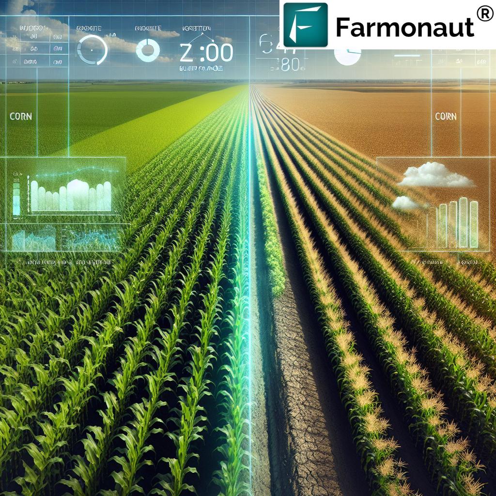
“Corn yield projections in Illinois vary dramatically, ranging from 138 to 276.4 bushels per acre due to weather variability.”
In the heart of America’s Corn Belt, Illinois farmers are facing unprecedented challenges as they navigate the complex landscape of crop yield variability. As we delve into the intricate world of agricultural productivity, we’ll explore how cutting-edge satellite monitoring technology from Farmonaut is revolutionizing farm management and boosting profitability across the Prairie State.
The Current State of Crop Yield Variability in Illinois
Recent crop tours across various states, including Illinois, have revealed significant fluctuations in crop conditions. From the fertile plains of McLean County to the rolling hills of Southern Illinois, farmers are experiencing a wide range of outcomes in their fields. This variability is largely attributed to the capricious nature of weather patterns, which have become increasingly unpredictable in recent years.
Let’s break down the factors contributing to this crop yield variability:
- Weather Extremes: Some regions are grappling with severe drought conditions, while others have benefited from timely rains.
- Soil Quality: Variations in soil composition and health across different parts of the state impact crop performance.
- Pest and Disease Pressure: Changing climate conditions have altered the prevalence and distribution of agricultural pests and diseases.
- Management Practices: The adoption of precision agriculture techniques varies among farms, influencing overall productivity.
These factors have led to a striking range in corn yield projections, from as low as 138 bushels per acre in drought-stricken areas to an impressive 276.4 bushels per acre in more favorable locations. This disparity underscores the critical need for advanced monitoring and management tools to help farmers adapt to these challenges.

The Rise of Climate-Smart Agriculture
As we navigate these challenging times, climate-smart agriculture has emerged as a beacon of hope for farmers across Illinois and beyond. This innovative approach integrates cutting-edge technology with traditional farming wisdom to create resilient and sustainable agricultural systems. At the forefront of this movement is precision agriculture technology, which is revolutionizing how farmers manage their crops and resources.
Precision agriculture leverages data-driven insights to optimize every aspect of farming, from planting to harvest. By utilizing advanced tools such as satellite imagery, IoT sensors, and AI-powered analytics, farmers can make informed decisions that maximize yields while minimizing environmental impact. This is where Farmonaut’s satellite monitoring capabilities come into play, offering Illinois farmers a powerful ally in their quest for profitability and sustainability.
Farmonaut: Empowering Illinois Farmers with Satellite-Based Solutions
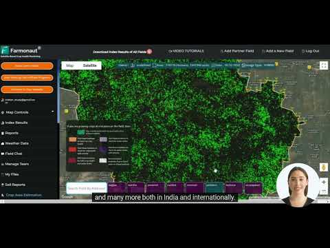
Farmonaut stands at the cutting edge of agricultural technology, providing farmers with a suite of tools designed to enhance decision-making and improve farm performance. By harnessing the power of satellite imagery and advanced analytics, Farmonaut offers real-time insights into crop health, soil moisture levels, and other critical metrics that directly impact yield potential.
Here’s how Farmonaut’s satellite monitoring is making a difference for Illinois farmers:
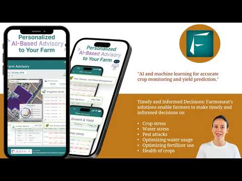
- Early Detection of Crop Stress: By analyzing multispectral satellite images, Farmonaut can identify signs of crop stress before they become visible to the naked eye, allowing farmers to take swift corrective action.
- Precision Irrigation Management: With accurate soil moisture data, farmers can optimize their irrigation schedules, ensuring crops receive the right amount of water at the right time.
- Targeted Fertilizer Application: By mapping nutrient deficiencies across fields, Farmonaut enables farmers to apply fertilizers more efficiently, reducing costs and environmental impact.
- Pest and Disease Monitoring: Early detection of pest infestations or disease outbreaks allows for timely interventions, minimizing crop losses.
- Yield Prediction: Advanced algorithms analyze historical and current data to provide accurate yield forecasts, helping farmers make informed decisions about marketing and storage.
To experience these benefits firsthand, Illinois farmers can access Farmonaut’s powerful platform through various channels:
Addressing the Challenges of Weather Variability
One of the most significant challenges facing Illinois farmers is the increasing unpredictability of weather patterns. From extended dry spells to sudden downpours, these fluctuations can have a profound impact on crop yields and farm profitability. Farmonaut’s satellite monitoring technology provides farmers with the tools they need to adapt to these changing conditions effectively.
Let’s explore how Farmonaut’s solutions address specific weather-related challenges:
- Drought Mitigation: By providing detailed soil moisture maps, Farmonaut helps farmers identify areas at risk of drought stress early on. This allows for targeted irrigation or the implementation of drought-resistant practices in vulnerable areas.
- Flood Risk Management: In regions prone to excessive rainfall, Farmonaut’s satellite imagery can help identify areas with poor drainage or standing water, enabling farmers to implement drainage solutions or adjust planting strategies.
- Frost and Heat Stress Monitoring: Advanced temperature monitoring capabilities alert farmers to potential frost events or heat stress conditions, allowing for timely protective measures.
- Extreme Weather Event Tracking: By integrating weather forecast data with satellite imagery, Farmonaut provides farmers with actionable insights to prepare for and mitigate the impacts of severe weather events.
Enhancing Farm Profitability Through Data-Driven Decision Making
In the face of crop yield variability, maximizing farm profitability requires a strategic approach backed by reliable data. Farmonaut’s satellite monitoring technology provides Illinois farmers with the insights they need to make informed decisions that positively impact their bottom line.
Here are some key ways Farmonaut enhances farm profitability:
- Resource Optimization: By providing precise data on crop health and soil conditions, Farmonaut helps farmers optimize their use of inputs such as water, fertilizers, and pesticides. This not only reduces costs but also minimizes environmental impact.
- Yield Maximization: Early detection of crop stress and timely interventions based on Farmonaut’s insights can significantly boost yields, even in challenging weather conditions.
- Risk Management: Accurate yield predictions and crop health assessments enable farmers to make informed decisions about crop insurance, forward contracts, and other risk management strategies.
- Time and Labor Savings: By identifying problem areas in fields, Farmonaut allows farmers to focus their efforts where they’re needed most, reducing unnecessary field scouting and labor costs.
- Market Timing: With better yield forecasts, farmers can make more strategic decisions about when to sell their crops, potentially capturing higher prices in the market.
“USDA crop yield estimates are being challenged by tour findings, highlighting the importance of real-time satellite monitoring.”
Comparative Analysis: Farmonaut vs. Traditional Crop Monitoring Methods
To truly appreciate the value that Farmonaut brings to Illinois farmers, it’s essential to compare its satellite monitoring capabilities with traditional crop monitoring methods. This comparison highlights why more farmers are turning to advanced agtech solutions to navigate the challenges of crop yield variability.
| Aspect | Traditional Methods | Farmonaut Satellite Monitoring |
|---|---|---|
| Coverage | Limited to areas physically scouted | Comprehensive coverage of entire fields |
| Frequency | Periodic, often weekly or bi-weekly | Daily updates with cloud-permitting conditions |
| Accuracy | Subject to human error and sampling bias | Consistent, data-driven insights across the entire farm |
| Early Detection | Limited to visible symptoms | Can detect issues before visible symptoms appear |
| Data Analysis | Often manual and time-consuming | Automated, AI-powered analytics for quick insights |
| Cost-Effectiveness | Labor-intensive and costly for large areas | Scalable and cost-effective for farms of all sizes |
| Weather Integration | Separate systems, often not integrated | Seamless integration of weather data with crop monitoring |
As this comparison demonstrates, Farmonaut’s satellite monitoring technology offers significant advantages over traditional methods, particularly in terms of coverage, frequency, and early detection capabilities. These benefits are especially crucial in the context of Illinois’s variable weather conditions and the need for timely, accurate information to guide farm management decisions.
Real-World Impact: Farmonaut in Action Across Illinois
To illustrate the tangible benefits of Farmonaut’s satellite monitoring technology, let’s examine how it’s making a difference across various regions of Illinois, each facing unique challenges in crop yield variability.
| Illinois Region | Estimated Corn Yield (bushels/acre) | Weather Conditions | Satellite Monitoring Benefits |
|---|---|---|---|
| Northern Illinois | 185-210 | Variable rainfall, risk of early frost | Early frost detection, optimized planting schedules |
| Central Illinois | 200-276.4 | Generally favorable, occasional dry spells | Precision irrigation management, yield optimization |
| Southern Illinois | 138-180 | Prone to drought, high heat stress | Drought early warning, heat stress mitigation strategies |
| Western Illinois | 170-220 | Mixed conditions, risk of flooding in river valleys | Flood risk assessment, targeted drainage recommendations |
This table illustrates the diverse challenges faced by farmers across Illinois and how Farmonaut’s satellite monitoring technology provides tailored solutions to address these region-specific issues. By leveraging these insights, farmers can make more informed decisions, ultimately leading to improved yields and increased profitability.
The Future of Farming: Integrating Satellite Monitoring with Precision Agriculture
As we look to the future of agriculture in Illinois and beyond, the integration of satellite monitoring technology with broader precision agriculture practices promises to revolutionize farming. Farmonaut is at the forefront of this agricultural evolution, offering tools that not only address current challenges but also pave the way for more sustainable and profitable farming practices.
Key areas of future development include:
- AI-Powered Predictive Analytics: Advanced machine learning algorithms will provide even more accurate yield predictions and pest outbreak forecasts, allowing farmers to stay one step ahead of potential issues.
- Integration with IoT Devices: Combining satellite data with ground-level sensors will create a more comprehensive picture of farm conditions, enabling hyper-localized management strategies.
- Automated Farm Equipment Guidance: Satellite-derived insights will directly inform autonomous tractors and sprayers, optimizing field operations with minimal human intervention.
- Carbon Sequestration Monitoring: As carbon markets develop, satellite technology will play a crucial role in verifying and quantifying carbon sequestration efforts on farms.
- Enhanced Crop Variety Selection: Data from satellite monitoring will inform breeding programs and help farmers choose the best crop varieties for their specific field conditions.
For developers and businesses looking to integrate Farmonaut’s powerful satellite and weather data into their own systems, the company offers robust API solutions:
Conclusion: Embracing Technology for a Prosperous Agricultural Future
As we’ve explored throughout this article, crop yield variability presents significant challenges for Illinois farmers. However, with the advent of advanced satellite monitoring technology offered by companies like Farmonaut, these challenges are increasingly becoming opportunities for innovation and growth.
By embracing these technological solutions, Illinois farmers can:
- Mitigate the impacts of weather variability
- Optimize resource use and reduce input costs
- Increase yields through data-driven decision making
- Enhance overall farm profitability
- Contribute to more sustainable agricultural practices
As we move forward, the integration of satellite monitoring with precision agriculture techniques will continue to shape the future of farming in Illinois and beyond. By staying at the forefront of these technological advancements, Illinois farmers can ensure their operations remain competitive, profitable, and sustainable in the face of ongoing environmental challenges.

Farmonaut Subscription Plans
Frequently Asked Questions (FAQ)
Q: How accurate is Farmonaut’s satellite monitoring technology?
A: Farmonaut’s satellite monitoring technology is highly accurate, providing insights with a resolution of up to 3 meters. The system uses multiple satellite sources and advanced algorithms to ensure reliable data, even in challenging weather conditions.
Q: Can Farmonaut’s technology work for small farms as well as large operations?
A: Yes, Farmonaut’s solutions are scalable and can benefit farms of all sizes. The technology is designed to be cost-effective and accessible, making it suitable for small family farms as well as large commercial operations.
Q: How often is the satellite data updated?
A: Farmonaut provides daily updates when weather conditions permit satellite imaging. This frequent updating ensures farmers have access to the most current information about their crops.
Q: Does Farmonaut require any special equipment to be installed on the farm?
A: No, one of the key advantages of Farmonaut’s technology is that it doesn’t require any on-farm hardware installations. All the necessary data is collected via satellites and processed in the cloud, making it a convenient and non-invasive solution.
Q: How does Farmonaut help with weather-related challenges?
A: Farmonaut integrates weather data with crop health information to provide early warnings about potential issues such as drought stress, frost risk, or excessive moisture. This allows farmers to take proactive measures to protect their crops.
Q: Can Farmonaut’s technology help with crop insurance claims?
A: Yes, the detailed, data-driven insights provided by Farmonaut can be valuable in supporting crop insurance claims. The historical data and precise field condition reports can serve as evidence when filing claims related to weather events or crop losses.
In conclusion, as we navigate the challenges of crop yield variability in Illinois, tools like Farmonaut’s satellite monitoring technology are becoming indispensable for modern farmers. By providing real-time, accurate data and actionable insights, Farmonaut empowers farmers to make informed decisions, optimize their operations, and ultimately enhance their profitability. As we look to the future, the continued integration of such advanced technologies will be key to ensuring the resilience and success of Illinois agriculture in the face of ongoing environmental challenges.


