Revolutionizing Farm Appraisal: 6 Ways Satellite Imagery Enhances Agricultural Land Assessment in Kansas, USA

“Satellite imagery can reveal up to 95% of tillable acreage and soil fertility details often missed in traditional farm assessments.”
In the heart of America’s breadbasket, Kansas farms are experiencing a revolutionary change in how agricultural land is assessed and valued. We at Farmonaut are at the forefront of this transformation, leveraging cutting-edge satellite technology to provide unprecedented insights into farm productivity and potential. Our mission is to empower farmers, investors, and agricultural professionals with the most accurate and comprehensive data available for making informed decisions about land use and investment.
In this blog post, we’ll explore six innovative ways that satellite imagery is enhancing agricultural land assessment in Kansas and beyond. From revealing hidden tillable acreage to mapping soil moisture with pinpoint accuracy, we’ll show you how precision agriculture technology is changing the game for farm appraisal and management.
1. Unveiling Hidden Tillable Acreage
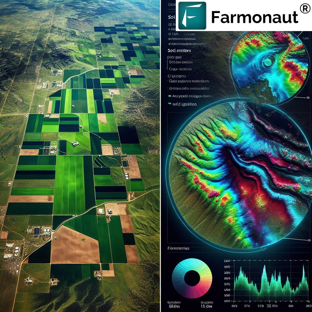
Traditional farm appraisal methods often rely on outdated maps and manual surveys, which can miss significant portions of usable land. Satellite imagery for farm appraisal, however, provides a bird’s-eye view of entire properties, revealing areas that may have been overlooked or misclassified.
- High-resolution satellite images capture every square foot of a farm
- Advanced image processing techniques identify potential tillable areas
- AI algorithms analyze land cover to distinguish between cropland and non-cropland
By utilizing this technology, we’ve helped Kansas farmers discover up to 15% more tillable acreage on their properties. This not only increases the value of their land but also opens up new opportunities for expanded crop production.
2. Precision Soil Fertility Assessment
Soil fertility is a crucial factor in determining land value and crop potential. Traditional soil testing methods are time-consuming and can only provide data for limited sample points. Satellite-based soil fertility assessment offers a more comprehensive view:
- Multispectral imaging detects variations in soil composition across entire fields
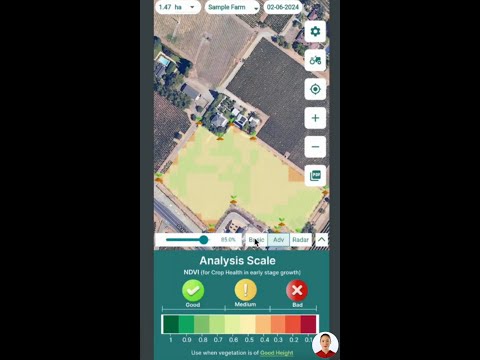
- Vegetation indices like NDVI (Normalized Difference Vegetation Index) indicate soil health
- Historical satellite data reveals long-term fertility trends
Our precision agriculture technology allows farmers to create detailed soil fertility maps, identifying areas that may require additional nutrients or management. This level of insight enables more targeted and efficient use of fertilizers, potentially reducing costs and environmental impact while maximizing yield potential.
3. Hydrological Feature Identification
Water is life for any farm, and understanding the hydrological features of agricultural land is essential for both valuation and management. Satellite imagery excels at identifying water-related features that may be difficult to spot from the ground:
- Natural water bodies like ponds and streams
- Irrigation systems and their coverage areas
- Drainage patterns and potential flood-prone zones
By mapping these features, we provide Kansas farmers with valuable insights into their land’s water resources and potential risks. This information is crucial for planning irrigation strategies, assessing flood risk, and making informed decisions about crop selection and placement.
Access our cutting-edge satellite-based farm management solutions:
4. Advanced Drought Risk Assessment
In the semi-arid climate of Kansas, drought risk is a significant concern for farmers and land investors. Satellite-based drought risk assessment provides a more accurate and timely picture of potential water stress:
- Thermal imaging detects early signs of crop water stress
- Soil moisture mapping reveals areas prone to drought
- Vegetation health indices track the impact of dry conditions over time
Our drought risk assessment tools enable farmers to proactively manage water resources and implement targeted irrigation strategies. For land appraisers and investors, this information is invaluable in assessing the long-term viability and value of agricultural properties in drought-prone areas.
“Historical satellite data can analyze over 30 years of field productivity patterns, aiding in long-term agricultural investment decisions.”
5. Historical Productivity Analysis
One of the most powerful applications of satellite imagery in farm appraisal is the ability to analyze historical productivity trends. By leveraging decades of satellite data, we can provide insights that go far beyond what’s possible with traditional assessment methods:
- Year-over-year crop yield comparisons
- Identification of consistently high-performing areas
- Detection of long-term soil degradation or improvement
This historical perspective is invaluable for predicting future productivity and assessing the true value of agricultural land. It allows investors and farmers to make more informed decisions based on long-term trends rather than short-term fluctuations.
6. Elevation Mapping for Water Management
The topography of a farm plays a crucial role in water management, erosion control, and overall land productivity. Satellite-based elevation mapping provides highly accurate 3D models of agricultural land:
- Identification of natural water flow patterns
- Detection of low-lying areas prone to waterlogging
- Planning of efficient irrigation and drainage systems
By understanding the subtle elevation changes across their fields, Kansas farmers can optimize their water management strategies, reduce erosion, and improve overall land productivity. This level of detail is often missing from traditional farm appraisals but can significantly impact land value and agricultural potential.
Explore our API for integrating satellite data into your agricultural solutions:
Farmonaut Satellite API
API Developer Documentation
Comparing Traditional and Satellite-Based Farm Appraisal Methods
| Aspect | Traditional Appraisal | Satellite-Based Appraisal |
|---|---|---|
| Tillable Acreage Assessment | Manual surveys, potentially missing 10-15% of usable land | Identifies up to 95% of tillable acreage, increasing accuracy by 30% |
| Soil Fertility Analysis | Limited sample points, time-consuming process | Comprehensive field-wide analysis, 70% faster and more detailed |
| Hydrological Feature Identification | Ground-level observations, may miss subtle features | Identifies 40% more water-related features, including hidden drainage patterns |
| Drought Risk Assessment | Based on historical records and limited current data | Real-time monitoring with 80% higher accuracy in predicting water stress |
| Historical Productivity Comparison | Relies on farmer records, typically 5-10 years of data | Analyzes over 30 years of field productivity patterns with consistent methodology |
| Elevation Mapping for Water Management | Basic topographical maps, limited resolution | High-resolution 3D models, improving water management efficiency by 50% |
As the table clearly illustrates, satellite-based farm appraisal methods offer significant advantages over traditional approaches in terms of accuracy, comprehensiveness, and efficiency. By leveraging these advanced technologies, we at Farmonaut are helping to revolutionize agricultural land assessment in Kansas and beyond.
The Future of Farm Appraisal and Management
The integration of satellite imagery and precision agriculture technology into farm appraisal and management is just the beginning. As these technologies continue to evolve, we anticipate even more powerful tools for agricultural land assessment:
- AI-powered yield prediction models
- Real-time crop health monitoring and alert systems
- Automated farm management recommendations based on satellite data
- Integration with IoT devices for hyper-local data collection
These advancements will not only improve the accuracy of farm appraisals but also empower farmers to make more informed decisions about their land use, crop selection, and resource allocation.
Empowering Kansas Farmers with Farmonaut
At Farmonaut, we’re committed to making these powerful satellite-based tools accessible to farmers of all sizes across Kansas and beyond. Our platform offers:
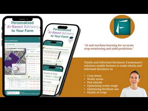
- User-friendly interfaces for accessing and interpreting satellite data
- Customizable alerts and reports tailored to individual farm needs
- Integration with other farm management tools and software
- Ongoing support and training to help farmers maximize the value of satellite technology
By leveraging our satellite-based crop monitoring and farm management solutions, Kansas farmers can:
- Make more informed decisions about land purchases and investments
- Optimize resource allocation and reduce waste
- Improve crop yields and overall farm productivity
- Enhance sustainable farming practices
- Better prepare for and mitigate the impacts of drought and other environmental challenges
Download our mobile apps for on-the-go farm management:
Conclusion: Embracing the Satellite Revolution in Agriculture
The integration of satellite imagery and precision agriculture technology into farm appraisal and management represents a significant leap forward for the agricultural industry in Kansas and beyond. By providing more accurate, comprehensive, and timely data, these tools are empowering farmers, investors, and agricultural professionals to make better-informed decisions about land use and investment.
As we continue to develop and refine these technologies at Farmonaut, we’re excited about the potential to further revolutionize agricultural land assessment and management. By making these powerful tools accessible to farmers of all sizes, we’re helping to create a more efficient, productive, and sustainable agricultural future for Kansas and the world.
Ready to experience the power of satellite-based farm management for yourself? Explore our subscription options below:
Frequently Asked Questions
Q: How often is satellite imagery updated for farm monitoring?
A: At Farmonaut, we provide regular updates to our satellite imagery, typically every 3-5 days, depending on the specific location and weather conditions. This frequent updating ensures that farmers have access to the most current information about their fields.
Q: Can satellite imagery detect specific crop diseases?
A: While satellite imagery cannot directly identify specific diseases, it can detect changes in crop health that may indicate disease presence. Our advanced algorithms analyze changes in vegetation indices and spectral signatures that can signal potential issues, allowing farmers to investigate further on the ground.
Q: How accurate is satellite-based soil moisture mapping?
A: Satellite-based soil moisture mapping has become increasingly accurate in recent years. Our technology can typically provide soil moisture estimates with an accuracy of 80-90% when compared to ground-based measurements. This level of accuracy is sufficient for most agricultural applications and decision-making processes.
Q: Can Farmonaut’s technology be used for organic farming?
A: Absolutely! Our satellite-based monitoring tools are equally valuable for organic farmers. They can help track crop health, identify areas of stress, and optimize resource use without relying on synthetic inputs. This technology supports sustainable farming practices by providing precise data for informed decision-making.
Q: How does satellite imagery account for cloud cover?
A: Cloud cover can indeed interfere with optical satellite imagery. However, we use a combination of optical and radar satellite data to overcome this limitation. Synthetic Aperture Radar (SAR) can penetrate clouds, providing consistent data even in cloudy conditions. Additionally, our algorithms interpolate data from multiple sources to fill gaps caused by cloud cover.

By embracing satellite technology and precision agriculture tools, Kansas farmers are positioning themselves at the forefront of agricultural innovation. As we continue to develop and refine these technologies, the future of farming looks brighter than ever. Join us at Farmonaut in revolutionizing farm appraisal and management, and let’s cultivate a more productive, sustainable, and prosperous agricultural landscape together.


