Mapping Banana Farms in West Bengal: A Farmonaut Initiative
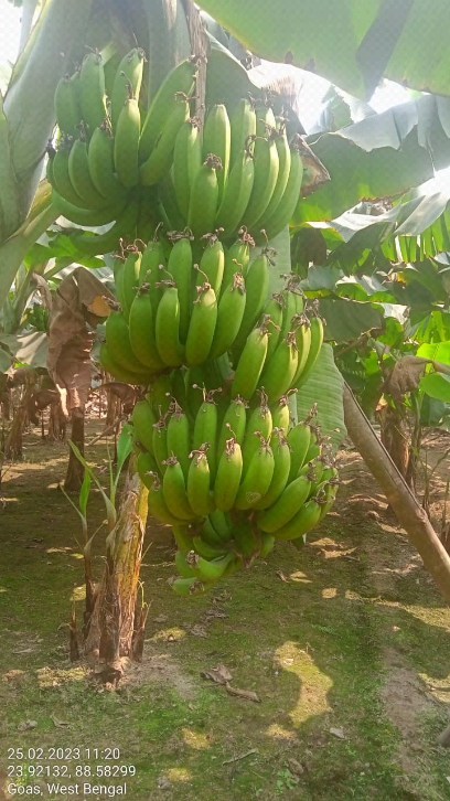
At Farmonaut, we’re excited to share our latest progress in mapping banana farms across West Bengal using cutting-edge remote sensing and GIS technologies. Our mission to revolutionize agriculture through accessible precision farming takes another significant step forward with this initiative. In this comprehensive blog post, we’ll delve into the intricacies of banana farming in West Bengal, the power of remote sensing in agriculture, and how our innovative approach is transforming the landscape of crop monitoring.
The Importance of Banana Farming in West Bengal
Banana cultivation plays a crucial role in West Bengal’s agricultural sector. As one of the state’s primary fruit crops, bananas contribute significantly to both the local economy and food security. West Bengal’s climate and soil conditions are particularly favorable for banana cultivation, making it an ideal region for this tropical fruit.
Some key points about banana farming in West Bengal include:
- West Bengal is among the top banana-producing states in India
- The crop provides livelihood to thousands of farmers in the region
- Banana cultivation supports both domestic consumption and export markets
- The industry faces challenges such as disease management and climate variability
Remote Sensing and GIS: Transforming Agricultural Monitoring
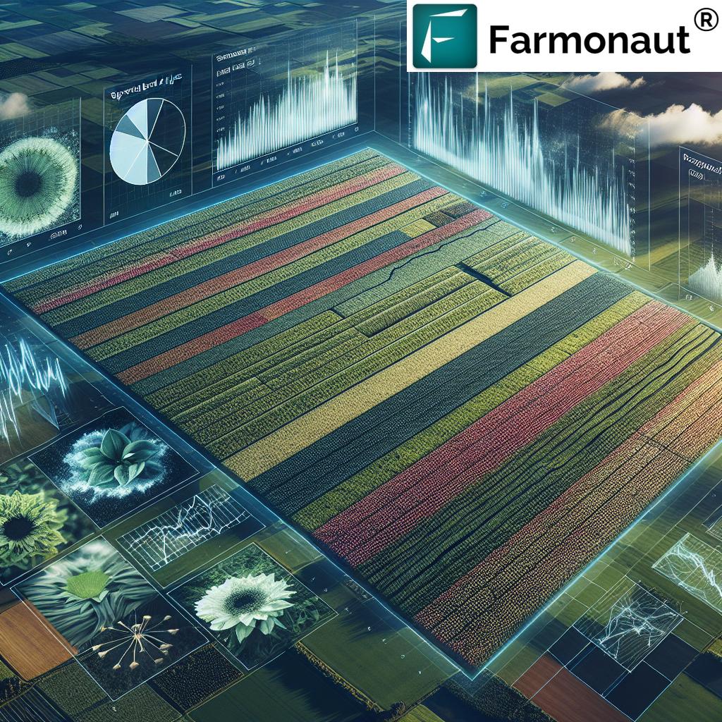
At Farmonaut, we leverage the power of remote sensing and GIS (Geographic Information Systems) to revolutionize agricultural practices. These technologies offer unprecedented insights into crop health, land use, and environmental conditions, enabling farmers and agricultural stakeholders to make informed decisions.
What is Remote Sensing in Agriculture?
Remote sensing involves collecting data about the Earth’s surface from a distance, typically using satellites or aerial imagery. In agriculture, this technology allows us to:
- Monitor crop health and growth patterns
- Detect pest infestations and diseases early
- Assess soil moisture levels and nutrient content
- Predict crop yields with greater accuracy
- Track land use changes over time
The Role of GIS in Agricultural Management
Geographic Information Systems (GIS) complement remote sensing by providing tools to analyze, visualize, and interpret spatial data. In the context of banana farming in West Bengal, GIS enables us to:
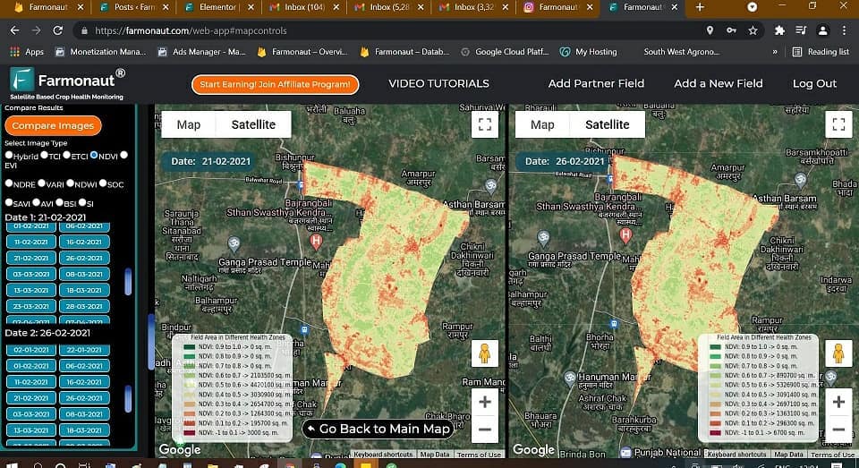
- Create detailed maps of banana plantations
- Analyze the distribution of banana farms across the region
- Identify optimal locations for new plantations
- Plan efficient resource allocation and logistics
- Monitor changes in land use and crop rotation patterns
Farmonaut’s Approach to Mapping Banana Farms in West Bengal
Our recent initiative to map banana farms in West Bengal demonstrates the practical application of our innovative technologies. Here’s how we approach this task:
1. High-Resolution Satellite Imagery
We utilize high-resolution multispectral satellite imagery to capture detailed views of agricultural areas across West Bengal. These images provide valuable information about vegetation health, land use patterns, and environmental conditions.
2. Advanced Image Processing
Our team employs sophisticated image processing techniques to enhance the quality of satellite data and extract relevant information. This includes atmospheric correction, image classification, and spectral analysis.
3. Machine Learning Algorithms
We’ve developed proprietary machine learning algorithms that can accurately identify banana plantations based on their unique spectral signatures. These algorithms are continuously refined to improve accuracy and adapt to different regional conditions.
4. Ground Truthing and Validation
To ensure the accuracy of our mapping, we conduct ground truthing exercises. This involves field visits to verify the satellite-based classifications and collect additional data on banana farming practices in West Bengal.
5. GIS Integration and Analysis
The processed data is integrated into our GIS platform, allowing for comprehensive spatial analysis. This enables us to generate detailed maps, conduct statistical analyses, and provide actionable insights to stakeholders.
Benefits of Mapping Banana Farms with Farmonaut
Our approach to mapping banana farms in West Bengal offers numerous benefits to farmers, policymakers, and the agricultural sector as a whole:
- Improved Crop Management: Farmers can access real-time information about their banana plantations, enabling better decision-making in areas such as irrigation, fertilization, and pest control.
- Resource Optimization: By accurately mapping banana farms, resources can be allocated more efficiently, reducing waste and improving overall productivity.
- Disease Monitoring: Early detection of diseases through remote sensing can help prevent widespread crop losses and reduce the use of pesticides.
- Policy Planning: Policymakers can use the detailed mapping data to develop targeted support programs and infrastructure planning for banana farmers in West Bengal.
- Market Intelligence: Accurate information on banana production areas can help in predicting yields and managing supply chains more effectively.
- Environmental Monitoring: By tracking land use changes over time, we can assess the environmental impact of banana cultivation and promote sustainable farming practices.
Farmonaut’s Satellite System vs. Drone and IoT-based Farm Monitoring
While drones and IoT devices have their place in agricultural monitoring, Farmonaut’s satellite-based system offers distinct advantages, especially for large-scale mapping projects like banana farms in West Bengal. Here’s a comparison:
| Feature | Farmonaut Satellite System | Drone-based Monitoring | IoT-based Monitoring |
|---|---|---|---|
| Coverage Area | Large (regional to global) | Limited (local) | Very Limited (field-level) |
| Frequency of Data Collection | Regular (daily to weekly) | On-demand (requires manual operation) | Continuous (real-time) |
| Initial Setup Cost | Low | High | Moderate to High |
| Operational Complexity | Low (automated) | High (requires skilled operators) | Moderate (requires maintenance) |
| Regulatory Constraints | Minimal | Significant (flight restrictions) | Moderate (connectivity issues) |
| Scalability | Highly Scalable | Limited Scalability | Moderate Scalability |
| Data Integration | Seamless with GIS | Requires additional processing | Requires data aggregation |
The Future of Banana Farming in West Bengal with Farmonaut
As we continue to map and monitor banana farms in West Bengal, we envision a future where precision agriculture becomes the norm rather than the exception. Our efforts are aimed at:
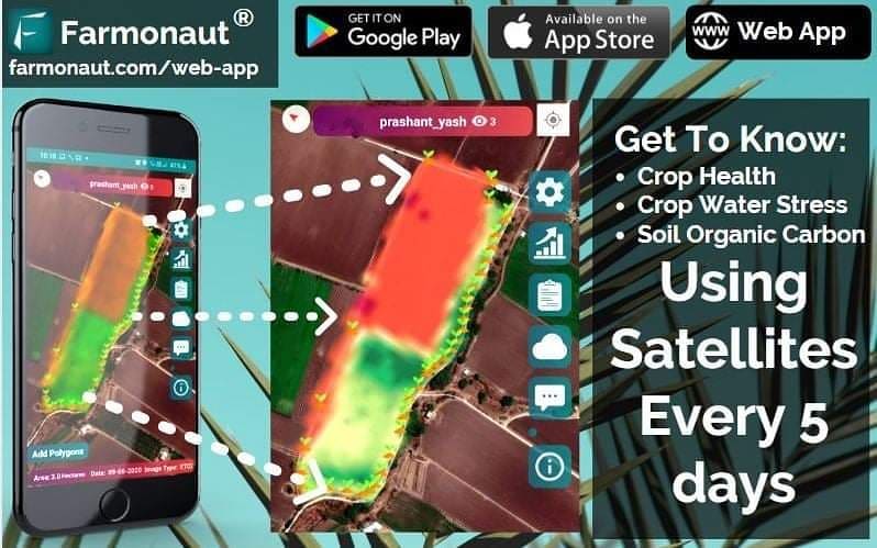
- Empowering Farmers: By providing easy access to satellite-based insights through our mobile app (Android | iOS), we’re putting the power of precision agriculture in the hands of every banana farmer in West Bengal.
- Promoting Sustainable Practices: Our technology enables farmers to optimize resource use, reducing the environmental impact of banana cultivation while improving yields.
- Enhancing Food Security: By improving banana production efficiency, we contribute to greater food security in the region and beyond.
- Facilitating Research: The comprehensive data we collect on banana farming in West Bengal serves as a valuable resource for agricultural research and innovation.
- Supporting Policy Decisions: Our mapping efforts provide policymakers with accurate, up-to-date information to inform agricultural policies and support programs.
How to Get Started with Farmonaut
If you’re a banana farmer in West Bengal or involved in the agricultural sector, here’s how you can leverage Farmonaut’s technology:
- Sign Up: Visit our website to create an account and explore our services.
- Download the App: Get our mobile app for Android or iOS to access farm monitoring tools on the go.
- Integrate Our API: For developers and businesses looking to incorporate our satellite data into their systems, check out our API documentation.
- Subscribe to Our Services: Choose a plan that fits your needs and start benefiting from our advanced agricultural monitoring tools.
Subscribe to Farmonaut
Ready to transform your approach to banana farming? Subscribe to Farmonaut today and join the precision agriculture revolution:
Conclusion
Our initiative to map banana farms in West Bengal using remote sensing and GIS technologies represents a significant leap forward in agricultural monitoring and management. By providing accurate, timely, and actionable insights, Farmonaut is empowering farmers, supporting sustainable practices, and contributing to the overall growth of the agricultural sector in the region.
As we continue to refine our technologies and expand our coverage, we remain committed to our mission of making precision agriculture accessible to all. The future of banana farming in West Bengal looks brighter than ever, and we’re proud to be at the forefront of this agricultural revolution.
FAQs
Q: How accurate is Farmonaut’s banana farm mapping in West Bengal?
A: Our mapping accuracy typically exceeds 90%, thanks to our advanced machine learning algorithms and regular ground truthing exercises.
Q: Can small-scale banana farmers in West Bengal benefit from Farmonaut’s technology?
A: Absolutely! Our services are designed to be accessible and beneficial to farmers of all scales, from small holdings to large plantations.
Q: How often is the satellite data updated for banana farms in West Bengal?
A: We provide regular updates, typically every 3-5 days, depending on satellite availability and cloud cover.
Q: Does Farmonaut offer services for crops other than bananas in West Bengal?
A: Yes, our technology can be applied to a wide range of crops. While this initiative focuses on bananas, we offer similar services for other major crops in the region.
Q: How can I access Farmonaut’s banana farm mapping data for West Bengal?
A: You can access our data through our web platform or mobile app. For more comprehensive data access, consider our API services.
Q: Is training provided on how to interpret and use the mapping data?
A: Yes, we offer training and support to help users make the most of our agricultural monitoring tools and data.
Join us in revolutionizing banana farming in West Bengal with the power of remote sensing and GIS. Together, we can create a more sustainable, productive, and prosperous future for agriculture in the region and beyond.


