

Agricultural Land Use Planning: 7 Shocking Farm Hacks!
Table of Contents
- Introduction to Agricultural Land Use Planning
- 1. Zoning Regulations & Farmland Preservation
- 2. Participatory Land Use Planning
- 3. Technological Integration: GIS in Agriculture
- 4. Policy Frameworks for Climate Adaptation
- 5. Agroforestry Systems and Sustainable Practices
- 6. Resource Allocation & Smart Farm Management
- 7. Digital Empowerment: Farmonaut’s Technological Edge
- Sustainable Land Use Approaches: Impact & Implementation Comparison
- FAQ: Agricultural Land Use Planning
- Conclusion: Strategic Agricultural Land Use for the Future
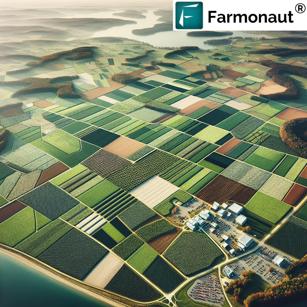
Introduction to Agricultural Land Use Planning
As we face an era of rapid population growth, climate variability, and increasing demand for food, agricultural land use planning emerges as a cornerstone for sustainable agriculture. This strategic process encompasses the allocation and integrated management of farmland, forestry, and rural spaces to maximize productivity, safeguard environmental health, and support economic viability.
At its core, comprehensive agricultural land use planning isn’t just about mapping plots for different crops—it’s about creating adaptive, inclusive frameworks that meet evolving needs. We draw on multiple tools, from zoning regulations to digital technologies like GIS, and emphasize participatory and policy-based approaches. In this blog, let’s explore seven eye-opening farm hacks that can revolutionize your approach to land use planning—bolstering sustainability, improving resilience, and driving long-term rural development.



How agricultural land use planning is done, step by step
Agricultural land use planning is the process of deciding which land should be farmed, how, and which land should be kept for other uses, based on what the land can support and what the community needs. The standard method comes from the FAO Guidelines for Land-Use Planning (1993), which sets out ten steps (FAO):
- Establish goals and terms of reference.
- Organise the work.
- Analyse the problems.
- Identify opportunities for change.
- Evaluate land suitability.
- Appraise the alternatives: environmental, economic and social analysis.
- Choose the best option.
- Prepare the land-use plan.
- Implement the plan.
- Monitor and revise the plan.
Step 5 is where soil maps, slope, climate and water data come in. Each area is rated for each possible use, such as cropping, grazing or forestry. GIS and satellite imagery make this faster and easier to update, but the ratings still depend on field soil data.
In rural land use planning in the US, the plan is usually put into effect through county zoning, tax assessment at farm-use value and the purchase of development easements. The FAO steps apply at every scale, from a single farm to a whole region. On a farm, the same logic means mapping soils and slopes, matching fields to crops or pasture, and reviewing the plan each season.
1. Zoning Regulations & Farmland Preservation: Foundation of Sustainable Farmland Management
The Role of Zoning Regulations in Agriculture
Zoning regulations for agriculture are instrumental in shaping how lands are utilized, protected, and sustained for future generations. They provide the legal backbone for farmland preservation programs by ensuring that agricultural activities remain the primary land use in rural and peri-urban zones.
- Definition: Agricultural zoning assigns specific use categories to parcels, dictating what activities can take place. This prevents incompatible uses (e.g., housing development) from encroaching on valuable farmland.
- Goal: Support sustainable agriculture practices, reduce urban sprawl, and maintain the rural character of important farming areas.
- Key Elements: Minimum lot sizes, designated buffer zones, and operational restrictions.
Examples: Montgomery County, Maryland & New Jersey Farmland Protection
For instance, Montgomery County, Maryland established the renowned Agricultural Reserve in 1980. The reserve covers 93,000 acres, almost a third of the county’s land (Montgomery Planning), and shields farms from development pressure near Washington, DC. The reserve has become a model in farmland preservation programs worldwide, showing how zoning can keep farmland in farming near a large city.
Meanwhile, New Jersey’s Farmland Assessment Act taxes qualifying land at its farm-use value, and the state’s Farmland Preservation Program, run by the State Agriculture Development Committee, buys development easements to protect farms permanently (NJ SADC).
Did you know? By supporting carbon footprinting tools, farmers and agribusinesses can proactively comply with evolving environmental regulations and demonstrate their commitment to sustainability.
Benefits of Strategic Agricultural Zoning
- Long-term protection of high-quality soils and water resources.
- Reduced conflicts between farm and non-farm land uses.
- Lowered development pressure, preserving the economic viability of farming communities.
- Enables regionally tailored regulatory frameworks in line with local priorities.
Our ability to optimize development while preserving rural identities has never been more important.

2. Participatory Land Use Planning: Harnessing Local Wisdom & Community Engagement
No single planning strategy achieves lasting success without community participation. Participatory land use planning puts local farmers and stakeholders at the heart of the process, drawing on their real-world knowledge to steer decision-making.
Why Participatory Approaches Matter
- Inclusiveness: It ensures that land use decisions reflect the unique social, environmental, and economic fabric of rural communities.
- Resilience: By encouraging collaboration, farmers are empowered to address shared challenges, such as soil conservation, climate adaptation, and resource-sharing.
- Ownership: Local buy-in reduces conflict and increases the commitment to implement sustainable practices.
Real-World Example: Mapping for Resilience
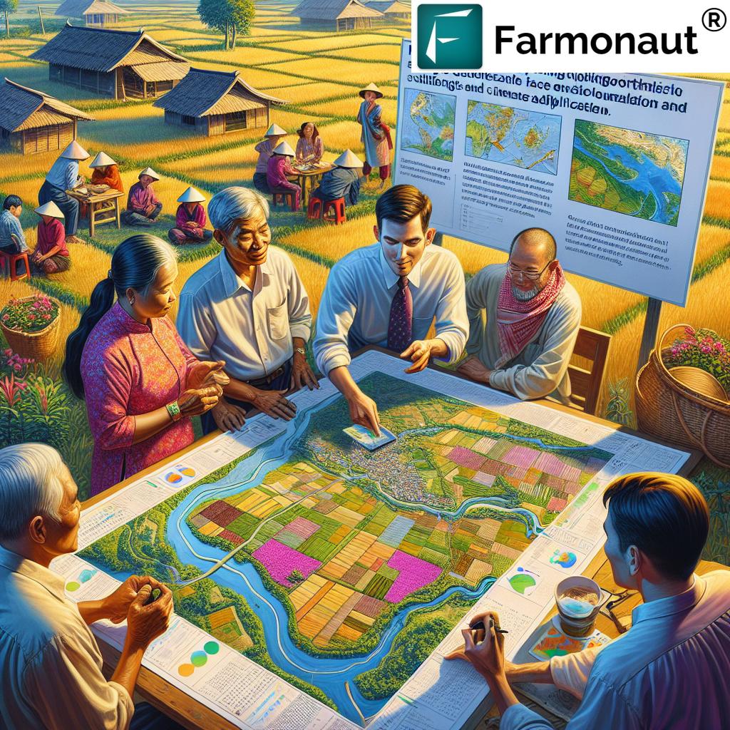
In Vietnamese communities, village-level land-use maps, co-created with local farmers, have enabled smarter allocation of crops and targeted interventions for soil erosion. Such collaborative maps are powerful strategic tools in optimizing land resources.
- Identification of suitable areas for diverse crops increases productivity and enables deliberate resource management.
- Community ownership of planning outcomes builds trust and improves on-ground adoption of new practices.
Farmonaut supports participatory resource management by supplying trusted, actionable data to both agribusinesses and smallholder farmers, enhancing the power of collaborative land-use planning.
APIs for Participatory Planning: Integrate satellite and weather data directly into local planning tools with the
Farmonaut Satellite & Weather API. Learn more in our Developer Docs.
3. Technological Integration: GIS in Agriculture for Precision Land Management
Geographic Information Systems (GIS) are game-changers in agricultural land use planning. By combining spatial analysis with up-to-date imagery and soil data, GIS empowers us to make smarter, data-driven decisions at field, farm, or even regional scale.
GIS in Agriculture: Advantages and Applications
- Land Suitability Assessment: Evaluate variables like soil health, topography, and water access to assign the best use for each field or area.
- Precision Farming: Geospatial mapping leads to efficient irrigation management, accurate fertilizer application, and pest control—all reducing input costs and resource wastage.
- Resource Optimization: Real-time overlays help us identify which areas need interventions, supporting adaptive management strategies.
- Environmental Stewardship: GIS helps pinpoint locations for habitat buffers, conservation strips, and monitor cropland health—vital for sustainable farming operations.
Farmonaut’s Advantage: With satellite-based crop health monitoring and easy-to-interpret GIS outputs, Farmonaut enables growers, advisors, and agribusinesses to transform vast amounts of geospatial data into actionable insights—helping optimize land allocation and crop management with ease on large-scale farms.
Example Applications:
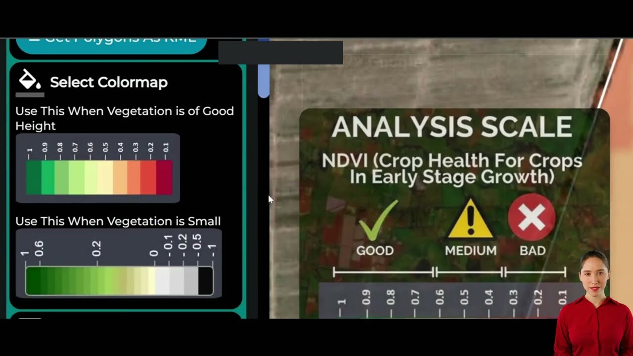
- **Soil fertility zones**—Guide nutrient application by mapping field variability using NDVI and NDWI indices.
- **Drought predictions**—Use moisture maps to forecast and mitigate crop stress, improving long-term resilience.
By leveraging satellite analytics from the Farmonaut Crop Plantation, Forest, and Advisory App, farmers can receive precise, field-specific advisory to improve the sustainability and economic viability of their operations.
4. Policy Frameworks for Climate Adaptation in Agriculture
Creating robust policy frameworks is crucial for guiding sustainable development in the face of climate change. Climate adaptation in agriculture hinges on policies that foster both innovation and conservation.
Types of Agricultural Zoning Policies & Policy Tools
- Climate-Smart Incentives: Provide financial incentives and technical assistance for practices like crop diversification, reduced tillage, and precision irrigation.
- Land Allocation Mandates: Zoning rules dictate where agriculture must be maintained, shielding sensitive zones from development and preserving environmental health.
- Conservation Programs: National and local programs reward farmers who adopt soil improvement, water conservation, or reforestation efforts.
- Emergency Adaptation: Disaster response funding and insurance umbrellas safeguard rural livelihoods during adverse climatic events.
For governments and financial institutions, Farmonaut’s Crop Loan and Insurance Verification Tools provide reliable, satellite-based data for crop verification. This streamlines insurance claims and increases trust in support programs.
Supporting Sustainable Agriculture: Policy Impact
- Encourages the adoption of sustainable land management strategies.
- Reduces external pressures on rural areas, thus preserving cultural and economic identities.
- Enhances adaptive capacity and resilience when responding to climate and market shocks.
Policy frameworks are most effective when integrated with digital monitoring, ensuring transparency and accountability in resource allocation and environmental stewardship.
5. Agroforestry Systems and Sustainable Land Use Practices
Agroforestry systems blend forestry and agriculture for holistic land management. By integrating trees, crops, and sometimes livestock on the same parcels, these systems deliver short- and long-term benefits for farms and the broader ecosystem.
- Biodiversity Boost: Diverse planting supports richer flora and fauna, enhancing natural pest management and pollination.
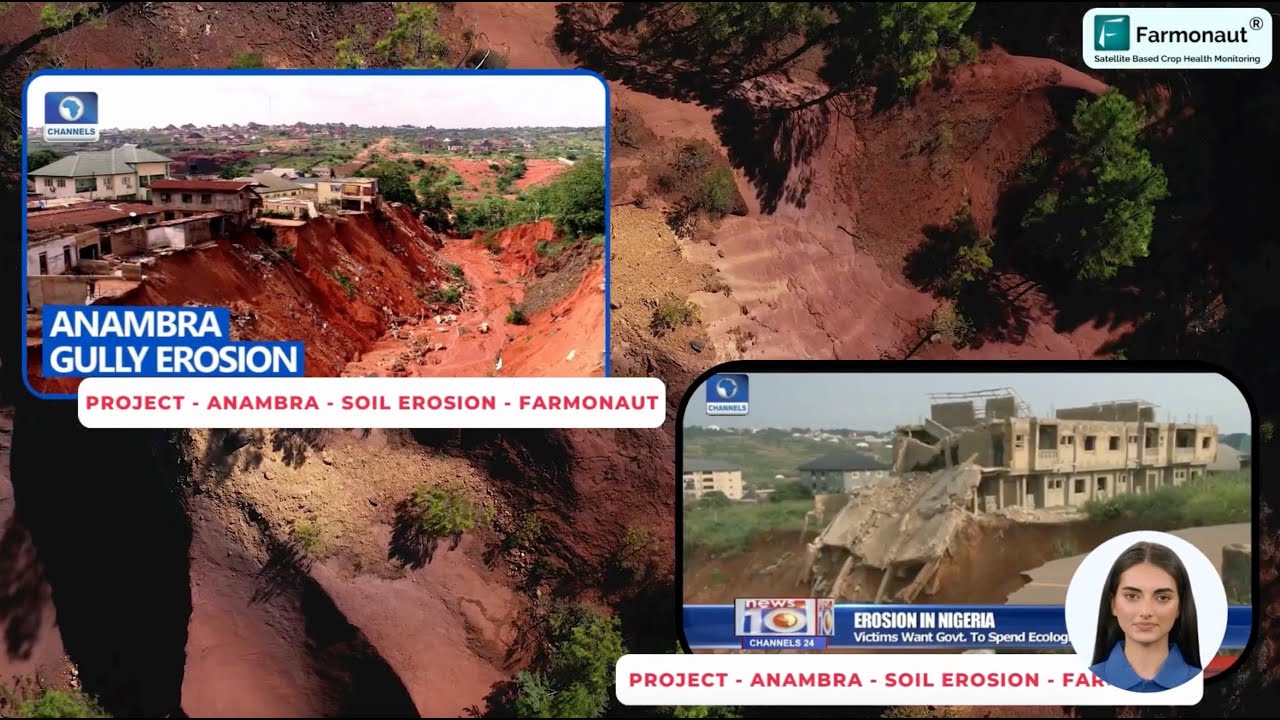
- Soil Structure: Tree roots stabilize soil, prevent erosion, and increase water infiltration.
- Carbon Sequestration: Trees absorb carbon dioxide, helping to reduce the agricultural carbon footprint.
- Product Diversification: Multiple revenue streams are possible through food, timber, bioenergy, or medicinal crops.
Agroforestry Hacks for Land Use Planning:
- Use windbreaks (tree rows) to protect crops from wind damage, boost yield, and conserve water.
- Implement alley cropping—row crops between trees—to maximize space and soil health.
- Design silvopastoral systems—grazing livestock in wooded areas—to increase resource efficiency.
- Adopt carbon monitoring to track ecological gains.
6. Resource Allocation & Smart Farm Management: Boosting Productivity Sustainably
Precision in resource allocation is central to modern agricultural land use planning. By monitoring inputs and outcomes, we can optimize productivity while minimizing waste and enhancing environmental health.
- Water Smart Farming: Satellite-driven soil moisture and irrigation analytics help avoid over- or underwatering, reducing costs and protecting water tables.
- Fleet Management: Real-time vehicle and machinery tracking enhances efficiency, lowers emissions, and extends equipment life. Farmonaut’s Fleet Management tools empower agribusinesses to manage logistics, cut external pressures, and optimize supply chains.
- Integrated Pest & Disease Monitoring: Early warnings reduce chemical usage and crop loss.
Deploying such smart management systems ensures that your land performs at its best—year after year—while safeguarding community and environmental interests.
7. Digital Empowerment: Farmonaut’s Technological Edge in Land Use Planning
The next phase of resilient farming evolves through the digital transformation of land use monitoring, advisory, and traceability. Farmonaut is at the forefront—democratizing technology and advanced analytics for farmers everywhere.
- Satellite-Based Crop Health Monitoring: Farmonaut provides field-level insights like NDVI (Normalized Difference Vegetation Index) and NDWI (Normalized Difference Water Index), letting you identify suitable areas for different crops and catch emerging threats.
- AI-Based Advisory & Weather Forecasts: Personalized, satellite-informed crop management improves resilience against pests, drought, and fluctuating external pressures. The Jeevn AI Advisory System supports smarter, real-time decision-making.
- Blockchain-Based Product Traceability: Secure supply chain transparency increases market confidence, food safety, and supports regulatory requirements. Explore how traceability solutions protect farm-to-table authenticity.
- Carbon Footprinting: Real-time monitoring of operational emissions drives compliance with environmental regulations and strengthens sustainability branding.
- Modular and Scalable: Solutions support both individual smallholders and large-scale farms, governments, and institutions.
Utilizing Farmonaut’s platform is as simple as installing the Android or iOS app, or accessing the web application directly from any browser.
For those seeking to leverage digital solutions for large-scale farm management, Farmonaut’s Agro Admin App offers an advanced control center for monitoring, planning, and reporting across vast operational areas.
Sustainable Land Use Approaches: Impact & Implementation Comparison
Explore Farmonaut’s Flexible Subscription Plans for All Scales
Start your transition to data-driven, sustainable, and resilient agriculture. Our flexible plans provide everything from crop monitoring to advanced advisory and traceability.
Frequently Asked Questions: Agricultural Land Use Planning
-
What is agricultural land use planning?
Agricultural land use planning is a strategic, comprehensive approach to the allocation and management of farmland to optimize productivity, preserve environmental health, and support the economic viability of farming and forestry operations. -
How do zoning regulations for agriculture protect farmland?
Zoning regulations designate specific areas for agricultural use, preventing non-farm development and preserving natural and economic resources for future generations. -
How does GIS improve agricultural land use planning?
GIS provides spatial analysis capabilities that help farmers and planners assess land suitability, manage resources efficiently, and implement precision agriculture techniques. -
Why is participatory land use planning beneficial?
It ensures land use plans are tailored to the real needs and knowledge of local farmers, fostering resilient, sustainable communities. -
What are agroforestry systems?
Agroforestry systems integrate trees, crops, and sometimes livestock to enhance biodiversity, improve soil structure, and increase long-term farm profitability. -
Can digital technology make land use planning more efficient?
Yes, platforms like Farmonaut offer real-time crop health monitoring, AI-driven advice, traceability, and fleet/resource management—a leap forward for efficient and sustainable land use planning. -
How can I access Farmonaut’s services?
Farmonaut’s solutions are available via web, Android, and iOS apps, as well as through APIs and developer integrations for businesses and governments.
Conclusion: Strategic Agricultural Land Use for the Future
Embracing sustainable agricultural land use planning is not a luxury—it is a necessity for both today and tomorrow. By diligently combining zoning regulations, participatory frameworks, advanced GIS technology, innovative policy, resource management, and digital empowerment, we empower ourselves, our communities, and future generations.
Platforms like Farmonaut are innovating how we see, measure, and manage our farmlands—making precision, transparency, and resilience accessible for all. The key to optimizing land use lies in our ability to stay informed, adopt new practices, and collaborate across disciplines and geographies.
Let’s champion strategic land planning, protect our rural spaces, and secure the sustainability and prosperity of agriculture for years to come.
Ready to revolutionize your land use planning? Empower your farm—and planet—with smart, sustainable solutions from Farmonaut.
Discussion
Questions, corrections or field experience? Share them below. First-time comments are reviewed before they appear, and your email is never published.
No comments yet. Be the first to add a question or your experience.

 FCF India
 Rashail Infotech
 Unifrutti Gulf
 Deluxe Conseil
 TVS Electronics
 BW Pipelines
 WICO
WICO Gen Chayat
 Chimera Innovation
 SkyHarvest
 Polaris Digitech
 Teledarbas
 Wild Oak Farm
 SFX
SFX Doodlakine
 Exurbia Geospatial
