Revolutionizing Agriculture: Farmonaut’s Journey in Empowering Farmers with Satellite Technology
At Farmonaut, we’re on a mission to transform the agricultural landscape by harnessing the power of satellite technology. Our commitment to empowering the farming community drives us to create and advance accessible technology that puts the future of farming in the hands of those who need it most. In this comprehensive exploration, we’ll delve into how we’re reshaping modern agriculture, one satellite image at a time.
The Farmonaut Vision: Bridging the Gap Between Space and Soil
Our primary goal at Farmonaut is multi-faceted, focusing on several key areas that are crucial for modern, sustainable agriculture:
- Helping farmers understand their crop health
- Identifying appropriate fertilizer requirements
- Detecting pests and diseases early
- Comprehending irrigation needs accurately
These objectives form the cornerstone of our innovative approach to agricultural technology. By leveraging satellite data and advanced AI algorithms, we’re bringing space-age technology down to earth, making it accessible and actionable for farmers across the globe.
The WhatsApp Revolution: Satellite Advisory at Your Fingertips
One of our groundbreaking innovations is our WhatsApp-based satellite advisory system. This unique service exemplifies our commitment to accessibility and ease of use. Here’s how it works:
- AI-Powered Farm Boundary Detection: Our exclusive AI-based system accurately detects and maps farm boundaries.
- Rapid Geotagging: We geotag farms quickly and efficiently, establishing a connection with satellites.
- Instant Connectivity: The entire process takes just 2 minutes, providing farmers with immediate access to satellite data.
This system is designed with one primary goal in mind: to make cutting-edge technology easily accessible for farmers, creating a new paradigm for modern farming.
The Technology Behind Farmonaut’s Success
At the heart of Farmonaut’s offerings lies a sophisticated blend of technologies that work in harmony to provide unparalleled insights and support to farmers:
1. Satellite-Based Crop Health Monitoring
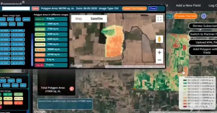
Our satellite farming approach utilizes multispectral satellite images to provide a comprehensive view of crop health. This technology allows us to offer:
- Vegetation health indices (NDVI)
- Soil moisture level assessments
- Critical metrics for informed decision-making
By leveraging this data, farmers can optimize their irrigation strategies, fine-tune fertilizer usage, and implement targeted pest management practices.
2. Jeevn AI Advisory System
Our AI-driven personalized farm advisory tool, Jeevn AI, is at the forefront of agricultural intelligence. It provides:
- Real-time insights based on satellite data analysis
- Accurate weather forecasts
- Expert crop management strategies
This system ensures that farmers have access to tailored advice that takes into account their specific farm conditions and needs.
3. Blockchain-Based Product Traceability
In an era where transparency is key, our blockchain integration offers:
- End-to-end traceability in agricultural supply chains
- Enhanced trust between producers and consumers
- Reduced risk of fraud in the food supply system
4. Fleet and Resource Management
For larger agricultural operations, our fleet management tools provide:
- Efficient logistics management
- Optimized vehicle usage
- Improved safety measures
- Better overall management of agricultural machinery
5. Carbon Footprinting
In line with global sustainability goals, we offer carbon footprint tracking that enables:
- Real-time emission data monitoring
- Insights for reducing environmental impact
- Compliance with evolving environmental regulations
Farmonaut vs. Traditional Farm Monitoring Methods
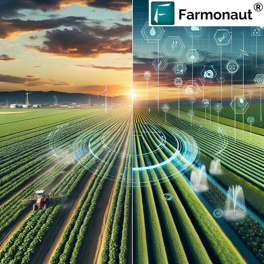
To understand the revolutionary nature of our satellite-based system, let’s compare it with traditional farm monitoring methods:
| Feature | Farmonaut Satellite System | Drone-based Monitoring | IoT-based Monitoring |
|---|---|---|---|
| Coverage Area | Large scale (100s to 1000s of hectares) | Limited (10s of hectares) | Very limited (based on sensor placement) |
| Frequency of Data Collection | Daily to weekly | As needed (manual operation required) | Continuous (limited by battery life) |
| Initial Setup Cost | Low | High (drone purchase required) | Medium to High (sensors and network setup) |
| Operational Complexity | Low (automated) | High (requires skilled operator) | Medium (requires maintenance) |
| Data Processing | Automated with AI | Manual or semi-automated | Automated but limited in scope |
| Weather Independence | High (can penetrate clouds) | Low (affected by wind and rain) | Medium (some sensors affected by weather) |
| Scalability | Highly scalable | Limited scalability | Moderately scalable |
The Farmonaut Advantage: Democratizing Precision Agriculture
Our approach at Farmonaut is not just about technology; it’s about making precision agriculture accessible to all. Here’s how we’re achieving this:
1. Cost-Effective Solutions
By relying on satellite imagery rather than expensive on-ground hardware, we’ve significantly reduced the cost barrier to entry for precision farming. This democratization of technology means that farmers of all scales, from small-holders to large agribusinesses, can benefit from our services.
2. Increased Farm Productivity
Our real-time data on crop health, soil moisture, and weather patterns empowers farmers to make informed decisions that optimize their resources. This leads to:
- Better crop yields
- Reduced input costs
- Minimized crop losses
3. Promoting Sustainability
Through features like carbon footprint tracking and efficient resource management, we’re at the forefront of promoting sustainable farming practices. This is crucial in today’s agricultural landscape, where there’s growing pressure to reduce environmental impact while increasing food production.
4. Enhancing Transparency and Trust
Our blockchain-based traceability solution ensures transparency in supply chains, particularly for corporate clients in agriculture and related sectors. By offering verifiable data on product origin and journey, we help build consumer trust and strengthen brand reputations.
5. Improving Access to Financing
Through our partnerships with financial institutions, we provide farmers with satellite-based verification for loans and insurance. This innovative approach:
- Improves access to financing for farmers
- Reduces risks for lenders
- Streamlines the loan approval process
The Soil Health Monitoring Market: Farmonaut’s Role
The soil health monitoring market is a rapidly growing sector within agricultural technology, and Farmonaut is positioned at its forefront. Our satellite-based solutions offer several advantages in this market:
- Comprehensive soil health assessments without invasive sampling
- Large-scale monitoring capabilities for vast agricultural areas
- Integration of soil health data with other critical farm metrics
- Historical tracking of soil health trends for long-term planning
By providing these advanced soil health monitoring capabilities, we’re enabling farmers to make more informed decisions about soil management, leading to improved crop yields and more sustainable farming practices.
Leveraging AI for Precision: Our Farm Boundary Detection System
One of our most innovative features is our AI-based farm boundary detection system. This technology is crucial for several reasons:
- Accuracy: AI algorithms can detect farm boundaries with high precision, even in complex landscapes.
- Efficiency: The system can process large areas quickly, saving time and resources.
- Adaptability: Our AI can adjust to different types of farmland and crop patterns.
- Integration: Accurate boundary detection is the foundation for all our other satellite-based services.
This system allows us to geotag farms rapidly, establishing a crucial link between the physical farm and our satellite data. The result is a seamless integration of space technology with on-ground farming realities.
The Power of Data: Our Satellite Data API
For developers and businesses looking to integrate our powerful satellite data into their own systems, we offer a robust satellite data API. This API provides access to:
- Real-time satellite imagery
- Historical data for trend analysis
- Processed agricultural insights
- Weather data correlated with farm locations
Our API is designed to be developer-friendly, with comprehensive documentation and support. It opens up a world of possibilities for creating custom agricultural solutions, research applications, and integrated farm management systems.
For more information on our API, visit our Satellite Data API page or check out our detailed API documentation.
Farmonaut in Action: Real-World Impact
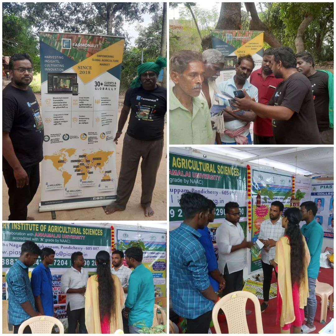
Our team at Farmonaut is not just about developing technology; we’re about making a real difference in the lives of farmers. Recently, we’ve been working closely with farming communities in the regions of Pondicherry and Tamil Nadu, India. These engagements have allowed us to:
- Understand the unique challenges faced by local farmers
- Tailor our solutions to meet specific regional needs
- Demonstrate the practical benefits of our satellite-based advisory system
- Build trust and rapport with the farming community
The feedback and insights we’ve gained from these interactions are invaluable, driving us to continually improve and refine our services to better serve farmers everywhere.
Join the Farmonaut Revolution
We invite farmers, agribusinesses, and agricultural enthusiasts to join us in revolutionizing farming practices. Here’s how you can get started with Farmonaut:
- Mobile Apps: Download our user-friendly apps for on-the-go farm management:
- Web Platform: Access our comprehensive web-based tools at Farmonaut Web Platform
- API Access: For developers and businesses, explore our Satellite Data API
Subscribe to Farmonaut
Ready to transform your farming practices with cutting-edge satellite technology? Subscribe to Farmonaut today and unlock the full potential of your farm:
Frequently Asked Questions (FAQ)
Q: How accurate is Farmonaut’s satellite data?
A: Our satellite data is highly accurate, with resolution capabilities down to 10 meters. We use a combination of optical and radar satellites to ensure consistent data quality, even in cloudy conditions.
Q: Can Farmonaut’s system work for small farms?
A: Absolutely! Our system is designed to be scalable and can provide valuable insights for farms of all sizes, from small holdings to large plantations.
Q: How often is the satellite data updated?
A: We provide daily to weekly updates, depending on the subscription plan and specific needs of the farm. Our system continually collects and processes data to ensure you have the most current information.
Q: Is internet connectivity required to use Farmonaut’s services?
A: While internet connectivity enhances the real-time aspects of our service, we’ve designed our WhatsApp-based system to work with minimal connectivity. Basic alerts and advisories can be received via SMS in areas with limited internet access.
Q: How does Farmonaut’s system compare to traditional field scouting?
A: While field scouting remains valuable, our satellite-based system offers broader coverage, more frequent updates, and data-driven insights that complement and enhance traditional scouting methods. It allows farmers to focus their on-ground efforts more efficiently.
Q: Can Farmonaut’s technology detect specific crop diseases?
A: Our system can detect anomalies in crop health that may indicate disease presence. While it cannot diagnose specific diseases, it can alert farmers to potential issues early, allowing for timely intervention and expert consultation.
Q: Is training required to use Farmonaut’s tools?
A: We’ve designed our tools to be intuitive and user-friendly. However, we do offer comprehensive training and support to ensure our users can maximize the benefits of our technology.
Q: How does Farmonaut ensure data privacy and security?
A: We take data privacy very seriously. All farm data is encrypted and stored securely. We adhere to strict data protection regulations and never share individual farm data without explicit consent.
Conclusion: Cultivating a Brighter Future for Agriculture
At Farmonaut, we’re not just observing the future of agriculture from afar – we’re actively shaping it. Our commitment to empowering farmers through accessible, cutting-edge technology is unwavering. By bridging the gap between satellite technology and on-ground farming practices, we’re cultivating a future where data-driven decisions lead to more sustainable, productive, and profitable farming.
As we continue to innovate and expand our services, we remain grounded in our core mission: to support and empower the farming community. Whether you’re a small-scale farmer in rural India or a large agribusiness operation, Farmonaut is here to help you harness the power of satellite technology for a more bountiful harvest.
Join us in this agricultural revolution. Together, we can cultivate a brighter, more sustainable future for farming – one satellite image at a time.


