Satellite Data Reveals Miami’s Sinking Skyline: Analyzing Soil Subsidence Risks in Luxury Real Estate
“Satellite data reveals some Miami luxury high-rises are sinking at alarming rates, challenging the city’s iconic skyline.”
In recent years, the glamorous skyline of Miami, Florida, has been making headlines for reasons that are far from celebratory. As we delve into the heart of this pressing issue, we uncover a story of luxury, geology, and the unforeseen consequences of rapid urban development. The Magic City, known for its stunning beaches and opulent high-rises, is facing a crisis that threatens the very foundation of its most iconic structures.
At Farmonaut, we specialize in leveraging cutting-edge satellite technology and geospatial data for agricultural applications. However, the principles we apply in monitoring soil health and land use patterns are equally valuable in urban contexts. Our expertise in analyzing satellite radar data provides unique insights into the challenges faced by Miami’s luxury real estate market.
The Sinking Sensation: Unveiling Miami’s Subsidence Crisis
A groundbreaking study from the University of Miami has sent shockwaves through the real estate community and beyond. By analyzing satellite radar data from 2016 to 2023, researchers have uncovered a disturbing trend: numerous luxury high-rises along Miami Beach and Sunny Isles Beach are sinking at rates ranging from 0.8 to 3 inches annually. In some cases, structures have sunk up to 8 inches over the observed period.
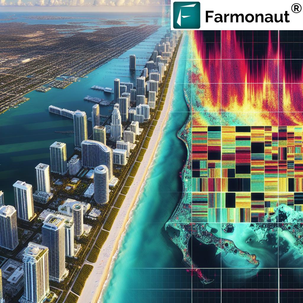
The iconic Porsche Design Tower, a 57-story marvel celebrated for its innovative robotic car elevators, has become a prime example of this alarming phenomenon. Since its inauguration in 2017, the tower has sunk nearly four inches and shows signs of tilting. This is not an isolated case; other prestigious buildings such as the Ritz-Carlton Residences, Trump Towers, Regalia, and Surf Club Towers are experiencing similar issues.
Understanding the Geological Culprits
Miami’s unique geology plays a significant role in this unfolding drama. The city is built upon a foundation of porous limestone bedrock overlaid with sandy layers. This geological makeup is particularly susceptible to subsidence, especially when subjected to the constant pressures of urban development and construction.
Key factors contributing to the subsidence include:
- Porous Limestone Bedrock: The underlying limestone is naturally filled with holes and cavities, making it unstable under heavy loads.
- Sandy Soil Layers: The sandy layers above the bedrock are prone to compaction and shifting.
- Constant Ground Movement: Natural geological processes cause ongoing subtle movements in the ground.
- Construction Vibrations: Ongoing construction activities create vibrations that can further destabilize the soil.
- Rising Sea Levels: As a coastal city, Miami is particularly vulnerable to the effects of climate change and rising sea levels, which can exacerbate soil instability.
The lead researcher of the University of Miami study pointed out a clear correlation between ongoing construction activities and the observed sinking. The prolonged deformation of sandy layers within the limestone bedrock, compounded by vibrations from construction, creates a perfect storm for subsidence.
The Role of Satellite Radar Data in Agriculture and Urban Planning
At Farmonaut, we recognize the vital role that satellite radar data plays in both agricultural and urban contexts. Our expertise in satellite radar data in agriculture translates seamlessly to urban applications, offering valuable insights for city planners and developers.
Satellite-based remote sensing technologies allow us to monitor subtle changes in ground elevation over time. This capability is crucial for:
- Soil Subsidence Monitoring: Detecting and tracking land subsidence in both rural and urban areas.
- Agricultural Land Use Analysis: Assessing the suitability and stability of land for various agricultural purposes.
- Urban Development Planning: Informing decisions about where and how to build in geologically challenging areas.
By leveraging these technologies, we can provide accurate, real-time data that is essential for making informed decisions about land use and development strategies.
Comparative Analysis of Soil Subsidence Rates in Miami
| Location/Neighborhood | Estimated Annual Subsidence Rate (mm/year) | Dominant Soil Type | Bedrock Characteristics | Proximity to Coastline (km) | Number of High-rises (>20 stories) | Average Building Age (years) | Estimated Risk Level |
|---|---|---|---|---|---|---|---|
| Sunny Isles Beach | 20-76 | Sandy | Porous limestone | 0.1 | 40 | 15 | High |
| Miami Beach | 15-50 | Sandy with organic matter | Porous limestone | 0.2 | 30 | 25 | Medium-High |
| Brickell | 10-30 | Clay-sand mixture | Porous limestone | 1.5 | 60 | 20 | Medium |
| Downtown Miami | 5-20 | Urban fill over sand | Porous limestone | 2.0 | 50 | 30 | Medium-Low |
| Coconut Grove | 2-10 | Organic soil over limestone | Shallow limestone | 3.0 | 10 | 40 | Low |
This table provides a clear overview of the varying subsidence risks across different areas of Miami. It’s evident that coastal neighborhoods with newer, taller buildings on sandy soil are at the highest risk of subsidence.
The Long-Term Implications of Subsidence
While the current rates of sinking might seem minimal, experts warn of significant long-term consequences. The cumulative effects of ongoing subsidence can lead to:
- Structural damage, including cracks in foundations and walls
- Misalignment of doors and windows
- Potential compromise of building integrity
- Increased vulnerability to flooding and storm surges
- Negative impact on property values and insurance rates
These issues pose a serious threat to the longevity and stability of Miami’s booming luxury real estate market, particularly in coastal areas already vulnerable to rising sea levels and geological instability.
Innovative Solutions and Sustainable Urban Development
As we face these challenges, it’s crucial to explore innovative solutions that can mitigate the risks associated with soil subsidence. At Farmonaut, we believe that the same technologies we use for precision farming technologies can be adapted to urban contexts.
Some potential solutions include:
- Advanced Foundation Technologies: Developing new building techniques that can better withstand ground movement.
- Continuous Monitoring Systems: Implementing real-time monitoring of building movement using satellite and ground-based sensors.
- Green Infrastructure: Incorporating natural elements to help stabilize soil and manage water runoff.
- Adaptive Design: Creating buildings that can adjust to gradual ground changes over time.
These approaches align with our commitment to sustainable development and innovative soil management techniques. By leveraging geospatial data and remote sensing technologies, we can create more resilient urban environments.

The Intersection of Urban Planning and Agricultural Practices
“Miami’s foundation of porous limestone and shifting sands contributes to constant ground movement, affecting both urban development and agriculture.”
The challenges faced by Miami’s urban developers share surprising similarities with those encountered in agriculture. Both sectors must contend with the realities of soil composition, water management, and environmental pressures. At Farmonaut, we specialize in agricultural land use analysis and remote sensing for crop health, and we see numerous opportunities to apply these technologies to urban planning.
Key areas where agricultural technologies can benefit urban development include:
- Soil Composition Analysis: Using remote sensing to map and analyze soil types across urban areas.
- Water Management: Applying precision irrigation techniques to urban landscaping and flood control.
- Environmental Impact Assessment: Utilizing satellite data to monitor the effects of urban development on surrounding ecosystems.
By bridging the gap between agricultural and urban land management, we can create more sustainable and resilient cities.
The Role of GIS and Remote Sensing in Risk Mitigation
Geographic Information Systems (GIS) and remote sensing technologies are powerful tools in addressing the challenges posed by soil subsidence. At Farmonaut, we leverage these technologies for GIS in agriculture, but their applications extend far beyond the farm.
In the context of urban development and soil subsidence, GIS and remote sensing can:
- Create detailed maps of soil types and bedrock characteristics
- Monitor ground movement over time with millimeter-level precision
- Model potential impacts of new construction projects
- Assess the effectiveness of mitigation strategies
By integrating these technologies into urban planning processes, we can make more informed decisions about where and how to build, reducing the risks associated with soil subsidence.
Sustainable Urban Development: Lessons from Agriculture
As we grapple with the challenges of urban subsidence, there are valuable lessons to be learned from sustainable agricultural practices. At Farmonaut, we’ve developed innovative soil management techniques that can be adapted for urban contexts:
- Soil Health Monitoring: Regular assessment of soil composition and stability.
- Water Management: Efficient irrigation systems to prevent soil erosion and instability.
- Green Infrastructure: Incorporating natural elements to stabilize soil and manage runoff.
- Crop Rotation Principles: Applying the concept of alternating land use to reduce stress on urban soils.
By adopting these principles, urban planners can create more resilient and sustainable cities that work in harmony with their geological foundations.
The Future of Miami’s Skyline: Adaptation and Innovation
As Miami faces the reality of its sinking skyline, the path forward lies in adaptation and innovation. The city’s unique geological challenges present an opportunity to pioneer new approaches to urban development that can serve as a model for coastal cities worldwide.
Key strategies for the future include:
- Stricter Building Codes: Implementing regulations that account for long-term soil subsidence.
- Adaptive Architecture: Designing buildings that can adjust to gradual ground changes.
- Integrated Monitoring Systems: Implementing city-wide networks of sensors to track ground movement.
- Public-Private Partnerships: Collaborating with tech companies and research institutions to develop innovative solutions.
By embracing these strategies, Miami can transform its challenges into opportunities for growth and innovation.
Conclusion: A Call for Sustainable Urban Development
The sinking skyline of Miami serves as a stark reminder of the delicate balance between urban development and environmental realities. As we’ve explored in this article, the challenges faced by luxury high-rises in Miami are not isolated incidents but symptoms of a larger issue that requires a comprehensive, data-driven approach.
At Farmonaut, we believe that the technologies and methodologies we’ve developed for agriculture have profound applications in urban planning and development. By leveraging satellite data, GIS, and remote sensing, we can create more resilient, sustainable cities that are better equipped to face the challenges of the future.
As we move forward, it’s crucial that developers, policymakers, and technology providers work together to implement innovative solutions. The future of Miami’s iconic skyline – and indeed, the future of coastal urban development worldwide – depends on our ability to adapt, innovate, and build in harmony with our environment.
FAQ Section
Q: What is causing the buildings in Miami to sink?
A: The sinking is primarily caused by Miami’s unique geology, which includes porous limestone bedrock and sandy soil layers. This geological makeup, combined with constant ground movement and vibrations from construction activities, contributes to soil subsidence.
Q: How fast are the buildings sinking?
A: According to the University of Miami study, some buildings are sinking at rates ranging from 0.8 to 3 inches annually, with some structures having sunk up to 8 inches over the observed period from 2016 to 2023.
Q: Is there an immediate danger of building collapse?
A: While officials currently state that there is no immediate danger of collapse, the cumulative effects of ongoing subsidence highlight an emergent concern regarding the longevity and stability of these structures.
Q: How can satellite data help in monitoring soil subsidence?
A: Satellite radar data allows for precise monitoring of ground movement over time. This technology can detect millimeter-level changes in elevation, providing valuable insights for both urban planners and agricultural applications.
Q: What solutions are being proposed to address this issue?
A: Proposed solutions include implementing stricter building codes, developing advanced foundation technologies, continuous monitoring systems, and incorporating green infrastructure to help stabilize soil.
Q: How does this issue affect the real estate market in Miami?
A: The subsidence issue poses potential long-term risks to property values and could impact insurance rates. It also raises questions about the sustainability of current development practices in coastal areas.
Q: Can the technologies used in agriculture help address urban subsidence?
A: Yes, many technologies used in precision agriculture, such as satellite imaging, soil composition analysis, and water management techniques, can be adapted to urban contexts to help monitor and mitigate subsidence risks.
For more information on how Farmonaut’s technologies can be applied to urban planning and development, please visit our web application or explore our API for custom solutions.
You can also download our mobile apps for on-the-go access to our advanced agricultural and geospatial tools:
Farmonaut Subscriptions
By leveraging Farmonaut’s cutting-edge technologies and expertise in geospatial analysis, we can work towards creating more resilient and sustainable urban environments. Together, we can address the challenges of soil subsidence and build a stronger future for cities like Miami and beyond.


