Revolutionizing South Australian Agriculture: Farmonaut’s GIS and Remote Sensing Solutions for Sustainable Crop Management
“South Australian agriculture employs GIS and remote sensing to manage over 4.5 million hectares of cropland sustainably.”
In the heart of South Australia, a revolution is underway. The vast expanses of cropland that have long been the backbone of the region’s economy are undergoing a remarkable transformation. At Farmonaut, we are at the forefront of this change, bringing cutting-edge GIS and remote sensing solutions to the forefront of sustainable crop management. Our mission is to empower farmers, agribusinesses, and policymakers with the tools they need to navigate the challenges of modern agriculture while preserving the rich natural heritage of South Australia.
The Changing Landscape of South Australian Agriculture
South Australia’s primary industries have long been a cornerstone of the state’s economy, with agriculture playing a pivotal role. However, the sector faces unprecedented challenges, from climate change to resource scarcity. In response, we’re witnessing a surge in the adoption of agricultural technology solutions and precision farming techniques. These innovations are not just changing the way we farm; they’re reshaping our understanding of sustainable agriculture practices.

The Department of Primary Industries and Regions (PIRSA) has been instrumental in this transformation. Through their Freedom of Information disclosure logs, crucial data on crop management systems, biosecurity measures, and sustainable agriculture practices have come to light. This transparency has not only fostered accountability but has also driven research and investment in agtech, creating a fertile ground for innovation.
GIS and Remote Sensing: The Pillars of Modern Agriculture
At the heart of this agricultural revolution are Geographic Information Systems (GIS) and remote sensing technologies. These powerful tools are transforming farm planning and management in ways that were unimaginable just a decade ago. Let’s explore how these technologies are making a difference:
- Precision Crop Monitoring: Satellite imagery allows us to track crop health in real-time, enabling early detection of issues and optimized resource allocation.
- Soil Health Analysis: Advanced sensors and spectral analysis provide detailed insights into soil composition and health, guiding fertilizer application and crop rotation strategies.
- Water Management: Remote sensing data helps in assessing soil moisture levels and optimizing irrigation schedules, crucial in water-scarce regions of South Australia.
- Pest and Disease Management: Early detection of pest infestations and disease outbreaks through multispectral imaging allows for targeted interventions, reducing the need for broad-spectrum pesticides.
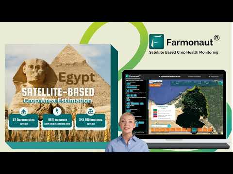
At Farmonaut, we’ve integrated these technologies into our platform, providing farmers with actionable insights at their fingertips. Our web application and mobile apps for Android and iOS put the power of satellite-based crop monitoring directly in the hands of farmers.
Climate Change and South Australian Agriculture: Adapting Through Technology
“Climate change impacts on South Australian agriculture have led to a 15% increase in precision farming adoption since 2018.”
The effects of climate change on South Australian agriculture are undeniable. Rising temperatures, altered rainfall patterns, and increased frequency of extreme weather events pose significant challenges to traditional farming methods. However, these challenges have also been a catalyst for innovation.
- Drought Resilience: GIS and remote sensing technologies enable better water resource management and drought-resistant crop selection.
- Crop Diversification: Data-driven insights help farmers identify and transition to crops better suited to changing climate conditions.
- Carbon Sequestration: Precision agriculture techniques, guided by remote sensing, can enhance soil carbon sequestration, contributing to climate change mitigation.
Our platform at Farmonaut integrates climate data with crop health information, providing farmers with a comprehensive tool for climate-adaptive agriculture. By leveraging our API, developers and researchers can access this wealth of data, fostering further innovation in climate-resilient farming practices.
Biosecurity in the Digital Age
Biosecurity is a critical concern for South Australian agriculture, protecting crops and livestock from pests and diseases. The integration of GIS and remote sensing in biosecurity measures has revolutionized our approach:
- Early Warning Systems: Satellite imagery can detect changes in vegetation that may indicate pest infestations or disease outbreaks.
- Quarantine Zone Mapping: GIS tools enable precise delineation of quarantine zones, crucial for containing outbreaks of diseases like fruit fly.
- Wildlife Management: Remote sensing aids in monitoring wildlife movements, helping prevent the spread of diseases between wild and domesticated animal populations.
At Farmonaut, we’re committed to supporting these biosecurity efforts. Our platform’s capabilities in detecting vegetation anomalies serve as an early warning system for potential biosecurity threats, allowing for rapid response and containment.

Aquaculture and Fisheries: The Blue Revolution
South Australia’s coastline is not just a tourist attraction; it’s a vital economic resource. The integration of GIS and remote sensing in aquaculture and fisheries management is ushering in a blue revolution:
- Site Selection: GIS tools help identify optimal locations for aquaculture farms, considering factors like water quality, currents, and environmental impact.
- Stock Monitoring: Satellite imagery and underwater sensors provide real-time data on fish populations and aquatic plant health.
- Marine Ecosystem Management: Remote sensing aids in monitoring coral reefs, seagrass beds, and other critical marine habitats.
While Farmonaut’s primary focus is on terrestrial agriculture, our technologies have applications in aquaculture and fisheries management. Our satellite-based monitoring systems can be adapted to track coastal vegetation and water quality, providing valuable insights for the aquaculture industry.

Agricultural Data Analytics: Turning Information into Action
The true power of GIS and remote sensing lies not just in data collection, but in the insights derived from that data. Agricultural data analytics is transforming raw information into actionable strategies:
- Yield Prediction: By analyzing historical data and current crop health, we can provide accurate yield predictions, helping farmers and markets prepare.
- Resource Optimization: Data analytics guide decisions on water usage, fertilizer application, and pest control, maximizing efficiency and minimizing environmental impact.
- Market Trend Analysis: By correlating production data with market trends, farmers can make informed decisions about crop selection and timing.
At Farmonaut, we’ve developed sophisticated algorithms that process vast amounts of satellite and on-ground data to provide farmers with clear, actionable insights. Our API Developer Docs provide a gateway for integrating these powerful analytics into various agricultural management systems.
Smart Farming Innovations: The Future of Agriculture
The convergence of GIS, remote sensing, and Internet of Things (IoT) technologies is paving the way for smart farming innovations:
- Automated Irrigation Systems: Soil moisture sensors combined with weather data enable precise, automated irrigation.
- Robotic Harvesting: GPS-guided robotic harvesters increase efficiency and reduce labor costs.
- Drone Technology: Drones equipped with multispectral cameras provide high-resolution crop health data, complementing satellite imagery.
Farmonaut’s platform is designed to integrate seamlessly with these smart farming technologies, providing a unified interface for modern agricultural management.
Regional Development and Sustainable Agriculture
The adoption of GIS and remote sensing technologies in agriculture has far-reaching implications for regional development in South Australia:
- Job Creation: The growth of agtech creates new opportunities in technology, data analysis, and precision agriculture.
- Rural Connectivity: The need for real-time data transmission is driving improvements in rural internet infrastructure.
- Sustainable Land Use: Precision agriculture techniques reduce environmental impact, preserving the land for future generations.
At Farmonaut, we’re proud to contribute to this regional development by providing tools that enhance agricultural productivity while promoting sustainability.
The Role of Government and Industry Collaboration
The transformation of South Australian agriculture is not the work of technology companies alone. It’s a collaborative effort involving government agencies, research institutions, and industry players:
- Policy Support: Government initiatives that promote the adoption of agtech solutions are crucial for widespread implementation.
- Research Partnerships: Collaboration between universities, CSIRO, and private companies drives innovation in agricultural technology.
- Industry Standards: The development of standards for data sharing and interoperability is essential for the growth of the agtech ecosystem.
While Farmonaut operates independently, we recognize the importance of these collaborative efforts in advancing sustainable agriculture practices.

The Future of South Australian Agriculture
As we look to the future, the integration of GIS and remote sensing in South Australian agriculture promises to deliver:
- Increased Productivity: Precision farming techniques will continue to boost yields while optimizing resource use.
- Enhanced Sustainability: Data-driven decision-making will reduce the environmental footprint of agriculture.
- Greater Resilience: Advanced monitoring and predictive analytics will help farmers adapt to changing climate conditions.
- Food Security: Improved crop management and yield predictions will contribute to long-term food security for the region and beyond.
At Farmonaut, we’re committed to being at the forefront of this agricultural revolution, providing the tools and insights needed to make this future a reality.
South Australian Agricultural Technology Adoption
| Technology Type | Adoption Rate (%) | Primary Crop Application | Environmental Impact | Productivity Increase (%) |
|---|---|---|---|---|
| Satellite Imagery | 65 | Wheat, Barley | Medium | 20 |
| Drone Mapping | 40 | Vineyards | Low | 15 |
| Soil Sensors | 55 | Various | High | 25 |
| Precision Irrigation Systems | 70 | Horticulture | High | 30 |
Conclusion: Embracing the Agricultural Revolution
The transformation of South Australian agriculture through GIS and remote sensing technologies is not just a technological shift; it’s a paradigm change in how we approach farming, sustainability, and food security. At Farmonaut, we’re proud to be part of this revolution, providing farmers and agribusinesses with the tools they need to thrive in this new era of agriculture.
As we move forward, the integration of these technologies will become increasingly seamless, making precision agriculture the norm rather than the exception. The challenges are significant, but so are the opportunities. By embracing these innovations, South Australian agriculture is poised not just to survive but to lead the way in sustainable, productive, and resilient farming practices.
We invite you to join us on this journey. Whether you’re a farmer looking to optimize your operations, a researcher exploring new frontiers in agtech, or a policymaker shaping the future of agriculture, Farmonaut’s solutions are here to support you. Together, we can build a more sustainable and prosperous future for South Australian agriculture.
FAQs
- What is GIS in agriculture?
GIS (Geographic Information System) in agriculture is a technology that captures, stores, analyzes, and displays geographical data related to farming. It helps in precision agriculture, crop monitoring, and resource management. - How does remote sensing benefit farmers?
Remote sensing provides farmers with real-time data on crop health, soil moisture, and environmental conditions, enabling informed decision-making for irrigation, fertilization, and pest management. - What crops in South Australia benefit most from precision agriculture?
Wheat, barley, and vineyards are among the crops that benefit significantly from precision agriculture techniques in South Australia. - How does Farmonaut’s technology help in sustainable agriculture?
Farmonaut’s satellite-based monitoring and AI-driven insights help optimize resource use, reduce chemical inputs, and improve overall farm sustainability. - Can small-scale farmers benefit from GIS and remote sensing technologies?
Yes, Farmonaut’s solutions are designed to be accessible and affordable for farmers of all scales, including small-scale operations.