Revolutionizing Australian Agriculture: Farmonaut’s Precision Weather Forecasting and Satellite Imagery for Smart Farming

“Farmonaut’s precision agriculture system integrates data from over 10,000 weather stations for hyper-local farm forecasts.”
Welcome to the future of agriculture in Australia! At Farmonaut, we’re excited to share how our cutting-edge weather forecasting and satellite imagery technologies are transforming the landscape of smart farming. In this comprehensive guide, we’ll explore the intersection of meteorology and agriculture, unveiling how precision agriculture meets state-of-the-art weather intelligence to revolutionize farm decision-making across the diverse climates of Australia.
From the sun-baked fields of Western Australia to the tropical plantations of Queensland, and the temperate farms of Victoria, weather plays a crucial role in every aspect of farming. That’s why we’ve developed advanced tools that combine satellite technology, artificial intelligence, and robust weather data to provide farmers with unprecedented insights into their operations.
The Power of Precision Weather Forecasting in Agriculture
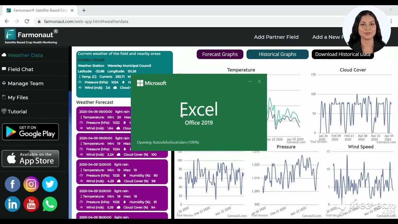
In the realm of modern farming, precision is key. Our weather forecast for agriculture goes beyond general predictions, offering hyper-localized data that can make all the difference in crop management and yield optimization. Let’s delve into how Farmonaut’s farm weather data is changing the game for Australian farmers.
- Micro-climate Monitoring: Our network of weather stations across Australia provides real-time data on temperature, humidity, wind patterns, and precipitation at a micro-level.
- Satellite-Powered Insights: By integrating satellite imagery with ground-level data, we offer a comprehensive view of farm conditions that was previously unattainable.
- AI-Driven Predictions: Our advanced algorithms analyze historical weather patterns and current data to provide accurate short-term and long-range forecasts.
With these precision agriculture weather tools at their fingertips, farmers can make informed decisions about planting, irrigation, pest control, and harvesting. This level of insight is particularly crucial in a country like Australia, where weather conditions can vary drastically from one region to another.
Harnessing Satellite Imagery for Crop Management
Satellite imagery for crop management is no longer a futuristic concept—it’s a present-day reality that Farmonaut brings to Australian farms. Our advanced remote sensing technologies provide farmers with a bird’s-eye view of their fields, offering insights that were once impossible to obtain without extensive ground surveys.
- Vegetation Health Index: Using multispectral imagery, we can assess crop health across vast areas, identifying issues before they become visible to the naked eye.
- Soil Moisture Analysis: Our satellite data helps in understanding soil moisture levels, crucial for efficient irrigation planning.
- Crop Yield Estimation: By analyzing historical and current imagery, we can provide accurate yield predictions to help with harvest planning and market strategies.
This satellite-based approach to crop monitoring is particularly beneficial in Australia’s vast agricultural landscapes, where traditional monitoring methods can be time-consuming and costly.
GIS in Agriculture: Mapping the Future of Farming
Geographic Information Systems (GIS) have become an indispensable tool in modern agriculture, and at Farmonaut, we’ve integrated GIS capabilities into our platform to provide farmers with powerful spatial analysis tools. Here’s how GIS in agriculture is transforming farm management:
- Field Mapping: Create detailed maps of your farm, including soil types, crop varieties, and infrastructure.
- Precision Application: Use GIS data to apply fertilizers and pesticides precisely where they’re needed, reducing waste and environmental impact.
- Yield Mapping: Analyze spatial patterns in crop yields to identify areas for improvement and optimize resource allocation.
By leveraging GIS technology, Australian farmers can gain a deeper understanding of their land and make data-driven decisions that boost productivity and sustainability.
Weather-Based Irrigation Planning: Every Drop Counts
In a country where water scarcity is a constant concern, efficient irrigation is crucial. Farmonaut’s weather-based irrigation planning tools help farmers make the most of this precious resource. Here’s how our system optimizes water use:
- Evapotranspiration Modeling: We calculate daily evapotranspiration rates to determine precise water needs for different crops.
- Rainfall Forecasting: Accurate precipitation predictions allow farmers to adjust irrigation schedules and avoid overwatering.
- Soil Moisture Sensors: Integration with on-ground sensors provides real-time data on soil water content.
By combining these data points, we help farmers develop irrigation strategies that conserve water while ensuring optimal crop growth. This is particularly valuable in drought-prone regions of Australia, where water management can make or break a season.
“Satellite imagery analysis by Farmonaut can detect crop stress up to 14 days before visible symptoms appear.”
Agricultural Climate Monitoring: Adapting to Change
Climate change poses significant challenges to agriculture worldwide, and Australia is no exception. Our agricultural climate monitoring tools help farmers stay ahead of these changes and adapt their practices accordingly. Here’s what we offer:
- Long-Term Climate Trends: Analysis of historical data to identify shifting patterns in temperature, rainfall, and extreme weather events.
- Seasonal Outlooks: Predictions for upcoming seasons to aid in crop selection and planning.
- Frost and Heat Wave Alerts: Early warning systems for extreme temperature events that can damage crops.
With this information at their fingertips, Australian farmers can make proactive decisions to mitigate climate risks and ensure the long-term sustainability of their operations.
Explore Farmonaut’s API for advanced weather data integration
Crop Weather Analytics: Turning Data into Decisions
At Farmonaut, we believe that data is only valuable if it leads to actionable insights. That’s why we’ve developed sophisticated crop weather analytics tools that help farmers interpret complex weather data and translate it into practical farm management decisions.
- Crop-Specific Weather Indices: Customized weather metrics tailored to different crop types and growth stages.
- Risk Assessment Models: Algorithms that calculate the likelihood of weather-related risks such as disease outbreaks or pest infestations.
- Yield Prediction Tools: Advanced models that combine weather data with crop information to forecast yields accurately.
These analytics empower farmers to make informed decisions about everything from planting dates to harvest timing, optimizing their operations for maximum efficiency and profitability.
Agtech Weather Solutions: The Farmonaut Advantage
As leaders in agtech weather solutions, we at Farmonaut are constantly innovating to meet the evolving needs of Australian farmers. Our platform offers a unique combination of features that set us apart in the agricultural technology landscape:
- Integration of Multiple Data Sources: We combine satellite imagery, weather station data, and on-farm sensors to provide a comprehensive view of farm conditions.
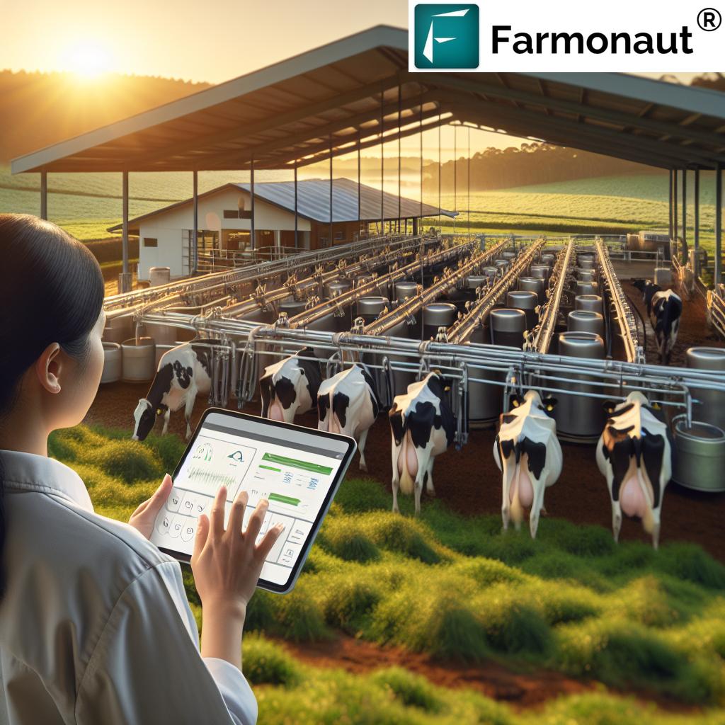
- User-Friendly Interface: Our intuitive mobile and web applications make it easy for farmers to access complex data on-the-go.
- Customizable Alerts: Set up personalized notifications for critical weather events or crop health issues.
- Data-Driven Recommendations: Receive tailored advice on farm management practices based on real-time and forecasted conditions.
These features come together to create a powerful toolkit that helps Australian farmers navigate the challenges of modern agriculture with confidence and precision.
Check out our API Developer Docs for seamless integration
Remote Sensing for Farm Decision-Making: Seeing is Believing
Remote sensing technology has revolutionized the way we understand and manage agricultural landscapes. At Farmonaut, we harness the power of remote sensing to provide farmers with unprecedented insights into their fields. Here’s how remote sensing aids in farm decision-making:
- Crop Health Monitoring: Detect early signs of stress, disease, or nutrient deficiencies across large areas.
- Biomass Estimation: Assess crop growth and potential yield without the need for time-consuming field sampling.
- Land Use Classification: Identify different crop types and monitor changes in land use over time.
- Disaster Assessment: Quickly evaluate the impact of extreme weather events or natural disasters on crops.
By leveraging these remote sensing capabilities, Australian farmers can make more informed decisions about crop management, resource allocation, and risk mitigation.
Weather Intelligence Across Australia’s Diverse Climates
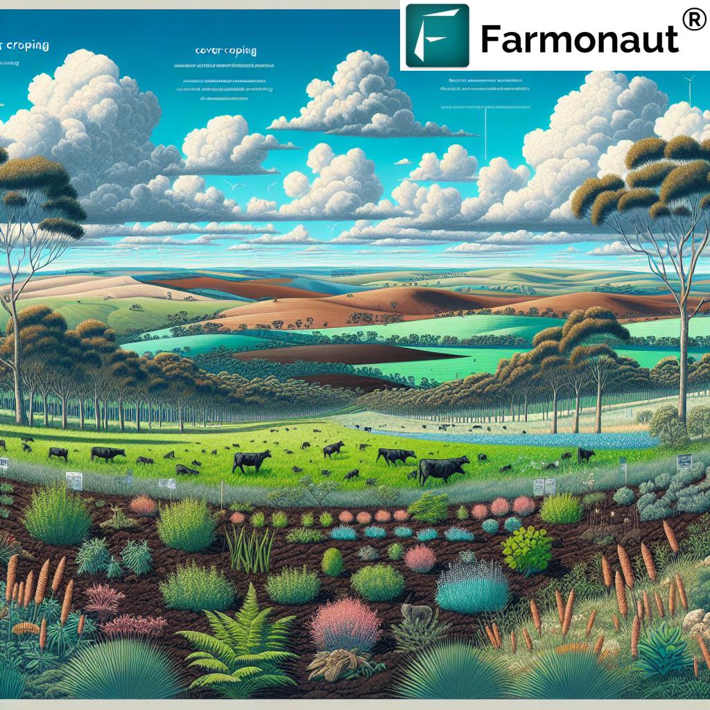
Australia’s vast landmass encompasses a wide range of climate zones, from tropical in the north to temperate in the south, and arid in the center. Farmonaut’s weather intelligence system is designed to cater to this diversity, providing localized insights for farms across the country:
- Tropical North (Darwin, Cairns): Monitoring cyclone patterns and monsoon rains for effective crop planning.
- Arid Center (Alice Springs): Precise tracking of rare rainfall events and heat stress monitoring.
- Mediterranean South (Perth, Adelaide): Frost forecasting and fire danger assessments during dry summers.
- Temperate East (Sydney, Melbourne): Detailed precipitation forecasts and temperature trend analysis.
- Subtropical East (Brisbane): Humidity tracking and severe storm predictions.
Our system adapts to the unique challenges of each region, ensuring that farmers receive relevant and actionable weather intelligence regardless of their location.
The Future of Weather-Smart Agriculture in Australia
As we look to the future, the role of weather intelligence in agriculture will only grow more significant. At Farmonaut, we’re committed to staying at the forefront of this evolution, continually enhancing our tools and technologies to meet the changing needs of Australian farmers. Here are some trends we’re excited about:
- Artificial Intelligence and Machine Learning: Developing even more sophisticated predictive models for weather and crop behavior.
- Internet of Things (IoT) Integration: Expanding our network of connected sensors to provide even more granular, real-time data.
- Climate Change Adaptation: Enhancing our long-term forecasting capabilities to help farmers plan for and adapt to shifting climate patterns.
- Precision Agriculture Automation: Integrating our weather intelligence with farm machinery for automated, weather-responsive farming practices.
These advancements will further empower Australian farmers to make data-driven decisions, optimize resource use, and build resilience in the face of climate variability.
| Tool Name | Primary Function | Data Sources | Accuracy Range | Key Benefits for Farmers |
|---|---|---|---|---|
| Satellite Imagery Analysis | Crop health monitoring | Multispectral satellite data | 85-90% | Early detection of crop stress and diseases |
| GIS-based Weather Modeling | Localized weather prediction | Weather stations, topographical data | 80-85% | Precise micro-climate forecasts for farm planning |
| Historical Data Analysis | Long-term trend forecasting | Multi-decade weather records | 75-80% | Seasonal outlooks for crop selection and planning |
| Farmonaut’s Integrated Weather Intelligence System | Comprehensive farm weather management | Satellites, weather stations, IoT sensors, historical data | 90-95% | Holistic farm management with real-time insights and predictive analytics |
Conclusion: Empowering Australian Farmers with Weather Intelligence
In conclusion, the integration of precision weather forecasting and satellite imagery into agricultural practices is transforming farming in Australia. At Farmonaut, we’re proud to be at the forefront of this revolution, providing farmers with the tools they need to thrive in an increasingly complex and challenging environment.
From the cotton fields of New South Wales to the wheat belts of Western Australia, our weather intelligence system is helping farmers make smarter decisions, conserve resources, and increase yields. By combining cutting-edge technology with deep agricultural expertise, we’re not just predicting the weather – we’re helping to shape the future of farming in Australia.
As we continue to innovate and expand our services, we remain committed to our mission of making precision agriculture accessible and affordable for farmers across Australia and beyond. Together, we can build a more resilient, productive, and sustainable agricultural sector that’s ready to face the challenges of tomorrow.
Frequently Asked Questions (FAQ)
- How accurate are Farmonaut’s weather forecasts?
Our forecasts typically have an accuracy range of 90-95%, thanks to our integration of multiple data sources and advanced AI algorithms. - Can Farmonaut’s system be used for all types of crops?
Yes, our system is designed to work with a wide variety of crops and can be customized for specific crop types and growing conditions. - How often is satellite imagery updated?
We provide regular updates, with most areas receiving new imagery every 3-5 days, depending on satellite coverage and weather conditions. - Is Farmonaut’s platform suitable for small-scale farmers?
Absolutely! We offer solutions tailored to farms of all sizes, making precision agriculture accessible to small-scale farmers as well as large operations. - How does Farmonaut help with water management?
Our system provides detailed insights on soil moisture, evapotranspiration rates, and precipitation forecasts to help optimize irrigation and water use efficiency.


