Celebrating a Remarkable Month of Milestones: Farmonaut’s Journey in August 2023

At Farmonaut®, we’ve always been committed to revolutionizing agriculture through innovative technology. August 2023 marked a significant chapter in our journey, filled with groundbreaking achievements and collaborations that have propelled us further in our mission to make precision agriculture accessible to farmers worldwide.
1. Processing 1 Crore Satellite Images: A Leap in Satellite Data Processing
One of our most remarkable achievements this month was the processing of a staggering 1 crore satellite images within just 10 days. This milestone is not just a number; it represents a quantum leap in our satellite data processing capabilities.
The Significance of Satellite Imagery in Agriculture
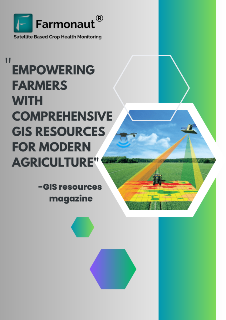
Satellite imagery has become an indispensable tool in modern agriculture. The applications of satellite imagery in farming are vast and transformative:
- Crop Health Monitoring: Satellites provide a bird’s-eye view of entire fields, allowing farmers to identify problem areas quickly.
- Yield Prediction: By analyzing historical and current imagery, we can make accurate yield predictions.
- Resource Management: Satellite data helps in optimizing water usage and fertilizer application.
- Disaster Assessment: In case of natural calamities, satellite imagery can quickly assess the extent of damage to crops.
Our ability to process such a large volume of images in a short time frame means that we can provide farmers with more frequent and up-to-date information about their crops. This rapid processing capability is crucial for real-time decision-making in agriculture.
How Farmonaut Leverages Satellite Imagery
At Farmonaut, we use advanced algorithms to analyze satellite images and extract valuable insights. Our Farmonaut app provides farmers with easy access to this processed data, allowing them to:
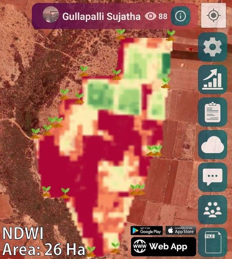
- Monitor crop health using vegetation indices like NDVI (Normalized Difference Vegetation Index)
- Identify areas of stress in their fields
- Track crop growth stages
- Plan irrigation and fertilization more effectively
By processing 1 crore images in 10 days, we’ve significantly enhanced our ability to provide timely and accurate information to our users.
2. Precision Agriculture Milestone: Mapping Egypt’s Wheat Areas
Another significant achievement in August was the alignment of our accuracy in mapping Egypt’s wheat areas with government records. This precision agriculture milestone showcases the reliability and effectiveness of our satellite-based crop monitoring system.
The Importance of Accurate Crop Mapping
Accurate crop mapping is crucial for several reasons:
- Policy Making: Governments rely on this data for agricultural policy decisions and food security planning.
- Resource Allocation: It helps in the efficient distribution of resources like water and fertilizers.
- Yield Estimation: Accurate mapping leads to more precise yield forecasts.
- Market Intelligence: It provides valuable information for commodity traders and food processors.
Farmonaut’s Approach to Crop Mapping
Our success in mapping Egypt’s wheat areas is a testament to the sophistication of our crop monitoring satellite technology. We use a combination of:
- Multi-spectral satellite imagery
- Machine learning algorithms
- Ground-truthing data
- Historical crop patterns
This integrated approach allows us to achieve high levels of accuracy in crop identification and area estimation.
Impact on Egyptian Agriculture
The alignment of our data with government records in Egypt is significant because:
- It validates our technology in one of the world’s oldest agricultural regions.
- It provides Egyptian farmers and policymakers with a reliable tool for agricultural planning.
- It demonstrates the potential of satellite technology in enhancing food security in arid regions.
3. Visit to the Prestigious Indian Institute of Science (IISC)
In August, we had the distinct honor of being invited to the renowned Indian Institute of Science (IISC) in Bengaluru. This visit was more than just a recognition of our work; it was an opportunity for invaluable knowledge exchange.
The Significance of IISC
IISC is one of India’s premier research institutions, known for its cutting-edge work in science and technology. Our invitation to this esteemed institution underscores the scientific credibility of our work at Farmonaut.
Knowledge Exchange Sessions
During our visit, we engaged in several knowledge exchange sessions, focusing on:
- Advanced remote sensing techniques
- Artificial intelligence in agriculture
- Sustainable farming practices
- Climate-resilient agriculture
These sessions not only allowed us to share our experiences but also gave us insights into the latest research in agricultural technology.
Potential Collaborations
Our visit to IISC has opened doors for potential collaborations. We are exploring possibilities of joint research projects that could further enhance the capabilities of our satellite-based farm management solutions.
4. Netherlands Economic Mission in Bengaluru
Another highlight of August was our invitation to the Netherlands Economic Mission in Bengaluru, attended by the Prime Minister of the Netherlands and the Consul General. This event was a significant platform for international collaboration and showcasing our technology on a global stage.
The Importance of International Recognition
Being part of this high-profile economic mission:
- Validates our global relevance in agritech
- Opens doors for international partnerships
- Provides exposure to global best practices in agriculture and technology
Potential Impact on Farmonaut’s Growth
This international exposure is expected to accelerate our growth by:
- Facilitating entry into new markets
- Attracting global investors
- Enabling knowledge transfer with Dutch agricultural experts
5. Collaboration with the Rader Group: A Game-Changer for African Agriculture
One of our most exciting developments in August was the exclusive partnership between Farmonaut® and the RADER group for the Africa Green Impact (AGI) Program in Central Africa and Nigeria. This collaboration with the Rader Group is set to make a significant impact on African agriculture.
The Scope of the AGI Program
The AGI Program is ambitious in its scale and impact:
- Coverage: Over 11 countries involved
- Area: Monitoring more than 10 million hectares
- Beneficiaries: Impacting over 10 million farmers
How Farmonaut’s Technology Will Benefit African Farmers
Our satellite-based farm management solutions will provide African farmers with:
- Real-time crop health monitoring
- Personalized agricultural advisories
- Weather forecasts and alerts
- Resource optimization recommendations
This technology has the potential to significantly increase agricultural productivity in a region where food security is a critical concern.
Long-term Impact on African Agriculture
We believe this collaboration will lead to:
- Increased crop yields
- More efficient use of water and fertilizers
- Better resilience against climate change
- Improved livelihoods for millions of smallholder farmers
6. Partnership with Anambra: Fostering Sustainable Agriculture
In addition to our pan-African initiative, we’ve also forged a partnership closer to the ground. Farmonaut® has joined forces with the STEi Foundation in Anambra, Nigeria, to make a positive impact on agriculture and environmental sustainability.
The STEi Foundation
The STEi Foundation is known for its work in promoting science, technology, engineering, and innovation in Nigeria. Our partnership with them aligns perfectly with our mission to make precision agriculture accessible to all farmers.
Goals of the Partnership
Through this collaboration, we aim to:
- Introduce satellite-based farm management to smallholder farmers in Anambra
- Provide training on sustainable farming practices
- Improve crop yields and farmer incomes
- Promote environmental conservation in agriculture
Expected Outcomes
We anticipate that this partnership will result in:
- Increased adoption of precision farming techniques in Anambra
- Reduction in water usage and chemical inputs in agriculture
- Improved food security in the region
- Creation of a model for sustainable agriculture that can be replicated in other parts of Nigeria
Farmonaut’s Technological Edge: Satellite vs. Drone and IoT
As we celebrate these milestones, it’s worth highlighting how Farmonaut’s satellite-based system compares to other farm monitoring technologies like drones and IoT devices.
| Feature | Farmonaut Satellite System | Drone-based Monitoring | IoT-based Monitoring |
|---|---|---|---|
| Coverage Area | Global | Limited to flight range | Limited to sensor placement |
| Frequency of Data | Daily to weekly | On-demand, weather dependent | Continuous |
| Initial Setup Cost | Low | High (drone purchase) | Medium to High (sensors) |
| Maintenance | Minimal | Regular (battery, repairs) | Regular (battery, repairs) |
| Scalability | Highly scalable | Limited by flight time | Limited by sensor network |
| Data Processing | Automated, AI-driven | Often manual | Automated |
| Regulatory Compliance | No issues | Flight permissions needed | Generally no issues |
As you can see, Farmonaut’s satellite-based system offers unparalleled coverage, scalability, and cost-effectiveness compared to other technologies.
How to Get Started with Farmonaut
Ready to experience the power of satellite-based farm management? Here’s how you can get started:
- Download our app:
- Explore our API for developers
- Check out our API documentation
- Subscribe to our services:
FAQ Section
Q1: What is Farmonaut?
A1: Farmonaut is a pioneering agricultural technology company that offers advanced, satellite-based farm management solutions. Our mission is to make precision agriculture affordable and accessible to farmers worldwide.
Q2: How does Farmonaut’s satellite imagery work?
A2: Farmonaut uses multispectral satellite images to monitor crop health, providing insights into vegetation health, soil moisture levels, and other critical metrics. This data helps farmers make informed decisions about irrigation, fertilizer usage, and pest management.
Q3: What is the Jeevn AI Advisory System?
A3: Jeevn AI is our personalized farm advisory tool that delivers real-time insights, weather forecasts, and expert crop management strategies to farmers. It analyzes satellite data and other inputs to generate customized advice.
Q4: How does Farmonaut’s technology compare to drones and IoT devices?
A4: Farmonaut’s satellite-based system offers global coverage, high scalability, and low maintenance compared to drones and IoT devices. It’s also more cost-effective and doesn’t require on-site hardware installation.
Q5: Can Farmonaut help with sustainability in farming?
A5: Yes, Farmonaut promotes sustainable farming practices through features like carbon footprint tracking and efficient resource management. Our technology helps farmers optimize their use of water, fertilizers, and other inputs.
Q6: How can I access Farmonaut’s services?
A6: You can download our mobile app from the App Store or Google Play Store, or access our web platform. We also offer API access for developers who want to integrate our data into their own systems.
Q7: Is Farmonaut suitable for small farmers?
A7: Absolutely! Farmonaut is designed to be accessible and affordable for farmers of all scales, from smallholders to large agribusinesses.
Q8: What types of crops can Farmonaut monitor?
A8: Farmonaut can monitor a wide range of crops, including cereals, fruits, vegetables, and cash crops. Our system is continually expanding to include more crop types.
Q9: How often is satellite data updated?
A9: The frequency of updates depends on the subscription plan, but we typically provide updates every 3-5 days, weather permitting.
Q10: Does Farmonaut offer customer support?
A10: Yes, we offer comprehensive customer support. You can reach us via email at support@farmonaut.com or by phone at +91-6366026267.
As we continue to innovate and expand our services, we remain committed to our core mission: empowering farmers with cutting-edge technology to improve productivity, sustainability, and profitability. Join us in revolutionizing agriculture for a better tomorrow!


