Case Study

Revolutionizing Palm Oil Production: Farmonaut’s Satellite-AI Based Farm Intelligence

In the ever-evolving agricultural landscape, oil palm plantations play a crucial role in meeting the global demand for vegetable oil. As the industry faces numerous challenges, a groundbreaking solution has emerged to revolutionize plantation management: Farmonaut’s Satellite-AI Based Farm Intelligence system for automated oil palm tree detection and mapping.

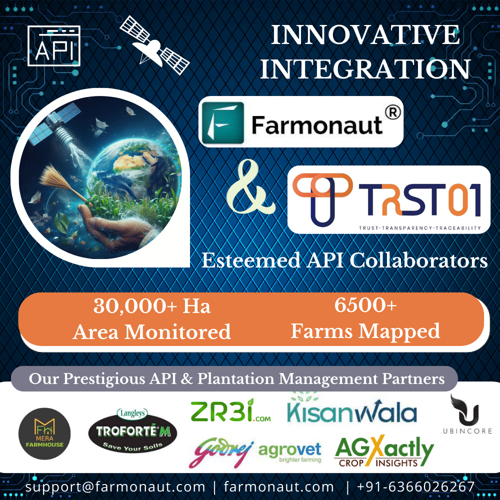
Farmonaut Thrives as a Valued API Collaborator

TRST01, a company founded in 2019 and based in Madhapur, India, focuses on climate technology within the environmental services industry. TRST01 integrates Farmonaut’s remote sensing data seamlessly into its operations, bolstering its ability to detect and monitor deforestation and afforestation activities. This integration enriches TRST01 analytical capabilities by incorporating advanced insights derived from Farmonaut’s sophisticated remote sensing technology. Challenges Encountered by TRST01 Limited ability to monitor and analyze land cover changes and vegetation dynamics: This denotes challenges in accurately observing and understanding changes in land cover and vegetation dynamics, essential for ecological monitoring, resource management, and biodiversity preservation. Inability to accurately map and monitor deforestation and afforestation: This highlights challenges in accurately mapping and monitoring deforestation and afforestation due to a lack of precise data and monitoring systems. These are crucial for assessing environmental impacts and implementing conservation measures. Lack of precise data for sustainable farming practices and supply chain management: The challenge is the lack of precise data for supporting sustainable farming practices and effective supply chain management. This encompasses soil health, water usage, crop yields, and the environmental footprint of agricultural activities. Without accurate data, optimizing farming techniques, reducing resource usage, and ensuring supply chain sustainability are challenging. Inability to provide real-time monitoring and reporting of environmental impacts: This point indicates a deficiency in systems capable of monitoring and reporting environmental impacts in real time. Without timely information on factors such as pollution levels, habitat destruction, or ecosystem changes, it becomes difficult to respond promptly to environmental threats, mitigate risks, and enact appropriate conservation measures. Limited ability to assess and address climate change impacts on agriculture and food production: This highlights challenges in assessing and mitigating climate change impacts on agriculture. It indicates a lack of tools to evaluate effects on crop yields, water availability, pest patterns, and food security. Without robust assessment, implementing adaptive strategies in agriculture becomes difficult.  Transforming Agriculture with Farmonaut Services Farmonaut offers farmers and businesses satellite-based crop health monitoring and field mapping services. Their services include crop health monitoring, area estimation, water stress, carbon content, soil health, and other parameters. Farmonaut’s satellite imagery is updated every 2-5 days and has a resolution of 10 meters, which is twice as good as Google Maps. They have worked with international corporations such as Sunpalm Australia, Troforte Fertilizer Australia, Agro Drones Israel, Grupo Los Grobo Argentina, and Godrej Agrovet. With around  6500+ farms covering approximately 30,000+ Ha of area, Farmonaut has already monitored with TRST01. Deforestation Deforestation is the process of clearing forests for various purposes, such as agriculture, urbanization, logging, and infrastructure development. It has significant environmental impacts, including loss of biodiversity, disruption of ecosystems, soil erosion, and contribution to climate change through increased greenhouse gas emissions. Farmonaut’s Deforestation Monitoring Experise Satellite Imagery Analysis: Farmonaut uses satellite imagery from sources like Landsat and Sentinel-2 to detect changes in forest cover. Machine Learning Algorithms: Advanced algorithms automatically identify patterns indicative of deforestation. Timely Detection: Enables quick response by environmental authorities and policymakers. Monitoring and Reporting: Provides ongoing tracking of deforestation trends for effective conservation efforts. Global Forest Coverage: An Overview Till 2020 In 2020, global forest cover reached 4.06 billion hectares, accounting for one-third of Earth’s land area. The FRA 2020 noted a 30-year decline of 178 million hectares in net forest loss since 1990. Notably, 399 million hectares are now protected for soil and water, a 119 million-hectare increase since 1990. Additionally, 424 million hectares are designated for biodiversity conservation, with 111 million hectares added since 1990. FRA 2020 aids in policy development for sustainable forest management, stressing their crucial role in biodiversity conservation. Farmonaut’s Solutions API Integration Mastery: Providing access to various data types, including image types, colormaps, and analysis scales. Offering vegetation water stress, evapotranspiration, soil organic carbon, and weather forecast data, even during cloudy weather through radar sensors. Helping monitor over 1 million hectares of farmland worldwide. Assisting companies such as Godrej Agrovet Limited, ITC Limited, Coromandel International Limited, and Troforte Innovations, among others. Satellite Crop Health Monitoring: Enabling users to access various data, including image types, colormaps, analysis scales, and other relevant information, to develop custom agricultural remote sensing solutions. Automatically estimating crops and their sown area from anywhere around the world directly through their web platform itself. Impact and Result Impact: TRST01 integrates Farmonaut’s remote sensing data, enhancing its capacity to detect and monitor deforestation and afforestation activities. This integration strengthens TRST01’s analytical capabilities by incorporating valuable insights from Farmonaut’s advanced remote sensing technology. Result: This integration facilitates early detection of deforestation, enabling proactive measures to mitigate associated risks. Farmonaut Platform has seen a significant expansion of 30,000 hectares and over 6500 farms, highlighting the increased monitoring scope. Our Prestigious Clients

Enhancing Precision Agriculture: Farmonaut’s Impact on Boosting Sugarcane Yields

Introduction Sugarcane, a tall, perennial grass of the genus Saccharum, is primarily cultivated for sugar production. It is a robust tropical plant that contributes to about 70% of the world’s sugar production and has a great potential for biomass and biofuel production. It is the most important source of sugar production in India, with about 359 million tonnes produced annually. In the 2022-23 sugar season, approximately 360 million tons of sugar is anticipated to be procured by sugar mills. The Fair and Remunerative Price (FRP) for sugarcane, as approved for the same period, is Rs. 305 per quintal. The average sugarcane yield in India ranges from 80 to 100 tonnes per hectare. Uttar Pradesh leads as the highest sugarcane-producing state, followed by Maharashtra and Karnataka The current agriculture scenario in the sugarcane sector is rapidly evolving with the integration of satellite technology. Satellite-based monitoring systems enable efficient and effective monitoring of sugarcane plantations, allowing for the delineation of field boundaries, tracking of crop growth across vast areas, and monitoring of soil moisture levels. Challenges Affecting India’s Sugarcane Sector The sugarcane sector in India faces several challenges, including stagnating production, price regulations, unstable sugarcane market, and water scarcity. Some of the key challenges faced by the sector are: Stagnating Production: Sugarcane production in India has stagnated in the last 20 years, with farmers producing around 70 tonnes per hectare. By 2030, they will need to produce around 100-110 tonnes per hectare to meet the increasing demand for sugar. Price Regulations: Sugar, being an essential commodity, is controlled through various regulatory mechanisms in India, including minimum prices. However, the sugar price for consumers is not regulated, making sugar manufacturers vulnerable. Unstable Sugarcane Market: The unstable sugarcane market poses a significant challenge for the sector, as it affects the prices paid to farmers and the overall profitability of sugarcane cultivation. Water Scarcity: India is facing an increasing lack of water, which can impact crop yields and the overall sustainability of sugarcane cultivation. Low Yield of Sugarcane: Despite being the largest producer of sugarcane in the world, India’s yield per hectare is extremely low compared to some of the major sugarcane-producing countries. This leads to low overall production and results in a short supply of sugarcane to sugar mills Economic and Social Injustices: Sugarcane farmers in India are dealing with various economic and social injustices. A majority of those dependent on sugarcane farming are small and marginal farmers, and the cultivation of the crop is their primary source of income. These farmers are vulnerable to price fluctuations and face economic and social injustices Source: Indian Council of Agriculture Research Source: Indian Council of Agriculture Research Transforming the landscape of Precision Agriculture with Farmonaut Sugarcane farming in India faces numerous challenges, impacting both yield and sustainability. Thankfully, innovative solutions like Farmonaut can equip farmers with the tools and insights to overcome these hurdles and cultivate sweeter success. Let’s explore how Farmonaut can address key challenges in the sugarcane industry: 1. Fluctuating Sugar Prices: Market Intelligence: Farmonaut provides real-time market data and analysis, empowering farmers to make informed decisions about planting, harvesting, and selling their sugarcane based on anticipated price trends. 2. Water Scarcity: Precision Irrigation: Farmonaut leverages satellite imagery, soil moisture sensors, and weather data to recommend customized irrigation schedules, optimizing water usage and minimizing wastage. Drought-Resistant Varieties: The platform provides information on high-yielding, drought-resistant sugarcane varieties suitable for specific regions, helping farmers adapt to water scarcity. 3. Climate Change: Climate-Smart Practices: Farmonaut offers guidance on adopting climate-resilient practices like cover cropping, mulching, and integrated pest management, mitigating the impact of extreme weather events. Crop Monitoring: Satellite imagery and on-field sensors enable real-time crop health monitoring, allowing farmers to identify and address climate-related stresses promptly. 4. Pest and Disease Management: Targeted Application: The platform guides farmers in applying fertilizers, pesticides, and herbicides only where and when necessary, reducing the cost of inputs and environmental impact. 5. Yield Optimization: Data-Driven Insights: Farmonaut analyzes farm data to identify yield-limiting factors like soil deficiencies, inadequate irrigation, or pest infestations, guiding farmers towards corrective actions. Precision Agriculture: The platform recommends optimal planting densities, fertilizer application rates, and harvesting times based on specific field conditions, maximizing yield potential. Effective Methods for Managing Sugarcane Farm Losses: Case Study  Understanding the Impact on Production Loss A conducted study revealed that  50% of agricultural losses can be directly attributed to the deficiencies in water and nitrogen. Tamil Nadu Agricultural University (TNAU) reports that regions, including Tamil Nadu and nearby states, witness approximately 20% loss in sugarcane yield. TNAU additionally notes a 15% decrease in sugar yield, attributing the losses to insects like borers, sucking pests, and soil-dwelling insects..  The complexity of the problem deepens as the research identifies an extensive array of approximately 200 insect species affecting sugarcane. Optimize Operations with Farmonaut Management Farmonaut Technologies provides satellite-based services to help farmers manage their sugarcane farms more effectively. By utilizing satellite images and data, farmers can address issues such as water deficiency, pest and disease infestations, and declining yields. The technology allows for early detection of these problems, enabling farmers to take necessary actions to mitigate losses and improve crop health.  Additionally, Farmonaut’s services include crop health monitoring, water stress assessment, and crop area and yield estimation, all of which are crucial for optimizing farming practices and increasing yields.  The innovative technological interventions for sugarcane improvement, production, and management have helped the industry progress towards a more sustainable and self-reliant future. Exploring Success: Case Studies of Successful and Satisfied Farmer (Mr. Ashok Shinde : Shree Datta Shetkari Sahakari Sakhar Karkhana Ltd.) Mr. Ashok Shinde, a sugarcane farmer from Maharashtra, has effectively utilized Farmonaut Services to address irrigation challenges and monitor crop health. By leveraging NDMI, NDWI, and evapotranspiration data, he optimized his irrigation strategies, leading to improved yields.  The reports generated by Farmonaut Services also provided valuable insights into crop health, temperature, pests, and diseases, enabling Mr. Shinde to take proactive measures to control pest and disease intrusions.  In addition to addressing irrigation

Data Driven Excellence: Farmonaut’s Impact at Viswamatha Farms

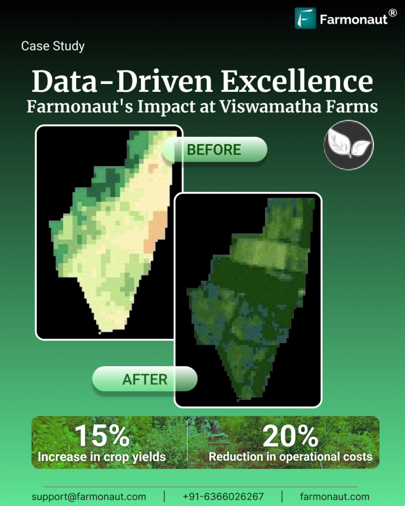
In the heartland of Andhra Pradesh, South India, where agriculture is not just an occupation but a way of life, Viswamatha Farms has emerged as a beacon of innovation and sustainable farming practices. This case study explores the remarkable journey of Viswamatha Farms and their pioneering use of Farmonaut’s Satellite-Based Crop Health Monitoring System. We will delve into the challenges they faced, the innovative solution provided by Farmonaut, and the measurable improvements achieved through data-driven decision-making in modern agriculture. Challenges faced by Viswamatha farms Viswamatha Farms, a multifaceted farming operation, was not immune to the complexities and uncertainties of modern agriculture: Unpredictable Weather Patterns: The farm grappled with erratic weather patterns, including droughts and unseasonal rainfall, leading to volatile crop yields and health issues in their livestock. Resource Optimization: Efficiently managing critical resources such as water, fertilizers, and labor proved to be a daunting task, resulting in escalating costs and environmental concerns. Pest and Disease Management: Coping with persistent pest and disease challenges in crops and livestock posed a constant threat, often causing financial losses and product quality degradation. Market Volatility: Fluctuating commodity prices introduced further unpredictability into their operations, making long-term planning a challenging endeavor. Farmonaut’s Solution In September 2019, Viswamatha Farms embarked on a transformative journey by integrating Farmonaut’s Satellite-Based Crop Health Monitoring System into their farming practices. This cutting-edge technology, accessible through user-friendly Android, iOS, and web applications, provided them with real-time insights into their crops and fields. Data-Driven Decision-Making: Farmonaut’s platform empowered Viswamatha Farms with actionable satellite data, enabling them to make informed, data-driven decisions in response to weather patterns, crop health, and resource management. Precision Agriculture: By accurately identifying areas with poor crop health, the farm reduced chemical and fertilizer usage, leading to an impressive 15% reduction in expenses. Resource Optimization: The platform’s data analytics tools helped optimize the use of critical resources such as water and labor, contributing to a 20% reduction in labor costs and a substantial 30% reduction in water wastage. Market Insights: Viswamatha Farms gained access to market insights, allowing them to time their product sales strategically and increase revenue by 10%. The image presented above illustrates the state of the farm prior to the acquisition of data-driven insights provided by Farmonaut, with no subsequent corrective actions taken. Significantly, the farm exhibits widespread issues related to poor crop health and severely degraded soil health in key areas. The above depicted image portrays the post-intervention condition of the farm following the implementation of remedial measures based on insights offered by Farmonaut. Notably, the green color-coded regions signify a notable enhancement in both crop health and soil health across nearly all sections of the farm. Measureable Improvements The integration of data-driven decisions into their farming practices resulted in a profound transformation: Increased Crop Yields: By optimizing resource usage and improving crop health, Viswamatha Farms achieved an average 15% increase in crop yields across all major crops. Cost Reduction: Due to resource optimization and reduced pesticide use, the farm saw a 20% reduction in operational costs. Enhanced Sustainability: The farm’s reduced resource usage and pesticide application contributed to a 25% reduction in their environmental footprint, aligning with their commitment to sustainable farming.

CASE STUDY : How textile & fashion businesses can be benefitted from Farmonaut’s blockchain based traceability product?

INTRODUCTION In this technology-driven world, an affordable and reliable traceability solution is unavoidable in all industrial sectors. Therefore, here we will look into the ways in which Farmonaut makes traceability solutions utterly transparent for the textile and fashion industry. We offer the technology in vogue built on blockchain hyperledger fabric, ensuring transparency across the entire supply chain. Optimizing RFID and NFC technology, our solution allows for seamless tracking of products from the farming stage to the CMT (Cut, Make, Trim) stage, as well as PCR testing for DNA identification. Our platform caters to B2B and B2C markets, with user-friendly apps for easy data input and product scanning. This enables businesses to efficiently manage data and track products while providing customers with complete transparency on their purchases. CLIENT JOURNEY The German-based clients specializing in cotton face the need to meticulously monitor data related to its cotton-sourcing operations. Farmonaut has provided multiple services to these German-based clients.  Blockchain-based traceability, ensures transparency and authenticity in supply chains, particularly in industries like textiles. Secondly, the IoT Devices and Dashboard. Installing IoT devices to collect data on weather, soil, and more, with a centralized dashboard for real-time monitoring. Further, the Drone Data Utilizes drones for agricultural and land management data collection. Satellite-Based Crop Monitoring and Crop Area Estimation utilizing satellite technology for precise crop monitoring and estimating crop areas. The collected data is transmitted at regular intervals, typically every 5 to 15 minutes, and is presented on a dashboard accessible to the German- based clients. Given the company’s specialization in cotton, this data allows them to monitor various parameters throughout the cotton crop cycle and identify areas that may require special attention or intervention. By combining satellite and IoT data, precise insights are obtained, aiding in the improvement of cotton yield and productivity across different seasons. Furthermore, Farmonaut extends its support to trace the entire cotton supply chain for the beneficiaries . This blockchain-based traceability solution provides end-to-end traceability in the supply chain using a tamper-proof ledger. It is highly secure, scalable, and efficient, the solution ensures the integrity and confidentiality of data. TIERS, involved in the process: This supply chain encompasses multiple stages, from cotton procurement from farmers to the production of finished products.  These stages include ginning, spinning to produce yarn, weaving, Cut Make Trim (CMT), sorting of finished garments, and warehousing or retailing with lot numbers assigned at each step.  At each stage of this process, Farmonaut assists in capturing transportation details. When lots of cotton move through various stages, Farmonaut’s system meticulously tracks them, recording origin points, intermediate stops, and final destinations.  This traceability relies on blockchain technology, offering benefits such as flexibility, historical data tracking, and ensuring the authenticity of information. As a result, blockchain-based traceability helps detect fraudulent transactions, trace product origins, and address any discrepancies. This comprehensive system empowers the clients to maintain transparency, accountability, and efficiency throughout their cotton supply chain operations.   At each and every step of the process of making a particular garment the information is captured. The journey of Cotton from farm-to-finish product is stored in Farmonaut’s platform. Farmonaut is providing services to B2B & B2C. The platform for B2B can be accessed through Web App.For B2C, the information can be accessed by scanning QR & RFID. It is available for consumers as App on Web, Android and IOS as well. Check out this video by Farmonaut on the cost-effective blockchain-based traceability solutions for textile and fashion industry In conclusion, Farmonaut’s innovative solutions have proven to be a game-changer for Fashion for Biodiversity and the entire cotton industry. By seamlessly integrating satellite-based crop health monitoring and IoT devices, they’ve empowered the clients to navigate the complexities of cotton farming with precision and foresight. This technology not only aids in optimizing crop yield but also in ensuring the sustainability of cotton production, with a strong emphasis on biodiversity.

Case Study – Wheat Area Estimation by Farmonaut in EGYPT

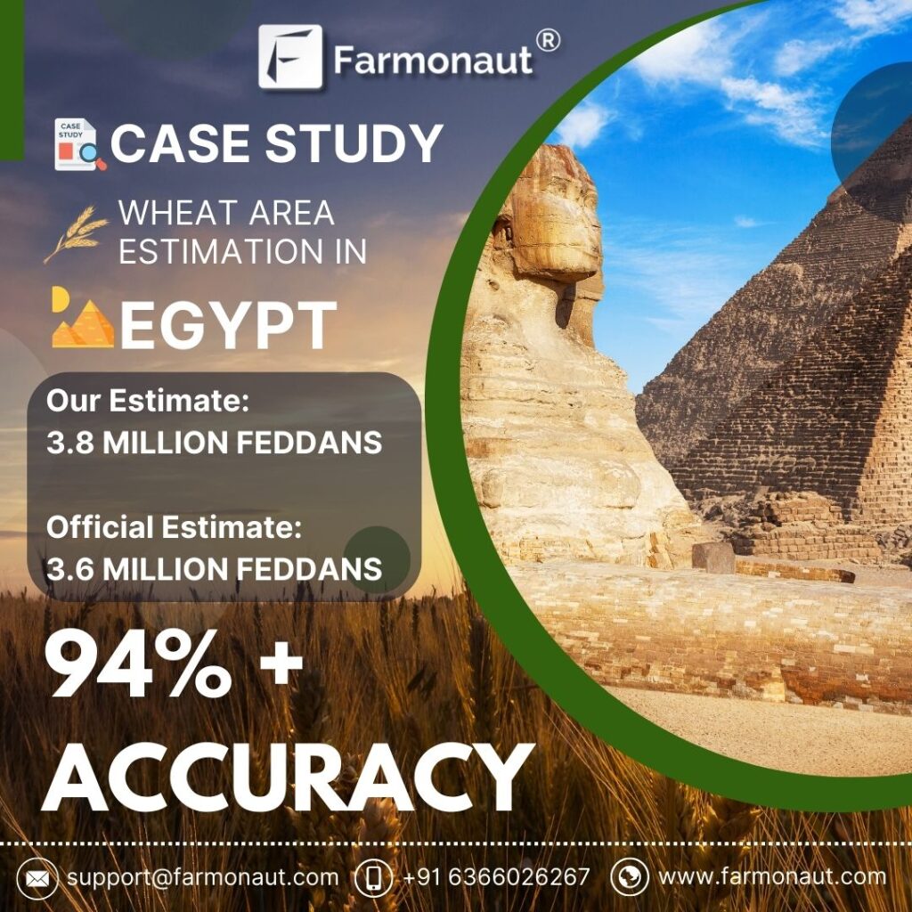
WHEAT AREA ESTIMATION Farmonaut’s area estimation results align with official estimates with an accuracy of 94%. The accuracy and reliability of agricultural data are of paramount importance for effective decision-making, policy formulation, and resource allocation. In recent years, advancements in technology have led to the emergence of innovative solutions for crop area estimation, with Farmonaut being a prominent player in this arena. One key measure of the credibility of such solutions is their alignment with official government assessments. This blog explores the significance of the synchronization between Farmonaut’s wheat area estimations and the assessments conducted by the Government of Egypt, highlighting how this alignment reinforces the platform’s reliability and robustness. Farmonaut’s data-driven approach Farmonaut’s wheat area estimation methodology is grounded in advanced technology and data analytics. Leveraging high-resolution satellite imagery, machine learning algorithms, and spectral analysis techniques, Farmonaut captures intricate details of agricultural landscapes. This data-driven approach allows for rapid and accurate assessments of crop cultivation extents, surpassing the limitations of traditional field surveys and ground-based assessments STANDARD METHODOLOGY OF CROP AREA ESTIMATION 1. Satellite Imagery Acquisition 2. Image Segmentation 3. Ground Truthing Data Collection 4. Crop Classification 5. Training and Validation 6. Crop Area Estimation 7.  Accuracy Assessment Synchronization with the Government of Egypt’s assessments & Credibility Farmonaut conducted an area estimation in Egypt and derived certain results after the learnings. The alignment of Farmonaut’s wheat area estimations with official government assessments carries significant implications. It serves as a crucial validation of the platform’s accuracy and reliability. When an independent technology-driven solution produces results that closely match those of established government assessments, it underscores the platform’s potential as a trustworthy source of agricultural intelligence. This alignment also contributes to the overall credibility of remote sensing and data-driven methodologies in the agricultural sector. Egypt holds a prominent position in the global wheat market. The country’s agricultural sector plays a vital role in ensuring food security for its population. Accurate estimations of wheat cultivation areas are essential for effective agricultural planning, resource allocation, and policy formulation. Therefore, any technology or platform that offers reliable wheat area estimations holds immense value for the Egyptian government and stakeholders. Farmonaut’s assessments in Egypt revealed that there are approximately 3.8 million Feddans of wheat currently under cultivation. The Head of the National Wheat Project, in official figures, corroborated this by stating that around 3.6 million Feddans of wheat have indeed been cultivated. This validation of our findings establishes the accuracy of our numbers at 94%. The alignment of Farmonaut’s wheat area estimations with the assessments conducted by the Government of Egypt signifies the convergence of technological innovation and agricultural intelligence. The consistent results underscore the reliability and robustness of Farmonaut’s data-driven approach, validating its potential as a trustworthy source for crucial agricultural insights. This alignment not only bolsters the credibility of Farmonaut’s platform but also showcases the broader potential of data-driven methodologies in shaping the future of agriculture. As the demand for accurate agricultural data continues to grow, the synchronization between technology-driven solutions and official assessments holds promise in steering informed decision-making and advancing agricultural sustainability.

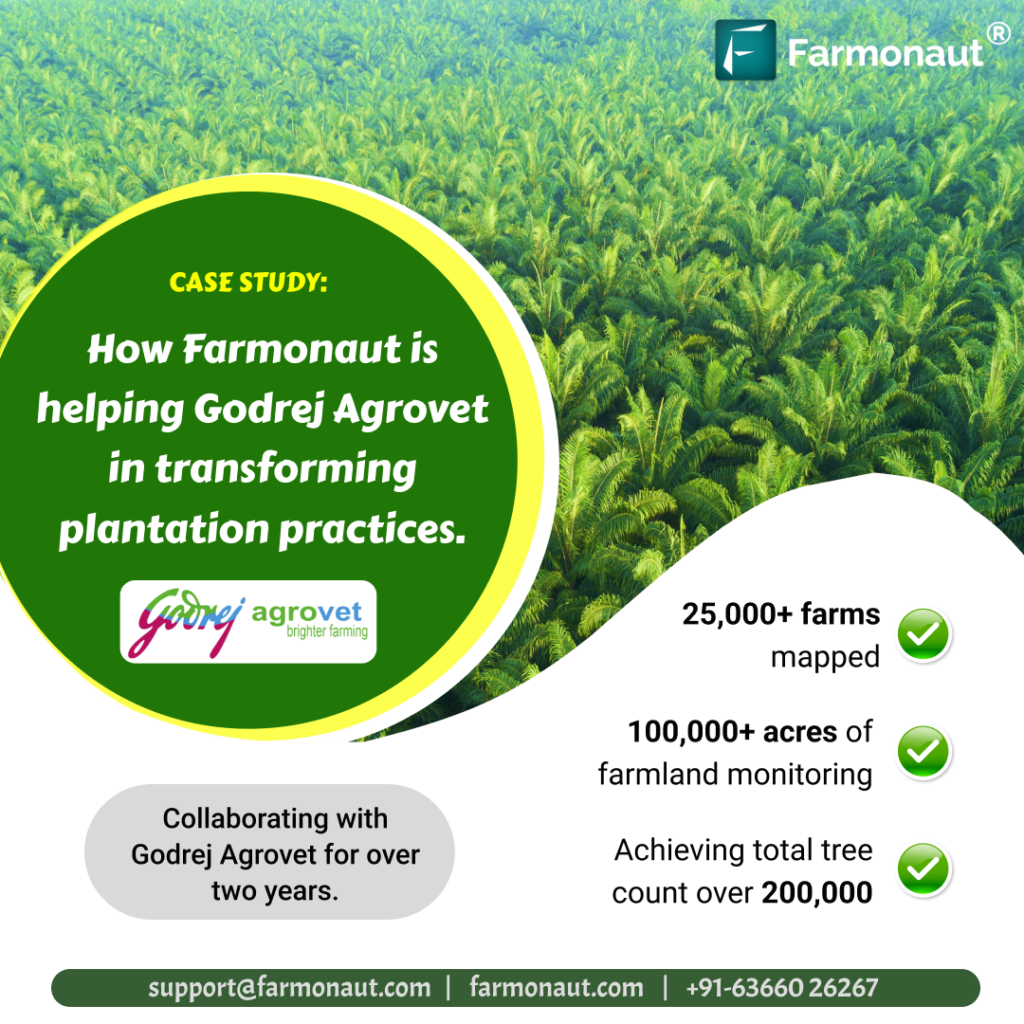
How Farmonaut Transformed Plantation Practices: A Case Study with Godrej Agrovet

Introduction This case study explores the successful partnership between Godrej Agrovet and Farmonaut, which commenced in 2021 and has led to remarkable advancements in digitizing plantation practices. Over the span of two years, this collaboration has enabled Godrej Agrovet to harness cutting-edge technology to map farms, monitor vast agricultural landscapes, count trees accurately, and expand their operations with technology across multiple states in India. Client’s Background Godrej Agrovet, a subsidiary of the renowned Godrej Group, is a prominent player in the Indian agricultural sector. With a history dating back to 1971, the company is committed to driving agricultural growth and sustainability through various segments such as animal feed, crop protection, oil palm, dairy, poultry, and processed foods. Research and development are at the core of Godrej Agrovet’s endeavors, seeking to empower farmers and elevate agricultural practices. Challenges Encountered by Godrej Agrovet 1. Limited Digitalization: Before partnering with Farmonaut, Godrej Agrovet faced challenges in digitizing their plantation processes. Manual data collection was time-consuming, inefficient, and limited the scope for real-time insights and decision-making. 2. Scaling Mapping Efforts: The vast scale of mapping and monitoring thousands of farms across Andhra Pradesh presented logistical challenges. Traditional methods could not cope with the scale required for timely and accurate results. 3. Ongoing Monitoring: Once farms were mapped, continuous monitoring of over 100,000 acres was essential. However, effective and real-time monitoring of crops, pest infestations, and anomalies was a complex task. 4. Tree Counting: Accurate tree counting was labor-intensive and error-prone, hindering efficient inventory management and planning. 5. Expansion to Multiple States: Godrej Agrovet’s vision to expand their digitization efforts to five states required customized solutions for different regions with unique agricultural practices and challenges. Farmonaut’s Innovative Resolution 1. Satellite-based Mapping: Our deployed high-resolution satellite imagery and advanced analytics to swiftly map 20,000+ farms in Andhra Pradesh. This satellite-based approach enabled rapid data collection and a comprehensive view of the plantation landscape. 2. Cloud-based Monitoring Platform: We provided a user-friendly, cloud-based platform for ongoing monitoring of the vast agricultural areas. The platform integrated satellite imagery and advanced algorithms, facilitating timely detection of crop health issues and pest infestations. 3. AI-powered Tree Counting: We also introduced AI-powered tree counting, accurately counting 200,000+ trees. The automated process saved time and resources while ensuring precise inventory management. 4. Customized Solutions for Multiple States: We tailored our services to cater to the unique needs of each state, enabling seamless integration with local agricultural practices and providing region-specific insights. Execution of Technology Farmonaut collaborated with Godrej Agrovet for over two years and to cater the specific needs of Godrej Agrovet, Farmonaut’s advanced field mapping platform played a pivotal role in geotagging farms across various states. Utilizing Farmonaut’s feature-rich admin application, our ground team seamlessly created farm boundaries and gathered essential KYC details of farmers, encompassing approximately 50 key parameters, such as Name, Phone No., and Area. Additionally, we diligently collected critical data points, including irrigation details, survey numbers, taluka mandal, village, and state, providing comprehensive information to evaluate and grade farmers effectively. Through our user-friendly web application, the office team gained access to the geotagged areas, enabling them to monitor farms efficiently and identify any potential gaps or delays in the geotagging process. Furthermore, our cutting-edge system revolutionized tree counting on each farm, eliminating the need for manual counting or reliance on farmers’ estimates, which can often be imprecise for extensive farmlands. With Farmonaut’s proprietary system, powered by high-resolution satellite data, the accurate number of trees per hectare on every farm became readily available, enhancing overall operational efficiency and enabling data-driven decision-making. Outcomes: Farmonaut’s collaboration with Godrej Agrovet for over two years, yielded impressive results: 1.The digitization efforts expanded to cover more than 100,000 acres of agricultural land across five states: Andhra Pradesh, Telangana, Tamil Nadu, Mizoram, and Orissa. 2. Continuous monitoring provided by Farmonaut’s platform empowered Godrej Agrovet to promptly detect and address issues, leading to improved crop yields and resource optimization. Over 25,000+ farms were mapped and monitored. 3. AI-powered tree counting eliminated manual labor, providing Godrej Agrovet with precise tree distribution and health data for better inventory management. Achieving total tree count of over 200,000. 4. The flexibility of Farmonaut’s platform allowed Godrej Agrovet to leverage tailored insights for Tree Counting, Tree Uprooting and Tree Age Estimation which encountered 85-95% Accuracy.   In conclusion, Farmonaut’s advanced technology and tailor-made solutions have played a vital role in helping Godrej Agrovet transform their plantation processes. By embracing digitalization and satellite-based monitoring, Godrej Agrovet has not only optimized agricultural practices but also empowered farmers and communities across multiple states, advancing sustainable agriculture in India.

Case Study: SOPA Collaborated with Farmonaut for Crop Yield Estimation of Soybean in 50 Districts

Introduction Farmonaut, a leading agricultural technology company, partnered with the Soybean Processors Association of India (SOPA) to conduct a comprehensive crop yield estimation for soybean in approximately 50 districts across Maharashtra, Rajasthan, and Madhya Pradesh. This groundbreaking initiative aimed to leverage advanced technologies and data analytics to empower farmers and stakeholders in the soybean industry. In this blog, we delve into the details of this remarkable project and its significance for the future of agriculture. Understanding SOPA: The Soybean Processors Association of India (SOPA) is a prominent industry association dedicated to promoting the interests of soybean farmers, processors, and exporters in India. SOPA plays a vital role in advancing sustainable agricultural practices and enhancing the growth of the soybean sector. By collaborating with SOPA, we (Farmonaut) aimed to utilize their extensive network and expertise to conduct an accurate and comprehensive crop yield estimation for soybean. Scope The project undertaken by us encompassed crop yield estimation for soybean in approximately 50 districts spanning Maharashtra, Rajasthan, and Madhya Pradesh. These regions were specifically chosen due to their significance in soybean cultivation and their contribution to India’s overall soybean production. The project aimed to gather robust data, analyze it using advanced technologies, and provide actionable insights to improve the efficiency and productivity of soybean farming. Methodology We used remote sensing, satellite imagery analysis, and machine learning algorithms to achieve accurate crop yield estimation. High-resolution satellite imagery and advanced analytics provided vital information on crop health, vegetation indices, and growth patterns. Ground-level observations were correlated with the data to validate findings. Employing sophisticated machine learning models enabled precise crop yield estimates for each district, offering valuable insights into soybean cultivation. Benefits & Implications By using the satellite technology for Crop Yield Production, Farmonaut have aided SOPA in many ways possible: Has optimized production and profitability for industry stakeholders and farmers. Yield Prediction has also been beneficial to SOPA in planning and resource allocation of soybean including market forecasting. Supply chain management being the biggest concern, Yield Prediction has also benefitted soybean processors and exporters to manage it effectively. Due to this collaboration SOPA has ace to understand the insights provided by Farmonaut through satellite technology in order to enhancing productivity, sustainability, and profitability in soybean cultivation. Farmonaut’s Yield Prediction Accuracy of greater than 80% assisted SOPA in management, resource allocation, planning and market forecasting.

Scroll to Top