Maximizing Corn Yields: Advanced Precision Farming Strategies for Early Harvest and Crop Performance
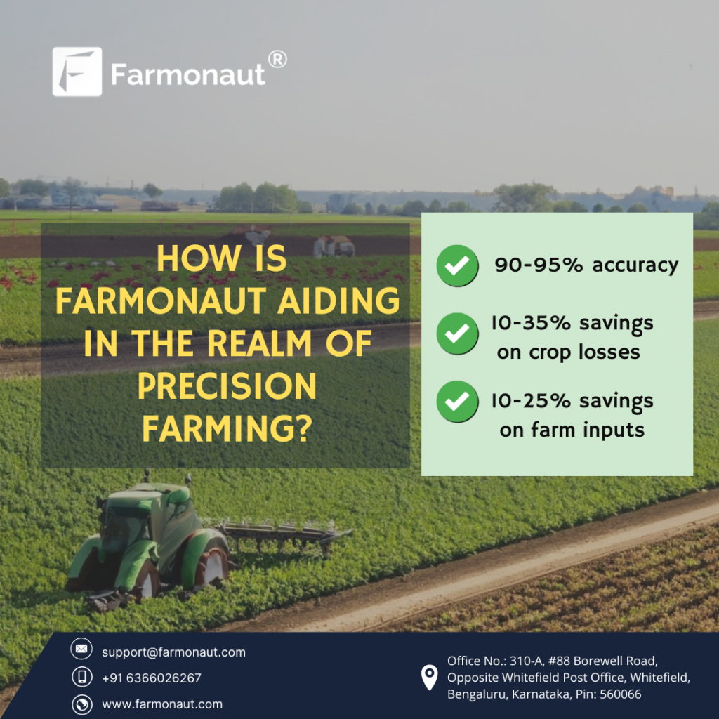
In the ever-evolving world of agriculture, we at Farmonaut are committed to revolutionizing the way farmers approach corn cultivation. Our advanced precision farming techniques are designed to optimize every aspect of corn production, from planting to harvest. In this comprehensive guide, we’ll explore how our satellite-based technologies and data-driven insights can help farmers achieve early harvests, improve crop performance, and maximize yields in the face of changing climate conditions.
Understanding the Importance of Early Harvest in Corn Production
Early harvest in corn production is a critical factor that can significantly impact overall yield and profitability. By leveraging our cutting-edge technologies, we enable farmers to make informed decisions about when to harvest their corn crops for optimal results. Here’s why early harvest matters:
- Reduced risk of weather-related damage
- Improved grain quality
- Enhanced market opportunities
- Increased flexibility for subsequent crop planning
Our satellite-based monitoring system provides real-time data on crop maturity, allowing farmers to pinpoint the ideal harvest window with unprecedented accuracy.
The Role of Climate and Weather in Corn Production
Climate and weather conditions play a crucial role in corn growth and development. At Farmonaut, we understand the complex interplay between environmental factors and crop performance. Our advanced weather monitoring and prediction tools help farmers stay ahead of the curve when it comes to managing their corn fields.
Temperature and Growing Degree Units (GDUs)
Corn growth is heavily influenced by temperature, which is often measured in Growing Degree Units (GDUs) or Corn Heat Units (CHUs). These metrics help farmers track the cumulative heat required for corn to reach various growth stages. Our precision farming platform provides accurate GDU calculations, enabling farmers to:
- Predict crop development stages
- Estimate time to maturity
- Plan for critical management activities
Moisture Management: Navigating Wet and Dry Conditions
Proper moisture management is essential for optimal corn growth. Too much or too little water can significantly impact yield potential. Our satellite-based soil moisture monitoring system helps farmers:
- Detect areas of excessive moisture or drought stress
- Optimize irrigation scheduling
- Mitigate the risks associated with floods or prolonged dry spells
By providing real-time insights into soil moisture levels across entire fields, we empower farmers to make data-driven decisions that protect their crops and maximize yield potential.
Precision Planting: Setting the Stage for Success
The foundation of a successful corn crop begins with precision planting. Our advanced farming technologies help farmers optimize their planting strategies for maximum yield potential. Here’s how we support precision planting efforts:
Field Mapping and Analysis
Our satellite imagery and data analysis tools provide detailed field maps that highlight variations in soil types, topography, and historical performance. This information allows farmers to:
- Identify optimal planting zones within each field
- Adjust seeding rates based on soil fertility and moisture-holding capacity
- Create variable-rate planting prescriptions for improved uniformity and yield potential
Soil Temperature Monitoring
Planting corn at the right soil temperature is crucial for uniform emergence and strong early-season growth. Our platform provides real-time soil temperature data, helping farmers:
- Determine the ideal planting window for each field
- Avoid cold soil conditions that can lead to poor germination and stunted growth
- Maximize the chances of achieving optimal plant populations
Advanced Crop Monitoring and Management Techniques
At Farmonaut, we believe that continuous monitoring and adaptive management are key to maximizing corn yields. Our suite of precision farming tools provides farmers with unparalleled insights into their crops’ health and development throughout the growing season.
Satellite-Based Vegetation Health Monitoring
Our advanced satellite imagery technology allows for frequent and accurate assessment of crop health across entire fields. By analyzing multispectral data, we provide farmers with:
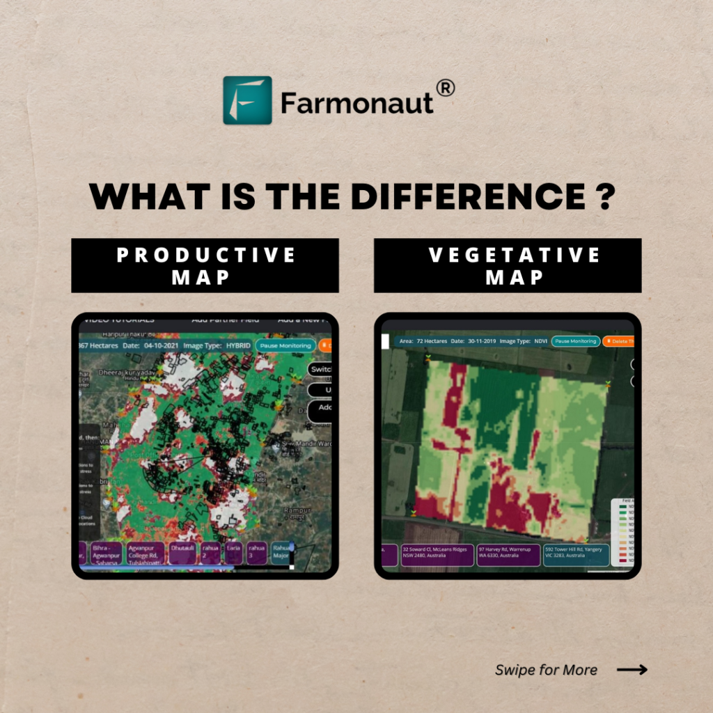
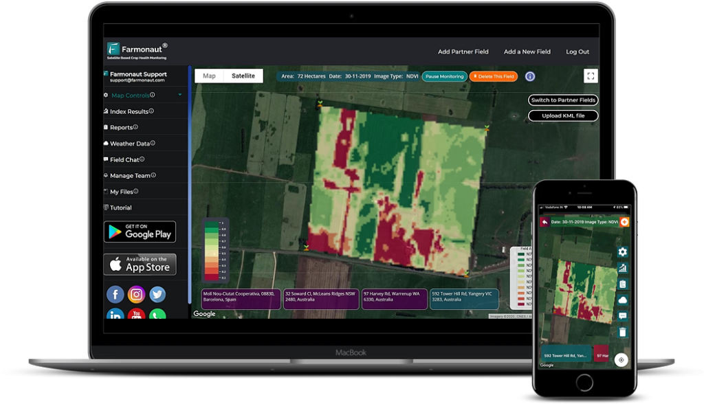
- Normalized Difference Vegetation Index (NDVI) maps to track overall crop vigor
- Early detection of stress factors such as nutrient deficiencies, pest infestations, or disease outbreaks
- Identification of spatial variations in crop performance for targeted management interventions
Growth Stage Tracking and Phenology
Understanding the current growth stage of corn plants is crucial for timing management activities and predicting harvest dates. Our platform integrates GDU data with satellite imagery to provide accurate growth stage estimates, enabling farmers to:
- Plan fertilizer applications at critical growth stages
- Time pesticide applications for maximum efficacy
- Predict the onset of key developmental milestones, such as tasseling and black layer formation
Field Scouting Optimization
While our satellite-based monitoring provides a comprehensive view of field conditions, we also recognize the importance of ground-truthing and detailed observations. Our platform supports efficient field scouting by:
- Generating scouting maps that highlight areas of concern or variability
- Allowing for geo-tagged notes and photos to be uploaded and integrated with satellite data
- Providing mobile access to field data for on-the-go decision-making
Fertility Management: Nourishing Your Corn Crop for Success
Proper fertility management is essential for achieving high corn yields. Our precision farming approach to nutrient management helps farmers optimize their fertilizer inputs while minimizing environmental impact.
Soil Fertility Mapping
By combining satellite imagery with soil test data, we create detailed fertility maps that show the spatial variability of key nutrients across fields. This information allows farmers to:
- Identify areas of nutrient deficiency or excess
- Create variable-rate fertilizer prescriptions for more efficient nutrient use
- Track changes in soil fertility over time to inform long-term management strategies
In-Season Nutrient Monitoring
Our platform provides ongoing assessment of crop nutrient status throughout the growing season. By analyzing satellite imagery and integrating weather data, we help farmers:
- Detect early signs of nutrient stress
- Determine the optimal timing for sidedress nitrogen applications
- Adjust fertilizer plans based on crop uptake and environmental conditions
Protecting Your Investment: Integrated Pest and Disease Management
Effective pest and disease management is crucial for preserving yield potential and ensuring a successful harvest. Our precision farming tools support an integrated approach to crop protection.
Early Detection of Pest and Disease Pressure
Our satellite-based monitoring system can detect subtle changes in crop health that may indicate the presence of pests or diseases. This early warning system allows farmers to:
- Identify potential problem areas before symptoms become visible to the naked eye
- Target scouting efforts to areas of concern, saving time and resources
- Implement control measures promptly to prevent widespread damage
Weather-Based Risk Assessment
Many pest and disease issues are closely tied to weather conditions. By integrating local weather data with our crop monitoring system, we provide farmers with:
- Risk assessments for common corn diseases based on temperature and humidity patterns
- Alerts for weather conditions conducive to pest outbreaks
- Guidance on optimal timing for preventative treatments
Harvest Planning and Yield Estimation
As the growing season progresses, our focus shifts to helping farmers prepare for a successful harvest. Our advanced analytics and predictive modeling capabilities provide valuable insights for harvest planning and yield estimation.
Predicting Optimal Harvest Dates
By tracking GDUs, moisture levels, and crop development, we help farmers pinpoint the ideal harvest window for each field. This precision approach allows for:
- Maximizing grain quality and test weight
- Minimizing field losses due to lodging or ear drop
- Optimizing combine settings for efficient harvesting
Yield Mapping and Estimation
Our satellite-based yield estimation tools provide farmers with accurate predictions of corn yields well before harvest. These estimates help with:
- Pre-harvest marketing decisions
- Planning for storage and transportation needs
- Identifying high and low-yielding areas within fields for future management consideration
Post-Harvest Analysis and Planning for the Next Season
At Farmonaut, we believe that the end of one growing season is the beginning of preparation for the next. Our platform provides powerful tools for post-harvest analysis and future planning.
Yield Data Integration and Analysis
By combining harvest yield data with our season-long satellite imagery and field observations, we create comprehensive performance reports that help farmers:
- Identify factors that contributed to yield variability across fields
- Evaluate the effectiveness of management decisions and inputs
- Develop strategies for improving yields in underperforming areas
Climate-Smart Planning for the Future
Our platform’s historical data and predictive analytics help farmers adapt to changing climate conditions. We provide:
- Long-term climate trend analysis for informed crop selection and rotation planning
- Recommendations for climate-resilient farming practices
- Scenario modeling to help farmers prepare for various weather possibilities
Embracing Digital Connectivity in Corn Farming
At Farmonaut, we’re committed to leveraging the power of digital connectivity to revolutionize corn farming. Our platform serves as a central hub for all your farm data and management tools.
Cloud-Based Data Storage and Access
All your field data, satellite imagery, and management records are securely stored in the cloud, allowing for:
- Easy access from any device, anywhere, anytime
- Seamless sharing of information with trusted advisors or team members
- Long-term data preservation for historical analysis and trend identification
Integration with Farm Equipment and IoT Devices
Our platform is designed to work with a wide range of precision agriculture equipment and Internet of Things (IoT) devices. This integration enables:
- Automatic data transfer from field operations to your Farmonaut account
- Real-time monitoring of equipment performance and field conditions
- Streamlined implementation of variable-rate prescriptions for planting, fertilization, and crop protection
The Power of Data Visualization in Decision Making
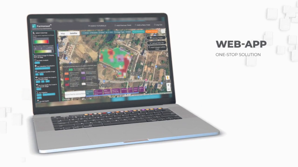
We believe that effective data visualization is key to turning complex information into actionable insights. Our platform offers a range of visualization tools to help farmers make informed decisions.
Interactive Field Maps
Our interactive field maps allow you to:
- Toggle between different data layers (e.g., NDVI, soil moisture, yield estimates)
- Zoom in on specific areas of interest
- Create custom management zones based on multiple data inputs
Time-Series Analysis
Our time-series visualization tools help you track changes in crop health and field conditions throughout the season, enabling:
- Early identification of emerging issues
- Assessment of the impact of management interventions
- Comparison of current season progress with historical data
Precision Agriculture: A Comparison of Traditional and Farmonaut Methods
To illustrate the advantages of our precision farming approach, we’ve compiled a comparison table highlighting the differences between traditional farming methods and Farmonaut’s satellite-based precision farming techniques:
| Farming Aspect | Traditional Method | Farmonaut Method | Benefits |
|---|---|---|---|
| Crop Monitoring | Periodic visual inspections | Continuous satellite-based monitoring with multispectral imagery | Early detection of issues, comprehensive field coverage, reduced labor costs |
| Field Health Assessment | Subjective visual assessment | Objective NDVI and other vegetation index maps | Precise identification of problem areas, quantifiable health metrics |
| Irrigation Management | Fixed schedules or visual cues | Soil moisture mapping and weather-based recommendations | Optimized water use, reduced stress on crops, improved yield potential |
| Yield Prediction | Historical averages and manual estimates | AI-powered yield estimation based on satellite data and field history | More accurate yield forecasts, better planning for harvest and marketing |
| Pest/Disease Detection | Regular scouting of random locations | Targeted scouting based on satellite-detected anomalies | Earlier intervention, more efficient use of crop protection products, reduced yield loss |
Frequently Asked Questions (FAQ)
Q: How accurate is Farmonaut’s satellite-based crop monitoring?
A: Our satellite-based monitoring system provides highly accurate data, with resolution down to 3 meters for some imagery products. We continuously validate our data against ground-truth observations to ensure reliability.
Q: Can Farmonaut’s platform integrate with my existing farm management software?
A: Yes, we offer API integration capabilities that allow our platform to work seamlessly with many popular farm management software solutions. For more information, visit our API documentation page.
Q: How often is satellite imagery updated on the Farmonaut platform?
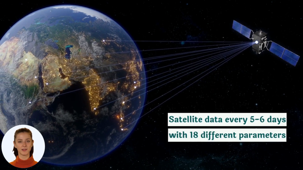
A: The frequency of imagery updates depends on the specific subscription plan, but we typically provide new imagery every 3-5 days, weather permitting.
Q: Is Farmonaut’s technology suitable for small-scale corn farmers?
A: Absolutely! We’ve designed our platform to be scalable and accessible for farms of all sizes. Our mobile apps for Android and iOS make it easy for small-scale farmers to access powerful precision agriculture tools.
Q: How can I get started with Farmonaut for my corn farming operation?
A: Getting started is easy! Simply visit our sign-up page to create an account and choose a subscription plan that fits your needs. Our team is always available to help you get set up and answer any questions you may have.
Conclusion: Embracing the Future of Corn Farming with Farmonaut
As we’ve explored throughout this comprehensive guide, the future of corn farming lies in the adoption of advanced precision agriculture techniques. At Farmonaut, we’re committed to providing farmers with the tools and insights they need to maximize yields, optimize resource use, and adapt to changing environmental conditions.
By leveraging our satellite-based monitoring, AI-powered analytics, and user-friendly platform, corn farmers can:
- Make data-driven decisions throughout the growing season
- Improve crop health and yield potential
- Reduce input costs and environmental impact
- Adapt more effectively to climate variability
- Streamline farm operations and increase overall profitability
We invite you to join the precision agriculture revolution and experience the benefits of Farmonaut’s advanced farming technologies for yourself. Whether you’re managing a small family farm or overseeing large-scale corn production, our platform is designed to help you achieve your goals and push the boundaries of what’s possible in modern agriculture.
Ready to take your corn farming to the next level? Sign up for Farmonaut today and start your journey towards more efficient, productive, and sustainable corn production.


