Revolutionizing Agriculture: How Farmonaut’s Satellite-Based Solutions are Transforming Farming Practices
In the ever-evolving landscape of agriculture, technology continues to play a pivotal role in enhancing productivity, sustainability, and efficiency. At the forefront of this agricultural revolution stands Farmonaut, a pioneering company that has been making waves with its innovative satellite-based solutions. In this comprehensive blog post, we’ll delve into how Farmonaut is reshaping the farming industry, providing farmers with unprecedented access to crucial data and insights.
The Power of Satellite Data in Modern Agriculture
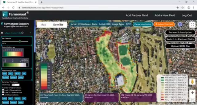
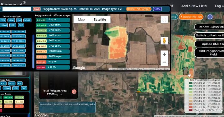
At Farmonaut, we believe in harnessing the power of satellite data to revolutionize farming practices. Our award-winning platforms, available on Android, iOS, and web, have been instrumental in monitoring vast expanses of farmlands both nationally and internationally.
But what makes satellite data so crucial for modern agriculture? Let’s break it down:
- Real-time Monitoring: Satellite imagery allows for continuous monitoring of crop health, soil conditions, and environmental factors.
- Wide Coverage: Satellites can cover large areas quickly, making them ideal for monitoring extensive farmlands.
- Cost-effective: Compared to traditional methods, satellite-based monitoring is more economical, especially for large-scale operations.
- Precision: High-resolution satellite images provide detailed insights into field conditions, enabling precise decision-making.
Farmonaut’s Comprehensive Satellite Data Offerings
At Farmonaut, we don’t just stop at providing basic satellite imagery. Our platform offers a wealth of valuable data to farmers, including:
- Vegetation Water Stress: This crucial information helps farmers identify areas where crops might be suffering from water deficiency or excess.
- Evapotranspiration Data: Understanding the water cycle in crops is essential for efficient irrigation management.
- Soil Organic Carbon: Our soil carbon data provides insights into soil health and fertility, crucial for sustainable farming practices.
- Weather Forecast: We integrate data from the nearest weather stations to provide accurate and localized weather predictions.
What sets us apart is the frequency of our data updates. Farmers receive fresh insights every 3-5 days, ensuring they always have the most current information at their fingertips.
Overcoming Cloudy Weather with SAR Technology
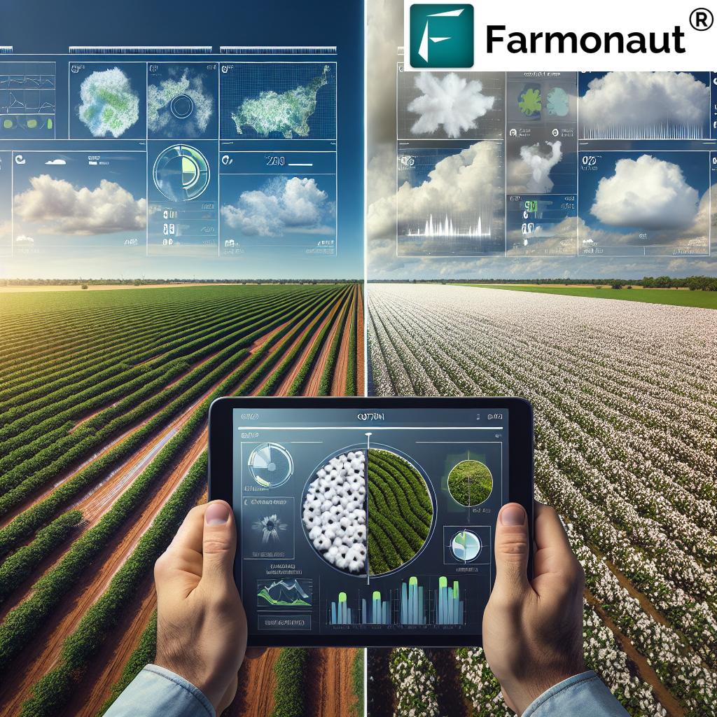
One of the biggest challenges in satellite-based agriculture monitoring has been cloud cover. Cloudy weather can obstruct traditional optical satellites, leading to gaps in data. At Farmonaut, we’ve tackled this problem head-on.
We utilize Synthetic Aperture Radar (SAR) sensors to provide uninterrupted crop health satellite data even during cloudy weather. This technology allows radar waves to penetrate cloud cover, ensuring continuous monitoring regardless of atmospheric conditions.
Streamlining Field Management with Geotagging
Geotagging farmer fields has never been easier, thanks to Farmonaut’s innovative approach. Our interconnected app ecosystem has revolutionized the process, making it faster and more streamlined than ever before.
Here’s how our system works:
- Field Mapping: Users can easily map their fields using our Android app.
- Data Access: Once mapped, field data can be monitored, managed, and accessed through our robust web app.
- Interoperability: The seamless integration between our mobile and web platforms ensures a smooth user experience.
This interoperability is a game-changer for organizations that previously struggled with mapping and managing fields efficiently. Now, they can accomplish these tasks at an unprecedented pace.
Advanced Satellite Data for Proactive Farm Management
Beyond mapping, our advanced app ecosystem provides users with the latest and continuous satellite data for all mapped fields. This real-time information empowers farmers to take proactive measures and make informed decisions well in advance.
Key benefits of our continuous satellite monitoring include:
- Early detection of crop stress or disease
- Optimized resource allocation
- Improved yield predictions
- Enhanced sustainability through precise input application
The Science Behind Farmonaut’s Remote Sensing Technology
Remote sensing is at the heart of Farmonaut’s technology. This scientific approach involves gathering information about the Earth’s surface without making physical contact. In agriculture, remote sensing has proven to be a game-changer.
Here’s a deeper look into how we utilize remote sensing:
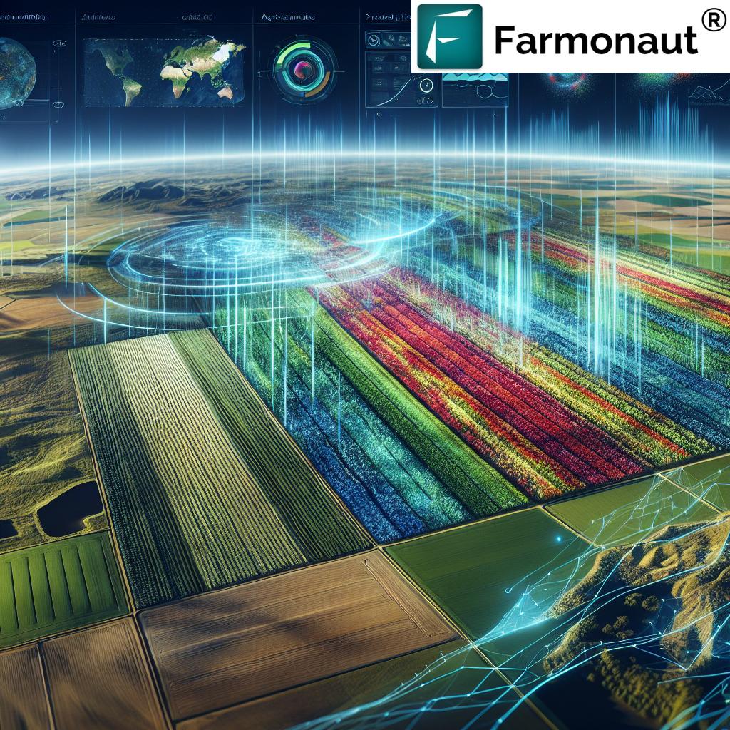
- Multispectral Imaging: We use satellites equipped with multispectral sensors to capture data across various light wavelengths. This allows us to analyze different aspects of crop and soil health.
- NDVI (Normalized Difference Vegetation Index): This index helps us assess plant health and biomass by measuring the difference between near-infrared light (which healthy plants reflect) and red light (which they absorb).
- Thermal Imaging: By analyzing heat signatures, we can detect water stress in crops before visible signs appear.
- SAR Technology: As mentioned earlier, our use of Synthetic Aperture Radar allows for continuous monitoring regardless of weather conditions.
The combination of these technologies enables us to provide farmers with a comprehensive view of their fields, empowering them to make data-driven decisions.
Farmonaut vs. Traditional Monitoring Methods
To truly appreciate the value of Farmonaut’s satellite-based system, it’s helpful to compare it with other farm monitoring methods. Here’s a table comparing Farmonaut’s Satellite System with drone and IoT-based monitoring:
| Feature | Farmonaut Satellite System | Drone-based Monitoring | IoT-based Monitoring |
|---|---|---|---|
| Coverage Area | Large (Hundreds to thousands of hectares) | Medium (Tens of hectares) | Small (Limited by sensor placement) |
| Frequency of Data Collection | Every 3-5 days | As needed (limited by battery life and regulations) | Continuous (but limited to sensor locations) |
| Weather Dependency | Low (SAR technology works through clouds) | High (Cannot operate in bad weather) | Low (But sensors can be affected by extreme conditions) |
| Initial Setup Cost | Low | Medium to High | High |
| Maintenance Required | Minimal | Regular (Battery changes, repairs) | Regular (Battery changes, sensor calibration) |
| Data Analysis Complexity | Low (Automated analysis provided) | High (Requires specialized software and expertise) | Medium (Depends on the system) |
| Scalability | High | Medium | Low |
As the table illustrates, Farmonaut’s Satellite System offers unparalleled coverage, frequency, and ease of use compared to other monitoring methods.
The Impact of Farmonaut on Different Agricultural Sectors
Farmonaut’s technology isn’t just transforming traditional farming; it’s making waves across various agricultural sectors. Let’s explore how different areas of agriculture are benefiting from our satellite-based solutions:
1. Precision Agriculture
Precision agriculture is all about optimizing inputs and maximizing outputs. Our satellite data allows farmers to:
- Identify variations in field conditions
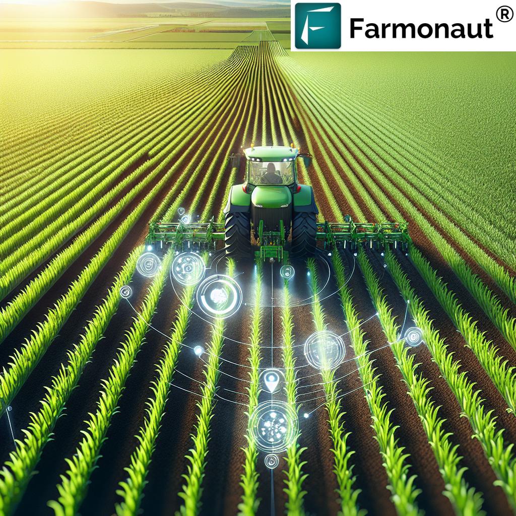
- Apply inputs (water, fertilizers, pesticides) precisely where needed
- Reduce waste and environmental impact
- Increase crop yields and quality
2. Organic Farming
For organic farmers, our soil carbon and vegetation health data are particularly valuable. They can:
- Monitor soil health without invasive testing
- Detect pest and disease outbreaks early
- Optimize natural fertilizer application
- Ensure compliance with organic farming standards
3. Urban Farming
Even in urban settings, our technology proves useful:
- Monitoring rooftop and vertical gardens
- Optimizing resource use in space-constrained environments
- Supporting urban food security initiatives
4. Large-scale Commercial Farming
For large agricultural operations, Farmonaut offers:
- Comprehensive field scouting capabilities
- Efficient management of vast land areas
- Data-driven decision making for crop rotation and resource allocation
- Improved yield forecasting
The Future of Farming with Farmonaut
As we look to the future, Farmonaut is committed to continuing its role as a pioneer in agricultural technology. We’re constantly exploring new ways to leverage satellite data and AI to address the evolving challenges in agriculture.
Some areas we’re focusing on include:
- Climate Change Adaptation: Using our data to help farmers adapt to changing climate patterns and extreme weather events.
- Biodiversity Monitoring: Expanding our capabilities to monitor and promote biodiversity in agricultural landscapes.
- Integration with IoT: While our satellite system is powerful on its own, we’re exploring ways to integrate it with IoT devices for even more comprehensive farm monitoring.
- AI-Powered Predictive Analytics: Developing more advanced AI models to provide even more accurate predictions and recommendations to farmers.
Join the Agricultural Revolution with Farmonaut
Are you ready to take your farming practices to the next level? Farmonaut offers a range of subscription options to suit farms of all sizes. Whether you’re a small organic farmer or managing a large commercial operation, we have a solution for you.
To get started with Farmonaut, you can:
- Download our app from the Google Play Store or Apple App Store
- Visit our web application for desktop access
- Explore our API options for developers and businesses looking to integrate our data into their systems
Ready to subscribe? Choose your plan below:
Frequently Asked Questions (FAQ)
Q: How accurate is Farmonaut’s satellite data?
A: Our satellite data is highly accurate, with resolution down to 10 meters for most applications. For specific accuracy metrics, please contact our support team.
Q: How often is the satellite data updated?
A: We provide updates every 3-5 days, ensuring you always have the most current information about your fields.
Q: Can Farmonaut’s system work for small farms?
A: Absolutely! Our system is scalable and can be used for farms of all sizes, from small holdings to large commercial operations.
Q: Is internet connectivity required to use Farmonaut?
A: Internet connectivity is required to receive updates and access our web platform. However, our mobile app can store some data for offline use in areas with limited connectivity.
Q: How does Farmonaut protect user data?
A: We take data security very seriously. All user data is encrypted and stored securely. We never share individual farm data without explicit permission.
Q: Can Farmonaut’s system be integrated with other farm management software?
A: Yes, we offer API access for integration with other software systems. Check our API documentation for more details.
Conclusion
As we’ve explored in this comprehensive overview, Farmonaut is at the forefront of agricultural innovation, leveraging cutting-edge satellite technology and remote sensing to transform farming practices. From providing real-time crop health data to streamlining field management through advanced geotagging, our solutions are designed to make farming more efficient, sustainable, and productive.
In an era where food security and sustainable agriculture are more important than ever, Farmonaut stands as a beacon of progress, empowering farmers with the tools and insights they need to meet the challenges of modern agriculture. By bridging the gap between advanced technology and traditional farming practices, we’re not just changing the way farms operate – we’re helping to secure a better, more sustainable future for agriculture worldwide.
Join us in this agricultural revolution. Together, we can cultivate a smarter, more sustainable future for farming.


