Revolutionizing Agriculture: Farmonaut’s Innovative Crop Area Estimation Technology
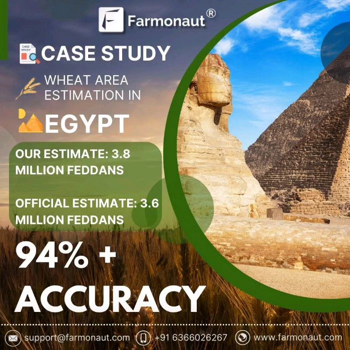
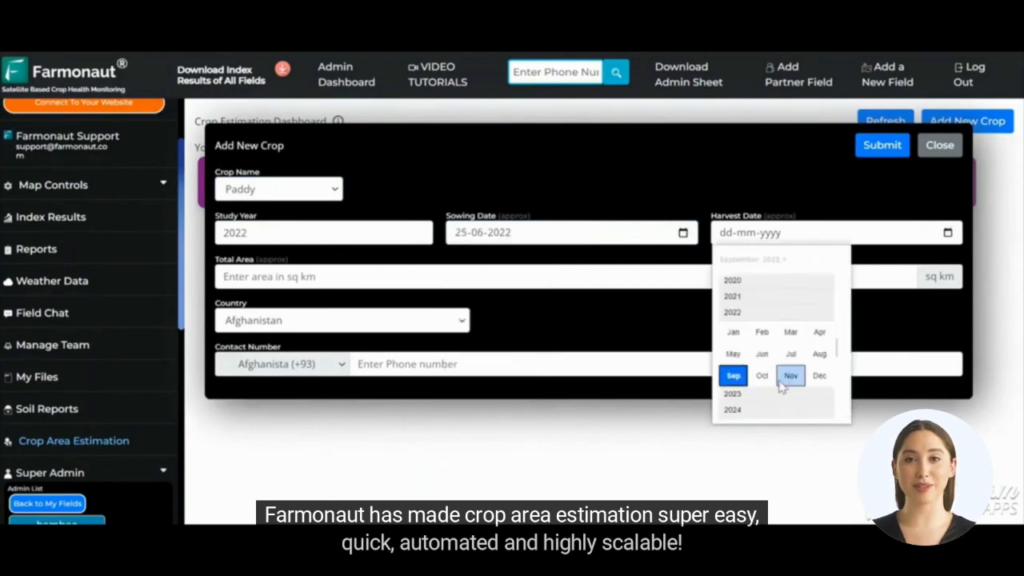
In today’s data-driven world, reliable agricultural information is invaluable for shaping policies, allocating resources, and driving growth. As technology continues to reshape the landscape, we at Farmonaut® are at the forefront, providing innovative solutions for accurate crop area estimation. Our case study dives deep into the significance of Farmonaut®’s wheat area estimations in Egypt, showcasing their alignment with the Government’s assessments.
The Power of Precision: Farmonaut’s Crop Area Estimation
At Farmonaut, we understand the critical importance of accurate
crop area estimation in modern agriculture. Our cutting-edge technology has demonstrated an impressive 94% accuracy rate when compared to official government estimates. This level of precision is not just a number; it’s a testament to the robustness and reliability of our platform.
Why Accurate Crop Area Estimation Matters
Accurate
e crop estimation is fundamental to various aspects of agricultural planning and policy-making. Here’s why it’s so crucial:
- Resource Allocation: Helps governments and organizations distribute resources effectively
- Food Security: Enables better forecasting of food production and potential shortages
- Economic Planning: Assists in making informed decisions about imports, exports, and pricing
- Farmer Support: Allows for targeted support and interventions where needed most
- Environmental Management: Aids in understanding land use changes and environmental impacts
Farmonaut’s Approach to Crop Area Estimation
Our approach to crop area estimation combines several advanced technologies:
- Satellite Imagery: We utilize high-resolution multispectral satellite images to capture vast areas quickly and efficiently.
- Machine Learning Algorithms: Our proprietary algorithms analyze satellite data to identify and classify crops accurately.
- Ground Truthing: We validate our satellite-based estimates with on-the-ground data collection.
- Historical Data Integration: By incorporating historical crop data, we enhance the accuracy of our predictions.
- Continuous Monitoring: Regular updates allow us to track changes in crop areas throughout the growing season.
The Egypt Case Study: A Triumph in Precision
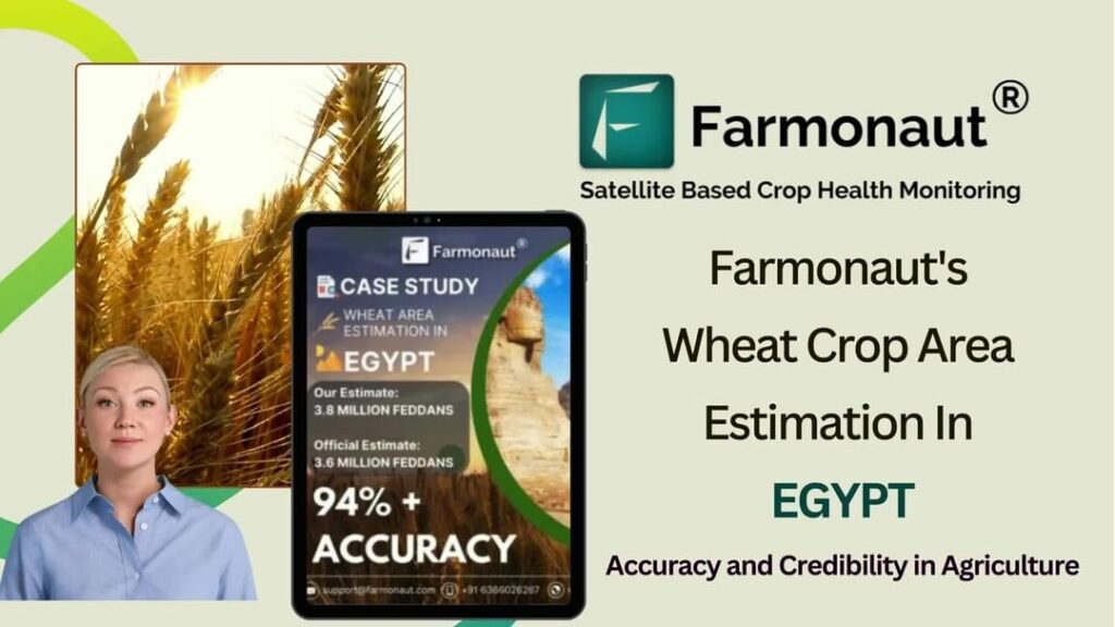
Our recent case study in Egypt exemplifies the power of Farmonaut’s technology. Here are the key findings:
- Farmonaut’s Estimate: 3.8 million feddans of wheat
- Official Government Estimate: 3.6 million feddans
- Accuracy Rate: 94%
This remarkable alignment between our estimates and official figures underscores the reliability of our
ag tech solutions. It demonstrates that Farmonaut’s technology can provide valuable insights for agricultural planning and policy-making at a national level.
The Advantages of Satellite-Based Crop Estimation
Satellite-based crop estimation, as employed by Farmonaut, offers several advantages over traditional methods:
| Feature |
Farmonaut Satellite System |
Drone-based Monitoring |
IoT-based Monitoring |
| Coverage Area |
Large scale (national/global) |
Limited (local) |
Very limited (field-level) |
| Data Collection Frequency |
Daily to weekly |
As needed (manual flights) |
Continuous |
| Initial Setup Cost |
Low |
High |
Medium to High |
| Maintenance |
Minimal |
Regular (hardware) |
Regular (sensors/devices) |
| Scalability |
Highly scalable |
Limited scalability |
Moderate scalability |
| Data Processing |
Automated (AI/ML) |
Semi-automated |
Automated |
| Regulatory Constraints |
Minimal |
Significant (flight restrictions) |
Moderate |
Driving Agricultural Innovation
At Farmonaut, we’re not just providing data; we’re driving
agricultural innovation. Our technology enables:
- Precision Farming: By providing accurate crop area estimates, we help farmers optimize their resource use..
- Market Intelligence: Traders and agribusinesses can better understand supply dynamics and market trends.
- Sustainability: Accurate land use data supports efforts to promote sustainable agricultural practices.
The Future of Crop Area Estimation
As we look to the future, we see enormous potential for further advancements in crop area estimation technology:
- AI and Deep Learning: Continued improvements in AI algorithms will enhance the accuracy and speed of crop identification.
- Hyperspectral Imaging: New satellite sensors will provide even more detailed data about crop health and type.
- Integration with IoT: Combining satellite data with ground-based sensors will create a more comprehensive view of agricultural landscapes.
- Real-time Monitoring: Faster data processing will enable near real-time crop area estimations.
- Global Coverage: Expanded satellite networks will provide consistent, high-resolution coverage of agricultural areas worldwide.
Farmonaut’s Comprehensive Suite of Services
While our crop area estimation technology is groundbreaking, it’s just one part of our comprehensive suite of
ag tech solutions. At Farmonaut, we offer a range of services designed to revolutionize farming practices:
1. Satellite-Based Crop Health Monitoring
Our platform uses multispectral satellite images to provide real-time insights into crop health. Farmers can access vital information about:
- Vegetation health (NDVI)
- Soil moisture levels
- Pest and disease detection
This data empowers farmers to make informed decisions about irrigation, fertilizer usage, and pest management, ultimately optimizing crop yields and reducing resource wastage.
2. Jeevn AI Advisory System
Our AI-driven personalized farm advisory tool, Jeevn AI, delivers:
- Real-time insights
- Weather forecasts
- Expert crop management strategies
By analyzing satellite data and other inputs, Jeevn AI generates customized advice to improve farm productivity and efficiency.
3. Blockchain-Based Product Traceability
We’ve integrated blockchain technology to enable robust traceability solutions, particularly for the agricultural sector. This ensures:
- Transparency in supply chains
- Enhanced trust between producers and consumers
- Reduced fraud in agricultural products
4. Fleet and Resource Management
Our tools for fleet management help agribusinesses optimize their operations by:
- Improving vehicle usage efficiency
- Ensuring safety in agricultural machinery operations
- Reducing operational costs
5. Carbon Footprinting
In response to growing environmental concerns, we offer carbon footprint tracking that provides:
- Real-time data on emissions
- Insights for reducing environmental impact
- Support for compliance with environmental regulations
Precision Farming: The Farmonaut Way
Precision farming is at the heart of what we do at Farmonaut. Our technology enables farmers to:
- Optimize resource use (water, fertilizers, pesticides)
- Reduce environmental impact
- Increase crop yields
- Improve overall farm profitability
By providing accurate, timely, and actionable data, we’re helping to transform agriculture into a more precise, efficient, and sustainable industry.
The Farmonaut Advantage
What sets Farmonaut apart in the crowded field of
ag tech solutions?
- Accuracy: Our 94% accuracy rate in crop area estimation speaks for itself.
- Comprehensive Solutions: From crop monitoring to carbon footprinting, we offer a full suite of agricultural technology services.
- Accessibility: Our platform is designed to be user-friendly and accessible to farmers of all sizes.
- Scalability: Whether you’re managing a small farm or overseeing national agricultural policy, our solutions can scale to meet your needs.
- Continuous Innovation: We’re constantly improving our technology to stay at the forefront of agricultural innovation.
Empowering Farmers Worldwide
At Farmonaut, our mission goes beyond providing technology. We’re committed to empowering farmers worldwide with the tools and knowledge they need to thrive in an increasingly complex agricultural landscape. Our platform is designed to be:
- Affordable: We believe precision agriculture should be accessible to all, not just large-scale operations.
- Easy to Use: Our intuitive interface ensures that even those with limited technical experience can benefit from our technology.
- Adaptable: Whether you’re growing wheat in Egypt or rice in India, our solutions can be tailored to your specific needs.
- Supportive: We provide ongoing support and training to ensure our users get the most out of our platform.
Sustainable Agriculture for a Growing World
As the global population continues to grow, the need for sustainable agricultural practices becomes ever more critical. Farmonaut is at the forefront of this challenge, providing solutions that:
- Reduce water usage through precise irrigation recommendations
- Minimize chemical inputs by identifying areas that truly need treatment
- Optimize land use through accurate crop area estimation
- Promote biodiversity by helping farmers make informed decisions about crop rotation and land management
- Support climate-smart agriculture by providing data on carbon footprints and environmental impact
Partnering for Progress
We believe that the future of agriculture lies in collaboration. That’s why Farmonaut actively partners with:
- Research Institutions: To stay at the cutting edge of agricultural science and technology
- Government Agencies: To ensure our solutions align with and support national agricultural policies
- Agribusinesses: To develop tailored solutions for large-scale agricultural operations
- Financial Institutions: To improve access to agricultural finance through data-driven risk assessment
The Road Ahead: Farmonaut’s Vision for the Future
As we look to the future, we at Farmonaut are excited about the possibilities that lie ahead. Our vision includes:
- Global Expansion: Bringing our crop area estimation and precision farming solutions to more countries and regions.
- Advanced AI Integration: Developing even more sophisticated AI models to provide hyper-personalized farming advice.
- Climate Resilience: Enhancing our platform to help farmers adapt to and mitigate the effects of climate change.
- Ecosystem Approach: Creating a comprehensive digital ecosystem that connects all aspects of the agricultural value chain.
- Democratizing Technology: Continually working to make advanced agricultural technology accessible to farmers of all scales.
Join the Farmonaut Revolution
Are you ready to take your farming practices to the next level? Whether you’re a small-scale farmer, a large agribusiness, or a government agency, Farmonaut has the tools and expertise to help you succeed in the modern agricultural landscape.
Visit our website at
Farmonaut App to learn more about our services and how we can help you optimize your agricultural operations.
For developers interested in integrating our powerful API into their own applications, check out our
API documentation.
Download our mobile app to access Farmonaut’s features on the go:
For more detailed information about our satellite and weather API, visit our
developer documentation
Subscribe to Farmonaut
Ready to transform your farming practices with cutting-edge satellite technology? Subscribe to Farmonaut today and unlock the full potential of your farm:
Frequently Asked Questions (FAQ)
Q: What is crop area estimation, and why is it important?
A: Crop area estimation is the process of determining the amount of land used for growing specific crops. It’s crucial for agricultural planning, resource allocation, food security assessments, and policy-making.
Q: How accurate is Farmonaut’s crop area estimation technology?
A: Our recent case study in Egypt demonstrated a 94% accuracy rate when compared to official government estimates.
Q: What technologies does Farmonaut use for crop area estimation?
A: We use a combination of high-resolution satellite imagery, advanced machine learning algorithms, and historical data integration to achieve accurate estimates.
Q: Can Farmonaut’s technology be used for all types of crops?
A: Yes, our technology is adaptable and can be used for a wide variety of crops across different regions and climates.
Q: How often is the crop area data updated?
A: The frequency of updates can vary depending on the specific service package, but we typically provide updates on a weekly to monthly basis.
Q: Is Farmonaut’s technology suitable for small-scale farmers?
A: Absolutely. We’ve designed our platform to be accessible and affordable for farmers of all scales, from small family farms to large agricultural enterprises.
Q: How does Farmonaut contribute to sustainable agriculture?
A: By providing precise data on crop areas and health, we help farmers optimize resource use, reduce chemical inputs, and make more environmentally friendly decisions.
Q: Can government agencies use Farmonaut for national-level agricultural planning?
A: Yes, our technology is scalable and can provide valuable insights for national and even global-level agricultural planning and policy-making.
Q: How does Farmonaut’s technology compare to traditional methods of crop estimation?
A: Our satellite-based technology offers greater accuracy, coverage, and frequency of updates compared to traditional ground-based survey methods.
Q: Is training provided for using Farmonaut’s platform?
A: Yes, we offer comprehensive training and ongoing support to ensure our users can fully leverage the power of our technology.
In conclusion, Farmonaut is at the forefront of agricultural innovation, providing cutting-edge solutions for crop area estimation and precision farming. Our technology is not just changing the way we farm; it’s shaping the future of agriculture itself. By combining accuracy, accessibility, and sustainability, we’re empowering farmers, policymakers, and agricultural businesses to make informed decisions that drive productivity, efficiency, and environmental stewardship. Join us in revolutionizing agriculture for a more sustainable and food-secure world.
 In today’s data-driven world, reliable agricultural information is invaluable for shaping policies, allocating resources, and driving growth. As technology continues to reshape the landscape, we at Farmonaut® are at the forefront, providing innovative solutions for accurate crop area estimation. Our case study dives deep into the significance of Farmonaut®’s wheat area estimations in Egypt, showcasing their alignment with the Government’s assessments.


