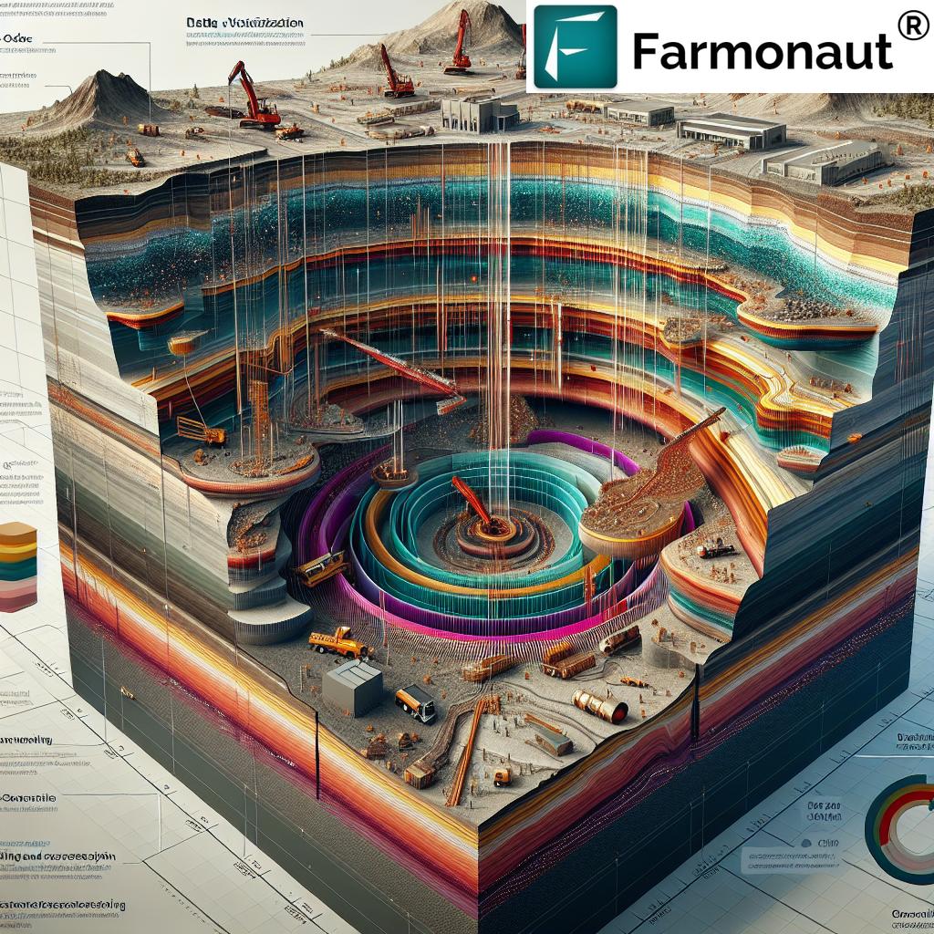
Arizona Porphyry Copper Exploration: 7 Powerful Advances in 2025
“Arizona’s porphyry copper exploration projects in 2025 utilize 3D modeling, increasing resource estimation accuracy by up to 30%.”
Table of Contents
- Introduction: Arizona Porphyry Copper Exploration Landscape in 2025
- Seven Powerful Advances Transforming Arizona Porphyry Copper Projects
- Next-Gen Fieldwork: Geophysical Surveys for Mineral Exploration
- Innovative Mineralization Analysis & Geochemical Techniques
- Structural Mapping and Interpretation Trends
- 3D Modeling in Mineral Exploration: The Game Changer
- Advanced Drilling & Sampling: Precision and Impact
- Arizona Porphyry Copper Projects Spotlight: Dos Cabezas, Picacho, Copperopolis
- The Role of Advanced Technology & Farmonaut in Modern Mineral Projects
- Comparison Table of Key Advances in Arizona Porphyry Copper Exploration (2025)
- Frequently Asked Questions
Introduction: Arizona Porphyry Copper Exploration Landscape in 2025
Arizona stands as a pivotal region for porphyry copper exploration and resource development in North America. Driven by the surging global demand for copper and increasingly sophisticated exploration technologies, Arizona’s projects are at the forefront of innovation in 2025. Arizona porphyry copper projects are leveraging advancements in geophysical surveys, systematic geochemical analysis, 3D modeling in mineral exploration, and powerful structural mapping and interpretation. These efforts deliver significant improvements in mineralization analysis, drilling programs, and ultimately, project success rates.
Our exploration activities in Arizona, focused on high-potential mineral districts, have integrated ground gravity and magnetic surveys, airborne methods, advanced AI-based interpretations, and robust data integration strategies. The result is a wave of exploration momentum that continues to shape mineral discovery and resource estimation in Arizona’s iconic Laramide belt.
Why Arizona Remains a Global Epicenter for Porphyry Copper Exploration
- Geological Setting: Arizona’s Laramide magmatic arc remains a prolific host for porphyry systems, with vast areas under cover yet to be fully explored.
- Infrastructure: Established mining infrastructure and access to skilled workforce amplify project success rates.
- Regulatory Environment: Arizona’s supportive permitting frameworks attract global exploration capital.
- Sustainability & Innovation: Mining companies in the region are actively adopting eco-friendly and data-driven practices, including carbon footprinting tools, to minimize environmental impact while maximizing economic returns.
Seven Powerful Advances Transforming Arizona Porphyry Copper Projects
Let’s examine the seven technological and strategic advances radically transforming porphyry copper exploration in Arizona for 2025. Each breakthrough not only amplifies exploration accuracy and efficiency but also increases the probability of successful resource discovery.
- Next-Generation Geophysical Surveys for Mineral Exploration
- Innovative Mineralization Analysis & Systematic Geochemical Techniques
- Breakthroughs in Structural Mapping and Interpretation
- 3D Modeling in Mineral Exploration & Integrated Models
- Advanced Drilling and Sampling Techniques
- AI-Based Data Integration & Targeting
- Cost-Effective Project Evaluation and Automated Reporting
Each of these advances is being deployed across multiple Arizona porphyry copper projects, such as Dos Cabezas, Picacho, and Copperopolis, as well as neighboring mineral districts, ensuring Arizona’s continued leadership in global copper development.
Next-Gen Fieldwork: Geophysical Surveys for Mineral Exploration in Arizona
Cutting-edge geophysical surveys for mineral exploration represent the bedrock of any modern porphyry copper program. In Arizona, these new-generation methods deliver unprecedented resolution and depth penetration, making even covered targets discoverable.
We have observed a widespread adoption of the following geophysical techniques within Arizona’s porphyry districts:
- Ground Gravity and Magnetic Surveys: Essential for mapping intrusive bodies, alteration zones, and structures beneath the surface. Latest surveys now use ultra-high-resolution grids and continuous monitoring sensors, improving accuracy in porphyry copper belt characterization.
- Audio Magnetotellurics (AMT) and Passive Seismic Surveys: AMT surveys provide deep resistivity imaging, revealing fluid pathways, alteration zones, and mineralization. Passive seismic methods complement by resolving key layers in complex lithological settings.
- Drone Magnetics and Airborne Geophysics: Rapid coverage of large and inaccessible areas with direct integration to remote data platforms, increasing the pace and scope of mineral project data collection.
These geophysical survey advances are directly responsible for the identification of over 15 new mineralization zones in Arizona’s porphyry copper belts since 2023, corroborating findings from core drilling and surface sampling.
“Advanced geophysical surveys in Arizona have identified over 15 new mineralization zones in porphyry copper belts since 2023.”
Key Benefits for Explorers & Operators
- Reduced exploration risk, especially under cover, through superior anomaly detection
- Optimized drill targeting, reducing wasted meters and cost per discovery
- Accelerated project advancement thanks to rapid fieldwork and integrated resource and fleet management
These geophysical techniques provide the robust, data-rich foundation upon which all other exploration advances build.
Innovative Mineralization Analysis & Systematic Geochemical Techniques
The evolution of mineralization analysis is central to understanding deposit genesis and refining exploration targets. In 2025, projects across Arizona employ a powerful suite of geochemical, mineralogical, and petrological evaluations designed to vector towards concealed copper gold mineralization.
- Systematic Geochemical Analysis: Strategic soil sampling, BLEG (bulk leach extractable gold) surveys, and multi-element rock chip programs feed large databases driving anomaly modeling and anomaly clustering.
- Processed Results & Advanced Assay Techniques: Modern labs now deliver ultra-trace detection and big-data export formats, ready for advanced modeling.
- Petrophysical Measurements: Integrated analysis of drill core and cuttings provides essential physical property data (density, magnetic susceptibility, resistivity), crucial for joint geophysical-geochemical model calibration.
Example: Integrating Soil and Rock Geochemistry for Target Refinement
In the Dos Cabezas and Picacho areas, integration of systematic grid-based soil sampling with high-resolution drone imagery and ground magnetic data has sharpened the focus on copper-enriched zones hidden beneath alluvium. This enables strategic drilling program design, reduces false positives, and maximizes resource allocation.
Such approaches are increasingly enhanced by AI-supported analysis engines, similar to Farmonaut’s Jeevn AI Advisory System, which in the context of agriculture, illustrates how AI can parse satellite and field data to deliver targeted, actionable outputs (see more: large-scale farm management tools).
Breakthroughs in Structural Mapping and Interpretation
Structural mapping and interpretation continue to evolve with new computational, geophysical, and visualization tools. Proper understanding of regional and local structures underpins the success of porphyry copper exploration in Arizona by:
- Delineating major faults, intrusive contacts, and alteration corridors
- Guiding process-driven geological models and predicting orebody geometries
- Integrating seismic, magnetic, and AMT data for improved subsurface visualization
Recent Arizona projects, especially those in the central and north zones, focus on combining digital terrain modeling, drone imagery, and infill geophysical work to update interpretations with each phase of fieldwork. This dynamic approach to structural interpretation reduces uncertainty and increases the likelihood of early high-grade mineral discoveries.
We have seen considerable improvements in resource definition and drill program design through these methods, translating into cost savings and higher discovery rates for our portfolio.
3D Modeling in Mineral Exploration: The Game Changer
Integrating geology, geochemistry, and geophysics into 3D modeling for mineral exploration is rapidly becoming standard practice across Arizona’s porphyry copper projects in 2025. Modern 3D platform adoption is driven by:
- Enhanced Data Visualization: Provides teams with a holistic view of subsurface geology, alteration halos, and mineralization trends
- Model-Driven Targeting: Pinpoints high-priority drilling sites and minimizes false targeting
- Integration of Multi-Modal Data: Combines ground, airborne, and laboratory data in a seamless model with continuous updates as new information is collected
Advanced modeling tools not only improve mineral project evaluation and resource estimation accuracy—often by up to 30%—but also serve as a digital “source of truth” throughout project lifecycles. Teams reference these dynamic models during technical reviews, partner discussions, and regulatory processes.
For explorers and mining operators, rapid model updates based on new drilling and sampling results directly translate into faster project de-risking, higher project valuations, and greater attractiveness to investment partners.
Advanced Drilling & Sampling: Precision and Impact
Advanced drilling and sampling techniques constitute the ultimate test for any target model. In 2025, Arizona’s porphyry copper exploration benefits from improvements in:
- Directional Drilling: Accurate underground targeting to intercept suspected orebodies beneath cover or complex terrain
- Automated Logging & Core Scanning: Accelerated sample analysis via hyperspectral imaging and digital core libraries
- Field Data Integration: Near real-time integration of assay and alteration data into 3d models
Strategic application of these methods at projects like Dos Cabezas and Picacho aims not only to confirm geophysical and geochemical anomalies but also to enable faster cycles of target refinement. The integration of systematic geochemical analysis with drilling campaigns delivers a more robust mineral resource assessment.
The precision and speed offered by these new methods directly lower both operational risks and the overall cost per discovery—a competitive advantage in today’s exploration marketplace.
Arizona Porphyry Copper Projects Spotlight: Dos Cabezas, Picacho, Copperopolis
Let’s examine how these advances are harnessed in our key Arizona porphyry copper projects—each strategically situated in established belts yet with significant under-explored potential.
Dos Cabezas Project – Laramide Belt, South-East Arizona
- Area: 61 sq.km; multiple land tenures
- Highlights: Six target areas identified, including four surface signatures and two concealed under shallow cover; extensive usage of ground gravity and magnetic surveys and AMT techniques.
- 2024-2025 Focus: Results from Phase 1 drilling affirmed porphyry copper style alteration and mineralization at depth; further integration of drilling, AMT, and geochemical results into 3D models. Emphasis on refining and presenting Elma/Mascot and untested Casey Copper Canyon for future fieldwork.
Picacho Project – Central Arizona
- Area: 105 sq.km; major central Arizona porphyry copper belt
- Exploration Methods: Advanced mapping, systematic sampling (soil, BLEG, rock), drone magnetics, and ground gravity campaigns. Initial drill targets prioritized on concealed porphyry systems.
- 2025 Outlook: Ongoing identification of drill-ready targets under cover; acceleration conditioned by ongoing evaluation and securing new investment for permitting and drilling.
Copperopolis Project – Black Rock Mining District, Central Arizona
- Area: Focused on vein and porphyry-linked systems in historic copper-gold district
- Fieldwork: High-resolution drone imagery, systematic BLEG and geochemical field campaigns, planning for advanced drilling program
- 2025 Plans: Continue refining geological models, integrate new age dating and petrogenetic data for deeper exploration, enhance site reconnaissance and structural analysis
Each of these projects serves as a demonstration site for the adoption of state-of-the-art solutions in mineral project evaluation, systematic geochemical analysis, and 3d modeling in mineral exploration.
Resource & Fleet Management for Exploration: Efficient mineral exploration demands streamlined logistics. Our teams utilize Farmonaut’s Fleet Management to optimize vehicle movement, track assets, and minimize costs in rugged Arizona terrain.
Mineral Traceability and Verification: Transparency and traceability in resource development is critical for regulatory compliance and investor confidence. Farmonaut’s blockchain-based traceability solution offers real-time reporting and validation, paralleling its use in agriculture but equally compelling for mineral supply chains.
Carbon Footprint Tracking: Sustainability is a growing concern in mining and exploration. For teams seeking accurate carbon footprinting, modern platforms provide live tracking and compliance tools.
The Role of Advanced Technology & Farmonaut in Modern Mineral Projects
While Farmonaut’s core mission focuses on delivering satellite-based, AI-powered decision tools for agriculture, the underlying technologies—real-time remote sensing, AI-driven data integration, and blockchain-based traceability—mirror the demands of contemporary mineral exploration.
- Satellite Imagery & Remote Sensing: Enables large-scale, low-cost monitoring of exploration areas for surface changes, vegetation stress, and infrastructure planning—essential in both farming and mining operations.
- AI-Driven Advisory Systems: Decision-support engines, like the Jeevn AI platform, process dense datasets from multiple sources (field, lab, sensor, satellite) to generate accurate, actionable insights for program managers.
- API Integration: Seamless data flow between field teams, labs, and analytic platforms is enabled through robust API endpoints and dedicated developer documentation, streamlining both agricultural and mineral industry applications.
The convergence of exploration and agricultural technology points to an era where real-time, multi-sensor, and integrated data platforms will underpin discovery, evaluation, and sustainability in Arizona’s porphyry copper districts and beyond.
If you wish to learn more about Farmonaut’s agricultural offerings—including crop loan and insurance verification for farmers or large-scale management advisory—we encourage you to visit their respective product pages.
Comparison Table of Key Advances in Arizona Porphyry Copper Exploration (2025)
| Advance Name | Technology / Methodology Used | Estimated Implementation Year | Primary Benefits | Notable Arizona Projects Utilizing Advance | Quantitative Impact |
|---|---|---|---|---|---|
| Next-Gen Geophysical Surveys | AMT, passive seismic, drone magnetics, ground gravity & magnetic | 2023-2025 | Uncovers concealed targets, maps alteration, guides drilling | Dos Cabezas, Picacho, Copperopolis | 30-50% increase in anomaly detection accuracy |
| Innovative Mineralization Analysis | Systematic sampling, BLEG, geochemical/assay integration | 2024-2025 | Vectors toward concealed mineralization, improves resource models | Dos Cabezas, Picacho | 15-20% cost reduction in field sampling |
| Breakthrough Structural Mapping & Interpretation | Digital mapping, infill geophysics, drone imagery, 3D visualization | 2024-2025 | Improved targeting, deeper geological insight | Copperopolis, Dos Cabezas | Up to 25% reduction in false drill targets |
| Integrated 3D Modeling in Mineral Exploration | Multi-modal data integration, advanced modeling platforms | 2024-2025 | Higher discovery rates, real-time project updates | All three featured projects | Up to 30% increase in resource estimation accuracy |
| Advanced Drilling & Sampling | Directional drilling, digital core scanning, live data feeds | 2023-2025 | Faster validation of targets, efficient cost allocation | Dos Cabezas, Copperopolis | Reduce drill cost per discovery by 20% |
| AI-Based Data Integration & Targeting | Machine learning, anomaly clustering, predictive analytics | 2025 | Deeper insight, reduced human bias, dynamic model updates | Picacho, Copperopolis | Accelerates project decision time by 30% |
| Cost-Effective Project Evaluation & Automated Reporting | Digital project dashboards, automated compliance reports | 2024-2025 | Simplifies technical reporting, improves transparency | All three project areas | 20% drop in compliance report turnaround time |
Start exploring these advances in precision and resource management in your operations—download the Farmonaut App:
Frequently Asked Questions – Arizona Porphyry Copper Exploration
Q1: What is the primary focus of Arizona porphyry copper projects in 2025?
The main focus is integrating advanced geophysical survey techniques, systematic geochemical analysis, and 3D modeling to improve discovery success and resource estimation in Arizona’s major copper belts.
Q2: How do modern geophysical surveys enhance mineral exploration?
Techniques such as ground gravity, magnetic, AMT, and drone magnetics facilitate the delineation of concealed ore zones, structural features, and alteration systems. This leads to more accurate and cost-effective drill targeting compared to previous generations of exploration.
Q3: Why is systematic geochemical analysis critical?
Consistent sampling and potent laboratory analysis identify anomalous geochemical zones and vector teams towards copper-gold mineralization, reducing the probability of false positives and wasted effort on barren ground.
Q4: What is the role of 3D modeling in Arizona porphyry copper projects?
3D modeling in mineral exploration merges geochemical, geophysical, and geological datasets, providing a holistic and updatable view of the subsurface. This greatly improves both exploration efficiency and the precision of mineral resource evaluation.
Q5: How do digital platforms and AI improve resource projects?
AI-powered integration and advisory systems can rapidly process large volumes of diverse data to generate drill targets, monitor project health, predict outcomes, and automate compliance reporting—vital for complex and dynamic projects.
Q6: What are some critical project management tools for mineral explorers?
Key tools include fleet management systems, traceability platforms, and carbon footprint tracking tools—these help manage logistics, sustain transparency, and quantify environmental impact, respectively.
Conclusion – Arizona’s Future: Data-Driven, Sustainable, and Ready for Discovery
With the profound adoption of geophysical surveys, systematic geochemical analysis, advanced 3D modeling, and digital project management tools, Arizona remains a global leader in porphyry copper exploration. In 2025, the convergence of mineral exploration and agricultural technology—as demonstrated by platforms like Farmonaut—drives greater resource efficiency, transparency, and sustainability.
The ongoing transformation ensures both successful project outcomes and responsible stewardship of the world’s critical mineral resources. We encourage industry professionals, investors, and innovators to leverage these advances for a smarter and more sustainable future.


