
Table of Contents
- Introduction: Precision Grow Satellite Imagery
- Understanding Satellite Imagery in Agriculture
- Key Applications of Satellite Imagery in Precision Agriculture
- Advancements in Precision Agriculture Technology
- Farmonaut’s Satellite Imagery Solutions
- Comparative Benefits: Traditional vs Satellite vs AI-Integrated Farming
- Challenges, Considerations & The Future of Satellite Imagery in Agriculture
- Farmonaut Subscription Plans
- Frequently Asked Questions (FAQ)
- Summary: Precision Agriculture for Sustainable Food Production
“Satellite imagery can analyze over 10,000 acres of farmland in just one hour, revolutionizing precision agriculture monitoring.”
Boost Yield Fast: Precision Grow Satellite Imagery Secrets
Welcome to the digital revolution in agriculture. As we collectively strive for improved productivity, sustainability, and resource efficiency, precision agriculture technology has emerged as a game-changer—anchored by the transformative power of satellite imagery in agriculture. By leveraging advanced satellite imagery, AI, and machine learning (ML), we, as farmers, agribusinesses, and industry stakeholders, can now monitor, analyze, and optimize every critical stage of crop production. In this comprehensive guide, let’s unlock the secrets behind precision grow satellite imagery, exploring how this innovation boosts yield, enhances crop health monitoring, and supports sustainable soil, water, and farm management practices for the future of agriculture.


Understanding Satellite Imagery in Agriculture
Satellite imagery in agriculture is the science of capturing high-resolution (multispectral and thermal) images from orbiting sensors to monitor and analyze agricultural landscapes at regional, field, and even plot-scale levels. By using specialized satellite bands—including visible, near-infrared (NIR), red, and thermal—we gain unique visibility into the plant health, soil moisture, nutrient levels, and biomass development of crops across large areas, efficiently and comprehensively.
How Satellite Data Powers Precision Agriculture
- Multispectral Imaging: Spectral bands (visible, red, NIR, thermal) reveal vital parameters of vegetation, soil, and water status, making real-time crop health monitoring and soil mapping far more accurate.
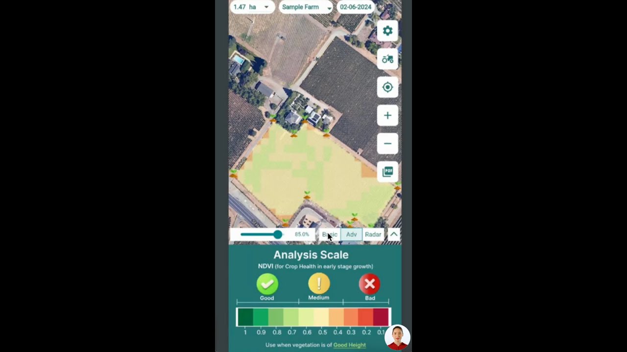
- Index Calculation and Analysis: Indices such as NDVI (Normalized Difference Vegetation Index) and EVI (Enhanced Vegetation Index) represent photosynthetic activity, allowing rapid assessment of crop vitality and early detection of stress, disease, or pest outbreaks.
- Big Data Integration: With the integration of AI and machine learning (ML) for processing and interpreting satellite imagery, we now gain actionable intelligence for site-specific management practices, minimizing input waste while maximizing yield.
By processing and interpreting this data, we can now optimize irrigation, fertilization, pesticide application, and farming operations with unmatched efficiency.

Key Applications of Satellite Imagery in Precision Agriculture
Let’s delve into the direct applications of satellite imagery in agriculture and how these key areas—when combined with AI and digital farm management tools—are driving the next wave of innovation in crop production and sustainable agriculture.
1. Crop Health Monitoring with Satellite Imagery
- Early Stress Detection: Satellite imagery enables proactive crop monitoring by analyzing reflectance in red and near-infrared regions; using indices like NDVI, we evaluate plant vitality, photosynthetic activity, and biomass build-up.
- Fast Targeted Interventions: By pinpointing zones of nutrient deficiencies, water scarcity, or beginning disease, we enable prompt and targeted interventions—minimizing resource waste and maximizing the potential yield.
- Quantifiable Benefits: With timely and site-specific responses, crop loss is drastically reduced, and input efficiency increases, leading to significant uplift in yields.
For large farm advisors and foresters looking for advanced precision farm management, Farmonaut’s crop plantation and forest advisory tools offer real-time, high-resolution crop monitoring & custom insights.
2. Soil Mapping and Analysis: Optimizing Resource Use
- Spatially Detailed Soil Maps: Integrating satellite data with ground sampling results in highly detailed maps, highlighting soil properties such as texture, organic matter, and nutrient levels, enabling targeted, site-specific management strategies.
- Smart Fertilizer Application: Variable-rate fertilization based on soil mapping and analysis lessens environmental impact and ensures every zone receives only what is needed, reducing both costs and input waste.
- Enhanced Productivity: This approach supports healthy crop establishment and allows us to optimize every step, from planting density to irrigation.
Looking for end-to-end food supply chain transparency? Farmonaut’s blockchain-based product traceability guarantees product origins and quality, building trust from field to market.
3. Water Use Optimization & Sustainable Irrigation
- Moisture and Evapotranspiration Data: With satellite-derived soil moisture and evapotranspiration rates, we develop efficient irrigation schedules that conserve water and prevent over- or under-watering.
- Reduced Energy & Costs: Smart water usage cuts down on pumping energy, lowers fertilizer runoff, and enhances both sustainability and crop yields.
- Sustainable Practices: Conserving water strengthens ecosystem resilience and supports compliance with environmental guidelines.
For agribusinesses invested in sustainability, Farmonaut’s carbon footprinting tools provide real-time emissions monitoring and reporting for sustainable agriculture compliance.
4. Pest and Disease Detection in Crops Using Satellite Data
- Proactive Pest & Disease Monitoring: Hyperspectral satellite imagery detects changes in plant reflectance, enabling us to anticipate and respond to pest infestations or disease outbreaks before damage is visible.
- Targeted Pesticide Use: Early detection allows for site-specific, minimal pesticide application, reducing input costs and environmental impact.
- Prevention of Epidemics: Fast, data-driven decisions prevent widespread yield loss and help protect food security.
Want to reduce insurance risks and speed up crop loan approvals? Explore Farmonaut’s crop loan and insurance verification solutions that leverage satellite data for swift and accurate field status validation.
“AI-powered satellite data improves crop yield predictions by up to 30% compared to traditional field scouting methods.”
5. Yield Forecasting in Agriculture: Predict the Future, Plan for Success
- Biomass & Environmental Analysis: Combining crop growth models, NDVI time-series, and environmental parameters (temperature, rainfall, radiation), satellite monitoring now enables highly accurate yield predictions.
- Supply Chain Optimization: Forecasting yields ahead of harvest empowers farmers and agribusinesses to streamline logistics, pricing, and sales—reducing post-harvest losses and ensuring food security.
- Data-Driven Decision Making: Advance knowledge of potential yields helps us adjust planting, harvesting, and marketing strategies to minimize waste and maximize returns.
Is your business scaling up operations? Use Farmonaut’s fleet management tools for seamless monitoring, optimized resource allocation, and efficient machinery tracking.


Advancements in Precision Agriculture Technology: From Satellite Images to AI Insights
We’re entering a new era where advanced agricultural monitoring—driven by rapid satellite launches, machine learning models, and big data—empowers farmers to achieve more with less. Here’s how the latest innovations are pushing precision agriculture forward:
AI in Precision Farming: Real-Time, Actionable Intelligence
- Pattern Detection & Predictive Analysis: By processing huge volumes of satellite imagery, AI and ML algorithms can now detect trends (such as pest risk or nutrient deficiencies), offering timely advisory before issues escalate.
- Personalized Recommendations: Platforms like Farmonaut’s Jeevn AI Advisory System deliver real-time, crop-specific advice—leveraging satellite, weather, and historical data to maximize productivity.
- Soil Nutrient Prediction: Emerging models, such as those in the AgroLens project, predict soil nutrient levels without time-consuming lab tests, directly from satellite imagery and environmental parameters.
For agri-tech developers: unlock the power of satellite data for farming and machine learning with Farmonaut’s robust API and API documentation.
Emerging Satellite Platforms and High-Frequency Data
- Constant Monitoring: With satellite constellations such as EOS SAT-1, frequent and high-resolution data collection enables us to monitor field development daily, overcoming weather-induced data gaps.
- Global Scale Precision: From smallholder plots in India to commercial farms in the US or Africa, satellite imagery and AI-integration democratize access to sustainable agriculture practices.
- Blockchain Integration: By embedding field-level satellite and operational data into the blockchain, Farmonaut’s solutions support full supply chain transparency, food safety, and brand credibility.
Farmonaut’s Satellite Imagery Solutions: Affordable Precision Agriculture for All
At Farmonaut, our mission has always been to democratize access to precision agriculture by making advanced agricultural monitoring technologies affordable, accessible, and data-driven for every farmer, agribusiness, and organization.
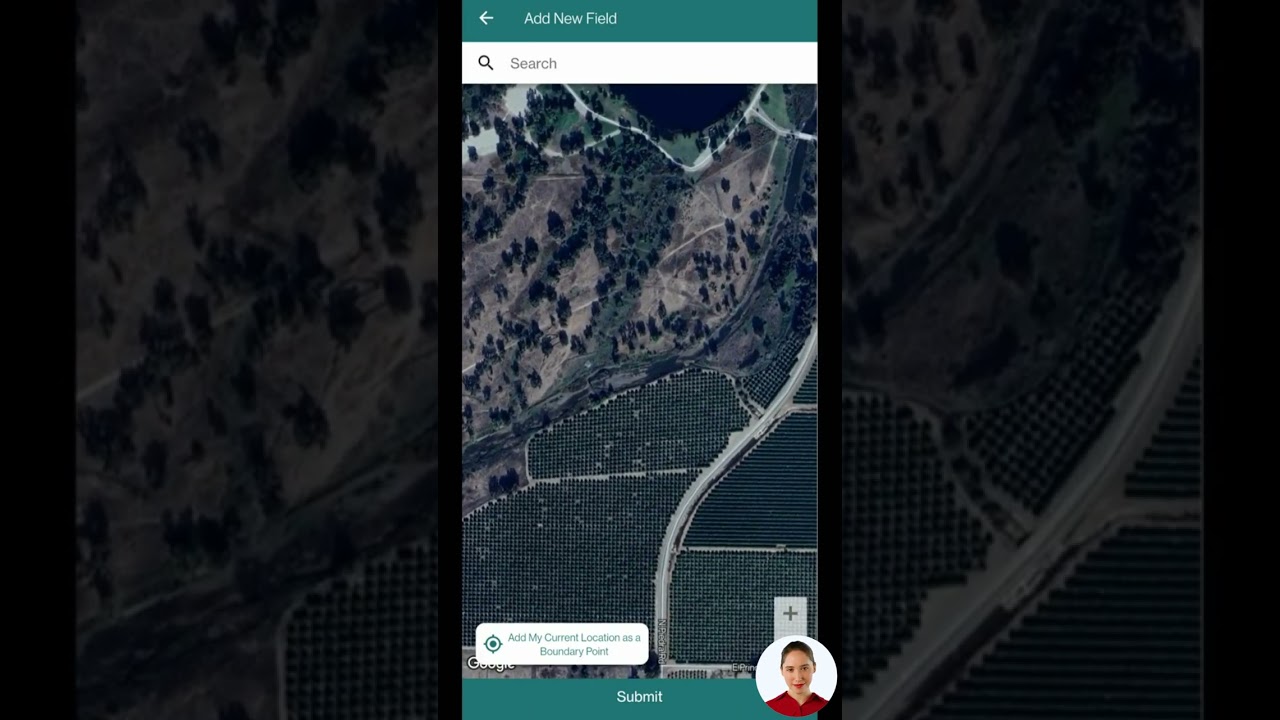
- Accessible Platforms: Available through Android, iOS, and Web App (try Farmonaut apps here), as well as via API integration.
-
Core Solutions:
- Satellite-Based Crop Health Monitoring: Real-time field-level insights such as NDVI, crop stress, and soil moisture maps.
- Jeevn AI Advisory System: AI-driven, personalized advice powered by continuous analysis of satellite & environmental data.
- Blockchain Traceability: End-to-end traceability for food, textile, and bio-based supply chains (more on traceability here).
- Fleet and Resource Management: For efficient logistics, crop scouting, and machinery operations (details).
- Carbon Footprinting: Supporting agribusinesses in environmental reporting and compliance (farm carbon tracking).
- Business Model & Scalability: Subscription-based, scalable for individual farmers to governments and corporate supply chains (see pricing and plans below).
Comparative Benefits of Satellite Imagery and AI in Precision Agriculture
One of the fastest ways to understand the impact of satellite imagery in agriculture is by comparing it side-by-side with traditional and AI-augmented farming methods. Use this table as a guide to make informed, future-ready decisions for your farm or agribusiness:
| Farming Method | Crop Health Monitoring Accuracy (%) | Soil Analysis Speed (days) | Yield Increase (%) | Input Reduction (%) |
|---|---|---|---|---|
| Traditional Scouting | 65 | 7-21 | 5-10 | 2-5 |
| Satellite Imagery Based | 85 | 1-2 | 15-22 | 15-20 |
| AI-Integrated Approach (Satellite + AI/ML) | 95 | <1 | 25-35 | 25-35 |
Challenges, Considerations & The Future of Satellite Imagery in Agriculture
Adoption Challenges
- Data Accessibility: Access to high-resolution, frequent data can be cost-prohibitive for some; ongoing innovation and scaling are helping to drive prices down.
- Expertise Required: Interpreting large, complex datasets demands training and digital literacy—which platforms like Farmonaut are working to simplify via user-friendly dashboards and guided insights.
- Cloud Cover & Weather: Weather conditions occasionally impact satellite image clarity, though new constellations and synthetic aperture radar (SAR) are helping mitigate this.
What Does the Future Hold?
- Greater Accuracy & Speed: AI-driven systems will continue to elevate predictive, proactive management—reaching even higher accuracies for crop and soil analysis.
- Scalability & Democratization: With high-frequency imaging and cloud-based analytics, all farmers—regardless of scale or geography—can access advanced agricultural monitoring.
- Full Spectrum Integration: The integration of drones, IoT sensors, and blockchain will further enrich field-level data and automate agricultural decision-making.
Farmonaut’s Role in the Future of Precision Agriculture
By blending advanced satellite imagery, AI/ML, and blockchain into an intuitive, scalable platform, Farmonaut is spearheading a new era of sustainable agriculture practices—helping stakeholders boost yield, cut costs, and secure the world’s food future.
Farmonaut Subscription Plans
Farmonaut’s flexible subscription model ensures that precision agriculture technology is accessible for individual farmers, cooperatives, agribusinesses, and governments. Whether you own one hectare or thousands, our platform scales to fit your needs—get started with transparent pricing and the solutions that matter to you:
Frequently Asked Questions (FAQ)
What is satellite imagery in agriculture and why is it important?
Satellite imagery refers to high-resolution images captured by satellites equipped with advanced sensors, enabling the real-time monitoring and analysis of agricultural landscapes. These images help us understand crop health, soil properties, water stress, and environmental influences, making more informed, precise, and sustainable field management possible.
How does AI improve satellite imagery applications in precision agriculture?
AI in precision farming automates the interpretation of vast satellite data, detecting patterns (such as pest outbreaks, nutrient shortages, and soil moisture variation) and generating personalized management recommendations—leading to increased accuracy and faster responses compared to traditional methods.
What are the main benefits of adopting satellite data for farming?
- Significantly improves crop health monitoring and early stress detection.
- Enables detailed soil mapping and variable-rate fertilizer application.
- Optimizes water use and irrigation efficiency.
- Facilitates timely pest and disease interventions, reducing input waste.
- Supports sustainable practices and higher crop yields with less resource expenditure.
- Offers predictive yield analytics for better planning and reduced losses.
Who can benefit from Farmonaut’s satellite-based solutions?
Our solutions are designed for individual farmers, cooperatives, agribusinesses, government agencies, NGOs, corporate supply chains, and financial institutions—scaling to fit small fields or large territories seamlessly.
How do I get started with Farmonaut satellite imagery tools?
You can access our solutions via Android, iOS, and Web App. For developers and businesses, our API is also available for seamless integration.
Summary: Harnessing Precision Agriculture for a Resilient Food Future
As we have explored, satellite imagery in agriculture sits at the heart of the next agricultural revolution. By combining satellite-powered remote monitoring with AI-driven evaluation of crop, water, soil, and resource conditions, we unlock decisive gains in efficiency, yield, and sustainability—empowering every farmer, farm manager, and agribusiness with the knowledge needed to thrive in a rapidly changing world.
Farmonaut is committed to making advanced, satellite imagery and precision grow technologies accessible and affordable. We are not a farm input marketplace, manufacturer, or regulatory body. Instead, we stand as your technology partner—delivering transparent, data-driven, and scalable solutions that:
- Enhance crop health monitoring and yield
- Streamline soil mapping and analysis for site-specific resource management
- Enable pest and disease detection in crops with unprecedented speed and accuracy
- Support yield forecasting in agriculture and farm planning
- Promote sustainable agriculture practices for a secure, resilient food system
Join us and become part of the digital transformation of farming—where satellite imagery, AI, and precision management pave the way to a smarter, more sustainable agricultural future.


