

Reviewed September 2026 against Penn State Extension, the European Environment Agency, and Climate Central.
Try it: Run your own numbers →
Introduction: Growing Degree Days, by Zip Code, Explained
A growing degree day (GDD) is a single number: the average of a day’s high and low temperature, minus the base temperature at which a crop or pest actually starts developing. Look up growing degree days by zip code and you get a running seasonal total that tells you, more reliably than a calendar date, whether your corn is close to silking or your soybean aphids are about to hatch. The formula itself is public and simple — Penn State Extension documents it in full — but the number only becomes useful once it is tied to your own location’s daily temperature record.
This page covers the GDD formula, the base temperatures that make or break the calculation, where to pull growing degree days by zip code in the US free of charge, what a tool like LiveGDD (livegdd.com) actually does versus what it doesn’t publish, and where vertical crop growing departs from GDD logic entirely because it controls temperature directly. We also cover the base-5°C standard used across the EU for readers checking degree days in France and elsewhere in Europe.
What Are Growing Degree Days (GDD)?
Plants and insects are ectothermic in their development rate — they don’t grow at a fixed pace, they grow in proportion to how much heat accumulates above a minimum threshold. Growing Degree Days quantify that accumulated heat, giving agronomists a way to track “biological time” instead of calendar time. A GDD total, not a date, is why two fields planted the same week can reach flowering ten days apart if one sits in a warmer microclimate.
- Cold-blooded development: Corn, soybeans, wheat, and the insects that feed on them all develop in direct relation to ambient heat, not the calendar.
- Predicting stages: A running GDD total estimates germination, flowering, fruiting, and harvest windows more precisely than “days since planting.”
- Pest timing: Life cycles of major pests are pinned to GDD thresholds, which lets growers time interventions instead of guessing.
The climate baseline is shifting under this metric. Climate Central reports that 97% of US weather stations analyzed have recorded increased growing degree days since 1970 — meaning the GDD total your field hits by a given calendar date is, at most stations, higher now than it was decades ago. That single fact is why last decade’s planting calendar is a worse guide than this season’s actual accumulated GDD.
GDD Formula: How the Calculation Works
The standard growing degree day formula, as documented by Penn State Extension, is:
GDD = (Tmax + Tmin) / 2 - Tbase
- Tmax = the day’s maximum temperature (°F or °C)
- Tmin = the day’s minimum temperature
- Tbase = the crop’s base (developmental threshold) temperature
Two adjustments matter for accuracy. First, if the result is negative, it is set to zero — Penn State Extension is explicit that plants do not develop in reverse, so days below the base temperature contribute nothing rather than subtracting from the season total. Second, for corn specifically, Penn State Extension caps the high temperature input at 86°F, because growth plateaus above that point; without the cap, a run of very hot days would overstate how much the crop actually advanced.
Example: GDD for Corn
Max temperature 85°F, min temperature 60°F, base temperature for corn 50°F:
GDD = ((85 + 60)/2) - 50 = (145/2) - 50 = 72.5 - 50 = 22.5
That day contributes 22.5 GDD to the season’s running total. Every subsequent day is added the same way, and the cumulative figure — not the date on the calendar — is what should drive planting, spraying, and harvest decisions.
The Same Formula, European Units
The European Environment Agency uses the identical formula but with metric inputs and a base temperature of 5°C, representative of most European crops. The EEA’s dataset spans 38 countries and covers 1950 through 2100, combining historical station records with climate-model projections — useful for a French grower who wants a multi-decade trend rather than a single season’s number. The EEA does not publish a France-specific base-temperature table separate from the general European 5°C standard, so French growers working with a specific crop should pair the EEA’s 5°C baseline with that crop’s own published threshold from an agronomic reference for their region.
Base Temperature by Crop: Why It Changes the Answer
The base temperature is not a rounding convenience — it is the single input most likely to make a GDD total wrong if you get it wrong. Penn State Extension documents 50°F as the standard base for US corn and soybeans, and 41°F for alfalfa — an almost 9°F gap that changes how much of a mild spring day even counts toward the season total. In Europe, the EEA’s representative base for most crops is 5°C (41°F), which is close to the US alfalfa threshold but noticeably lower than the US corn/soybean standard.
| Crop / Standard | Base Temp (°F) | Base Temp (°C) | Source |
|---|---|---|---|
| Corn (US) | 50°F | 10°C | Penn State Extension |
| Soybeans (US) | 50°F | 10°C | Penn State Extension |
| Alfalfa (US) | 41°F | 5°C | Penn State Extension |
| Most European crops (EU) | 41°F | 5°C | European Environment Agency |
| Corn high-temp cutoff (US) | 86°F | 30°C | Penn State Extension |
The Penn State Extension and EEA figures above are the only base-temperature values verified for this article. Wheat, tomato, and potato base temperatures are widely cited in extension literature but are not among the figures verified here — check your state or national extension service’s current published table before applying one to a spray or planting decision, since values are periodically revised as agronomic research updates.
Growing Degree Days by Zip Code: Where to Look It Up
Searching “growing degree days by zip code” or “degree days by zip code” is really a request for one thing: a tool that takes your location and a base temperature, and returns the running seasonal accumulation for the nearest weather station. Three tools do this without a paywall:
-
North Carolina State Climate Office GDD Explorer
: interactive GDD maps built for crop and pest management, queryable by location. -
USA National Phenology Network AGDD Maps
: daily accumulated-GDD maps at multiple base-temperature thresholds, covering the continental US. -
Farmwest GDD Tools
: calculators and reference guides for heat accumulation, pest control timing, and crop planning.
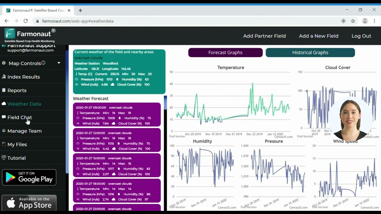
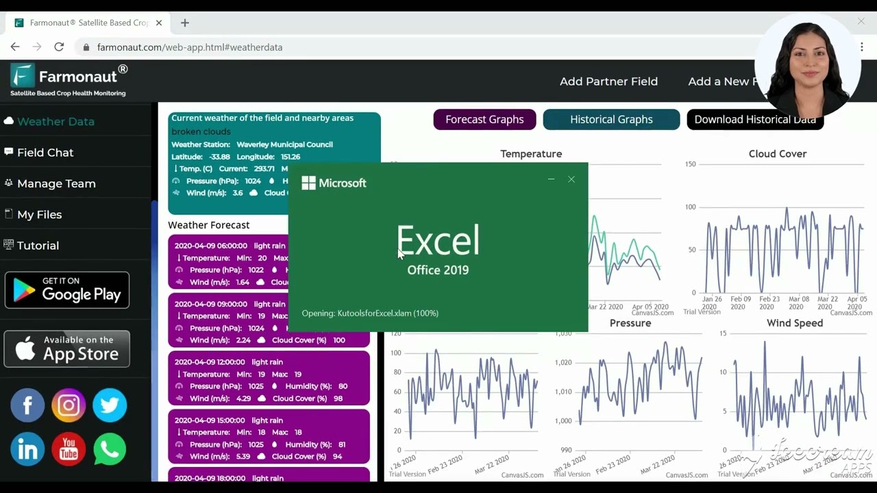
Behind every one of these tools sits the same underlying data source: NOAA weather-station observations. Real-time, zip-code-level GDD services — including the daily-updated tools referenced above — pull current-season figures from live NOAA station readings, which is why the number for your zip code can shift day to day as new observations come in, and why a GDD total from early in the season should always be treated as provisional rather than final.

GDD API & Data Integration for Smart Farming
For developers and agritech companies building custom solutions, access live GDD and weather data via Farmonaut’s
Satellite & Weather Data API. Full documentation is available here. With this API, you can integrate zip-code-specific GDD data directly into your own platforms and mobile apps, rather than manually checking a public map each morning.
LiveGDD and Similar Zip-Code Tools: What They Do and Don’t Show You
“LiveGDD” and “livegdd.com” are recurring searches for a specific class of product: a zip-code-entry GDD tracker aimed at row-crop growers who want a fast daily number without building their own spreadsheet. That category of tool is real and useful for a quick check, but it comes with a gap worth naming plainly: published, independent accuracy metrics, subscription pricing, and adoption figures for LiveGDD specifically are not available in the research used for this article, and no such figures could be verified. If subscription cost or accuracy benchmarking matters to your decision, the only reliable path is to check the provider’s own site directly for current terms, since third-party figures on it are not published anywhere this review could confirm.
What can be verified is the standard against which any zip-code GDD tool should be judged, because it’s the same standard Penn State Extension and the free public tools above use:
- Base temperature disclosed: the tool should state which base temperature (50°F corn/soybean, 41°F alfalfa, or a custom value) it’s using, since a hidden default can silently misrepresent your crop’s accumulation.
- Station source disclosed: a zip code doesn’t have its own weather station — every tool interpolates from the nearest NOAA station or a gridded model, and the distance to that station affects accuracy in areas with elevation change or coastal influence.
- High-temperature cutoff applied or not: for corn, omitting the 86°F cutoff Penn State Extension documents will overstate GDD during hot spells.
- Negative-day handling: cold days should floor at zero, not subtract from the running total.
Any tool — free or subscription, LiveGDD included — that discloses those four things is giving you enough to judge its number against the public NC State, USA-NPN, or Farmwest tools linked above. One that doesn’t disclose them is asking you to trust a black box.
Sample GDD and Crop Milestones by Zip Code
The table below illustrates how GDD accumulation, planting windows, and pest pressure differ across a sample of North Carolina zip codes at the standard 50°F corn/soybean base. These are illustrative regional patterns for demonstrating how the metric behaves across microclimates, not a live feed — for a current-season total at your own zip code, use the NC State GDD Explorer or USA-NPN AGDD maps linked above.
| Zip Code / Region | Illustrative Annual GDD (Base 50°F) | Main Crop(s) Grown | Typical Planting Window | Typical Harvest Window | Pest Risk Level |
|---|---|---|---|---|---|
| 27516 (Chapel Hill) | 2700 | Corn, Soybeans, Wheat | Apr 5–15 | Sept 10–25 | Medium |
| 28732 (Asheville Area) | 2100 | Potatoes, Wheat, Apples | Apr 20–30 | Oct 1–15 | Low |
| 27858 (Greenville) | 2900 | Soybeans, Corn, Tobacco | Apr 1–10 | Aug 25–Sept 15 | High |
| 28301 (Fayetteville) | 3100 | Corn, Soybeans, Peanuts | Mar 25–Apr 5 | Aug 20–Sept 10 | Medium |
| 28403 (Wilmington) | 3200 | Tomato, Corn, Beans | Mar 18–28 | Aug 10–Aug 30 | High |
| 27215 (Burlington) | 2500 | Wheat, Soybeans, Corn | Apr 10–18 | Sept 12–26 | Medium |
The pattern that matters more than any single zip code’s number: coastal and southern locations (Wilmington, Fayetteville, Greenville) accumulate 500–1,100 more GDD per season than the mountain region (Asheville), which is why a single statewide planting calendar consistently under- or over-shoots half the state. Zip-code-level lookup exists specifically to correct for that gap.
Vertical Crop Growing and Why GDD Barely Applies
Vertical crop growing — stacked-layer, indoor cultivation under LED lighting, often called controlled-environment agriculture (CEA) — sits outside the GDD framework almost entirely, and it’s worth being direct about why searchers looking into vertical farming won’t find much use for a zip-code GDD tool.
- Temperature is an input, not an outcome: a vertical farm’s climate system sets air temperature directly, typically holding it within a narrow target band regardless of outdoor conditions. GDD exists to model heat accumulation under weather a grower cannot control; in a vertical farm, the grower sets the temperature, so there’s no external heat accumulation to track.
- Photoperiod and light spectrum dominate scheduling instead of accumulated heat units — crop timing in CEA is driven by light-hours and nutrient dosing schedules, not degree-day thresholds.
- Where GDD-like logic still applies: the concept resurfaces only if a vertical farm operator wants to model crop response to intentional temperature ramps (e.g., testing a lower-energy setpoint), at which point they’d apply the same Tmax/Tmin/Tbase formula to their control-system logs rather than outdoor weather data.
No verified adoption figures for GDD-style metrics inside the vertical farming industry exist in the research used for this article — that’s a genuine gap, not an oversight, because the industry’s own literature centers on light and nutrient dosing rather than degree-day accumulation. If you operate a vertical farm and want to quantify a temperature-response curve for a specific crop line, the method above (apply the GDD formula to your own logged setpoint data) is the honest way to build that figure yourself, since no third party publishes one for you.
Core Applications of Growing Degree Days in Agriculture
1. Crop Development Stages & Maturity
GDD tracking predicts key phenological stages from planting onward — germination, flowering, fruit set, grain fill, and maturity. Corn varieties commonly require 800 to 2,700 GDD (base 50°F) to reach maturity depending on the hybrid’s maturity rating; knowing your running accumulation tells you which milestone a given hybrid is approaching well before visual symptoms appear in the field.
2. Pest Management: Using GDD to Time Interventions
- Major pests such as corn earworm and soybean aphid have life stages synchronized to GDD accumulation rather than the calendar.
- Monitoring local GDD by zip code lets growers predict emergence and peak-risk windows, and time control measures to that window instead of a fixed spray date.
- Correct timing reduces the number of pesticide applications needed and supports traceable, sustainable farm practices.
3. Planting and Harvest Schedules
- Choosing planting dates around historical and forecast GDD accumulation reduces frost and heat-stress risk and maximizes usable growing days.
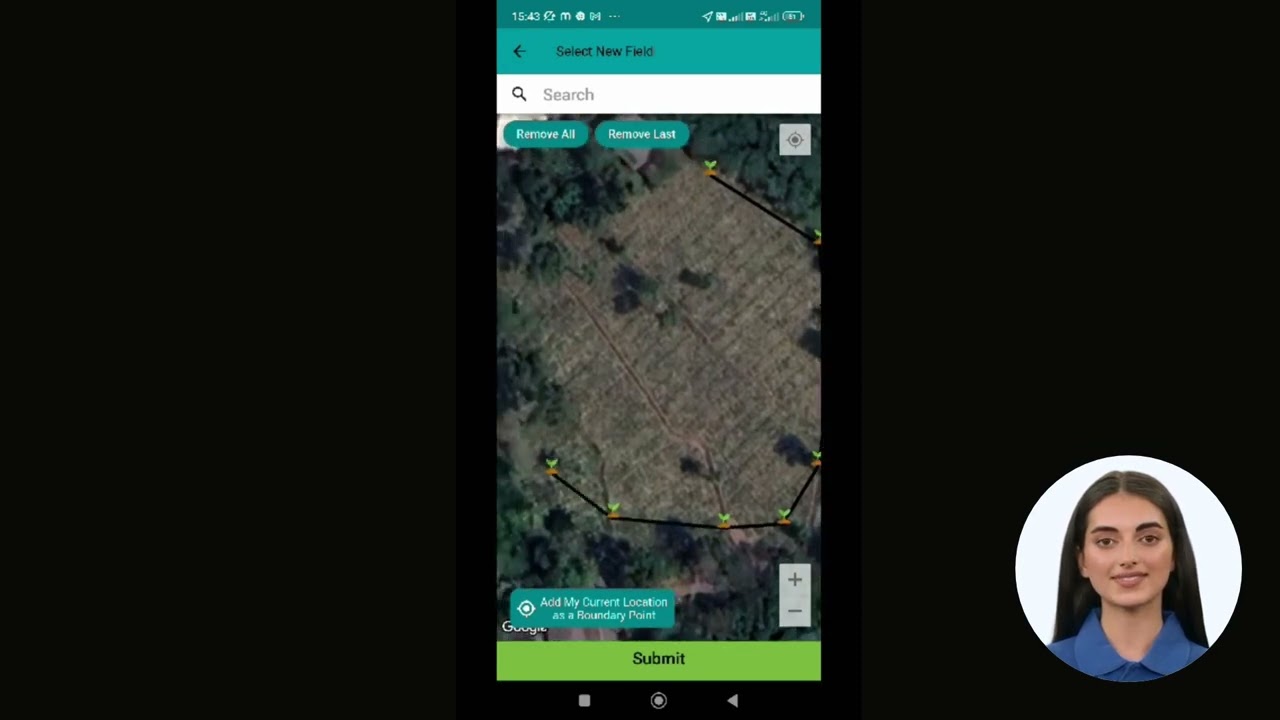
- What works for one zip code routinely fails in the next — which is the entire justification for location-specific data over a single regional calendar. Farms managing multiple non-contiguous fields benefit from large-scale farm management solutions that track GDD per field rather than per farm.
4. Adapting to a Shifting Climate Baseline
- Climate Central found that 97% of US weather stations analyzed have shown increased annual GDD since 1970 — meaning historical planting calendars calibrated even one or two decades ago are increasingly out of date.
- The EEA’s dataset extends this logic forward: its 1950–2100 coverage across 38 countries lets European growers see not just the historical trend but climate-model projections of how their local GDD baseline is expected to keep shifting.
- Practical takeaway: recalibrate planting-date assumptions against current-season GDD data rather than a fixed date carried over from a prior decade.
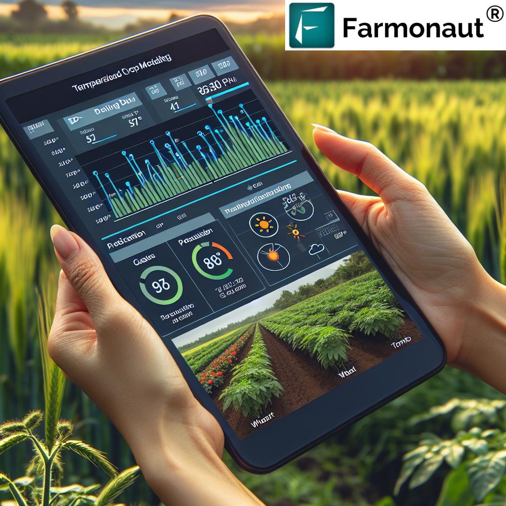
Satellite and AI-Based GDD Monitoring
Satellite-Based GDD Monitoring in Precision Agriculture
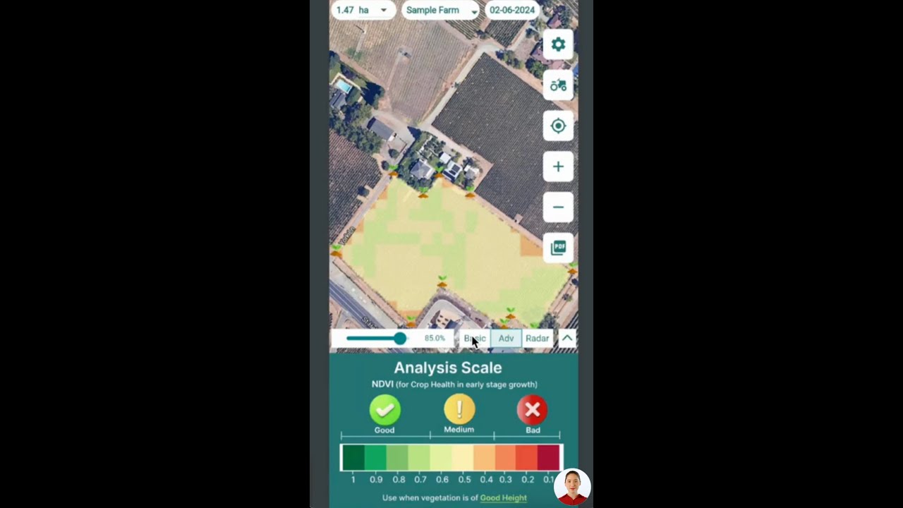
Satellite imagery and AI-based analytics platforms extend zip-code-level GDD lookups into field-by-field monitoring:
- Monitor GDD accumulation in near real time across a field, county, or region, including terrain with meaningful microclimate variation that a single zip-code average can mask.
- Overlay GDD with NDVI crop-health indices, soil moisture, and weather forecasts for a combined view of field status rather than a temperature number in isolation.
- Apply machine learning to pest-emergence and development models that adapt to local microclimate rather than relying on a single regional base-temperature assumption.
Machine Learning and AI: Beyond Temperature Alone
Machine-learning models built on top of raw GDD data incorporate additional variables — moisture, sunlight, wind, and historical field-level records — to produce zip-code- or field-specific recommendations for planting, pest management, irrigation, and harvest timing. Because these models retrain as new observations arrive, their output improves through the season rather than staying fixed to a static base-temperature table.
Farmonaut’s Satellite-Powered GDD and Precision Agriculture Solutions
Farmonaut brings satellite-driven GDD, weather, and precision-agriculture tools directly to growers and agribusinesses:
-
Real-Time Satellite Crop Health Monitoring:
Multispectral imagery lets you visualize temperature trends and GDD accumulation field-by-field through the season, informing irrigation, input, and pest decisions.
Try our app for free -
AI-Based Farm Advisory:
Farmonaut’s Jeevn AI delivers personalized, real-time crop management advice — including weather and GDD analytics — tuned to local microclimates. -
Resource and Fleet Management:
Fleet & Resource Management Tools coordinate machinery use and logistics around live GDD and weather mapping. -
Blockchain-Based Product Traceability:
Trace every crop’s journey from field to fork for compliance, food safety, and sustainability reporting. -
Carbon Footprinting for Climate-Smart Farming:
As GDD baselines shift, measure and adjust operations with Farmonaut’s Carbon Footprint Tracking. -
Large-Scale and Plantation Management:
Specialized tools for managing large agricultural operations, tracking GDD, crop health, and pest risk per field in real time.



All services are available via Web, Android, and iOS apps. For large agribusinesses or research teams, our team supports API integration, project setup, and custom configuration. Try the app for free today.
GDD Accumulation Calculator
Enter your daily high and low temperature, choose a base temperature, and add an optional high-temperature cutoff (Penn State Extension documents 86°F for corn) to see one day’s GDD contribution using the formula above.
Run your own numbers
Assumptions: uses the standard (Tmax+Tmin)/2 − Tbase formula with negative days floored at zero, per Penn State Extension. It does not account for microclimate variation within your zip code, soil temperature, or crop-specific stress thresholds beyond the optional 86°F cutoff — for a live, location-specific total, use the NC State GDD Explorer or USA-NPN AGDD maps linked above.
Farmonaut Subscriptions: Precision Tools for Every Farm
Select a plan to access satellite intelligence, AI-based GDD insights, and precision farm technology for planting, pest management, and sustainability tracking.
FAQ
-
What is the growing degree day formula?
GDD = ((daily max temperature + daily min temperature) / 2) − base temperature for the crop. If the result is negative, use zero. Add each day's value to a running seasonal total. See Penn State Extension for the full documented method, including the 86°F high-temperature cutoff used for corn.
-
Where can I find growing degree days by zip code?
Use NC State's GDD Explorer, USA-NPN AGDD maps, or Farmonaut's satellite-based field monitoring, which updates from live NOAA station data.
-
What is GDD (in one line)?
GDD stands for growing degree days — a measure of accumulated heat above a crop's base temperature, used to predict development stages and pest emergence rather than relying on calendar dates alone.
-
Is LiveGDD (livegdd.com) accurate?
No independent, published accuracy metrics for LiveGDD were found in the research for this article. Check any zip-code GDD tool's disclosed base temperature, weather-station source, and high-temperature cutoff against the Penn State Extension standard, and cross-check its output against the free NC State or USA-NPN tools above.
-
Does GDD apply to vertical crop growing?
Only in a limited sense. Vertical farms set air temperature directly through their climate-control systems rather than depending on outdoor weather, so there is no external heat accumulation to track. The GDD formula only becomes relevant if an operator applies it to their own logged setpoint data to study a crop's response to an intentional temperature change.
-
How do base temperature differences affect my GDD calculation?
Using the wrong base temperature skews every downstream prediction. Per Penn State Extension: US corn and soybeans use 50°F; alfalfa uses 41°F. Per the European Environment Agency, most European crops use a representative base of 5°C (41°F). A gap of even 9°F between the corn/soybean and alfalfa bases meaningfully changes how much of a mild day counts.
-
Can I integrate GDD or weather data into my own app?
Yes — use the Farmonaut Satellite & Weather API (see developer docs) for live GDD, temperature, and crop-monitoring data integration.
-
What is the benefit of satellite-based GDD monitoring over a single zip-code lookup?
A zip-code average can mask field-level microclimate variation. Satellite monitoring tracks GDD accumulation field-by-field, cross-correlated with NDVI crop-health data, giving a more precise picture than a single station-based zip-code number.
-
Is climate change actually shifting GDD totals?
Yes, measurably. Climate Central found that 97% of US weather stations analyzed have recorded increased annual GDD since 1970. The European Environment Agency's dataset, covering 38 countries from 1950 through 2100, shows the same upward trajectory continuing under climate projections.
-
Do you support crop loans or insurance verification using satellite and GDD data?
Yes — satellite tracking can support forest cover verification, replanting monitoring, and evidence for loan or insurance claims. See Farmonaut's crop loan and insurance solutions.
-
How do I get started with Farmonaut's GDD tracking tools?
Download the app, sign up, and start mapping your fields. Our support team assists with onboarding, API integration, and regional configuration.
Conclusion: GDD Is a Method, Not a Single Number
The number a zip-code GDD tool shows you today will be different next season, and the base-temperature standard behind it (50°F for US corn and soybeans, 41°F for alfalfa, 5°C across most of Europe, all per Penn State Extension and the EEA) is what makes that number comparable year over year. What doesn't change is the formula itself — (Tmax + Tmin)/2 − Tbase, floored at zero, capped at 86°F for corn — and the fact that 97% of US weather stations tracked by Climate Central have already shown rising GDD totals since 1970. That trend means the planting and pest-timing calendar that worked a decade ago is a progressively worse fit; the fix is to check current accumulation, not to memorize last year's dates.
For vertical crop growing, none of this zip-code lookup logic applies directly, since indoor climate control removes the outdoor-heat variable the formula was built to track — a distinct enough case that it's worth ruling out early rather than forcing GDD data onto a system that doesn't use it.
Whether you're checking a public zip-code map or monitoring GDD field-by-field via satellite, science-based tracking tied to your specific crop and field, and to your specific location, beats a fixed calendar every time.
Ready to move from a single zip-code number to field-level GDD, NDVI, and weather monitoring? Try Farmonaut today.

 Farmer Amigo
 Cresol
 Atur Kuliner
 MDCV UK
 Zerella Group
 Etech Consulting Madagascar
 Vestlandsforsking
 Agritein
 Delicio
 WB Dev
 Sama Premium
 Prochecker
 Tres Valles
 LACOS Geoinformation
 Magrifly
 LatConnect 60
 Blickwinkel
 Agricultural Credit Policy Council
 Marei Nursery
 eKGIS
eKGIS
