Revolutionizing Kansas Farms: Harnessing Satellite Imagery for Precision Farming and Yield Optimization
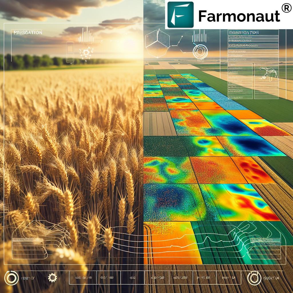
“Satellite imagery can detect up to 90% of field variability, outperforming traditional soil sampling methods for precision farming.”
In the heartland of America, Kansas farms are undergoing a revolutionary transformation. The integration of satellite imagery in agriculture and advanced precision farming techniques is reshaping the landscape of farm management, offering unprecedented insights into crop health, soil conditions, and overall farm productivity. At Farmonaut, we’re at the forefront of this agricultural revolution, providing farmers with cutting-edge tools to optimize their yields and manage resources more efficiently.
The vast plains of Kansas, known for their bountiful wheat and corn harvests, are now becoming testaments to the power of technology in agriculture. By harnessing the potential of satellite data, we’re enabling farmers to create detailed prescription maps and yield maps, offering a comprehensive understanding of their land’s fertility zones. This blog post delves into how these innovative approaches are changing the face of farming in Kansas and beyond.
Understanding Farm Fertility Zones
Farm fertility zones are areas within a field that share similar characteristics in terms of soil properties, topography, and crop response. Identifying these zones is crucial for implementing effective precision farming techniques. Here’s why:
- Optimized Resource Allocation: By understanding the specific needs of different areas within a field, farmers can apply inputs like fertilizers and water more precisely.
- Improved Crop Yields: Tailoring management practices to each zone’s requirements can significantly boost overall productivity.
- Cost Reduction: Precise application of resources means less waste and lower input costs.
- Environmental Stewardship: Targeted use of agricultural inputs reduces the risk of over-application and potential environmental impacts.
At Farmonaut, we use advanced satellite imagery in agriculture to help farmers identify and map these crucial fertility zones. Our technology provides a cost-effective and efficient alternative to traditional methods, making precision agriculture accessible to farms of all sizes.
The Role of Satellite Imagery in Precision Farming

Satellite imagery has emerged as a game-changer in the world of precision agriculture. Here’s how it’s revolutionizing farming practices:
- Comprehensive Field Views: Satellites provide a bird’s-eye view of entire farms, capturing data that would be impossible to gather through ground-level observations alone.
- Regular Monitoring: With frequent satellite passes, farmers can track changes in their fields over time, allowing for timely interventions.
- Multispectral Analysis: Satellites can capture data across various spectral bands, providing insights into crop health, soil moisture, and other vital parameters.
- Cost-Effective Solution: Compared to traditional methods like soil sampling or aerial surveys, satellite imagery offers a more affordable option for farm monitoring.
Our team at Farmonaut leverages this powerful technology to provide Kansas farmers with actionable insights. By analyzing satellite data, we can create detailed maps that highlight variations in crop health, soil properties, and potential yield across different areas of a field.
Creating Prescription Maps for Precision Farming
“Farmers using satellite-based prescription maps have reported yield increases of 10-15% while reducing input costs by 20%.”
Prescription maps are a cornerstone of modern precision agriculture. These maps provide a visual guide for variable-rate application of inputs like fertilizers, seeds, and pesticides. Here’s how we at Farmonaut create these invaluable tools:
- Data Collection: We gather multi-temporal satellite imagery of the farm throughout the growing season.
- Vegetation Index Calculation: Using spectral data, we compute vegetation indices like NDVI (Normalized Difference Vegetation Index) to assess crop health and vigor.
- Zone Delineation: Based on the vegetation indices and other parameters, we identify distinct management zones within the field.
- Prescription Generation: For each zone, we recommend specific input rates based on crop needs and soil conditions.
- Map Creation: The final step involves creating user-friendly maps that can be easily integrated with farm machinery for precise application.
These prescription maps enable Kansas farmers to apply the right amount of inputs at the right place and time, optimizing resource use and maximizing yields.
Yield Mapping: Understanding Productivity Patterns
Yield mapping is another crucial aspect of precision farming that we specialize in at Farmonaut. By analyzing historical yield data alongside satellite imagery, we can create comprehensive yield maps that offer valuable insights into field productivity. Here’s why yield mapping is essential:
- Identifying High and Low-Yielding Areas: Farmers can pinpoint which parts of their fields consistently perform well or poorly.
- Correlation with Other Factors: Yield patterns can be compared with soil types, elevation data, and other variables to understand influencing factors.
- Informing Future Decisions: Historical yield data helps in planning crop rotations, adjusting input levels, and making informed management decisions.
- Measuring ROI: Farmers can assess the return on investment for different areas of their fields and adjust strategies accordingly.
Our yield mapping technology combines satellite data with on-ground yield monitor information to create accurate, detailed maps of crop productivity across entire farms.
Soil Variation Analysis: The Foundation of Precision Farming
Understanding soil variation is fundamental to effective precision farming. In Kansas, where soil types can vary significantly even within a single field, this analysis is particularly crucial. At Farmonaut, we use satellite imagery and advanced data analysis techniques to map soil variations across farms. Here’s how it benefits farmers:
- Tailored Nutrient Management: Different soil types require different nutrient applications. Our soil variation maps help farmers adjust their fertilizer strategies accordingly.
- Water Management: Soil type influences water retention and drainage. Understanding these variations allows for more efficient irrigation practices.
- Crop Selection: Some crops perform better in certain soil types. Our analysis helps farmers make informed decisions about what to plant where.
- Targeted Soil Sampling: By identifying distinct soil zones, we can guide more efficient and representative soil sampling strategies.
By integrating soil variation data with other parameters like elevation and crop response, we create a comprehensive picture of each farm’s unique characteristics, enabling truly customized management strategies.
The Impact of Elevation and Topography on Farm Management
In the rolling landscapes of Kansas, elevation and topography play a significant role in farm productivity. Our satellite-based analysis takes these factors into account, providing farmers with insights into how land contours affect their crops. Here’s why this matters:
- Water Flow and Erosion: Understanding the topography helps in managing water runoff and preventing soil erosion.
- Microclimate Effects: Elevation changes can create microclimates within a field, affecting crop growth and pest pressures.
- Machinery Efficiency: Topographical data aids in optimizing the paths of farm equipment, improving operational efficiency.
- Frost Risk Assessment: Low-lying areas may be more susceptible to frost, influencing planting and harvesting decisions.
By incorporating elevation data into our analysis, we provide Kansas farmers with a more complete understanding of their land, enabling them to make better-informed decisions about crop management and resource allocation.
Remote Sensing for Crop Management: Beyond Visible Light
Remote sensing technology, particularly through satellite imagery, offers insights that go far beyond what the human eye can see. At Farmonaut, we utilize multispectral and hyperspectral imaging to provide Kansas farmers with a wealth of information about their crops. Here’s how advanced remote sensing benefits crop management:
- Early Stress Detection: Spectral analysis can reveal crop stress before visible symptoms appear, allowing for timely interventions.
- Nutrient Status Assessment: Certain spectral bands can indicate the nutrient status of crops, guiding fertilization strategies.
- Pest and Disease Monitoring: Remote sensing can help identify areas of pest infestation or disease outbreak, enabling targeted treatment.
- Crop Phenology Tracking: By monitoring crop development stages, farmers can optimize timing for various management activities.
Our remote sensing capabilities provide Kansas farmers with a powerful tool for proactive crop management, helping them stay ahead of potential issues and optimize their yields.
Vegetation Performance Maps: A Window into Crop Health
Vegetation performance maps are a key output of our satellite-based analysis at Farmonaut. These maps provide a visual representation of crop health and vigor across entire fields. Here’s why they’re invaluable for Kansas farmers:
- Identifying Problem Areas: Areas of poor crop performance are easily spotted, allowing for targeted investigation and intervention.
- Tracking Seasonal Progress: By comparing maps over time, farmers can monitor how their crops develop throughout the growing season.
- Validating Management Decisions: The impact of different management practices can be visualized and assessed using these maps.
- Yield Prediction: Vegetation performance is often correlated with final yield, providing early insights into potential harvest outcomes.
Our advanced algorithms process satellite data to create these detailed performance maps, offering Kansas farmers a powerful tool for monitoring and optimizing their crop production.
The Correlation Between Vegetation Maps and Actual Yields
One of the most powerful aspects of vegetation performance maps is their ability to predict and correlate with actual crop yields. At Farmonaut, we’ve developed sophisticated models that link satellite-derived vegetation indices with on-the-ground yield data. Here’s why this correlation is so valuable:
- Early Yield Estimation: Farmers can get a preview of potential yields well before harvest, aiding in planning and marketing decisions.
- Identifying Yield-Limiting Factors: Areas of lower predicted yield can be investigated to determine and address limiting factors.
- Validating Management Practices: The impact of different management strategies on yield can be assessed and quantified.
- Improving Future Decision-Making: Historical correlations between vegetation maps and yields inform more accurate predictions and better management decisions in subsequent seasons.
By providing this correlation analysis, we empower Kansas farmers to make data-driven decisions that optimize their yields and profitability.
The Evolution of Fertility Zones Over Time
Farm fertility zones are not static; they can change over time due to various factors such as crop rotations, management practices, and environmental conditions. At Farmonaut, we help farmers track these changes through continuous monitoring and analysis. Here’s why understanding the evolution of fertility zones is crucial:
- Adaptive Management: As zones change, management strategies can be adjusted to maintain optimal productivity.
- Long-Term Soil Health: Tracking zone changes over time provides insights into the long-term impacts of different farming practices on soil health.
- Resource Allocation: Understanding how zones evolve helps in more efficient allocation of resources like fertilizers and water over time.
- Crop Rotation Planning: Changes in fertility zones can inform decisions about crop rotations and variety selection.
Our long-term satellite monitoring and analysis capabilities allow Kansas farmers to stay ahead of these changes, ensuring their management practices remain optimized year after year.
Technical Steps in Creating Prescription and Yield Maps
At Farmonaut, we employ a rigorous process to create accurate and useful prescription and yield maps. Here’s an overview of the technical steps involved:
- Data Acquisition:
- Collect multi-temporal satellite imagery
- Gather historical yield data and soil test results
- Incorporate weather data and topographical information
- Data Preprocessing:
- Atmospheric correction of satellite imagery
- Geo-referencing and co-registration of all data layers
- Quality control to remove any anomalies or errors
- Analysis and Modeling:
- Calculate vegetation indices (e.g., NDVI, EVI)
- Perform time-series analysis to track crop development
- Apply machine learning algorithms to identify patterns and correlations
- Zone Delineation:
- Use clustering algorithms to identify homogeneous zones
- Incorporate expert knowledge and farmer input for zone refinement
- Prescription Generation:
- Develop input recommendations based on zone characteristics
- Calibrate recommendations with local agronomic knowledge
- Map Creation:
- Generate high-resolution maps using GIS software
- Ensure compatibility with farm machinery for variable-rate applications
- Validation and Refinement:
- Compare map outputs with ground-truth data
- Continuously refine models based on feedback and results
This comprehensive process ensures that the maps we provide to Kansas farmers are not only accurate but also practical and actionable for real-world farm management.
Comparing Zoning Approaches for Precision Farming
While satellite imagery is our primary tool for creating farm management zones, it’s important to understand how it compares to other methods. Here’s a comparison of different zoning approaches:
| Zoning Method | Data Collection Process | Farm Size Suitability | Cost Estimate ($/acre) | Time to Implement | Accuracy Level | Key Benefits |
|---|---|---|---|---|---|---|
| Satellite Imagery | Remote sensing | All sizes | $0.50 – $2.00 | 1-2 days | High | Comprehensive coverage, frequent updates, non-invasive |
| Soil Sampling | On-site collection | Small to medium | $3.00 – $10.00 | 1-2 weeks | Medium to High | Detailed soil nutrient analysis, direct measurement |
| Yield Monitoring | On-board sensors | Medium to large | $2.00 – $5.00 | Ongoing (harvest time) | Medium | Direct yield measurement, historical performance tracking |
As evident from this comparison, satellite imagery offers a unique combination of affordability, speed, and comprehensive coverage, making it the most practical choice for farms of all sizes in Kansas.
Integrating Satellite Data with Other Farming Technologies
At Farmonaut, we understand that satellite imagery is just one piece of the precision farming puzzle. To maximize its benefits, we integrate our satellite-based insights with other farming technologies. Here’s how this integration enhances farm management:
- IoT Sensors: Combining satellite data with ground-based IoT sensors provides a more complete picture of field conditions.
- Weather Stations: Integrating local weather data helps in interpreting satellite imagery and refining management decisions.
- Drones: While satellites provide broad coverage, drones can offer high-resolution imagery for specific areas of interest.
- Farm Management Software: Our satellite-derived maps and insights can be seamlessly integrated into broader farm management platforms.
- Variable-Rate Machinery: Our prescription maps are designed to be compatible with modern variable-rate application equipment.
This integrated approach ensures that Kansas farmers can leverage the full potential of precision agriculture technologies, with satellite imagery serving as a foundational data source.
The Role of AI and Machine Learning in Satellite-Based Farming
Artificial Intelligence (AI) and Machine Learning (ML) are integral to our satellite-based farming solutions at Farmonaut. These technologies enable us to process vast amounts of data and extract meaningful insights for Kansas farmers. Here’s how AI and ML enhance our services:
- Pattern Recognition: ML algorithms can identify complex patterns in satellite imagery that might be missed by human analysis.
- Predictive Modeling: AI helps in creating accurate yield prediction models based on historical data and current conditions.
- Anomaly Detection: Machine learning algorithms can quickly identify anomalies in crop health or field conditions, alerting farmers to potential issues.
- Automated Classification: AI assists in classifying different crop types and growth stages across large areas.
- Decision Support: Our AI-powered systems provide tailored recommendations based on the analysis of multiple data sources.
By leveraging these advanced technologies, we’re able to provide Kansas farmers with more accurate, timely, and actionable insights for improved farm management.
Sustainable Agriculture Practices Through Precision Farming
At Farmonaut, we’re committed to promoting sustainable agriculture practices through our precision farming solutions. By enabling more efficient use of resources, our satellite-based technologies contribute to environmental stewardship. Here’s how:
- Reduced Chemical Use: Precise application of fertilizers and pesticides minimizes excess use and potential runoff.
- Water Conservation: Targeted irrigation based on satellite-derived soil moisture maps helps conserve water resources.
- Soil Health Preservation: By optimizing inputs and practices, farmers can maintain and improve soil health over time.
- Carbon Footprint Reduction: More efficient farm operations lead to reduced fuel consumption and lower carbon emissions.
- Biodiversity Protection: Precision management allows for the creation of wildlife corridors and protection of sensitive areas within farms.
Our technology empowers Kansas farmers to not only improve their productivity but also to become better stewards of the land, ensuring sustainable farming practices for future generations.
The Future of Satellite-Based Precision Farming
As we look to the future, the potential for satellite-based precision farming continues to expand. At Farmonaut, we’re constantly innovating to stay at the forefront of this technology. Here are some exciting developments on the horizon:
- Higher Resolution Imagery: Advances in satellite technology will provide even more detailed insights into field conditions.
- Real-Time Analysis: Improvements in data processing and transmission will allow for near-real-time analysis and decision-making.
- Integration with Autonomous Systems: Satellite data will increasingly be used to guide autonomous farm equipment for truly precise operations.
- Advanced Crop Modeling: More sophisticated models will provide even more accurate predictions of crop development and yield.
- Blockchain Integration: Incorporating blockchain technology will enhance traceability and transparency in the agricultural supply chain.
These advancements will further empower Kansas farmers to optimize their operations, increase yields, and contribute to sustainable agriculture practices.
Getting Started with Farmonaut’s Satellite-Based Solutions
Ready to revolutionize your farming practices with satellite-based precision agriculture? Here’s how you can get started with Farmonaut:
- Explore Our Platform: Visit our website to learn more about our services and how they can benefit your farm.
- Sign Up for a Free Trial: Experience the power of our satellite-based insights with a no-obligation trial period.
- Customize Your Solution: Work with our team to tailor our services to your specific farm needs and goals.
- Integration and Training: We’ll help you integrate our tools with your existing farm management systems and provide training for you and your team.
- Ongoing Support: Our expert support team is always available to help you make the most of our technology.
To get started, simply click on the link below to access our web application:
For mobile users, our app is available on both Android and iOS platforms:
For developers interested in integrating our satellite and weather data into their own applications, we offer a robust API. You can find more information and access our API at:
For detailed documentation on how to use our API, please visit:
Subscription Options
Choose the plan that best fits your farming needs:
Frequently Asked Questions
Q: How often is satellite imagery updated?
A: Our satellite imagery is typically updated every 3-5 days, depending on weather conditions and satellite availability.
Q: Can satellite imagery detect specific crop diseases?
A: While satellite imagery can’t directly identify specific diseases, it can detect anomalies in crop health that may indicate disease presence, prompting further investigation.
Q: How accurate are yield predictions based on satellite data?
A: Our yield predictions have shown accuracy rates of 85-90% when compared to actual harvest data, though this can vary depending on factors like crop type and weather conditions.
Q: Is Farmonaut’s technology suitable for small farms?
A: Absolutely! Our solutions are scalable and can benefit farms of all sizes, from small family operations to large commercial enterprises.
Q: How does Farmonaut handle data privacy and security?
A: We take data privacy very seriously. All farm data is encrypted and securely stored, and we never share individual farm data without explicit permission.
Conclusion
The integration of satellite imagery and precision farming techniques is truly revolutionizing agriculture in Kansas and beyond. At Farmonaut, we’re proud to be at the forefront of this technological revolution, providing farmers with the tools they need to optimize their yields, reduce costs, and practice sustainable agriculture.
From creating detailed prescription maps to analyzing soil variations and predicting yields, our satellite-based solutions offer a comprehensive approach to modern farm management. By harnessing the power of data and technology, we’re empowering farmers to make more informed decisions, leading to increased productivity and profitability.
As we look to the future, the potential for satellite-based precision farming continues to grow. With ongoing advancements in satellite technology, AI, and machine learning, the capabilities of these systems will only become more sophisticated and valuable to farmers.
We invite Kansas farmers and agricultural professionals to join us on this exciting journey. Whether you’re looking to optimize your current operations or explore new possibilities in precision agriculture, Farmonaut is here to support you every step of the way.
Together, we can build a more efficient, sustainable, and prosperous future for agriculture in Kansas and around the world. Let’s revolutionize farming, one satellite image at a time.


