
Revolutionizing Midwest Agriculture: How Precision Technology and Satellite Imagery Are Transforming Crop Management
“Satellite imagery in agriculture can increase crop yields by up to 10% through precise field management and resource optimization.”
In the heartland of America, a quiet revolution is taking place. The vast fields of corn, soybeans, and wheat that have long defined the Midwest landscape are undergoing a profound transformation. At the forefront of this change are precision agriculture solutions and crop monitoring technology, powered by satellite imagery and advanced digital tools. These innovations are not just changing how we farm; they’re reshaping the entire agronomy cooperative industry.
As we delve into this exciting new world of agriculture, we’ll explore how these cutting-edge technologies are empowering farmers to make data-driven decisions, optimize resource use, and boost productivity while promoting sustainability. From satellite-based crop health monitoring to AI-driven advisory systems, we’re witnessing a new era in farming that promises to meet the challenges of feeding a growing global population while preserving our precious natural resources.

The Rise of Precision Agriculture in the Midwest
The Midwest, often referred to as America’s breadbasket, has long been at the forefront of agricultural innovation. Today, this region is embracing precision agriculture solutions with unprecedented enthusiasm. These technologies are helping farmers tackle some of their most pressing challenges, from unpredictable weather patterns to resource constraints and market volatility.
At the heart of this agricultural revolution is satellite imagery for agriculture. High-resolution satellite images provide farmers with a bird’s-eye view of their fields, offering insights that were previously unimaginable. This technology, combined with advanced analytics, is transforming how farmers approach crop management, soil health, and resource allocation.
- Real-time crop monitoring: Satellite imagery allows farmers to track crop health and growth patterns throughout the growing season.
- Precision resource management: By identifying areas of stress or low productivity, farmers can apply inputs like water, fertilizers, and pesticides with pinpoint accuracy.
- Early problem detection: Satellite imagery can reveal issues like pest infestations or disease outbreaks before they become visible to the naked eye.
One of the pioneers in bringing these technologies to farmers is Farmonaut, a company dedicated to making precision agriculture accessible and affordable. Through its innovative platform, Farmonaut is helping Midwest farmers harness the power of satellite imagery and AI to transform their operations.

Satellite Imagery: The Eyes in the Sky
Satellite imagery has become an indispensable tool in modern agriculture. By providing a comprehensive and up-to-date view of fields, it enables farmers to make informed decisions about crop management, resource allocation, and harvest timing. Here’s how satellite imagery is revolutionizing Midwest agriculture:
- Crop Health Monitoring: Multispectral satellite images can reveal the health of crops by analyzing their reflectance patterns. The Normalized Difference Vegetation Index (NDVI) is particularly useful in assessing crop vigor and identifying areas of stress.
- Soil Moisture Analysis: Satellites can detect variations in soil moisture across fields, helping farmers optimize irrigation schedules and prevent water stress or overwatering.
- Yield Prediction: By analyzing historical satellite data and current crop conditions, farmers can make more accurate yield predictions, which is crucial for planning and marketing.
- Field Boundary Mapping: Precise field boundary mapping helps in accurately calculating field sizes and planning operations more efficiently.
Farmonaut’s platform leverages these capabilities to provide farmers with actionable insights. By integrating satellite data with other sources of information, such as weather forecasts and soil data, Farmonaut offers a comprehensive view of farm conditions that guides decision-making throughout the growing season.

Digital Agriculture Tools: From Data to Decisions
While satellite imagery provides the raw data, it’s the digital agriculture tools that transform this information into actionable insights. These tools are the brains behind precision agriculture, analyzing vast amounts of data to guide farmers in their day-to-day decisions.
“Precision agriculture technologies can reduce water usage in farming by up to 30%, promoting sustainable agricultural practices.”
Some of the key digital agriculture tools revolutionizing Midwest farming include:
- Field Management Software: These platforms integrate various data sources, including satellite imagery, soil tests, and weather forecasts, to provide a comprehensive view of field conditions.
- Yield Prediction Analytics: By analyzing historical data and current conditions, these tools help farmers forecast yields more accurately, aiding in marketing and financial planning.
- Precision Planting Systems: These systems use GPS and other technologies to ensure optimal seed spacing and depth, maximizing yield potential.
- Variable Rate Technology (VRT): VRT allows farmers to apply inputs like fertilizers and pesticides at variable rates across a field, optimizing resource use and crop performance.
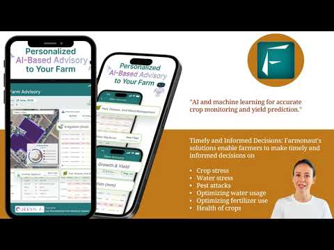
Farmonaut’s Jeevn AI Advisory System is a prime example of how these digital tools are being put to work. This AI-driven system analyzes satellite data, weather patterns, and other inputs to provide personalized recommendations for crop management, helping farmers make informed decisions about everything from planting dates to harvest timing.
Explore Farmonaut’s API for advanced agricultural data integration
Sustainable Farming Practices: Technology Meets Ecology
As the agricultural industry faces increasing pressure to reduce its environmental impact, precision agriculture technologies are playing a crucial role in promoting sustainable farming practices. By optimizing resource use and minimizing waste, these technologies are helping Midwest farmers produce more while treading more lightly on the environment.
- Water Conservation: Precision irrigation systems, guided by satellite-derived soil moisture data, can reduce water usage by up to 30%.
- Reduced Chemical Use: By applying fertilizers and pesticides only where and when they’re needed, farmers can significantly reduce chemical runoff and environmental pollution.
- Soil Health Management: Advanced soil testing and mapping technologies help farmers maintain and improve soil health, reducing erosion and preserving this vital resource for future generations.
- Carbon Management: Some precision agriculture tools can help farmers measure and manage their carbon footprint, opening up opportunities for carbon credit programs.
Farmonaut’s platform incorporates features specifically designed to support sustainable farming practices. Its carbon footprinting tool, for instance, allows agribusinesses to track their emissions in real-time, enabling them to take proactive steps towards reducing their environmental impact.

Agricultural Data Management: The New Currency
In the era of precision agriculture, data has become as valuable as the crops themselves. Effective agricultural data management is crucial for making sense of the vast amounts of information generated by various technologies and turning it into actionable insights.
Key aspects of agricultural data management include:
- Data Collection: From satellite imagery to IoT sensors in the field, data is collected from multiple sources.
- Data Integration: Combining data from various sources to create a comprehensive picture of farm operations.
- Data Analysis: Using advanced analytics and AI to derive insights from the collected data.
- Data Visualization: Presenting complex data in easy-to-understand formats, such as maps and charts.
- Data Security: Ensuring the privacy and security of sensitive farm data.
Farmonaut’s platform excels in agricultural data management, providing farmers with a user-friendly interface to access and analyze their farm data. The platform’s blockchain-based traceability solution also ensures the security and integrity of data throughout the agricultural supply chain.
Grain Marketing Strategies in the Digital Age
The advent of precision agriculture and digital tools has not only transformed how crops are grown but also how they’re marketed. In the Midwest, where grain production is a cornerstone of the agricultural economy, these technologies are reshaping grain marketing strategies.
Here’s how technology is influencing grain marketing:
- Real-time Market Data: Farmers now have access to up-to-the-minute market information, allowing them to make more informed selling decisions.
- Yield Prediction: Accurate yield forecasts enabled by satellite imagery and AI help farmers plan their marketing strategies well in advance of harvest.
- Quality Analysis: Advanced sensors can provide detailed information about grain quality, helping farmers target specific markets or buyers.
- Online Marketplaces: Digital platforms are connecting farmers directly with buyers, potentially increasing profitability by cutting out middlemen.
- Risk Management Tools: Sophisticated software helps farmers analyze market trends and manage price risks more effectively.
While Farmonaut doesn’t directly handle grain marketing, its yield prediction and crop classification tools provide valuable data that can inform marketing decisions. By giving farmers a clearer picture of their expected production, Farmonaut helps them develop more effective marketing strategies.
Access Farmonaut’s API Developer Docs for integration guidance
The Role of Agronomy Cooperative Services
Agronomy cooperative services play a crucial role in bringing the benefits of precision agriculture to farmers across the Midwest. These cooperatives serve as a bridge between cutting-edge technology and practical, on-the-ground implementation.
Key services provided by agronomy cooperatives include:
- Technology Adoption Support: Helping farmers understand and implement new precision agriculture technologies.
- Agronomic Consulting: Providing expert advice on crop management, informed by the latest data and research.
- Custom Application Services: Using precision technology to apply fertilizers, pesticides, and other inputs with maximum efficiency.
- Data Analysis and Interpretation: Helping farmers make sense of the vast amounts of data generated by precision agriculture tools.
- Equipment Sales and Support: Offering the latest in precision agriculture equipment and providing ongoing technical support.
While Farmonaut is not an agronomy cooperative, its platform can be a valuable tool for these organizations. By providing access to satellite imagery and advanced analytics, Farmonaut enables cooperatives to offer more data-driven, personalized services to their members.

Advanced Field Analytics: Beyond the Basics
As precision agriculture technologies continue to evolve, we’re seeing the emergence of increasingly sophisticated field analytics tools. These advanced analytics are taking farm management to new levels of precision and efficiency.
Some of the cutting-edge field analytics capabilities include:
- Predictive Analytics: Using historical data and machine learning to predict future trends in crop health, pest outbreaks, and yield potential.
- Prescriptive Analytics: Going beyond predictions to offer specific recommendations for actions farmers should take to optimize outcomes.
- Multi-spectral Analysis: Using data from multiple spectral bands to gain deeper insights into crop health and soil conditions.
- Crop Classification: Automatically identifying and mapping different crop types across large areas, aiding in regional planning and market analysis.
- Harvest Monitoring: Real-time tracking of harvest progress and yield variations across fields.
Farmonaut’s platform incorporates many of these advanced analytics capabilities. Its field detection system, for instance, uses AI and satellite imagery to automatically identify and map field boundaries, saving farmers time and improving the accuracy of their management practices.

The Future of Midwest Agriculture: Trends and Predictions
As we look to the future of agriculture in the Midwest, several trends are emerging that promise to further transform the industry:
- Increased Automation: From self-driving tractors to robotic harvesters, automation will play an increasingly important role in farm operations.
- AI-Driven Decision Making: Artificial intelligence will become more sophisticated, offering increasingly accurate predictions and recommendations.
- Blockchain in Agriculture: Blockchain technology will enhance traceability and transparency throughout the agricultural supply chain.
- Climate-Smart Agriculture: As climate change impacts become more pronounced, technologies that help farmers adapt and mitigate their environmental impact will be crucial.
- Vertical and Urban Farming: While not replacing traditional farming, these innovative approaches will complement Midwest agriculture, especially in peri-urban areas.
Farmonaut is well-positioned to play a key role in this future, with its focus on accessible, cutting-edge technologies that empower farmers to meet these emerging challenges and opportunities.

Precision Agriculture Technologies Impact Matrix
| Technology | Primary Benefits | Resource Optimization | Yield Improvement | Sustainability Impact |
|---|---|---|---|---|
| Satellite Crop Monitoring | Real-time crop health assessment | 20-30% water savings | 5-10 bushels/acre increase | High |
| Soil Moisture Analytics | Precision irrigation | 25-35% water savings | 3-7 bushels/acre increase | High |
| Yield Prediction Software | Accurate harvest planning | 10-15% resource efficiency | 2-5 bushels/acre increase | Medium |
| Farmonaut’s Field Detection System | Automated field boundary mapping | 15-25% input optimization | 4-8 bushels/acre increase | High |
Conclusion: Embracing the Agricultural Revolution
The transformation of Midwest agriculture through precision technology and satellite imagery represents a new chapter in the story of American farming. By embracing these innovations, farmers are not only increasing their productivity and profitability but also contributing to a more sustainable and resilient food system.
As we’ve explored, technologies like satellite imagery, AI-driven analytics, and blockchain are revolutionizing every aspect of agriculture, from planting to harvest to marketing. Companies like Farmonaut are at the forefront of this revolution, making these powerful tools accessible to farmers of all sizes.
The future of Midwest agriculture is bright, with precision technologies paving the way for smarter, more efficient, and more sustainable farming practices. As these technologies continue to evolve, they promise to help farmers meet the growing global demand for food while preserving the land for future generations.
For those ready to take the next step in their farming journey, Farmonaut offers a range of solutions to help you harness the power of precision agriculture. Whether you’re looking to optimize your crop management, improve your yield predictions, or enhance your sustainability practices, Farmonaut has the tools to help you succeed in the new era of digital agriculture.

Frequently Asked Questions
- What is precision agriculture?
Precision agriculture is an approach to farm management that uses information technology and a wide array of items such as GPS guidance, control systems, sensors, robotics, drones, autonomous vehicles, variable rate technology, GPS-based soil sampling, automated hardware, telematics, and software to optimize returns on inputs while preserving resources. - How does satellite imagery benefit farmers?
Satellite imagery provides farmers with a bird’s-eye view of their fields, allowing them to monitor crop health, detect issues early, optimize resource use, and make more informed decisions about planting, fertilizing, and harvesting. - What is NDVI and why is it important in agriculture?
NDVI (Normalized Difference Vegetation Index) is a measure of plant health derived from satellite imagery. It’s important because it helps farmers assess crop vigor, stress, and potential yield across their fields. - How can Farmonaut’s technology help improve farm productivity?
Farmonaut’s technology provides real-time crop monitoring, AI-driven insights, and advanced analytics that help farmers optimize their operations, leading to improved resource use, better crop health, and potentially higher yields. - Is precision agriculture only for large farms?
No, precision agriculture can benefit farms of all sizes. While some technologies may have been initially developed for larger operations, companies like Farmonaut are making these tools accessible and affordable for smaller farms as well.


