Colorado Forest Management: Powerful New Tracker Maps 1.5M Acres
Transforming Colorado forest management with innovative technology—explore how a new tracker revolutionizes forest restoration, wildfire mitigation, and transparency across 1.5 million acres.
“Colorado’s new forest tracker maps 1.5 million acres, providing real-time data on management and wildfire mitigation activities.”
- Introduction: Technology and Innovation in Colorado Forest Management
- The Colorado Forest Tracker: A Game Changer for Forest Management
- Benefits and Core Features of the Forest Tracker Online Tool
- Mapping 1.5 Million Acres: Data-Driven Wildfire Mitigation Efforts in Colorado
- Forest Activity Database Colorado: What the Data Tells Us
- Colorado Forest Tracker Impact Overview Table
- Advancing Forest Restoration Activities and Transparency
- Community Engagement: How the Tracker Helps Coloradans
- The Role of Satellite Technology and GIS in Colorado Forest Management
- Innovative Solutions Empowering Forest and Farm Management
- Explore Forest Technology in Action: Video Highlights
- How to Get Involved: Accessing and Contributing to the Tracker
- FAQs: Colorado Forest Management, Tracker Tool & Fire Data
- Conclusion: The Future of Colorado Forest Management
Introduction: Technology and Innovation in Colorado Forest Management
As wildfires become increasingly intense and restoration needs grow, Colorado’s approach to forest management demands bold innovation. Our forests, spanning the Rocky Mountains to the Eastern Plains, cover millions of acres, affecting everything from wildlife habitat to watershed protection and recreation. In 2025, Colorado forest management has reached a pivotal moment—with the launch of a powerful, tech-driven tracker that maps 1.5 million acres, connecting people, data, and action like never before.
Denver has become the center of statewide collaborative efforts in wildfire mitigation efforts colorado. Developed by the Colorado State Forest Service and the Colorado Forest Restoration Institute at Colorado State University, a new forest tracker online tool now allows us to monitor management, restoration, and prevention efforts in real time. Let’s explore how this transformation makes Colorado a national leader in environmental stewardship and wildfire resilience.
The Colorado Forest Tracker: A Game Changer for Forest Management
The new Colorado Forest Tracker is the centerpiece of innovation for statewide wildfire prevention and forest restoration activities. By leveraging numerous data sources—federal, state, and local—and integrating these into an accessible, interactive online database, the tracker brings extensive transparency to forestry operations statewide.
The tracker collects and standardizes management activity data across 51 of Colorado’s 64 counties. It provides clarity on where trees and bushes have been cut down, where prescribed burns colorado have reduced fuel loads, and where new trees are being planted (see the Colorado tree planting map). This expansive vision empowers us all to make informed decisions, anticipate wildfire risks, support restoration, and participate in the ongoing stewardship of our local landscapes.


With the new forest tracker online tool, Colorado is not just responding to wildfire and restoration challenges—we are shaping the future of forest management through transparent, data-driven strategies.
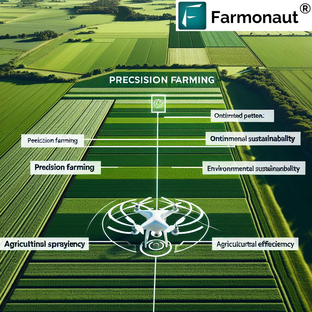
Benefits and Core Features of the Forest Tracker Online Tool
- Comprehensive Mapping: The tracker covers 1.5 million acres—a significant portion of Colorado’s forested landscape.
- Centralized Online Database: Data from federal, state, and local organizations is collected and standardized, ensuring easy comparisons and reliable reporting on forest management activities.
- Interactive GIS Map: The online map visualizes a wide array of forestry activities, making complex information digestible to landowners, firefighters, researchers, and the public.
- Wildfire Mitigation Efforts Colorado: Users gain real-time visibility into where wildfire mitigation and fuel reduction projects are underway—critical for statewide wildfire prevention.
- Forest Restoration Activities: Track projects ranging from tree planting to prescribed burns and canopy management.
- Public Engagement: Anyone can explore forest management activity in their area or throughout the state, helping to foster shared responsibility and informed civic participation.
Learn how satellite and AI technology powers precise tree mapping—essential for modern forest management.
Mapping 1.5 Million Acres: Data-Driven Wildfire Mitigation Efforts in Colorado
Managing wildfire risk is at the heart of Colorado forest management. Recent years have shown the catastrophic potential of uncontrolled wildfires—affecting communities, infrastructure, and ecosystems. Since 2000, approximately 4 million acres have burned across the state. In response, mitigation efforts have rapidly scaled up: today, more than 1.5 million acres of forests in 51 out of 64 counties are tracked for ongoing forest activities and interventions.
Understanding where prescribed burns, thinning of bushes and trees, or replanting is happening allows emergency responders and policy makers to focus resources for maximum impact. The forest tracker online tool provides an unprecedented level of accessibility—making forest fire data colorado visible, actionable, and easy to interpret.
“Over 1.5 million acres of Colorado forests are now monitored online, revolutionizing restoration and management transparency.”
Forest Activity Database Colorado: What the Data Tells Us
The forest activity database colorado collects a wide spectrum of forestry activity records, forming a comprehensive, time-stamped archive of what is happening across our forested lands. Activities are categorized by type, location, and timing—everything from prescribed burns colorado on rangelands to canopy pruning in mountain corridors, as well as efforts on the Eastern Plains.
Key insights revealed by the database include:
- The canopy and surface management activities help quantify how much vegetation remains that may fuel future wildfires.
- Tracking restoration activities allows us to measure recovery and health of burned areas, and monitor the growth and survival of newly planted trees.
- Prescribed burns data aids fire prevention by showing what areas have already had hazardous debris and fuels removed safely.
Understanding these metrics is vital for improving management, ensuring public safety, and communicating a unified environmental strategy across counties and regions.
Watch how machine learning and remote sensing shape large-scale land and forest analytics.
Colorado Forest Tracker Impact Overview Table
To bring clarity to the tracker’s reach and value, we have assembled a comparative overview of its main functions, estimated impact area, and usability.
Advancing Forest Restoration Activities and Transparency
Forest restoration activities not only address landscapes affected by wildfires but play a crucial role in ecosystem health by improving habitat, air quality, and water resources. With the tracker, we all stay informed about trees planted, canopy management, prescribed fire applications, and surface rehabilitation projects.
- Projects on the plains receive visibility alongside those in mountain and woodland regions, ensuring inclusive statewide management.
- The expanded online map raises awareness and increases accountability, supporting strategic allocation of funding and labor for urgent projects.
- Restoration efforts are tracked by county, date, method, and outcome, creating a transparent public record and fostering trust in service providers and land managers.
Anyone interested in forest health—from hikers and hunters to policy advocates—can see how Colorado is tending to its most precious natural resources in real time thanks to this advanced tool.
See polygon mapping and daily satellite data interpretation in action—tools that bridge agriculture and forestry data needs.
Community Engagement: How the Tracker Helps Coloradans
One standout benefit of the Colorado forest activity database is its role in uniting communities, agencies, and individuals under a single mapping and reporting umbrella. Some key advantages:
- Transparency for Residents: Locals in Denver, Colorado Springs, rural counties, and on the plains can all check current and planned forestry interventions in their neighborhood or favorite outdoor destinations.
- Planning and Preparation: The tool supports landowners and local authorities in fire mitigation planning and restoration project design by sharing lessons across counties and forest types.
- Educational Outreach: Educators and advocates can employ the map in schools and outreach, showing real-life examples of prescribed burns, canopy thinning, and restoration strategies in practice.
The inclusive design ensures everyone has access to forestry data—from recreational users protecting favorite trails, to land stewards seeking to improve their property, or agencies tasked with monitoring wildfire mitigation efforts colorado.
Ready to see real change? Explore local forest management projects or submit data here.
The Role of Satellite Technology and GIS in Colorado Forest Management
Remote sensing and GIS mapping form the backbone of modern Colorado forest management. The new tracker utilizes advanced spatial technology to:
- Capture real-time images of forest canopy and surface management activities, even in remote or inaccessible areas.
- Integrate historical satellite data (from 2000–2023), enabling long-term trend analysis for restoration and management effectiveness.
- Standardize data from multiple agencies, promoting “apples-to-apples” comparisons and improved decision making.
By visualizing millions of acres in high resolution, GIS provides actionable intelligence for wildfire prevention, early detection, damage assessment, and future planning—all via a free, accessible online map.
Discover the power of satellite data for land management—insights that cross over from agriculture to forestry.
Advanced Data Access: Integrating Forest Management Tools and APIs
To maximize value across user groups, the best-in-class online tools also connect with robust APIs and SaaS platforms that support everything from analytical dashboards to automated alerts.
-
API Access for Developers: Utilize advanced Farmonaut’s satellite & weather API to build custom forestry applications or automate data transfer between systems for landscape-scale fire risk assessment and more.
Read developer documentation at Farmonaut API Developer Docs.
Innovative Solutions Empowering Forest and Farm Management
While tracking Colorado’s forests, it’s important to recognize the growing intersection of forestry and farm management technologies. Farmonaut is a renowned agricultural technology provider making a significant impact on precision landscape monitoring. Here’s what sets Farmonaut apart in this evolving ecosystem:
- Satellite-Based Crop and Vegetation Monitoring: Farmonaut applies multispectral imagery for in-depth crop, soil, and forest health checks—allowing for preemptive intervention and optimized resource usage.
- AI Advisory System (Jeevn): Utilizes machine learning for real-time guidance, weather forecasting, and activity suggestions that boost productivity and sustainability.
- Blockchain Traceability: Ensures secure supply chains—from the field to the consumer—great for food, fiber, and timber producers wanting transparency and proof of origin.
- Resource and Fleet Management: The Fleet Management Solution streamlines agro-logistics, perfect for managing fieldwork and support vehicles on vast or remote forestry projects.
- Carbon Footprinting: Track and manage carbon emissions for compliance and to support eco-restoration claims.
- Insurance and Crop Loans: Integrate field verification through satellite imagery for crop loan and insurance validation, reducing risk for both lenders and land managers.
What’s unique? Farmonaut opens access via Android, iOS, web apps, or direct API integration, scalable from single-field farmers to large forestry operators or state institutions. All these features combine to drive better productivity, lower costs, increase transparency, and help meet modern compliance standards in forest and farm management.
Want to know how these tools support large-scale crop plantation and forest advisory? Explore the Farmonaut Advisory Platform.
Explore Forest Technology in Action: Video Highlights
- Satellite & AI Based Automated Tree Detection For Precise Counting and Location Mapping: Watch here
- Farmonaut Covered By Radix AI: Leveraging Remote Sensing and Machine Learning for a Greener Future: Watch here
- Farmonaut Web App | Search For Farms Visited Yesterday By Satellites | Track Polygon Mapping Process: Watch here
- Farmonaut | Making Farming Better With Satellite Data: Watch here
How to Get Involved: Accessing and Contributing to the Tracker
As wildfires and restoration remain central to our forest future, it’s more important than ever that landowners, residents, researchers, and agencies participate.
- For Public: Anyone can view management and restoration activities or submit data regarding tree plantings, prescribed burns, surface clearing, and more. Access the online tool: Colorado Forest Tracker Here.
For scalable solutions that extend to farm and forest monitoring, Farmonaut subscriptions offer tiered access for individuals, cooperatives, government agencies, and researchers.
To view the Colorado tree planting map, wildfire mitigation zones, and contribute to statewide data, access our Web App Platform.
FAQs: Colorado Forest Management, Tracker Tool & Fire Data
What is the Colorado Forest Tracker?
The Colorado Forest Tracker is an online, interactive database and map that displays forest management, wildfire mitigation, and restoration activities across 1.5 million acres. It combines data from multiple agencies into one transparent platform for public access.
How does the tracker help with wildfire mitigation?
The tracker visualizes where prescribed burns, thinning, and other fuel reduction efforts have been completed. This allows first responders and communities to better plan prevention, allocate resources, and reduce wildfire risks.
Who can use the tracker?
Anyone! Residents, landowners, researchers, educators, and agencies can explore, analyze, or submit forest management activity data.
How accurate is the data?
The data is collected from federal, state, and local sources and standardized for consistency. Users should always check the metadata for project timing and verification details.
How do restoration activities show up in the tracker?
Restoration projects are logged by type (tree planting, canopy management, surface clearing) as well as by location and date, supporting localized and statewide transparency.
Can I access this tool from my phone or tablet?
Yes! The tracker and related tools (like Farmonaut) are web and mobile-friendly for all device types.
What’s the distinction between prescribed burns and wildfires?
Prescribed burns are deliberately planned, low-intensity fires set to clear hazardous fuel and restore ecosystem balance, while wildfires are unplanned and often destructive.
Conclusion: The Future of Colorado Forest Management
With the launch of this innovative forest tracker online tool, Colorado forest management enters a new era of digital intelligence, transparency, and community empowerment. As we continue to navigate wildfire threats and ecosystem restoration, tools like these—and the powerful technologies behind them—put actionable data at our fingertips.
Whether you are a concerned resident in Denver, a land steward in the Rockies, or an educator on the plains, this free, interactive platform makes it easier than ever to contribute to our forests’ future—fostering a safer, healthier, and more resilient Colorado for generations to come.