
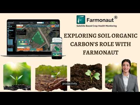
Farmonaut & IFPRI: Transforming Kharif Farming with Satellite Insights
“Farmonaut & IFPRI analyzed over 1 million Kharif fields using satellite data for precise crop health monitoring in 2023.”
“Satellite insights enabled yield comparisons across 500+ villages, revolutionizing data-driven decisions for Indian Kharif farmers.”
Table of Contents
- Introduction: The New Age of Digital Farming
- The Importance of Satellite-Based Agricultural Insights for Kharif Farming
- Farmonaut & IFPRI: Bringing Advanced Farming Data Directly to Local Farmers
- How Farmonaut’s Technology Empowers Modern Agriculture
- Marathi Leaflets: Making Satellite Data Accessible to Local Growers
- Farm Digitization Solutions: Precision Plot Mapping
- Kharif Season Yield Comparisons: Enabling Data-Driven Farm Decisions
- Soil Carbon Level Analysis for Sustainable Management
- Weather Trend Analysis for Informed Planning
- NDVI Crop Health Monitoring Maps: Early Detection of Crop Issues
- Comparative Benefits Table: Traditional Farming vs Satellite Insights
- Access, API, and Getting Started with Farmonaut
- FAQ: Farmonaut, IFPRI, and Satellite Agricultural Insights
- Conclusion: Shaping the Future of Sustainable, Data-Driven Farming
Introduction: The New Age of Digital Farming
At Farmonaut, we are passionate about pioneering digital farming initiatives that empower local farmers and revolutionize agricultural productivity. In a rapidly transforming landscape, the combination of satellite based agricultural insights and actionable, user-friendly information holds the key to enhanced sustainability, productivity, and resilience—especially across India’s vital Kharif season.
That’s why we are excited to announce a remarkable step forward: the delivery of advanced agricultural data and satellite-powered analysis directly to the farming community, crafted for immediate field use and local understanding.
Leveraging our expertise in sustainable agriculture technology, farm digitization solutions, and precision crop health monitoring, we bring cutting-edge innovation—traditionally reserved for large enterprises and research organizations—straight to the hands of the growers who feed the nation.

The Importance of Satellite-Based Agricultural Insights for Kharif Farming
The Kharif season is the backbone of Indian agriculture. Sown at the onset of the monsoon and harvested in autumn, its success directly impacts food security and rural livelihoods. Yet, Kharif farming faces unique challenges: unpredictable weather, pest infestations, soil degradation, and resource limitations. Traditional approaches, while powerful, often lack the data-driven precision needed to minimize losses and maximize sustainable yields.
This is where satellite based agricultural insights come in. By integrating geospatial data and advanced analytics into everyday farm management, we enable local farmers to:
- Monitor crop health at every stage of growth via objective, real-time measurements
- Compare yields across seasons and regions for insight-driven decisions
- Track soil organic carbon for healthier, more resilient soils
- Plan with weather patterns for risk reduction and climate resilience
- Detect and address crop issues early to reduce losses and optimize resource use
This data-first approach, reaching into the most rural corners, is transforming the future of sustainable farming.

Farmonaut & IFPRI: Bringing Advanced Farming Data Directly to Local Farmers
As part of our commitment to agricultural advancement, we’ve distributed more than 4,500 smartly crafted, easy-to-understand leaflets in Marathi. These materials equip local growers with high-quality, field-ready information covering:
- Precise farm digitization via satellite-powered plot mapping
- Yearly Kharif season yield comparisons (2022-2024)
- Actionable soil organic carbon level analysis for better soil management
- Weather pattern trends and three-year patterns for smart agricultural planning
- Intuitive NDVI crop health monitoring maps for early detection of crop issues
Our goal is two-fold: ensure that scientific agricultural data is no longer confined to labs or research centers, but is deployed in the real world—and ensure it is accessible and actionable for every farmer, in their own language.

How Farmonaut’s Technology Empowers Modern Agriculture
At Farmonaut, we harness the power of satellite imagery, advanced AI, and blockchain to redefine digital farming.
Our Cutting-Edge Solutions
- Satellite-Based Crop Health Monitoring: Multispectral satellite images reveal real-time vegetation health indicators (NDVI), soil moisture, and productivity maps. This supports strategic decisions for irrigation, fertilization, and crop protection.
- Farm Digitization Solutions: Using geospatial plot mapping, each field is precisely digitized, offering unprecedented clarity on every hectare.
- AI-Based Advisory (“Jeevn”): Personalized crop management insights, weather forecasts, and risk assessments, all refined through powerful machine learning models trained on 1M+ fields analyzed.
- Blockchain-Based Product Traceability: Ensuring every step in the food and textile value chain is verifiable and transparent.
Explore Blockchain-Driven Traceability - Fleet & Resource Management: Optimize the deployment, safety, and cost efficiency of all agricultural machinery.
Learn how Fleet Management Makes Farms Efficient - Soil Carbon Footprinting: Track farm progress toward carbon neutrality and verify sustainability metrics for certification.
Track Your Farm’s Carbon Footprint - Support for Crop Loans & Insurance: Use reliable satellite data for verification, reducing the risk for lenders and enabling better access to finance.
See Satellite-Powered Crop Loan Solutions - Large-Scale Plantation and Forest Advisory: Manage plantations and agroforestry projects at scale with digital insights.
Discover Plantation & Forest Advisory
Marathi Leaflets: Making Satellite Data Accessible to Local Growers
We firmly believe that empowering the farming community begins with language and communication. That’s why our Marathi leaflets are not just translations—they’re tools for practical decision-making.
Each leaflet is designed to make advanced farming data for farmers straightforward, field-actionable, and regionally relevant, featuring:
- Clear explanations of plot mapping and farm digitization solutions
- Kharif season yield comparisons for multiple years and villages
- Visuals of NDVI crop health monitoring maps
- Guidelines for using soil carbon level analysis data
- Seasonal weather pattern trends, improving risk forecasting
This initiative ensures farmer first values—making certain that no technological advancement is out of reach for India’s local growers and farming communities.

Farm Digitization Solutions: Precision Plot Mapping
Digitizing the farm is the essential first step in entering the era of digital farming. By transforming each physical plot into a geo-referenced digital asset, farmers unlock the gateway to precision agriculture and continuous monitoring.
What is Plot Mapping?
Plot mapping uses satellite imagery and location technology to define the exact shape and area of every field. This data forms the digital backbone for:
- High-accuracy crop monitoring across time
- Zone-specific recommendations for irrigation, fertilization, and crop protection
- Tracking progress in sustainability goals such as carbon reduction and water management
With farm digitization solutions, even remote or fragmented plots become part of a fully integrated digital system, setting the stage for scalable, agtech-driven improvement.
Kharif Season Yield Comparisons: Enabling Data-Driven Farm Decisions
Imagine being able to compare the yield of your farm not just over different years but against the regional average of hundreds of neighboring villages. Kharif season yield comparisons make this possible, enabling every farmer to measure and improve.
Why Are Yield Comparisons Vital?
- Plan Input Usage: Adjust fertilizer, seeds, and water inputs based on yield forecasts and historic outcomes.
- Spot Localized Issues: Identify whether poor performance is due to weather, soil, management, or pests.
- Adopt Best Practices: Leverage satellite data to match or exceed yield benchmarks seen in neighboring plots or villages.
With our tools, these yield comparisons are presented visually and statistically, allowing for quick adaptation and ongoing improvement.

Soil Carbon Level Analysis for Sustainable Management
Sustaining high productivity in Indian Kharif farming means nurturing the living foundation of agriculture: the soil. Soil organic carbon level analysis is now a vital parameter, linking soil management directly to yield, input efficiency, and environmental sustainability.
Benefits of Soil Organic Carbon Monitoring
- Healthier Soils: Tracking carbon content to manage soil fertility and prevent degradation.
- Climate Resilience: Healthier, carbon-rich soils retain more water and support crop stability through variable seasons.
- Input Optimization: Adjust fertilizer use based on soil status, reducing waste and cost.
- Sustainability Tracking: Quantitative, auditable data for meeting sustainable farming and carbon-credit goals.
Explore how Farmonaut translates satellite readings into clear, actionable advice for every farm—building a foundation for resilient, sustainable farming.

Weather Trend Analysis for Farmers: Smarter Risk Planning
For Indian farmers, few variables are as important—or as unpredictable—as the weather. Our weather trend analysis for farmers uses three years of data to provide actionable trends, helping optimize every aspect of production, protection, and harvesting.
How Weather Trend Data Supports Better Farming
- Predict rainfall & temperature shifts for smart crop scheduling.
- Plan pest and disease defense by recognizing climate triggers.
- Increase input efficiency by timing fertilizer and irrigation with upcoming weather.
- Boost resilience by proactively adjusting to expected droughts or floods.
By putting these insights in every Marathi-language leaflet, we make sophisticated weather planning practical and inclusive.

NDVI Crop Health Monitoring Maps: Early Detection of Crop Issues
Our NDVI crop health monitoring maps use satellites to spot subtle differences in plant vigor and color, long before they’re visible to the eye. This allows growers to take action early, maximizing yield while minimizing input costs.
What Makes NDVI Valuable for Farmers?
- Identify stressed areas before crops show symptoms.
- Differentiate healthy vs. non-healthy zones for targeted intervention.
- Measure success of application (fertilizer, pest control, irrigation) more clearly and quickly.
- Simplify scouting—maps steer field walk-throughs and treatment efforts for maximum efficiency.
This crop health monitoring enables farming with data at a local scale—every leaflet becomes a diagnostic and planning tool, turning every grower into a precision farmer.

Comparative Benefits Table: Traditional Kharif Farming vs. Satellite Insights
| Key Farming Parameter | Traditional Approach (Estimated Value) | With Satellite Insights (Estimated Value) | Benefit/Improvement |
|---|---|---|---|
| Crop Health Monitoring Accuracy | 50-60% | 85-95% | Significant increase in early identification of crop issues |
| Yield per Hectare (quintals) | 18-25 | 24-32 | 15-25% higher yield potential |
| Early Disease Detection Rate | 30-40% | 70-85% | Dramatic reduction of losses from unspotted outbreaks |
| Water Usage Efficiency (%) | 60-70% | 80-90% | 20-30% improved resource use, cost savings |
| Reduction in Chemical Inputs (%) | 0-10% | 20-30% | Lower costs, healthier environment, safer food |
Access, API, and Getting Started with Farmonaut
Ready to join the digital farming revolution and bring the power of satellite insights to your farm or organization? Here’s how you can access the full suite of tools:
Farmonaut App Platform Choices
-

Web App: Use our feature-rich browser App for end-to-end farm management, monitoring, and analysis directly on your desktop or mobile browser. -

Android App: Manage and monitor your fields on-the-go. -

iOS App: Full functionality tailored for iPhone and iPad.
API Access for Developers and Agri-Businesses
Integrate satellite and weather data directly into your agricultural or food platform with our robust API.
This opens the door to scalable digital farming initiatives, precision advisory, and custom solutions across cooperatives, NGOs, and agri-enterprises.
Farmonaut Subscriptions
Select the best-fit subscription plan for your needs, whether you’re a smallholder, cooperative, or enterprise-level farm manager:
“Farmonaut & IFPRI analyzed over 1 million Kharif fields using satellite data for precise crop health monitoring in 2023.”
FAQ: Farmonaut, IFPRI, and Satellite Agricultural Insights
What are satellite based agricultural insights, and how do they help farmers?
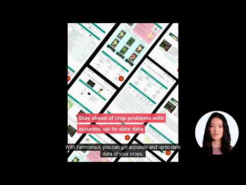
Satellite based agricultural insights transform raw imagery from space into meaningful, farm-level data. These insights visualize crop health, detect field-level issues, monitor weather and soil trends, and provide actionable recommendations to improve yield, cut costs, and embrace sustainable farming with minimal guesswork.
How does Farmonaut deliver crop health monitoring and planning support?
Through real-time NDVI crop health monitoring maps and digital dashboards, Farmonaut provides continuous updates on vegetation vigor, soil moisture, weather patterns, and yield data. The information is tailored and delivered via our user-friendly app platforms, web interface, and regionally adapted leaflets.
What is farm digitization, and why is it important?
Farm digitization involves converting physical plots into precise digital assets through satellite mapping and geolocation. This enables measured, monitored, and optimized farming—from resource allocation to harvest analysis—supporting the transition to precision digital farming.
Why is soil carbon analysis emphasized in sustainable farming?
Healthy, high-carbon soils are more productive and resilient to weather stress. Soil organic carbon level analysis helps growers adjust nutrient management, track long-term fertility, and verify carbon reduction for climate and sustainability goals—essential in modern, sustainable agriculture technology.
Can these tools be used for large-scale farm management?
Absolutely. Farmonaut’s scalable platform is ideal for cooperatives, government agencies, and enterprise agriculture. Features like fleet management, plantation and forest advisory, and API integration efficiently manage vast acreages. See Large-Scale Farm & Agro-Admin App Features
How do local farmers in Maharashtra benefit from Marathi-language insights?
Our Marathi leaflets break the language barrier, offering actionable, understandable data. This enables every local grower to unlock technology’s full benefits, driving inclusion, productivity, and sustainability.
How is satellite data secured and verified?
Farmonaut leverages blockchain-based traceability for transparency in agri-supply chains. This verifies farm data journeys and application—critical for food safety, loan verification, and crop insurance processes.
Conclusion: Shaping the Future of Sustainable, Data-Driven Farming
Through our extensive digital farming initiatives, we at Farmonaut ensure that the most advanced satellite and data technologies serve not just large agribusinesses but every local farmer, community, and cooperative. Our vision is clear: farmer first. We turn complex insights into actionable information, empower growers, and foster a new era of sustainable farming—from soil to satellite.
We are excited and proud to witness the positive impact of this initiative across the Kharif farming landscape. With more data, smarter planning, and sustainable approaches, the Indian farmer—and indeed all farming communities across the globe—are poised for greater resilience, environmental health, and lasting prosperity.
Together, let’s reimagine agriculture—powered by satellite insights, driven by data, and sustained by community.


