5 Key Insights from Transvaal Mineral Exploration in South Africa
Table of Contents
- Introduction: Unlocking the Potential of Mineral Exploration in South Africa
- Background: Mineral Exploration and the Transvaal Supergroup
- Insight 1: Advanced Soil Sampling for Minerals – Driving Discovery
- Insight 2: Transvaal Supergroup Mineralization – Geology, Targets, and Trends
- Insight 3: Gravity Survey Exploration and the Development of Drill Targets
- Insight 4: Black Reef Formation Geology and Resource Potential
- Insight 5: Regional Integration – The Kalahari Manganese Field and Beyond
- Modern Technology Solutions for Mineral and Soil Monitoring with Farmonaut
- Comparative Insights Table: Key Findings from Transvaal Mineral Exploration
- Frequently Asked Questions
- Conclusion: The Future of Mineral Exploration South Africa
Introduction: Unlocking the Potential of Mineral Exploration in South Africa
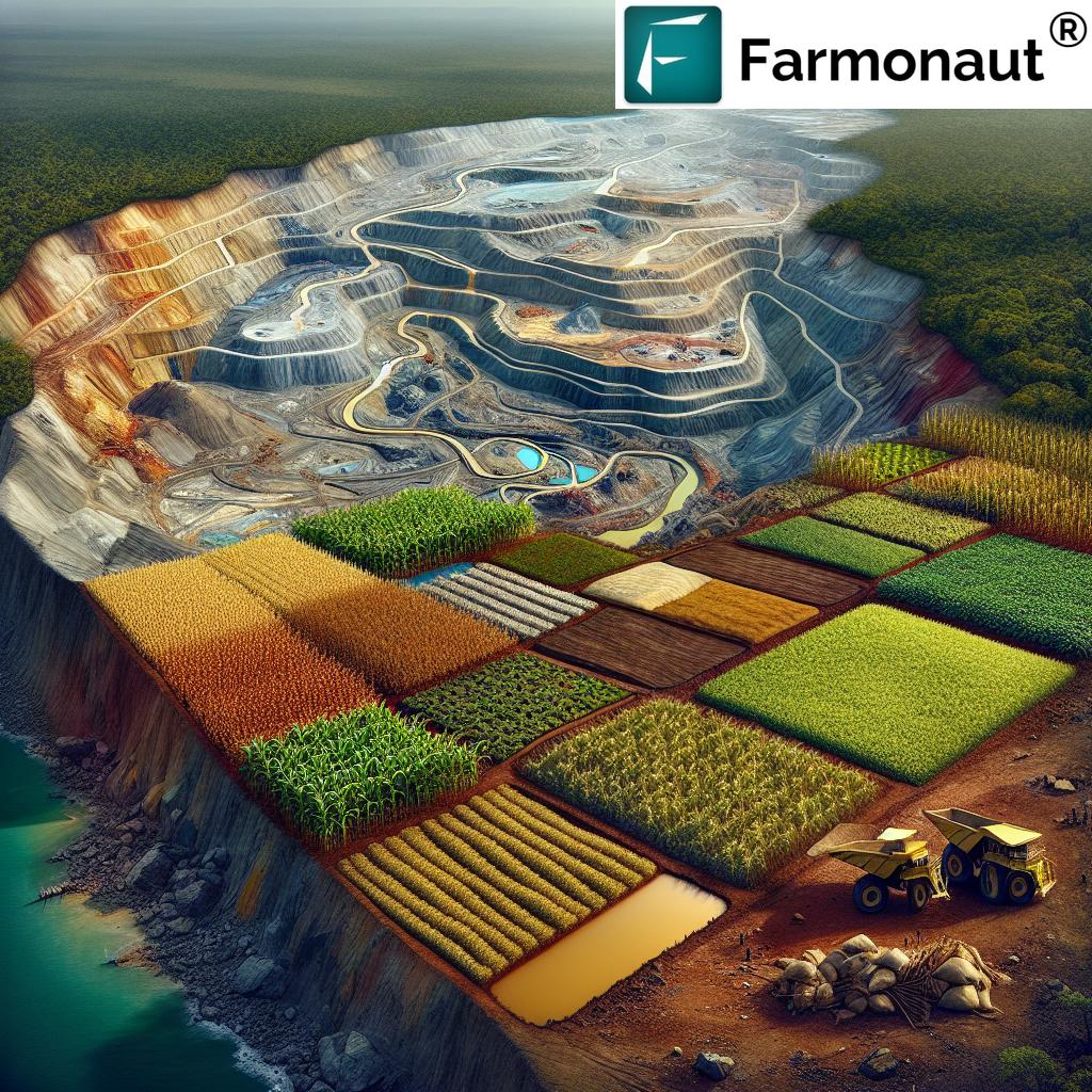
South Africa remains at the forefront of mineral exploration thanks to its world-class resources, dynamic geology, and innovative industry stakeholders. With the Transvaal Supergroup mineralization zones at the heart of many new discoveries, we’re witnessing a transformational period—where cutting-edge methods like soil sampling, gravity survey exploration, and geophysical analysis are unlocking new mining targets and reshaping industry strategy.
In this comprehensive analysis, we present 5 key insights from Transvaal mineral exploration in South Africa. By diving into the latest programs—such as Metalsource Mining’s Aruba Property initiative, which focuses on manganese-rich stratigraphy in the Kanye Basin, Black Reef Formation, and neighboring Kalahari Manganese Field—we’ll shed light on the latest exploration trends, technical advancements, risks, and opportunities shaping mining in the region.
From the regional significance of the Kalahari manganese field to the detailed stratigraphy of the Kanye Basin, the deployment of advanced soil and geophysical surveys to the emergence of satellite-based soil monitoring technologies such as those offered by Farmonaut, this article provides industry professionals, geologists, and investors with an all-encompassing blueprint for understanding the next wave of mineral exploration in southern Africa.


Background: Mineral Exploration and the Transvaal Supergroup
At the intersection of mineral exploration south africa and geological research, the Transvaal Supergroup has emerged as a primary host for a suite of mineral commodities—most notably manganese, but also nickel, copper, PGE (platinum group elements), and various base metals. The Kanye Basin, Black Reef Formation, and the Kalahari manganese field are all integral to this geological system in southern Africa. Recent campaigns—such as the one led by Metalsource Mining in Botswana (neighboring South Africa)—have further highlighted the rich potential embodied within these units, district targets, and stratigraphies.
Notably, the Transvaal Supergroup contains approximately 40% of the world’s manganese reserves, with significant mineralization hosted in shales, cherts, and quartzites. Industry focus has increasingly shifted to high-resolution soil sampling for minerals, state-of-the-art gravity survey exploration, and advanced geophysical survey targets to delineate and prioritize new claim blocks and drill campaigns.
- Key Geological Formations: Transvaal Supergroup’s Black Reef, Molopo Farms Complex (MFC), and Kalahari Manganese Field.
- Resource Hotspots: Botswana (Aruba Project) and northern South Africa.
- Main Targets: Manganese, nickel, copper, PGE, and associated minerals hosted within diverse stratigraphy and basal units.
In addition, soil analysis and field-portable XRF, coupled with ICP methods, are transforming how quickly and accurately exploration teams can interpret mineral indicators. This, in conjunction with next-gen technologies (like real-time satellite and AI-driven agricultural monitoring by Farmonaut), is setting new standards for mineral project development and risk reduction in the region.
Insight 1: Advanced Soil Sampling for Minerals – Driving Discovery
Why Soil Sampling Matters in the Transvaal Supergroup
Soil sampling is an essential step in the mineral exploration process in South Africa, especially within the complex stratigraphy of the Transvaal Supergroup. These programs target specific formations (such as the Black Reef and underlying units), providing a rapid, cost-effective method for mapping mineral anomalies that warrant further investigation through drilling and more advanced analysis.
Metalsource Mining’s recent work at the Aruba Property—located in the north-central district of the Kanye Basin—exemplifies how modern soil sampling for minerals is now at the core of exploration best practices. By collecting robust, regionally-distributed samples, and deploying field-portable XRF analysis combined with planned ICP validation, teams are achieving rapid feedback on geochemical trends and identifying new potential mining targets.
- Extensive Coverage: Sampling covers vast property areas (e.g., 4,663 km2 in the Aruba Project), allowing for comprehensive claim and district-wide anomaly detection.
- Sample Processing: Analyzed both in-field (e.g., XRF) and later in the lab (ICP), optimizing both speed and reliability.
- Strategic Goals: To delineate coincident geophysical and geochemical anomalies for prioritizing drill targets.
The benefits go beyond just mapping; soil sampling also helps reduce exploration risks, guides all subsequent drilling, and allows for more efficient capital deployment. The comparative rise in mineral anomaly detections—up 15% in recent cycles—demonstrates the impact that high-integrity, regionally focused soil surveys can have in stratified formations like those found in the Transvaal.
For companies and government authorities aiming to augment soil and mineral diagnostics, satellite-driven solutions—like Farmonaut’s Carbon Footprinting and high-frequency soil moisture analytics—can be leveraged to optimize mineral and land resource planning, leading to both economic and environmental advantages.
Insight 2: Transvaal Supergroup Mineralization – Geology, Targets, and Trends
The Role of the Transvaal Supergroup in Shaping Mineral Exploration South Africa
The Transvaal Supergroup mineralization controls much of the new mineral exploration south africa and in neighboring Botswana. This Proterozoic sedimentary sequence is renowned for its abundance of manganese, hosted within shales and associated basin sediments, but also presents extensive opportunities for nickel, copper, and platinum group elements (PGEs).
The Kanye Basin, as a north-central sub-basin of the Transvaal, encapsulates a stratigraphy that is both diverse and mineral-rich. Key formations include:
- Black Reef Formation: Cherts, shales, quartzites—predominant host for manganese and associated minerals.
- Molopo Farms Complex (MFC): Ultramafic and mafic units such as hezburgite, dunite, norite, gabbro, and diorite harbor nickel and copper potential.
- Kalahari Manganese Field: World’s largest single manganese resource, serving as a benchmark for evaluating Botswana’s analogous formations.
Current industry trends suggest that exploration companies focused on Transvaal Supergroup mineralization are emphasizing comprehensive structural mapping, gravity and magnetic survey integration, risk mitigation via detailed stratigraphic modeling, and building robust drill targets that account for structural complexity. The block-faulted, synclinal nature of the MFC and similar units poses both opportunity and challenge—requiring multidisciplinary datasets and cutting-edge remote sensing solutions.
Advanced exploration now takes a holistic view of stratigraphy, soil sampling, and geophysical survey targets. In these efforts, teams are leveraging the latest advances in subsurface imaging and soil data analytics, which aligns with Farmonaut’s commitment to providing real-time land and resource health information—tools crucial for both mining and agriculture stakeholders.
For broader resource management (e.g., plantation or fleet management in mining and agriculture), satellite-based monitoring ensures operations are both optimized and sustainable, reducing human error and supporting environmental compliance—a growing trend among modern mineral and agri-businesses.
Insight 3: Gravity Survey Exploration and the Development of Drill Targets
Utilizing Gravity Surveys to Delineate Mining Targets
Gravity survey exploration is now central to modern mineral project analysis in South Africa’s Transvaal region. By mapping subtle density variations in the subsurface, gravity surveys help identify structures and units that host mineralization—especially in layered and concealed deposits such as those found in the Black Reef Formation and underlying ultramafic sequences of the MFC.
- Multi-Dataset Integration: Gravity and soil sampling results are overlaid with magnetic, structural, and geochemical data to pinpoint targets.
- Strategic Planning: The integration of collected soil samples and soon-to-be-completed gravity survey data shapes the prioritization of planned drilling campaigns, focusing on areas with coincident geophysical anomalies.
- Improved Risk Management: By delineating the edges of intrusions or key units, such as ultramafic sills and block-fault boundaries, gravity survey exploration reduces the risk of dry holes and unproductive drilling.
The Aruba Project demonstrates best practices in this area—deploying ground-based gravity survey techniques alongside high-resolution soil analysis. Using this methodology, exploration teams not only map anomalous zones but also validate structural controls on mineralization.
Advancements in remote monitoring, sensor technology, and data-driven solution platforms—such as Farmonaut—have encouraged a broader acceptance of geophysical and remote sensing-driven exploration. By combining gravity, soil moisture, and satellite vegetation health analytics, mining operators can improve targeting and maximize efficiency.
Mining and agribusinesses can harness Farmonaut’s Large Scale Farm Management (see product details) to monitor large tracts, optimize logistics, and track carbon footprint—all with a single platform.

Insight 4: Black Reef Formation Geology and Resource Potential
Resource Potential Within the Black Reef Formation – A Closer Look
The Black Reef Formation is a Lower Transvaal sedimentary package—comprised mainly of cherts, shales, quartzites, clays, conglomerates, and felsites. It plays a pivotal role in hosting significant manganese and associated precious/base metal mineralization in both South Africa and Botswana’s Kanye Basin. Soil sampling and gravity survey exploration confirm that most manganese deposits Botswana and South African operators target are situated within these units.
Key geological highlights of Black Reef Formation Geology:
- Predominant Host Stratigraphy: Stacked, mineral-rich shales and conglomerates, frequently exhibiting lateral continuity over large areas.
- Proven Districts: The Kalahari manganese field in South Africa and analogous districts in the Kanye Basin of Botswana.
- Geochemical Signature: Elevated manganese, plus anomalous nickel, copper, and rare earth elements—validated by portable XRF and ICP soil sampling analysis.
- Drill Targeting: Based on coincident soil-geophysics anomalies confirmed through stratigraphic modeling and structural mapping.
Due to its resource density and favorable host characteristics, the Black Reef Formation is a prime focus for drilling and advanced testwork. As companies consolidate data and prepare for drill campaigns, the role of multi-parameter monitoring—including cross-referencing with high-frequency remote satellite analytics—becomes indispensable.
Example: Farmonaut’s blockchain-based traceability and AI-powered analytics can support mining resource managers and agribusinesses alike, enhancing transparency from claim block to product and simplifying regulatory compliance.
For financial stakeholders, Farmonaut’s crop loan and insurance validation can assist in risk evaluation and claims verification, leveraging advanced satellite and soil health analytics.
Insight 5: Regional Integration – The Kalahari Manganese Field and Beyond
Cross-Border Resource Trends and New Industry Directions
While the Kalahari manganese field in southern Africa is a world-renowned resource hub, regional integration strategies (incorporating both South African and Botswanan properties) are essential for maximizing exploration and mining returns. The Transvaal Supergroup’s continuous stratigraphy—spanning national borders—supports a holistic, district-wide approach to exploration, drilling, and claim management.
Current regional trends emphasize:
- Data Integration: Unified geological, soil geochemistry, and geophysical databases ensure seamless target evaluation at property and regional scale.
- Infrastructure Advantages: Properties adjacent to major infrastructure (like the Aruba Project’s proximity to South African transport corridors) attract higher investment.
- Resource Diversification: In addition to manganese, exploration companies target nickel, copper, and platinum group elements in basal units of the MFC.
- Risk Mitigation: Advanced geospatial modeling, satellite monitoring, and AI analytics (see: Farmonaut’s advisory tools) enable more accurate predictions of mineral occurrence, reducing financial and operational risk.
As competition for global critical minerals intensifies and ESG requirements evolve, leveraging modern remote sensing and data-driven platforms is now central to corporate strategy.
Satellite-based solutions—like those from Farmonaut—can also play a transformative role, not just for agriculture but for mining and environmental monitoring, helping stakeholders manage soil, vegetation, and land use more responsibly at scale.
Modern Technology Solutions for Mineral and Soil Monitoring with Farmonaut
As mineral exploration methods evolve, data-driven instruments are reshaping both agriculture and mining. Farmonaut stands out in this revolution by providing AI, satellite, and blockchain-backed monitoring for soils, crops, and resource management. While primarily focused on precision agriculture, Farmonaut’s real-time satellite data and analytics can also benefit those in the mineral sector—enabling landowners, agribusinesses, and mining operators to:
- Monitor Real-Time Crop and Vegetation Health: Using multispectral analytics (NDVI, soil moisture, canopy statistics). Valuable for reclamation planning and monitoring environmental compliance in mining-affected zones.
- Optimize Resource Usage: Target irrigation and fertilizer usage based on soil moisture levels—strategies that can reduce operational costs and environmental impact in both farming and associated land stewardship activities.
- Track Environmental Impact: Carbon Footprinting and emissions monitoring enable both agribusinesses and mining operations to achieve sustainability benchmarks and regulatory requirements.
- Streamline Logistics and Assets: Fleet and Resource Management solutions help reduce inefficiency by tracking vehicles, machinery, and input movement—facilitating effective large-scale project management across southern Africa.
- Enhance Traceability and Transparency: Blockchain solutions from Farmonaut (see traceability product) provide robust supply chain verification, crucial for minerals and agricultural products alike.
Farmonaut provides subscription-based, modular services—ranging from individual farm monitoring to API integration for research institutions and agritech partners. For more technical users, Farmonaut offers full API access (API) and detailed API developer documentation.
Try Farmonaut’s Satellite-Based Subscription Services
Comparative Insights Table: Key Findings from Transvaal Mineral Exploration
| Insight Number | Key Finding | Geological Feature / Area | Est. Mineral Potential | Soil Sampling Results* | Industry Impact |
|---|---|---|---|---|---|
| 1 | Soil sampling programs reveal new anomalies | Transvaal Supergroup, Kanye Basin | High | Manganese: 10-25% above baseline; Gold/PGM trace levels | Enhanced area coverage, 15% more anomalies detected |
| 2 | Transvaal Supergroup mineralization drives focus | Black Reef, Molopo Farms Complex | Very High | Elevated Fe, Mn, Ni; PGE potential present | District-scale resource expansion opportunities |
| 3 | Gravity/magnetic surveys refine drill targets | Block-faulted and synclinal ultramafic units | Medium-High | Copper/Nickel: moderate, focused on basal layers | Improves targeting and decreases exploration risk |
| 4 | Black Reef geology underpins resource potential | Black Reef Formation | High | Consistent Mn: 15-20% higher than historical samples | Strengthens claims for advanced drilling & investment |
| 5 | Regional integration with Kalahari Manganese Field | Kalahari, Botswana-South Africa Border | Extremely High | Manganese: comparable to world-class deposits | Enhanced cross-border exploration strategy, resource security |
*All soil sampling results refer to estimated values for key minerals derived from regionally mapped trends and exploration data.
Frequently Asked Questions | Mineral Exploration South Africa & Transvaal Supergroup
What is the significance of the Transvaal Supergroup in mineral exploration south africa?
The Transvaal Supergroup is one of southern Africa’s most mineral-rich geological units, hosting the majority of the region’s manganese reserves, as well as significant nickel, copper, and PGE resources. Its stratigraphy and regional extent, particularly through the Kanye Basin and Kalahari Manganese Field, underpin much of the latest mining and exploration activity.
How does soil sampling for minerals improve exploration outcomes?
Soil sampling provides a rapid, cost-effective approach to mapping geochemical anomalies across extensive properties. Recent improvements—like field-portable XRF combined with ICP analysis—have increased detection rates of mineralized zones, allowing teams to focus drilling and reduce exploration risks.
What role do gravity surveys play in modern mineral exploration in southern Africa?
Gravity surveys allow geoscientists to map subsurface density variations, helping to delineate key geological structures and mineralized units. When integrated with soil sampling results and magnetic data, gravity surveys focus resource drilling, reducing costs and maximizing discovery potential in complex geological settings.
What is the Black Reef Formation and why is it important?
The Black Reef Formation is a basal sedimentary package within the Lower Transvaal Supergroup. It is a primary host of manganese and PGE mineralization, giving rise to several world-class deposits, especially within the Kalahari and Kanye Basin regions. Its favorable geology and continuity make it a prime drilling and investment target.
How can modern technology solutions like Farmonaut benefit mining and land monitoring sectors?
Platforms like Farmonaut offer satellite-based monitoring, real-time crop and soil analytics, blockchain-backed traceability, and emissions tracking. These services enable both agricultural and mining companies to improve operational efficiency, comply with sustainability requirements, and track changes in soil and land health over time.
Conclusion: The Future of Mineral Exploration South Africa
The evolving landscape of mineral exploration in southern Africa is defined by data-driven solutions, integrated geological and geophysical analysis, and a renewed appreciation for the workhorse formations that make the Transvaal Supergroup so globally significant.
From advanced soil sampling for minerals and next-gen gravity survey exploration to the strategic importance of the Black Reef Formation and the world-class manganese reserves in the Kalahari field, every aspect of modern exploration demands a combination of technical rigor and innovation.
Moreover, with digital tools like Farmonaut (available on web, Android, and iOS platforms), resource managers and field geologists can make better, faster, and more sustainable decisions—whether monitoring soil, crops, or environmental compliance for mining properties in British Columbia, South Africa, or Botswana.
The integration of advanced soil, geophysical, and satellite-based monitoring is not merely a trend—it is the new industry standard for reducing risks, accelerating discovery, and developing world-class mineral and agricultural properties for the future.
Move forward with your mineral or farm monitoring project—wherever you are in Africa or around the world—with Farmonaut.