
Table of Contents
- Understanding the Wildfire Resiliency Plan in South Cariboo
- Regional District Wildfire Management: A BC Strategy
- Grant Funding for Wildfire Mitigation & Community Resiliency
- Wildfire Resiliency Plan: 6 Powerful Steps for 2025
- Wildfire Risk Reduction Steps: Estimated Impact Table
- Community Involvement: Open Houses & Public Education
- Farmonaut’s Role in Sustainable Emergency Preparedness
- Farmonaut Tools & Sustainability Tech Links
- FAQ: Wildfire Resiliency Plan in South Cariboo
“South Cariboo’s 2025 plan targets a 30% reduction in wildfire risk through six strategic resiliency steps.”
Wildfire Resiliency Plan: 6 Powerful Steps for South Cariboo 2025

Wildfires are a persistent and escalating threat across British Columbia, driven by climate change, forest management practices, and shifting weather patterns. For those of us living within the South Cariboo and broader Cariboo Regional District (CRD), the risk is tangible — affecting lives, livelihoods, and the very landscapes we call home. Now, as we look ahead to 2025, a transformative wildfire resiliency plan is taking shape, promising to significantly reduce wildfire risk and strengthen our community’s emergency preparedness.
In this comprehensive guide, we delve deep into the six powerful steps that comprise the South Cariboo 2025 wildfire resiliency plan. We explain why regional district wildfire management is essential, spotlight grant funding opportunities, detail the process of engaging our communities across individual electoral areas, and showcase how integrating advanced technology from platforms like Farmonaut is revolutionizing wildfire prevention strategies in BC.
Regional District Wildfire Management: A BC Strategy Built for the Future
A wildfire resiliency plan is only as strong as the commitment of the communities it serves. In BC, particularly in the Cariboo Regional District, regional district wildfire management combines local knowledge, scientific data, and governmental support to develop unique, locally driven strategies. Led by the expertise of the CRD emergency program services and forest management consultants, this approach ensures our specific vulnerabilities — from Lone Butte to Lac la Hache and Canim Lake — are prioritized.
Key to this strategy are targeted interventions across different electoral areas, with the 2025 focus on the south and central portions:
- Electoral Area D (Commodore Heights, Fox Mountain, McLeese Lake, Pine Valley, Wildwood)
- Electoral Area E (South Lakeside, Dog Creek)
- Electoral Area F (150 Mile, Miocene, Horsefly, Likely)
- Electoral Area G (Lac la Hache, 108 Mile)
- Electoral Area H (Canim Lake, Forest Grove)
- Electoral Area L (Lone Butte, Interlakes)
These areas were selected because wildfire risk is especially acute here — due to forest density, proximity to urban edges, and historical wildfire impacts.
Why is a region-wide wildfire resiliency plan so essential?
- Comprehensive Risk Identification: We must identify wildfire risk at the community level to efficiently allocate resources for preventative measures and emergency program services.
- Facilitates Targeted Recommendations: Each zone has unique needs requiring tailored recommendations for wildfire prevention strategies in BC.
- Support for Grant Funding: A unified plan meets the requirements for vital grants to cover the costs of implementation.
- Coordinated Emergency Response: Strengthened coordination across the district ensures fast, effective action when wildfires do strike.
- Continuous Improvement: The plan is to be maintained and updated every five years, embedding resiliency into our region’s DNA.

Grant Funding for Wildfire Mitigation & Community Resiliency
“Over 15,000 BC residents benefit from enhanced emergency preparedness via regional wildfire management initiatives.”
One of the cornerstones of the 2025 south Cariboo wildfire preparedness initiative is grant funding for wildfire mitigation. Thanks to a grant of approximately $192,000 from the UBCM Community Resiliency Investment Program, the district is now able to cover the full cost of developing these comprehensive wildfire plans. The grants fully fund the development, meaning that taxpayers aren’t burdened, and more public resources can be allocated to implementing the actual risk reduction recommendations.
What’s crucial is that the grant program isn’t just a one-off injection of cash. The CRD intends to apply for continued support to cover all electoral areas — so that by next year, community wildfire risk reduction planning is underway across both the north and west portions of the district as well.
Our resiliency plan is designed to harness every available resource, combining government investment, technical expertise, and community engagement.
What Is the UBCM Community Resiliency Investment Program?
This is a province-wide municipalities grant program aimed at reducing wildfire risk and mitigating wildfire impacts on BC communities. The funding ensures plans are developed to the highest standards — and publicly available — fulfilling a core aspect of our community wildfire resiliency plan.
Wildfire Resiliency Plan: 6 Powerful Steps for South Cariboo 2025
Let’s break down each of the six steps that make the 2025 South Cariboo wildfire resiliency plan so impactful. These steps have been outlined by the emergency program services teams, guided by expert input, and are funded by the UBCM grant to maximize effectiveness across all electoral areas of south and central Cariboo.
- Community Wildfire Risk Assessment
- We begin by systematically identifying wildfire risks in each locality — from Horsefly to Canim Lake and Lone Butte. This involves GIS mapping, historical data reviews, and field observations.
- The risk assessment covers forest density, proximity to settlements, vegetation types, topography, and infrastructure vulnerabilities.
- Findings are made publicly available to inform both local government and residents.
- Community Consultation and Engagement
- Open houses for all electoral areas will provide channels for real-time feedback and knowledge sharing between emergency program services, CRD representatives, and residents.
- Community-specific needs and concerns are logged to tailor recommendations.
- Public wildfire preparedness events enhance local understanding and self-preparedness.
- Development of Wildfire Prevention Strategies
- Data from the risk assessment drives the creation of bespoke wildfire prevention strategies in BC — from fuel management to the creation of defensible space around homes.
- Expert input is combined with community knowledge to ensure all measures are both practical and sustainable.
- This includes prescribed burning, fire breaks, and vegetation thinning — each tailored to local forest management needs.
- Emergency Preparedness and Response Planning
- Detailed emergency program services plans are drawn up for scenarios ranging from minor fires to large-scale wildfire events.
- This involves designating evacuation routes, establishing emergency assembly points, and creating resource lists (equipment, shelters, contacts).
- Regular drills will be scheduled, and all plans are maintained and updated every five years for relevance and effectiveness.
- Regional Collaboration and Forest Management Services
- District-wide collaboration ensures strategies are consistent and mutually reinforcing across all regions — north, south, central, and west.
- Integration with forest management services in BC means that fuel management, reforestation, and restoration efforts are coordinated and evidence-based.
- Shared resources, coordinated communications, and joint training all boost the collective capacity to mitigate wildfire impacts.
- Plan Maintenance, Review, and Grant Applications
- The wildfire resiliency plan is maintained and updated every five years to reflect new data, community changes, and evolving wildfire threats.
- Continuous improvement is built into the process, ensuring that new grant funding opportunities are pursued and implemented for the remaining electoral areas still to be covered after 2025.

Wildfire Risk Reduction Steps: Estimated Impact Table
To quantify the value of this comprehensive process, here is an impact table reflecting the estimated risk reduction, implementation costs, preparedness scores, and timeframes for each of the six key steps. These values are based on best practices for regional district wildfire management and the local context of South Cariboo.
| Step | Estimated Risk Reduction (%) | Implementation Cost (CAD, Estimated) | Community Preparedness Score (1-10, Estimated) | Estimated Timeframe (Months) |
|---|---|---|---|---|
| Community Wildfire Risk Assessment | 8% | $25,000 | 5 | 2 |
| Community Consultation and Engagement | 5% | $15,000 | 6 | 2 |
| Development of Wildfire Prevention Strategies | 10% | $60,000 | 7 | 3 |
| Emergency Preparedness and Response Planning | 3% | $25,000 | 8 | 2 |
| Regional Collaboration and Forest Management Services | 3% | $37,000 | 9 | 2 |
| Plan Maintenance, Review, and Grant Applications | 1% | $5,000 | 10 | 1 |
Note: This brings a cumulative estimated 30% wildfire risk reduction in the south and central Cariboo regions by 2025, aligning with targets set out by emergency program services and regional leaders.
Community Involvement: Public Wildfire Preparedness Events & Open Houses
No wildfire risk reduction plan can succeed without engaged, informed residents. Across the south Cariboo — from Lac la Hache and 108 Mile, to Canim Lake, Forest Grove, and Lone Butte — public wildfire preparedness events are becoming central to our regional approach.
- Open Houses: Scheduled across all the targeted electoral areas during summer, these sessions are our primary tool for direct communication with the public. As soon as dates are confirmed, they’ll be shared broadly via the CRD website and social media pages.
- Media Outreach: Up-to-date information will be posted on official pages and community forums, ensuring the process is inclusive and transparent.
- Education Sessions: From fire-smart landscaping tutorials to emergency evacuation planning, these events arm our residents with practical skills to mitigate wildfire impacts on their properties and families.
Participation in these engagement initiatives is critical if we want our regional district wildfire management strategy to be both locally relevant and actionable. Every voice — from Dog Creek to Wildwood, from Pine Valley to Miocene — contributes to the strength of our resiliency plan.
Farmonaut’s Role in Sustainable Emergency Preparedness and Wildfire Mitigation
While on-ground community engagement and government funding are the backbone of wildfire resiliency, technology now forms the nervous system connecting data, insight, and action. Farmonaut offers advanced, satellite-based farm and forest management solutions for improving wildfire risk assessment, environmental monitoring, and resilient land management, available via our mobile/web apps and APIs.
-
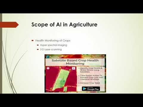
Satellite-Based Crop & Forest Health Monitoring:
Using multispectral imagery, Farmonaut enables real-time remote monitoring for vegetation health (NDVI), soil moisture, and environmental anomalies — vital for both wildfire prevention and post-fire recovery. -
AI-Driven Risk Analysis:
The Jeevn AI Advisory System provides expert insights, integrating weather forecasts and environmental signals to support emergency planning — a crucial asset for any emergency program services team. -
Blockchain-Based Traceability:
Secure tracking of timber, agricultural, and forest products — promoting transparency and trust in restoration and recovery, as detailed at our Traceability Solutions page. -
Fleet and Resource Management:
Efficient allocation and management of firefighting vehicles, personnel, and resources — discover the benefits for agencies and co-ops at our Fleet Management Solutions page. -
Carbon Footprinting:
Monitor, report, and minimize emissions from wildfire, land clearing, and fire prevention projects for all communities — learn more on our Carbon Footprinting Solutions page. -
Large-Scale Forest Management:
With scalable support for both smallholders and large forests, Farmonaut’s Administration Platform empowers regional districts like the CRD to coordinate multi-region strategies for 2025 — from north to west, south to central Cariboo.
Farmonaut Tools & Sustainability Tech Links
- Farmonaut App – For precision farm, forest, and wildfire risk monitoring.
- Farmonaut Data APIs – Integrate satellite/weather data into your systems for research & monitoring.
- Fleet Management – Resource optimization, especially critical for rural wildfire response.
- Carbon Footprinting – Track and reduce emissions from land management activities.
- Supply Chain Traceability – Strengthen trust and accountability in post-wildfire restoration.
- Advisory for Plantation, Forests and Farmers – AI-driven support for land stewards and risk managers.
- Large-scale Farm/Forest Admin Tools – For district-scale resource planning and monitoring.
- Crop Loan & Insurance – Use satellite-based verification to speed claims during recovery.
FAQ: Wildfire Resiliency Plan in South Cariboo
Conclusion: Building a Wildfire-Resilient Future in South Cariboo
The 2025 South Cariboo wildfire resiliency plan represents a milestone in community wildfire risk reduction and proactive regional district wildfire management for BC. With targeted wildfire prevention strategies, robust funding, broad community engagement, and state-of-the-art technological support from platforms like Farmonaut, the Cariboo Regional District is laying the foundation for a safer, more sustainable future.
Wildfires are not going away — but by acting together, staying informed, and using every tool at our disposal (both high-tech and community based), we are charting a course for resilience not just in 2025, but for generations to come.


