
Drone Data Service Market: 7 Shocking Agri-Boosts
“The global drone data service market in agriculture is projected to reach $1.2 billion by 2026.”
Welcome to our comprehensive guide on the Drone Data Service Market and its 7 Shocking Agri-Boosts! As technology enthusiasts and passionate advocates for precision agriculture, we believe that drone technology in agriculture is not just a trend—it’s a revolution transforming the way crops are monitored, managed, and nurtured from field to fork.
Precision agriculture solutions are now vital in optimizing farm resources, reducing costs, increasing yields, and promoting sustainability. Drones (or unmanned aerial vehicles—UAVs) have soared above farmlands, capturing data that shapes smarter decision-making at every level. In this blog, we’ll unpack the shocking advancements and market dynamics fueling this growth, while also giving you actionable insights into the future of sustainable farming practices worldwide.

Table of Contents
- Introduction: The Rise of Drone Technology in Agriculture
- Emergence and Growth of Drone Data Services
- The 7 Shocking Agri-Boosts
- Comparative Impact Table: Traditional vs. Drone Outcomes
- Market Dynamics & Growth Drivers
- Farmonaut’s Role in Precision Agriculture
- Challenges & Barriers in Drone Service Adoption
- Future Outlook: Drone Data Service Market
- Farmonaut’s Technology Ecosystem
- Farmonaut: Subscription & Access Options
- Frequently Asked Questions (FAQ)
- Conclusion
Introduction: The Rise of Drone Technology in Agriculture
The agricultural landscape is evolving at breakneck speed. With rising demands for sustainable food production, decreasing arable land, and increasing resource constraints, the need for technology-driven solutions has never been greater. Enter the world of drones in agriculture—a landscape where multispectral imaging, advanced sensors, real-time health monitoring, and AI-driven advisory systems work hand-in-hand to boost productivity and protect our planet.
By leveraging precision agriculture solutions and data-rich aerial surveillance, we can now monitor crop health, assess soil conditions, detect pests and diseases early, and even manage forests efficiently. These innovations aren’t limited to large agribusinesses; with accessible drone and satellite-based services, even smallholder farmers can tap into high-tech tools once reserved for elite operations.
How Big Is the Agricultural Drone Service Market?
Consider this: The global agricultural drone market stood at around $1.2 billion in 2020. By 2026, it is expected to surge past $4 billion, with a CAGR of 20%. Driving this growth are the needs for sustainable practices, higher yields, resource optimization, and automation in farming processes.
“Over 70% of large-scale farms in the US are expected to adopt drone data services by 2025.”
Emergence and Growth of Drone Data Services
The marriage between advanced imaging technologies and unmanned aerial vehicles (UAVs) is giving rise to an unprecedented era of precision agriculture. With agricultural drone services, we see the power of real-time, actionable data at the farmer’s fingertips, enabling smarter crop and farm management practices.
- High-Resolution Sensors: Drones are now equipped with multispectral, thermal, and hyperspectral cameras for detailed crop and soil assessments.
- AI & Machine Learning: Machine learning and artificial intelligence in agriculture streamline data processing for fast and accurate insights.
- API & Platform Solutions: Access to real-time satellite and drone data via advanced APIs and flexible mobile/web applications.
As agricultural drone services scale, their integration with IoT devices, AI systems, and digital farm management platforms enables a new chapter in agricultural innovation.
Key Benefits for Modern Farmers & Agribusinesses
- Early Problem Identification: Spot diseases, pest infestations, irrigation issues, and nutrient deficiencies before widespread impact.
- Resource Optimization: Apply water, fertilizers, and pesticides precisely where needed, reducing waste and boosting ROI.
- Sustainability: Sustainable farming practices made real with less environmental impact, improved carbon footprinting, and resilient production systems.
- Data-Driven Decisions: Make informed choices via detailed field assessment, boosting yields and cost-effectiveness.
The 7 Shocking Agri-Boosts: Drone Data Service Market
Let’s zero in on seven transformative agri-boosts driven by drone technology in agriculture—each one turbocharging how we monitor, manage, and protect our crops, soil, and forest resources.
1. Crop Monitoring with Drones: Elevating Plant Health Management
Utilizing crop monitoring with drones is reshaping the way farmers monitor plant health across vast areas. Multispectral imaging for farming enables rapid aerial field assessment, helping us identify heat, water, or nutrient stress long before symptoms are visible to the naked eye.
- Disease and Pest Detection: Drones equipped with advanced sensors and AI can identify disease symptoms and pest infestations, such as spotting anthracnose on cashew leaves with up to 95% accuracy. This enables early, targeted treatment—reducing pesticide and fertilizer application and boosting crop yields.
- Precision Assessment: High-resolution data from drones supports targeted intervention for stressed plants, reducing resource usage while improving plant health monitoring.
- Remote & Real-Time Insights: Satellite and drone-driven advisory systems deliver dynamic updates directly to farmers’ devices, eliminating guesswork.
2. Precision Agriculture Solutions: Optimized Resource Management
The core promise of precision agriculture solutions is data-driven resource management. Through site-specific crop management (SSCM), we analyze field variability, providing tailored fertilization, irrigation, and pesticide applications.
- Input Optimization: Reduce overuse of water and chemicals by up to 40%, directly translating into cost savings and higher sustainability.
- Yield Enhancement: Ensure each plant receives the right nutrients at the right time—driven by aerial and satellite data.
- Automation Potential: Drip irrigation or variable-rate fertilization systems can be programmed with data generated by drones and advanced platforms.
Looking to integrate advanced resource management into your farm? Explore Farmonaut’s fleet management tools for optimizing vehicle usage, logistics, and resource applications across your farm operations.
3. Soil and Field Analysis: Maximizing Soil Health with Drones
Healthy crops begin with healthy soil. Drones enable soil sampling and GIS-based mapping, providing actionable insights into soil health, moisture, and micro-nutrient variability across entire farms.
- Real-Time Mapping: Drones deliver high-density soil data, revealing nutrient deficiencies, compaction zones, and water retention issues.
- Fertilizer Prescription: Combine drone insights with advanced AI platforms to create precise fertilizer maps per zone, reducing waste and maximizing returns.
- Moisture Tracking: Monitor soil moisture levels, helping to optimize irrigation schedules and prevent waterlogging or drought-related losses.


4. Livestock Monitoring: Smarter Farm Animal Management
Livestock herding and health assessment, especially across large or remote pastures, are revolutionized by UAVs. Drones assist in:
- Locating missing animals via aerial surveys, even in difficult terrain
- Monitoring herd health and tracking behavioral anomalies indicative of disease outbreaks
- Assessing pasture quality and guiding optimal grazing patterns
The ability to monitor livestock with drones not only improves animal well-being but enhances biosecurity and operational efficiency.
5. Forestry Management: Forest Monitoring Drones in Action
Drones aren’t limited to open farmlands. Forest monitoring drones now map biomass, track species diversity, and assess forest health with precision.
- Sustainable Practices: Regular aerial monitoring helps identify illegal logging, insect outbreaks, or fire risk areas—critical for forest conservation.
- Biodiversity Assessment: Multispectral imaging supports species identification and tracking regeneration in forested areas.
- Data-Driven Reforestation: UAV data helps optimize planting for afforestation initiatives and monitor forest health over time.
Unlock advanced advisory for plantation and forestry management: Discover Farmonaut’s plantation and forest advisory solutions for AI-driven field insights and operational guidance.
6. Plant Disease and Pest Infestation Recognition (Powered by Artificial Intelligence)
AI-enhanced UAVs and satellite-based crop monitoring systems empower us to pinpoint plant stress, disease outbreaks, and pest infestations early.
- Automated Analysis: Machine vision algorithms sift through multispectral drone imagery to detect subtle signs of disease, like cankers or blight, that escape visual inspections.
- Geo-Targeted Treatments: AI-generated maps allow localized pesticide application, reducing environmental impact and costs.
- Continuous Learning: The more data is collected, the better these AI models become—empowering farms with automated, precision plant health monitoring at scale.
Interested in AI-driven insights for your agriculture operations? Visit Farmonaut’s Agro Admin solutions for multi-field analytics, large-scale reporting, and precision field management.

7. Traceability, Compliance & Sustainability: Assured Through Drone Data
Along with physical outcomes, drone data services assure robust traceability, compliance, and demonstrable sustainability:
- Blockchain Traceability: Linking drone and satellite imagery with blockchain ledger entries, we now enable secure, transparent tracking of products from farm to fork, reducing fraud and increasing consumer trust.
- Carbon Footprinting: UAV and satellite-derived data calculate real-time emissions, supporting green certification and brand reputation objectives.
- Compliance & Finance: Third-party verification of farm conditions helps secure crop insurance and access to credit, reducing the risk for all parties.
Explore further: Farmonaut’s crop loan and insurance verification tools and Farmonaut’s carbon footprinting solutions.
In summary, aerial field assessment via drone technology in agriculture delivers measurable boosts across the entire crop lifecycle—from field preparation to final harvest and post-harvest management.
Comparative Impact Table: How Drones Outperform Traditional Techniques
Below we present a data-driven view of how drone crop monitoring, precision farming, and digital management outperform traditional approaches in key agri-boost areas.
| Agri-Boost Area | Traditional Method Outcome | Drone-Assisted Outcome | Estimated Market Growth (%) / Value |
|---|---|---|---|
| Crop Monitoring & Management | Manual scouting, low-frequency, 70–80% detection accuracy | 95%+ accuracy (AI-powered drones), real-time data, large areas covered quickly | +28% (Compound Annual Growth Rate (CAGR) for drone monitoring) |
| Precision Input Application | Uniform application, higher input costs, risk of overuse | Site-specific, 30–40% reduction in input usage, improved yield | $3.5B market by 2025 |
| Soil & Field Analysis | Occasional manual sampling, inconsistent mapping | Realtime, high-resolution data for fertility & moisture mapping | 15–20% improvement in resource allocation |
| Livestock Monitoring | Visual checks, labor-intensive, slow issue identification | Aerial surveillance, rapid herd checks, early disease detection | +10% CAGR livestock drone sector |
| Forest & Plantation Management | Fieldworkers, data gaps, limited coverage | Full-coverage aerial mapping, multispectral forest health analysis | 17%/yr market growth |
| Disease & Pest Identification | Manual inspection, delayed response | AI-driven, early detection, targeted response | +$250M in agri-diagnostics by drones |
| Traceability & Compliance | Manual logs, low transparency, slow verification | Blockchain-enabled, instant audits, secure data sharing | On pace for $400M by 2026 |


Market Dynamics & Growth Drivers in Drone Data Services
The expansion of the drone data service market in agriculture rests on several critical pillars. These drivers reveal why precision farming and field assessment solutions will only keep accelerating in future seasons.
A. Technological Advancements
- Sensor Evolution: Improved multispectral, thermal, and high-res optical sensors yield richer, more reliable data.
- Longer Flight Times: Modern UAVs now cover larger fields in fewer trips, making routine monitoring practical and cost-effective.
- Autonomous Operation: AI and advanced flight software allow scheduled, repeatable data collection with minimal human intervention.
B. Falling Costs, Greater Accessibility
- Entry costs for drone hardware and aerial data service platforms have dropped, unlocking access for small and medium-sized farmers worldwide.
- Affordable, locally-manufactured UAVs increase technology adoption even in developing markets.
- Flexible APIs (such as Farmonaut’s API) enable easy integration with existing agricultural software stacks.
C. Data-Driven Decision Making
- Farms leveraging data-centric management systems outpace their peers in efficiency and sustainability.
- Real-time aerial and satellite imagery replaces guesswork with actionable field insights—crucial for optimizing irrigation, fertilization, pest control, and harvest timing.
D. Regulatory Support
- National and regional governments are evolving drone usage policies to embrace agricultural innovation while maintaining privacy and security standards.
- Legal frameworks now make commercial drone operations (including crop monitoring and spraying) more straightforward.

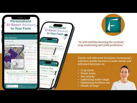
Farmonaut’s Role in the Age of Precision Agriculture
While drone data services provide real-time, hyperlocal imagery, integrating these with satellite-based analysis, AI-powered advisory, and blockchain-enabled traceability creates an irresistible value proposition for modern agriculture.
- Platform Accessibility: Farmonaut delivers advanced crop health monitoring services via Android, iOS, browser apps, and feature-rich APIs.
- AI Advisory: The Jeevn AI Advisory System translates satellite, weather, and drone data into specific field, crop, and input recommendations.
- Blockchain Traceability: Every product’s journey—from seed to harvest to consumer—can be logged and audited for transparency and compliance through secure blockchain links. (See Farmonaut product traceability)
- Carbon Tracking: Monitor your environmental impact, measure emissions, and improve sustainable farming practices with Farmonaut’s carbon footprint tools.
Unlike traditional solutions that require costly hardware installations, Farmonaut’s subscription-based service model democratizes access to enterprise-level analytics—lowering the cost barrier for farmers everywhere.
Ready to activate affordable precision for your farm?
Challenges & Considerations for Drone Data Adoption
Despite the clear value proposition that drone and satellite services deliver, several operational and regulatory challenges remain:
- Data Privacy & Security: Concerns persist among farmers about how their aerial data is used, stored, and shared. Comprehensive, transparent privacy policies are essential.
- Evolving Regulations: Rapid changes in UAV regulations can confuse new users and stall investment. Clear, long-term frameworks are vital.
- Technical Barriers: Issues like limited drone battery life, susceptibility to weather, and requirements for skilled operators may hold back expansive use, especially among smallholder farmers.
- Data Integration: Drone data needs to seamlessly plug into existing farm management systems for maximum value—favoring providers with robust API and automation capabilities.
Future Outlook: The Connected Future of Drone Data in Agriculture
The future is exhilarating. Integration of drone technology in agriculture with satellite monitoring, edge AI, and IoT devices is giving rise to the so-called “Internet of Drones” (IoD)—networks where UAVs communicate and coordinate, automating vast on-farm operations:
- Autonomous Agriculture: Expect more drones that plan and execute missions—like crop spraying or scouting—without human pilots on site.
- Deeper AI Integration: As data volumes grow, AI’s pattern recognition and predictive abilities will make disease, yield, and risk forecasting more accurate than ever.
- Scalable Sustainability: Advanced UAV and satellite analytics make large-scale carbon sequestration, biodiversity, and sustainability measurements practical.
Estimates project that, by the end of the decade, next-gen drone and satellite agriculture could contribute more than $500 billion to global GDP. The impact on food security, environmental stewardship, and rural economies will be profound.
Farmonaut’s Technology Ecosystem: Broad, Robust, Accessible
Our mission is clear: make affordable, advanced precision agriculture accessible for farmers everywhere. Here is how Farmonaut’s ecosystem empowers your agricultural journey:
- Satellite Crop Health Monitoring: Real-time NDVI and multispectral analysis for field health, soil moisture, and resource targeting.
- AI-Based Advisory Systems: Jeevn AI delivers custom action plans and weather-based recommendations, driving yields and efficiency.
- Blockchain Product Traceability: Build consumer trust and compliance from sowing through distribution. Learn more about traceability.
- Fleet & Resource Management: Optimize vehicle and equipment usage across your agri-enterprise. See Fleet Management.
- Carbon Footprinting: Calculate, monitor, and reduce your farm’s environmental impact at each stage. Explore the feature.
- API Access: Seamlessly integrate Farmonaut’s satellite and weather data into your digital solutions. Browse the developer documentation.
Farmonaut Subscription & Access: Get Started Today
Jumpstart your precision farming journey with Farmonaut’s flexible plans—whether you’re an individual farmer, agri-entrepreneur, or enterprise.
- Choose subscription levels based on area (hectares) and data frequency
- Unlock advanced features (AI advisory, blockchain, carbon tracking, fleet optimization) as needed
- Access via web, Android, or iOS apps for in-field mobility
Frequently Asked Questions (FAQ): Drone Data Service Market
-
What are the main benefits of drone technology in agriculture?
Drones provide multispectral and thermal imagery, enabling real-time crop health assessment, early disease and pest detection, and smart input management. They boost yields, reduce costs, and promote sustainable practices. -
How does drone crop monitoring compare to satellite solutions?
Drones offer higher spatial resolution and flexibility for targeted monitoring, while satellites provide broader, regular coverage. Integrating both (as with Farmonaut) ensures maximum data value. -
Are drone data services only for large farms?
No—they’re increasingly accessible for smallholder and medium farms, thanks to falling drone costs, SaaS pricing, and cloud-based analytics platforms. -
Is my field data secure when using satellite or drone-based services?
Modern providers use robust encryption and compliance frameworks to ensure privacy and data security. It’s always best to review provider privacy policies. -
Can drones be used for forest monitoring?
Yes, forest monitoring drones support mapping, species identification, habitat assessment, and conservation efforts, offering rapid response to threats like fires or illegal activities. -
Do I need a pilot’s license to operate agricultural drones?
Regulations vary by country and region. Most jurisdictions require certification for commercial use; always consult local laws and choose reputable service providers as needed. -
How do APIs help with digital agriculture?
APIs enable seamless integration of drone, satellite, and weather data into your farm management systems, automating analytics and alerts. -
What is blockchain traceability in agriculture?
Blockchain stores verifiable records of all production and logistics events, ensuring product authenticity, enhancing recall ability, and fostering consumer trust. -
Can drone and satellite data help me get better crop loan offers or insurance?
Yes. Objective, verifiable imagery speeds up credit approvals and insurance payouts, reducing fraud and administrative delay. -
Where can I try advanced crop analytics today?
Download the Farmonaut Android App or the iOS App or use the Farmonaut Web App to experience real-time monitoring and advisory.
Conclusion: The Future Is Here—Unlock the Power of Drone Data Services
As we’ve explored, drone technology in agriculture is no longer a futuristic vision—it’s the foundation of today’s most successful and sustainable farming practices. From crop monitoring with drones, AI-powered disease identification, and forest management to blockchain traceability and digital fleet optimization, the era of truly intelligent agriculture is here.
The drone data service market will only become more central to modern agricultural management, unlocking productivity gains, safeguarding resources, and offering robust compliance and finance solutions for all players in the global food chain.
Let’s embrace these seven shocking agri-boosts—and shape a more productive, profitable, and sustainable future for agriculture, together. For innovation that’s data-driven, affordable, and accessible, join Farmonaut’s platform today.
Revolutionize your Agri-Journey.
Experience Real Intelligence. Experience Farmonaut.


