Land Classification in the Philippines: A Comprehensive Guide for Farmers and Landowners

In the diverse archipelago of the Philippines, land classification plays a crucial role in shaping agricultural practices, urban development, and environmental conservation. As experts in remote sensing and agricultural technology, we at Farmonaut understand the importance of proper land classification for sustainable development and efficient resource management. In this comprehensive guide, we’ll explore the intricacies of land classification in the Philippines, its impact on farming, and how modern technology is revolutionizing land use management.
Table of Contents
- Introduction to Land Classification in the Philippines
- Historical Context of Land Classification
- Types of Land Classification
- The Process of Land Classification
- Impact on Agriculture and Farming
- Challenges in Land Classification
- Technological Advancements in Land Classification
- Farmonaut’s Role in Modern Land Management
- Legal Aspects of Land Classification
- Future Trends in Land Classification
- FAQ Section
1. Introduction to Land Classification in the Philippines
Land classification Philippines is a systematic process of categorizing land based on its characteristics, potential use, and legal status. This classification system is fundamental to the country’s land use planning, resource allocation, and development strategies. Understanding land classification is essential for farmers, landowners, developers, and policymakers alike.
The Philippines, with its diverse geography and rich natural resources, requires a robust land classification system to ensure sustainable development and proper resource management. This system helps in:
- Determining appropriate land use
- Protecting environmentally sensitive areas
- Guiding agricultural development
- Facilitating urban planning
- Resolving land disputes
2. Historical Context of Land Classification
The concept of land classification in the Philippines has evolved significantly over time. Its roots can be traced back to the Spanish colonial era, but the modern system began taking shape in the early 20th century under American administration.
Key milestones in the history of land classification in the Philippines include:
- 1903: The Philippine Commission Act No. 926 established the initial framework for public land classification.
- 1929: Public Land Act (Commonwealth Act No. 141) further refined the classification system.
- 1975: Presidential Decree No. 705 or the Revised Forestry Code introduced new categories for forest lands.
- 1992: Republic Act No. 7586 or the National Integrated Protected Areas System (NIPAS) Act added protected areas as a distinct classification.
This historical progression reflects the changing priorities and understanding of land use in the Philippines, from purely economic considerations to a more balanced approach incorporating environmental conservation and sustainable development.
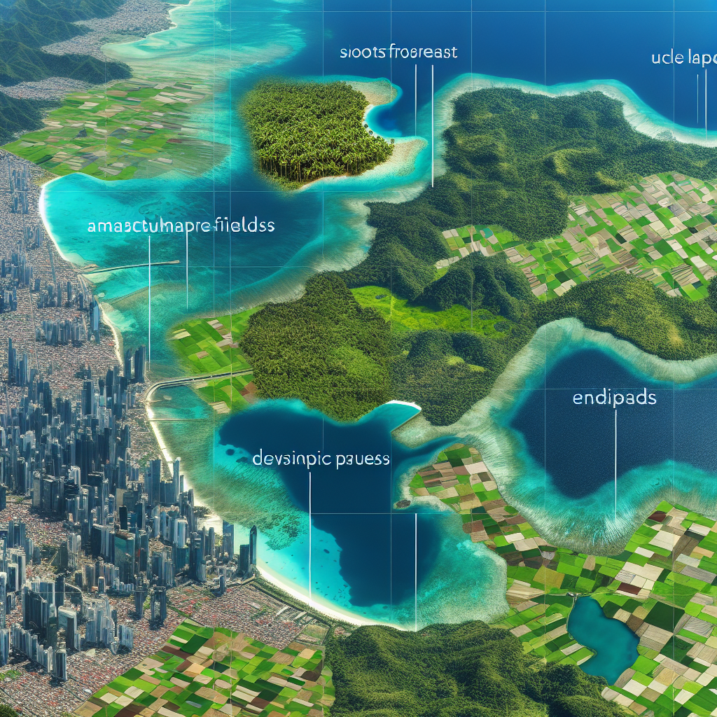
3. Types of Land Classification
In the Philippines, land is broadly classified into two main categories: Alienable and Disposable (A&D) Lands and Forest or Timber Lands. However, within these broad categories, there are several sub-classifications. Let’s explore each in detail:
3.1 Alienable and Disposable (A&D) Lands
A&D lands are those that have been officially declared open for disposition or utilization. These lands can be owned by private individuals or entities. They are further divided into:
- Agricultural Lands: Suitable for crop production, animal husbandry, and other agricultural activities.
- Residential Lands: Designated for housing and urban development.
- Commercial Lands: Allocated for business and commercial activities.
- Industrial Lands: Set aside for manufacturing and industrial purposes.
3.2 Forest or Timber Lands
These are lands that are primarily covered by forests or are intended for forest use. They include:
- Production Forests: Areas designated for sustainable timber production.
- Protection Forests: Forests maintained for watershed protection and biodiversity conservation.
- National Parks: Areas of scenic beauty or historical significance protected for conservation and recreation.
3.3 Special Classifications
In addition to the main categories, there are special classifications that overlap with or exist independently of the A&D and Forest Land categories:
- Mineral Lands: Areas with significant mineral deposits, governed by mining laws.
- Protected Areas: Established under NIPAS, these include strict nature reserves, natural parks, and wildlife sanctuaries.
- Ancestral Domains: Lands traditionally occupied by indigenous peoples, recognized under the Indigenous Peoples Rights Act.
Understanding these classifications is crucial for anyone involved in land use planning, agriculture, or development in the Philippines. It affects land rights, permissible activities, and conservation requirements.
4. The Process of Land Classification
The process of land classification in the Philippines is a complex and multi-faceted endeavor involving several government agencies and scientific methodologies. Here’s an overview of the key steps:
- Initial Survey and Data Collection:
- Topographic mapping
- Soil analysis
- Vegetation assessment
- Climate data collection
- Land Capability Assessment:
- Evaluation of soil fertility
- Analysis of slope and terrain
- Assessment of water resources
- Environmental Impact Study:
- Biodiversity assessment
- Ecosystem services evaluation
- Socio-economic Considerations:
- Population density analysis
- Economic potential assessment
- Legal and Policy Review:
- Compliance with existing laws
- Alignment with national development plans
- Stakeholder Consultation:
- Public hearings
- Engagement with local communities
- Final Classification and Mapping:
- Integration of all data
- Creation of official land classification maps
This process involves collaboration between various government agencies, including the Department of Environment and Natural Resources (DENR), the National Mapping and Resource Information Authority (NAMRIA), and local government units.
5. Impact on Agriculture and Farming
Land classification in the Philippines has a profound impact on agriculture and farming practices. It determines not only what can be grown where, but also influences land tenure, agricultural investments, and rural development strategies.
5.1 Agricultural Zoning
Land classification helps in agricultural zoning, which is crucial for:
- Optimizing crop selection based on soil and climatic conditions
- Planning irrigation systems and water management
- Implementing sustainable farming practices
5.2 Land Use Rights
The classification of land affects farmers’ rights and land tenure security:
- A&D lands can be privately owned, providing farmers with long-term security
- Forest lands may be subject to stewardship agreements, affecting farming practices
5.3 Agricultural Development Planning
Government agencies use land classification data to:
- Allocate resources for agricultural development
- Plan rural infrastructure projects
- Implement targeted support programs for farmers
5.4 Environmental Conservation in Farming
Land classification guides environmental conservation efforts in agricultural areas:
- Identifying areas for agroforestry
- Implementing soil conservation measures
- Protecting watersheds crucial for agriculture
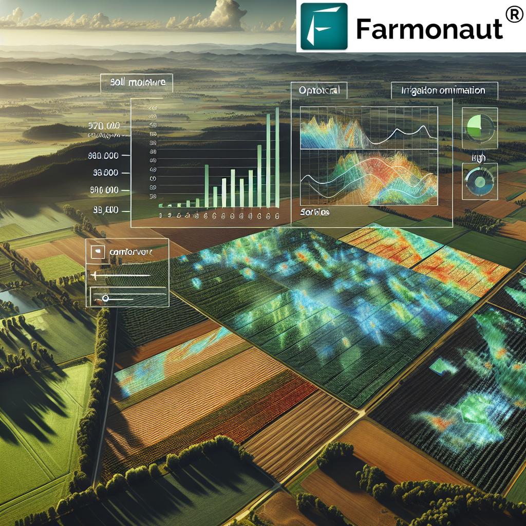
At Farmonaut, we recognize the critical role of proper land classification in sustainable agriculture. Our satellite-based crop monitoring system helps farmers optimize their practices within the framework of land classification, ensuring both productivity and environmental stewardship.
6. Challenges in Land Classification
Despite its importance, land classification in the Philippines faces several challenges:
- Outdated Data: Some classifications are based on decades-old surveys, not reflecting current conditions.
- Conflicting Land Claims: Overlapping claims between different stakeholders (e.g., indigenous peoples, private owners, government) complicate classification.
- Rapid Urbanization: Fast-paced urban expansion often outpaces the reclassification process.
- Climate Change Impact: Changing climate patterns affect land capability, requiring frequent reassessment.
- Limited Resources: Insufficient funding and technical capacity for comprehensive land surveys and reclassification.
- Political Influence: Local political interests sometimes interfere with scientific classification processes.
Addressing these challenges requires a multi-faceted approach, including technological innovation, policy reforms, and enhanced stakeholder engagement.
7. Technological Advancements in Land Classification
Modern technology is revolutionizing the way land classification in the Philippines is conducted. These advancements are making the process more accurate, efficient, and responsive to changing conditions:
7.1 Remote Sensing and Satellite Imagery
Satellite technology, like that used by Farmonaut, offers several benefits for land classification:
- High-resolution imagery for detailed land cover mapping
- Regular updates to track land use changes
- Multi-spectral analysis for vegetation and soil assessment
7.2 Geographic Information Systems (GIS)
GIS technology enhances land classification by:
- Integrating multiple data layers for comprehensive analysis
- Facilitating spatial analysis and modeling
- Enabling easy updates and revisions to classification maps
7.3 Artificial Intelligence and Machine Learning
AI and ML algorithms are being employed to:
- Automate land cover classification from satellite imagery
- Predict land use changes based on historical data
- Optimize land use recommendations based on multiple factors
7.4 Drones and LiDAR Technology
These technologies provide:
- High-resolution topographic mapping
- Detailed 3D modeling of terrain
- Accessibility to remote or difficult-to-survey areas
At Farmonaut, we leverage these technologies to provide farmers and land managers with up-to-date, actionable insights for effective land management within the framework of Philippine land classification.
8. Farmonaut’s Role in Modern Land Management
In the context of land classification Philippines, Farmonaut plays a significant role in enhancing agricultural practices and land management. Our satellite-based farm management solutions offer several advantages:
- Real-time Crop Monitoring: Our platform provides up-to-date information on crop health, helping farmers make informed decisions within their land classification constraints.
- Resource Optimization: By offering insights on soil moisture and vegetation health, we help farmers optimize resource use, particularly important in areas with specific land use restrictions.
- Compliance Monitoring: Our technology can assist in monitoring land use compliance, ensuring that agricultural activities align with designated land classifications.
- Environmental Impact Assessment: Farmonaut’s tools can track changes in land cover over time, aiding in environmental impact assessments crucial for land classification reviews.
To learn more about how Farmonaut can assist in your agricultural endeavors within the Philippine land classification framework, visit our application page.
| Feature | Farmonaut Satellite System | Drone-based Monitoring | IoT-based Monitoring |
|---|---|---|---|
| Coverage Area | Large scale (regional to national) | Limited (local) | Very limited (field-specific) |
| Data Frequency | Regular (every few days) | On-demand (labor-intensive) | Continuous (real-time) |
| Initial Setup Cost | Low | High | Medium to High |
| Maintenance | Minimal | Regular (equipment upkeep) | Regular (device maintenance) |
| Data Analysis | Advanced AI-driven insights | Requires specialized software | Primarily raw data |
| Scalability | Highly scalable | Limited scalability | Moderately scalable |
9. Legal Aspects of Land Classification
The legal framework governing land classification in the Philippines is complex and multifaceted. Key legal considerations include:
- Constitutional Provisions: The 1987 Philippine Constitution provides the foundational principles for land classification and use.
- Public Land Act: Commonwealth Act No. 141 remains a crucial piece of legislation governing public land disposition.
- Local Government Code: This empowers local government units in land use planning within their jurisdictions.
- Indigenous Peoples Rights Act: Recognizes ancestral domains and their unique classification status.
- Environmental Laws: Various environmental protection acts influence land classification and use restrictions.
Understanding these legal aspects is crucial for anyone involved in land management or agricultural activities in the Philippines.
10. Future Trends in Land Classification
The future of land classification in the Philippines is likely to be shaped by several emerging trends:
- Climate Change Adaptation: Land classification will increasingly need to account for changing climate patterns and their impact on land capability.
- Urban Expansion Management: As cities grow, there will be a greater need for dynamic land reclassification to balance urban needs with agricultural and environmental concerns.
- Precision Agriculture Integration: Advanced farming techniques will influence how agricultural lands are classified and managed.
- Biodiversity Conservation: Increased focus on protecting biodiversity hotspots will likely influence future land classification decisions.
- Technology-Driven Reassessment: Continuous monitoring using satellite and AI technologies will enable more frequent and accurate land classification updates.
At Farmonaut, we’re committed to staying at the forefront of these trends, providing farmers and land managers with the tools they need to navigate the evolving landscape of land classification and use in the Philippines.
11. FAQ Section
Q1: What is the primary purpose of land classification in the Philippines?
A1: The primary purpose of land classification in the Philippines is to categorize land based on its characteristics and potential use, guiding appropriate land use planning, resource allocation, and development strategies.
Q2: How often is land classification updated in the Philippines?
A2: While there’s no fixed schedule, land classification is ideally reviewed periodically. However, due to resource constraints, comprehensive updates are infrequent, sometimes spanning decades.
Q3: Can land classification be changed?
A3: Yes, land classification can be changed through a process called reclassification. This typically involves surveys, environmental impact assessments, and approval from relevant government agencies.
Q4: How does land classification affect farmers?
A4: Land classification affects farmers by determining what agricultural activities are permitted, influencing land tenure security, and guiding agricultural development programs and support.
Q5: What role does technology play in modern land classification?
A5: Technology, particularly satellite imagery, GIS, and AI, plays a crucial role in modern land classification by providing accurate, up-to-date data for land assessment and monitoring land use changes over time.
For more information on how Farmonaut’s technology can assist in land management within the Philippine context, visit our API documentation or download our app for Android or iOS.
Conclusion
Land classification in the Philippines is a critical aspect of national development, balancing agricultural needs, urban growth, and environmental conservation. As we’ve explored in this comprehensive guide, it’s a complex system with deep historical roots and significant implications for farmers, landowners, and policymakers alike.
The challenges facing land classification are numerous, from outdated data to the impacts of climate change. However, with the advent of new technologies and a growing understanding of sustainable land management practices, there’s great potential for improvement and innovation in this field.
At Farmonaut, we’re proud to be part of this evolution, offering cutting-edge satellite-based solutions that support efficient and sustainable land management. Our tools provide valuable insights that can help navigate the complexities of land classification and optimize agricultural practices within this framework.
As we look to the future, it’s clear that effective land classification and management will be crucial in addressing challenges like food security, urban expansion, and environmental conservation. By embracing technological advancements and fostering collaboration between stakeholders, the Philippines can develop a more responsive, accurate, and sustainable land classification system.
We invite you to explore how Farmonaut can support your agricultural endeavors within the context of Philippine land classification. Subscribe to our services to leverage the power of satellite technology for better land management:
Together, we can work towards a more sustainable and productive future for Philippine agriculture, guided by informed land classification and innovative technology.