Farmonaut’s Critical Role: Monitoring and Managing Wildfire Impact on Los Angeles Agriculture

“The Palisades Fire in Los Angeles spans 22,660 acres, with only 11% containment, threatening Brentwood and western San Fernando Valley.”
As we witness the devastating Palisades Fire unfold across Los Angeles, our hearts go out to the affected communities. At Farmonaut, we understand the critical importance of monitoring and managing the impact of such disasters on agriculture. In this comprehensive blog post, we’ll explore how our advanced satellite-based technology is playing a crucial role in addressing the challenges posed by this unprecedented urban wildfire.
The Palisades Fire: A Threat to Los Angeles Agriculture
The Palisades Fire has triggered a state of emergency in Los Angeles, with its far-reaching consequences affecting not only urban areas but also the agricultural landscape of Southern California. As the fire continues to spread, encompassing 22,660 acres with only 11% containment, the impact on local farming communities is becoming increasingly apparent.
- Over 5,000 structures destroyed
- 105,000 residents evacuated
- Significant threat to Brentwood and western San Fernando Valley
- Emergency response efforts include 405 Freeway closures
- California National Guard deployment
The agricultural sector in Los Angeles County, known for its diverse crops and urban farming initiatives, faces unprecedented challenges due to this wildfire. From avocado groves to vineyards, the fire’s path threatens to disrupt local food production and livelihoods.
Farmonaut’s Role in Wildfire Monitoring and Management
At Farmonaut, we are leveraging our cutting-edge satellite-based farm management solutions to assist farmers, agricultural authorities, and emergency responders in monitoring and managing the wildfire’s impact on Los Angeles agriculture. Our technology provides real-time insights that are crucial for decision-making during this crisis.
Satellite-Based Crop Health Monitoring
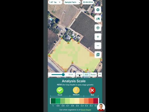
Our advanced satellite imagery analysis allows us to assess crop health across affected areas, providing valuable data on:
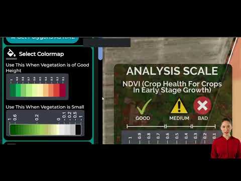
- Vegetation health (NDVI)
- Soil moisture levels
- Fire damage extent
- Smoke impact on crops
This information is crucial for farmers and agricultural agencies to prioritize resources and plan recovery efforts effectively.
Jeevn AI Advisory System
Our AI-driven Jeevn advisory system is working overtime to provide personalized recommendations to farmers in the affected areas. By analyzing real-time satellite data and weather forecasts, Jeevn AI offers crucial advice on:
- Evacuation planning for livestock
- Protection measures for crops
- Post-fire recovery strategies
- Resource allocation during the crisis
“The massive wildfire has destroyed over 5,000 structures and forced 105,000 residents to evacuate in Southern California.”
Blockchain-Based Product Traceability
In times of crisis, ensuring the safety and origin of agricultural products becomes even more critical. Our blockchain-based traceability solution is helping maintain transparency in the supply chain, allowing consumers and authorities to:
- Verify the source of agricultural products
- Ensure food safety standards are met
- Track the journey of produce from farm to table
This transparency is crucial in maintaining consumer confidence and supporting affected farmers during the recovery phase.
Explore Farmonaut’s API for advanced data integration
Assessing the Wildfire’s Impact on Los Angeles Agriculture
To better understand the extent of the Palisades Fire’s impact on local agriculture, we’ve compiled a comprehensive assessment based on our satellite data and AI analysis:
| Agricultural Sector | Estimated Acreage Affected | Potential Economic Loss (USD) | Recovery Time Estimate (months) | Farmonaut’s Monitoring Solutions |
|---|---|---|---|---|
| Avocado Orchards | 3,500 | $15 million | 24-36 | Satellite imagery, NDVI analysis |
| Vineyards | 2,800 | $20 million | 36-48 | Soil moisture monitoring, smoke impact assessment |
| Vegetable Farms | 1,200 | $5 million | 6-12 | Crop health monitoring, AI-based recovery advice |
| Citrus Groves | 2,000 | $10 million | 18-24 | Heat stress analysis, irrigation planning |
| Livestock Pastures | 5,000 | $8 million | 12-18 | Vegetation health tracking, grazing potential assessment |
This assessment highlights the significant impact of the Palisades Fire on various agricultural sectors in Los Angeles County. Farmonaut’s monitoring solutions are tailored to address the specific needs of each sector, providing valuable insights for recovery and resilience.
Emergency Response and Agricultural Support
As the wildfire crisis continues to unfold, Farmonaut is working closely with local authorities and agricultural organizations to provide critical support:
- Real-time mapping of fire-affected agricultural areas
- Coordination with emergency services for targeted evacuation of livestock
- Collaboration with the Los Angeles County Department of Agriculture for damage assessment
- Support for the California Department of Food and Agriculture in planning recovery efforts
Access our API Developer Docs for integration with emergency response systems
Climate Change and Increasing Wildfire Risks
The Palisades Fire serves as a stark reminder of the increasing wildfire risks faced by agricultural communities due to climate change. Farmonaut’s technology is not just reactive but also proactive in helping farmers adapt to these changing conditions:
- Long-term climate trend analysis for agricultural planning
- Early warning systems for potential fire risks
- Recommendations for climate-resilient farming practices
- Carbon footprint tracking to promote sustainable agriculture
By leveraging our advanced satellite technology and AI capabilities, we’re empowering farmers to build resilience against future climate-related challenges.
Water Management During Wildfire Crisis
One of the critical challenges during the Palisades Fire has been water management. With reports of water pressure issues and the unprecedented demand for firefighting efforts, Farmonaut’s technology is proving invaluable in optimizing water resources for agriculture:
- Real-time soil moisture monitoring to prioritize irrigation needs
- Identification of water-stressed crops for targeted intervention
- Collaboration with LADWP to balance agricultural and firefighting water needs
- Advisory on water-efficient farming techniques during the crisis
Our satellite-based monitoring ensures that farmers can make informed decisions about water usage, even as they face challenges from the ongoing wildfire situation.
Supporting Los Angeles’ Urban Agriculture
Los Angeles’ unique urban agriculture landscape, including community gardens and rooftop farms, faces specific challenges during this wildfire crisis. Farmonaut’s technology is adapted to support these urban farming initiatives:
- Micro-level crop health monitoring for small urban plots
- Air quality assessment to guide urban farmers on protective measures
- Coordination with city authorities to protect urban agricultural assets
- Support for community-based agriculture recovery efforts
Our commitment extends to preserving and nurturing Los Angeles’ vibrant urban farming culture, even in the face of this unprecedented challenge.
Evacuation Zone Management and Agricultural Assets
With the evacuation zone stretching from the Pacific Ocean to the San Diego (405) Freeway, managing agricultural assets within these areas is crucial. Farmonaut’s technology is assisting in:
- Mapping of critical agricultural infrastructure within evacuation zones
- Prioritizing the protection of high-value crops and livestock
- Coordinating with authorities for controlled access to farms when safe
- Monitoring abandoned agricultural areas for potential hazards
Our real-time monitoring capabilities are helping authorities make informed decisions about agricultural areas within the evacuation zones, balancing safety concerns with the need to protect valuable agricultural assets.
Post-Fire Recovery and Agricultural Resilience
As we look towards the future, Farmonaut is committed to supporting the recovery and rebuilding of Los Angeles’ agricultural sector. Our technology will play a vital role in:
- Assessing soil health and recommending restoration measures
- Monitoring the regrowth of vegetation in affected areas
- Providing data-driven insights for crop selection in recovery phases
- Supporting insurance claims with accurate damage assessments
By leveraging our advanced satellite technology and AI-driven insights, we aim to help Los Angeles’ agricultural community emerge stronger and more resilient from this crisis.
Farmonaut’s Commitment to Los Angeles Agriculture
As we continue to monitor and support the agricultural community through this challenging time, Farmonaut reaffirms its commitment to providing cutting-edge technology solutions for farmers and agricultural stakeholders. Our team is working tirelessly to ensure that our platform remains a reliable and indispensable tool in the face of such crises.

Farmonaut Subscriptions
Frequently Asked Questions
Q: How can Farmonaut help farmers affected by the Palisades Fire?
A: Farmonaut provides real-time satellite imagery and AI-driven insights to help farmers assess damage, plan recovery, and make informed decisions about crop management during and after the wildfire crisis.
Q: Is Farmonaut’s technology accessible to small-scale urban farmers in Los Angeles?
A: Yes, our platform is designed to cater to farms of all sizes, including urban agricultural projects. We offer tailored solutions that are both affordable and effective for small-scale operations.
Q: How accurate is Farmonaut’s satellite-based crop health monitoring?
A: Our satellite imagery provides highly accurate data, with resolution capabilities that can detect changes in crop health at a granular level. This accuracy is crucial for precise decision-making in crisis situations.
Q: Can Farmonaut’s technology help in predicting future wildfire risks?
A: While we don’t directly predict wildfires, our climate analysis and vegetation health monitoring can provide valuable data that, when combined with other factors, can help assess potential fire risks in agricultural areas.
Q: How does Farmonaut support long-term agricultural resilience in wildfire-prone areas?
A: We offer ongoing monitoring and analysis that helps farmers adapt their practices to changing climate conditions, implement water-efficient techniques, and make data-driven decisions for long-term sustainability.
Conclusion
As we navigate through the challenges posed by the Palisades Fire, Farmonaut stands ready to support Los Angeles’ agricultural community with our advanced satellite-based farm management solutions. Our technology not only aids in immediate crisis response but also paves the way for a more resilient and sustainable agricultural future.
We invite farmers, agricultural organizations, and local authorities to leverage our platform in these challenging times. Together, we can work towards rebuilding and strengthening Los Angeles’ agricultural sector in the face of unprecedented challenges.
Earn With Farmonaut: Affiliate Program
Earn 20% recurring commission with Farmonaut’s affiliate program by sharing your promo code and helping farmers save 10%. Onboard 10 Elite farmers monthly to earn a minimum of $148,000 annually—start now and grow your income!
Stay safe, stay informed, and let’s work together to protect and nurture our agricultural heritage in Los Angeles.


