Revolutionizing London’s Insurance Market: How Aerial Imagery and AI Transform Property Assessment
“AI-powered property assessment analyzes over 20 crucial attributes, including roof materials and building footprints, for precise insurance underwriting.”
In the heart of London’s bustling financial district, a quiet revolution is taking place. The insurance market, long known for its traditional approach, is undergoing a dramatic transformation. At the forefront of this change are cutting-edge technologies like aerial imagery and artificial intelligence (AI), which are reshaping how properties are assessed, risks are evaluated, and claims are processed. In this comprehensive exploration, we’ll delve into how these innovations are not just changing the game but redefining it entirely for the London insurance market and beyond.
The Dawn of a New Era in Insurance
The insurance industry has always been about managing risk, but the tools at our disposal are evolving at an unprecedented pace. Gone are the days when underwriters relied solely on manual inspections and historical data. Today, we’re witnessing the integration of high-resolution aerial mapping and AI-powered property assessment techniques that are bringing a new level of precision and efficiency to the sector.

The London Market Operations and Strategic Sourcing (LIMOSS) has recently announced a groundbreaking partnership with Vexcel Imaging, a leader in aerial imaging and hybrid mapping technologies. This collaboration is set to provide the Lloyd’s Market with access to Vexcel’s advanced aerial imagery services, geospatial data, and property attribute information starting January 1, 2025. This move signifies a major shift in how the insurance market operates, leveraging technology to enhance decision-making processes.
Understanding the London Insurance Market
Before we dive deeper into the technological advancements, it’s crucial to understand the significance of the London insurance market. As a global hub for insurance activities, it comprises:
- Over 50 insurance companies
- More than 380 registered brokers
- Upwards of 4,000 local cover-holders
This extensive network handles complex risks from around the world, making it a perfect testing ground for innovative technologies that can improve underwriting accuracy, streamline claims handling, enhance fraud detection, and revolutionize disaster response for both residential and commercial properties.
The Power of Aerial Imagery in Insurance
Aerial imagery for insurance is not just about pretty pictures from the sky. It’s a game-changer that’s transforming how insurers assess properties and manage risks. Here’s how:
- High-Resolution Mapping: Vexcel’s UltraCam sensors and dedicated aircraft fleet capture incredibly detailed images of properties.
- Geospatial Data Collection: Along with visual data, these flights collect crucial geospatial information that provides context to the images.
- Property Intelligence: By analyzing these images, insurers gain insights into property conditions that were previously difficult or expensive to obtain.
This level of detail allows for more accurate underwriting, faster claims processing, and better fraud detection. For instance, insurers can now assess roof conditions without sending an inspector to climb up there physically, saving time and reducing risks.
AI and Machine Learning: The Brains Behind the Operation
While aerial imagery provides the raw data, it’s the application of AI and machine learning that truly unlocks its potential. These technologies analyze vast libraries of images to extract and continuously update property insights. Some key applications include:
- Automatic detection of roof types and materials
- Precise measurement of building footprints
- Identification of property attributes like swimming pools, solar panels, or nearby hazards
By leveraging AI in property assessment, insurers can make more nuanced evaluations of risks and property conditions, leading to more accurate pricing and better risk management strategies.
Global Reach, Local Impact
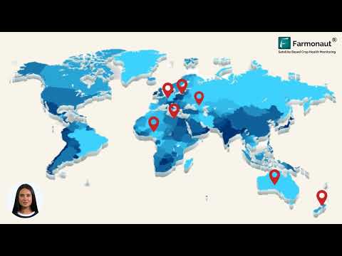
While our focus is on London’s insurance market, it’s important to note that these technological advancements are not confined to one city or country. Vexcel Imaging operates in over 40 countries, including major economies such as:
- Australia
- Canada
- Japan
- United Kingdom
- United States
- Western Europe
This global presence means that insurers can apply these advanced techniques across diverse markets, standardizing their approach to property assessment and risk evaluation.
“High-resolution aerial mapping is transforming insurance operations across 5 major global regions: Australia, Canada, Japan, UK, and Western Europe.”
Disaster Response and Natural Catastrophe Assessment
One of the most impactful applications of aerial imagery and AI in insurance is in the realm of natural disaster response. Vexcel’s Gray Sky initiative is particularly noteworthy, offering rapid imagery of properties affected by natural disasters such as:
- Wildfires
- Hurricanes
- Tornadoes
This capability allows insurers to:
- Quickly assess the extent of damage across affected areas
- Prioritize claims based on severity
- Detect potential fraud by comparing before and after images
- Expedite the claims process for policyholders in need
By leveraging these technologies, insurers can respond more efficiently to catastrophic events, providing faster relief to affected policyholders and managing their own exposure more effectively.

Enhancing Underwriting Precision
Geospatial data in underwriting is revolutionizing how insurers evaluate and price risks. By integrating aerial imagery and AI-driven insights, underwriters can:
- Assess property characteristics more accurately
- Identify potential hazards that may not be visible from the ground
- Evaluate the condition of structures over time
- Make more informed decisions about policy terms and pricing
This level of precision not only benefits insurers by reducing their risk exposure but also helps policyholders by ensuring they receive coverage that accurately reflects their property’s condition and location-specific risks.
Streamlining Claims Processing
The integration of aerial imagery and AI is significantly improving the efficiency and accuracy of claims processing. Here’s how:
- Rapid Assessment: After a reported incident, insurers can quickly access up-to-date imagery of the property.
- Automated Damage Detection: AI algorithms can identify and quantify damage, speeding up the estimation process.
- Historical Comparison: By comparing current images with historical data, adjusters can verify the timing and extent of damage.
- Remote Inspection: In many cases, claims can be assessed without an on-site visit, reducing time and costs.
These improvements lead to faster claim resolutions, improved customer satisfaction, and reduced operational costs for insurers.
Combating Insurance Fraud
Insurance fraud detection technology has taken a significant leap forward with the integration of aerial imagery and AI. These tools provide insurers with powerful means to verify claims and identify potential fraudulent activities:
- Pre-loss Condition Verification: Historical imagery can confirm the state of a property before an alleged incident.
- Change Detection: AI can automatically flag significant changes to a property that may indicate fraudulent claims.
- Pattern Recognition: Machine learning algorithms can identify patterns associated with fraudulent behavior across large datasets.
By leveraging these technologies, insurers can more effectively combat fraud, ultimately leading to lower premiums for honest policyholders and a healthier insurance ecosystem.
The Future of Property Intelligence
As we look to the future, the potential applications of aerial imagery and AI in property intelligence for insurers seem boundless. Some exciting developments on the horizon include:
- 3D Modeling: Creating detailed 3D models of properties for even more precise risk assessment.
- Real-time Monitoring: Integrating satellite and drone imagery for near-real-time property monitoring.
- Predictive Analytics: Using historical and current data to predict future property risks and changes.
- IoT Integration: Combining aerial imagery with data from Internet of Things (IoT) devices for comprehensive property insights.
These advancements promise to further enhance the accuracy of risk assessment, improve customer experiences, and drive innovation in insurance products and services.
Comparative Analysis: Traditional vs. AI-Powered Insurance Assessment
To fully appreciate the impact of these technological advancements, let’s compare traditional insurance assessment methods with the new AI and aerial imagery-powered approaches:
| Assessment Criteria | Traditional Method | AI/Aerial Imagery Method | Estimated Improvement |
|---|---|---|---|
| Time for Property Assessment | 2-3 days | 2-4 hours | 80-90% reduction in time |
| Accuracy of Risk Evaluation | 70-80% | 90-95% | 15-20% increase in accuracy |
| Fraud Detection Rate | 60% | 85% | 40% improvement in detection |
| Disaster Response Time | 5-7 days | 24-48 hours | 70-80% faster response |
| Cost-Effectiveness | Baseline | 30-40% cost reduction | 30-40% more cost-effective |
This comparison clearly illustrates the significant improvements that AI and aerial imagery bring to various aspects of insurance operations.
Challenges and Considerations
While the benefits of integrating aerial imagery and AI into insurance operations are clear, there are challenges that the industry must address:
- Data Privacy: Ensuring compliance with data protection regulations when collecting and processing property images.
- Technology Adoption: Overcoming resistance to change within traditional insurance structures.
- Integration Complexity: Seamlessly incorporating new technologies into existing insurance systems and processes.
- Skill Gap: Training personnel to effectively use and interpret AI-driven insights.
- Ethical Considerations: Addressing concerns about AI bias and ensuring fair treatment of policyholders.
Addressing these challenges will be crucial for the successful implementation and widespread adoption of these technologies in the insurance sector.
The Role of Regulatory Bodies
As with any significant technological advancement in the financial sector, regulatory bodies play a crucial role in shaping the adoption and implementation of aerial imagery and AI in insurance. In the UK, entities like the Financial Conduct Authority (FCA) and the Prudential Regulation Authority (PRA) are closely monitoring these developments. Their focus includes:
- Ensuring fair treatment of customers in AI-driven decision-making
- Maintaining data security and privacy standards
- Promoting transparency in how AI algorithms are used in underwriting and claims processes
- Encouraging innovation while safeguarding against potential risks
As these technologies evolve, we can expect regulatory frameworks to adapt, ensuring that innovation in the insurance sector proceeds responsibly and ethically.
The Impact on Insurance Professionals
The integration of aerial imagery and AI is not just changing processes; it’s transforming roles within the insurance industry. For professionals in the sector, this means:
- Upskilling Opportunities: Learning to interpret and leverage AI-driven insights
- Shifting Focus: Moving from manual data collection to strategic analysis and decision-making
- Enhanced Productivity: Automating routine tasks to focus on complex risk assessments and customer interactions
- Interdisciplinary Collaboration: Working more closely with data scientists and technology experts
Far from replacing human expertise, these technologies are empowering insurance professionals to make more informed decisions and provide better service to policyholders.
Environmental Considerations
The use of aerial imagery in insurance also has environmental implications worth considering:
- Reduced Carbon Footprint: Fewer on-site inspections mean less travel, reducing carbon emissions
- Better Natural Disaster Preparedness: Improved risk assessment can lead to more resilient building practices in vulnerable areas
- Environmental Risk Assessment: Aerial imagery can help insurers better understand and price environmental risks, potentially encouraging more sustainable practices
As the insurance industry becomes more data-driven, it also has the potential to play a larger role in promoting environmental sustainability.
The Global Perspective
While our focus has been on London’s insurance market, it’s important to recognize that these technological advancements are having a global impact. Different regions are adopting and adapting these technologies in unique ways:
- United States: Pioneering the use of drones for property inspection in areas prone to natural disasters
- Japan: Leveraging AI and imagery for earthquake risk assessment and tsunami preparedness
- Australia: Using advanced imaging to assess bushfire risks and improve disaster response
- Canada: Applying these technologies to manage flood risks in urban and rural areas
- Western Europe: Focusing on integrating these technologies with existing insurance systems and addressing data privacy concerns
This global adoption is creating a more interconnected and data-driven global insurance market, with potential for knowledge sharing and collaborative innovation across borders.
The Future of Insurance Policies
As aerial imagery and AI continue to evolve, we can expect to see significant changes in how insurance policies are structured and priced:
- Dynamic Pricing: Policies that adjust premiums in real-time based on changing property conditions or environmental factors
- Customized Coverage: Highly tailored policies that precisely match the unique risks of each property
- Proactive Risk Management: Insurance products that include preventative services based on AI-driven risk assessments
- Instant Quotes: The ability to provide accurate insurance quotes almost instantly using aerial imagery and AI analysis
These innovations have the potential to make insurance more accessible, affordable, and effective for policyholders while also improving profitability for insurers.
Conclusion: A New Era for London’s Insurance Market
The integration of aerial imagery and AI into London’s insurance market represents more than just a technological upgrade; it’s a paradigm shift in how we approach risk assessment, underwriting, and claims processing. As these technologies continue to evolve and mature, we can expect to see:
- More accurate and fair pricing of insurance policies
- Faster and more efficient claims processing
- Enhanced fraud detection and prevention
- Improved disaster response and resilience
- New insurance products and services tailored to emerging risks
While challenges remain, particularly in terms of data privacy, regulatory compliance, and industry-wide adoption, the potential benefits far outweigh the obstacles. As London’s insurance market embraces these innovations, it is poised to maintain its position as a global leader in the insurance industry, setting standards for efficiency, accuracy, and customer service that will ripple across the global market.
The future of insurance is here, and it’s being written in the skies above and the algorithms within. For insurers, policyholders, and the broader financial ecosystem, this revolution promises a more secure, efficient, and responsive insurance landscape for years to come.
FAQ Section
Q: How does aerial imagery improve insurance underwriting?
A: Aerial imagery provides detailed, up-to-date information about properties, allowing insurers to assess risks more accurately. It can reveal property features, conditions, and potential hazards that might not be visible from the ground, leading to more precise underwriting decisions.
Q: Can AI-powered property assessment completely replace human inspectors?
A: While AI significantly enhances the assessment process, it’s unlikely to completely replace human inspectors. Instead, it complements human expertise by providing additional data and insights, allowing inspectors to focus on more complex assessments and decision-making.
Q: How does this technology impact insurance premiums for homeowners?
A: The use of aerial imagery and AI can lead to more accurate risk assessment, potentially resulting in fairer premiums. For some homeowners, this might mean lower premiums if their property is deemed lower risk, while others might see increases if previously undetected risks are identified.
Q: Are there privacy concerns with using aerial imagery for insurance purposes?
A: Yes, privacy is a significant concern. Insurers must comply with data protection regulations and ensure that the use of aerial imagery doesn’t infringe on individuals’ privacy rights. This often involves using anonymized data and obtaining necessary permissions.
Q: How quickly can insurers respond to natural disasters using this technology?
A: With aerial imagery and AI, insurers can assess disaster-affected areas within hours or days, compared to weeks with traditional methods. This allows for much faster claims processing and disaster response.
Q: Will this technology be available to all insurance companies, or just large ones?
A: While larger insurance companies might have more resources to implement these technologies initially, the trend is moving towards more accessible solutions that smaller insurers can also leverage, often through partnerships or third-party service providers.
Earn With Farmonaut: Affiliate Program
Earn 20% recurring commission with Farmonaut’s affiliate program by sharing your promo code and helping farmers save 10%. Onboard 10 Elite farmers monthly to earn a minimum of $148,000 annually—start now and grow your income!
For developers interested in leveraging Farmonaut’s technology, check out our API and API Developer Docs.


