In the ever-evolving world of agriculture, the battle between satellite imagery vs drone imagery is reshaping how we approach farming. This technological revolution is not just changing the game; it’s redefining the playing field altogether. Let’s dive into how these cutting-edge tools are transforming crop monitoring using remote sensing and why every forward-thinking farmer needs to pay attention.
🌾 The Challenge of Modern Agriculture
Agriculture in the 21st century is far from simple. Gone are the days when a farmer could rely on intuition and traditional knowledge alone. Today’s agricultural landscape is complex, demanding, and resource-intensive.
Consider the following challenges:
- Managing multiple large fields efficiently
- Optimizing resource allocation (water, fertilizers, pesticides)
- Balancing profitability with environmental stewardship
- Reducing chemical usage in food production
- Scaling operations while maintaining quality
These challenges call for innovative solutions, and that’s where the power of satellite imagery vs drone imagery comes into play.
🛰️ Enter Remote Sensing: A Game-Changer for Crop Monitoring
Remote sensing technology has emerged as a powerful tool in the farmer’s arsenal. By leveraging satellite and drone imagery datasets, farmers can now map and monitor crops quickly, efficiently, and with unprecedented accuracy.
Here’s how remote sensing is revolutionizing agriculture:
- Early detection of crop health issues
- Precise application of resources
- Minimization of environmental impact
- Data-driven decision making
But the real question is: which technology reigns supreme in the battle of satellite imagery vs drone imagery?
🚁 Drone Imagery: The New Kid on the Block
Drones have quickly become a favorite tool for many farmers. These nimble flying machines offer several advantages in crop monitoring using remote sensing:
- High-resolution imagery
- On-demand data collection
- Ability to capture data beneath cloud cover
- Flexibility in scheduling flights
Drone technology allows farmers to get up close and personal with their crops, providing detailed insights that were previously impossible to obtain without physically walking the fields.
🌍 Satellite Imagery: The Bird’s Eye View
While drones offer unparalleled detail, satellite imagery brings its own set of advantages to the table:
- Vast coverage area
- Consistent, regular imaging schedules
- Historical data availability
- Cost-effective for large-scale operations
Satellite imagery allows farmers to monitor vast areas of land simultaneously, making it an invaluable tool for large-scale agricultural operations.
🤼 Satellite Imagery vs Drone Imagery: The Showdown
When it comes to crop monitoring using remote sensing, the choice between satellite imagery vs drone imagery isn’t always clear-cut. Let’s break down the key differences:
| Feature | Satellite Imagery | Drone Imagery |
|---|---|---|
| Resolution | Lower (meters per pixel) | Higher (centimeters per pixel) |
| Coverage Area | Large (global) | Small (local) |
| Frequency | Regular (days to weeks) | On-demand |
| Weather Dependency | Affected by cloud cover | Can fly below clouds |
| Cost | Lower for large areas | Lower for small areas |
The choice between satellite imagery vs drone imagery often depends on the specific needs of the farm and the scale of operations.
🌱 Crop-Specific Farming Apps: Bringing It All Together
The true power of satellite imagery vs drone imagery is unleashed when combined with crop-specific farming apps. These applications leverage the strengths of both technologies to provide farmers with actionable insights.
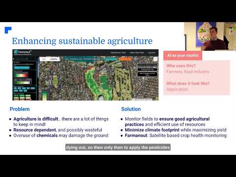
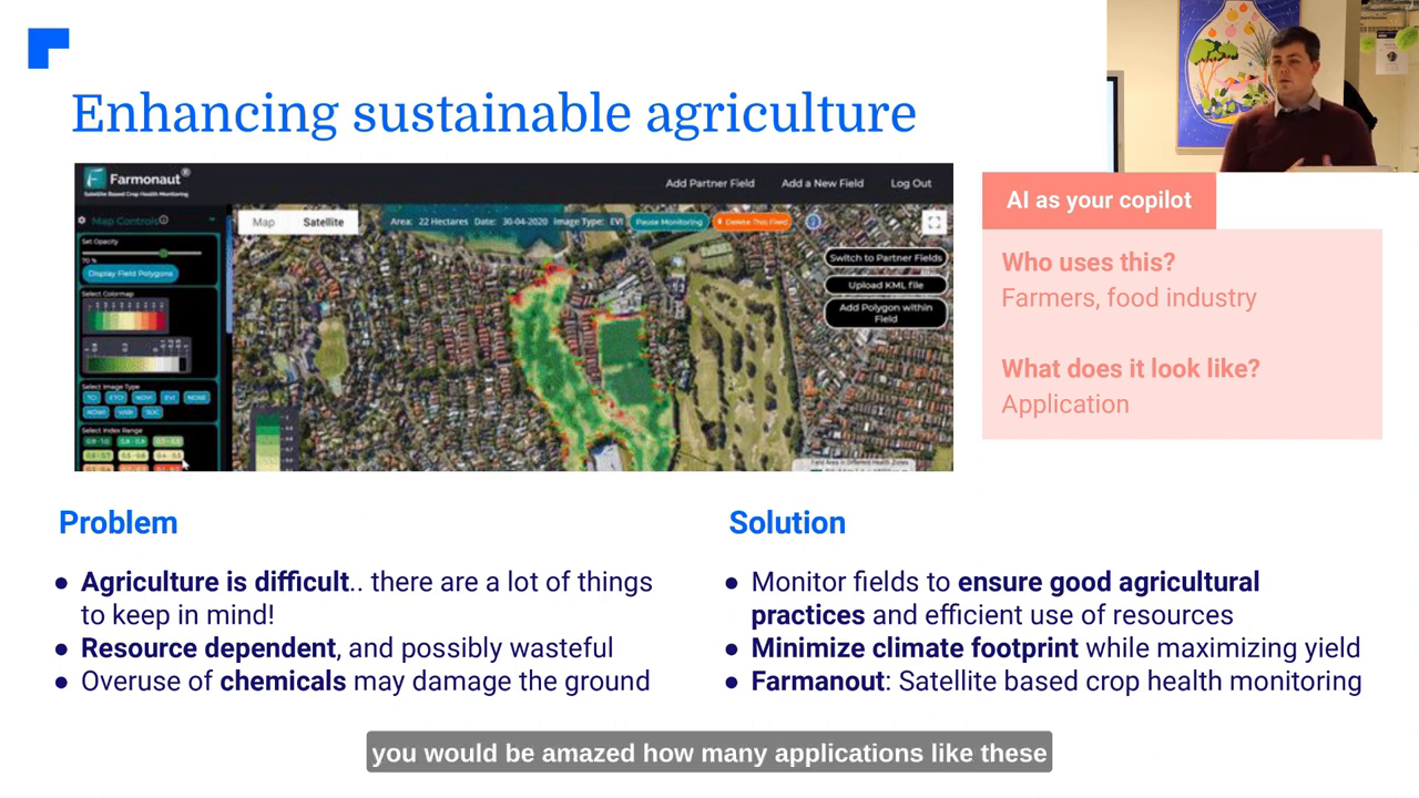
One such example is Farmonaut, an application that utilizes remote sensing data to help farmers optimize their practices. Here’s how it works:
- Collects data from satellites and drones
- Analyzes crop health using machine learning algorithms
- Provides recommendations for resource application
- Helps minimize chemical usage and environmental impact
💧 Optimizing Resource Usage: A Win-Win Scenario
One of the most significant benefits of using remote sensing in agriculture is the optimization of resource usage. This is particularly crucial when it comes to water management.
By leveraging satellite and drone imagery datasets, farmers can:
- Identify areas of water stress in crops
- Apply irrigation precisely where needed
- Reduce overall water consumption
- Prevent overwatering and associated issues
This not only saves money for the farmer but also contributes to environmental conservation by preserving precious water resources.
🌿 Enhanced Vegetation Monitoring: Keeping Crops Healthy
Both satellite imagery and drone imagery excel at providing enhanced vegetation monitoring capabilities. This allows farmers to keep a close eye on crop health and respond quickly to any issues that arise.
Key benefits include:
- Early detection of pest infestations
- Identification of nutrient deficiencies
- Monitoring of crop growth stages
- Assessment of crop damage after extreme weather events
By catching problems early, farmers can take targeted action, reducing the need for broad-spectrum treatments and minimizing crop losses.
🧪 Reducing Chemical Usage: A Step Towards Sustainable Farming
One of the most promising aspects of crop monitoring using remote sensing is its potential to significantly reduce chemical usage in agriculture. This aligns perfectly with the growing demand for more sustainable and environmentally friendly farming practices.
Here’s how satellite imagery vs drone imagery contributes to this goal:
- Precise identification of problem areas
- Targeted application of pesticides and herbicides
- Reduction in overall chemical usage
- Minimization of chemical runoff into water sources
By using these technologies, farmers can produce healthier food while also protecting the environment.
🌐 The Bigger Picture: Beyond the Farm
While the immediate benefits of satellite imagery vs drone imagery are clear for farmers, the impact of these technologies extends far beyond individual farms. The food industry as a whole stands to gain from these advancements.
Potential industry-wide benefits include:
- Improved supply chain management
- Better forecasting of crop yields
- Enhanced food traceability
- More efficient distribution of resources
As these technologies continue to evolve and integrate, we can expect to see a more resilient and sustainable global food system emerge.
❓ FAQ: Satellite Imagery vs Drone Imagery in Agriculture
Q: Which is better for crop monitoring: satellite imagery or drone imagery?
A: Both have their strengths. Satellite imagery is better for large-scale monitoring, while drone imagery offers higher resolution for detailed analysis of smaller areas.
Q: How often should I use remote sensing for my crops?
A: The frequency depends on your specific needs, but many farmers find weekly or bi-weekly monitoring to be effective for most crops.
Q: Can remote sensing completely replace traditional field scouting?
A: While remote sensing is powerful, it’s best used in conjunction with traditional methods for optimal results.
Q: Are there any privacy concerns with using satellite or drone imagery?
A: There can be. It’s important to be aware of local regulations regarding drone usage and to respect property boundaries when collecting data.
Q: How much can I expect to save by using remote sensing technologies?
A: Savings vary, but many farmers report significant reductions in resource usage and increased yields, leading to improved profitability.
🚀 The Future of Farming: Embracing Technology for Sustainability
As we look to the future, it’s clear that the integration of satellite imagery vs drone imagery in agriculture is not just a trend, but a necessary evolution. These technologies, combined with crop-specific farming apps and advanced data analysis, are paving the way for a more sustainable and efficient agricultural sector.
By embracing these innovations, farmers can:
- Increase crop yields while reducing resource usage
- Minimize their environmental impact
- Produce healthier, chemical-free food
- Adapt more quickly to changing climate conditions
The future of farming is here, and it’s powered by the eyes in the sky and the drones in the field. As we continue to refine and integrate these technologies, we move closer to a world where sustainable agriculture is not just a goal, but a reality.
Are you ready to take your farming practices to the next level? The time to embrace the power of satellite imagery vs drone imagery is now. Your crops, your bottom line, and the planet will thank you.