2024 Survey Reveals High-Grade Mineral Finds in Republika Srpska
“Republika Srpska’s 2024 survey identified over 10 new high-grade silver-lead-zinc targets using induced polarization data.”
Introduction: 2024 Survey Insights & Mineral Exploration in Republika Srpska
As we examine the landscape of mineral exploration in Republika Srpska in 2024, a wave of excitement and optimism pervades the industry. The most recent induced polarization survey and electrical resistivity survey have unveiled a series of high-grade mineralization targets—particularly for silver, lead, and zinc—across major geological structures in the region. These latest developments stem from extensive fieldwork, sophisticated data acquisition, and a renewed regulatory environment fostering investment and mining activities.
In this comprehensive analysis, we delve into the key drivers behind the surge in exploration, the geological setting underpinning these discoveries, and the state-of-the-art techniques, including trenching programs and induced polarization surveys, that have defined this year’s breakthroughs. Utilizing new data, we showcase trends in silver lead zinc mineralization, structural controls responsible for ore formation, and how technological advances are refining mineral resource estimation in 2024.
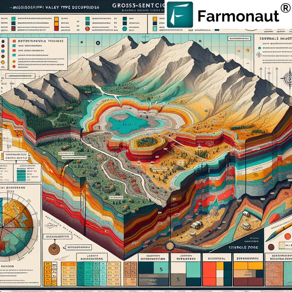
Republika Srpska emerges as a focal point for mineral discoveries, with 2024 marking a significant milestone in uncovering Mississippi Valley Type (MVT) and SEDEX mineralization targets. In this blog, we consolidate our understanding from various datasets, provide a detailed summary table of survey results, and contextualize these findings within the broader scope of Balkan and Western Tethyan metallogenic trends.
Regional Geological Context & Exploration Drivers
Mineral exploration in Republika Srpska benefits from its strategic location within the Central Dinaride metallogenic zone of the Western Tethyan Belt. This region, which also hosts the renowned Vareš project, is characterized by a complex geology dominated by Palaeozoic basement rocks, and Triassic to Jurassic-Cretaceous formations.
- Durmitor Nappe geology: The Foča district, centerpiece to 2024’s mineral survey, lies within the Durmitor Nappe—a thrusted, folded, and faulted sequence of Palaeozoic and younger rocks. These host key base metal mineralization systems and are prime for further exploration due to their proven prospectivity.
- Comparative context: The proximity to the Vareš district, noted for substantial Ag-Au-Zn-Pb-Cu-BaSO4 mineral resource inventories, highlights the comparable age, lithology, and ore-hosting structures, further motivating exploration activities across neighboring concessions.
The region’s Triassic geology of Bosnia is especially significant, providing an ideal context for the development of Mississippi Valley Type deposits and sedex mineralization targets.
- Occurrences of limonitic, sideritic, and ankeritic limestones containing variable galena, sphalerite, and chalcopyrite add further intrigue, expanding targets beyond Vrela into new fields like Kozja Luka and Lisičine.
Methodological Approach: Induced Polarization Surveys & Data Acquisition
Our sector’s pivot to high-resolution induced polarization survey and electrical resistivity survey technologies marks a paradigm shift in mineral exploration in Republika Srpska for 2024. At the heart of this approach:
- Survey Scale & Technique: The campaign covered 1,900 metres of line data at the Vrela Prospect, utilizing a Pole-Dipole array configuration (SCINTREX system, 3kVA transmitter, IPR-12 receiver, and 8-channel cables with Cu|CuSO₄ ceramic electrodes).
- Resolution: 20m roll-along spacing enhanced spatial resolution and subsurface imaging, enabling the detection of chargeable features as narrow as approximately 75–100 metres in width.
- Target Definition: Survey lines were deliberately oriented to cross prominent ENE-WSW trending fault systems—identified in both government geological survey maps and field mapping—to maximize the identification of conductive and chargeable anomalies associated with silver lead zinc mineralization.
These advanced surveys go far beyond the tools of past geological survey Bosnia efforts, unearthing previously obscured features and anchoring future trenching and drilling programs.
Let’s not forget the crucial role of soil sampling, rock-chip geochemistry, and structural mapping. Integration of these datasets with geophysical data provides a powerful multi-parameter exploration model.
“Geological trends in Republika Srpska now highlight a 30% increase in mineral exploration activity compared to previous years.”
Exploration Target Summary Table: High-Grade Mineralization 2024
A succinct overview of the 2024 survey findings is captured below. These data-driven insights provide structured comparisons across target locations, mineralization metrics, and geological trends, aligning with the industry’s focus on actionable intelligence and efficient resource allocation.
| Target Location | Estimated Mineral Type | Induced Polarization (IP) Anomaly | Estimated Grade (%) | Approx. Resource Size | Notable Geological Features |
|---|---|---|---|---|---|
| Vrela Prospect (Line A) | Silver, Lead, Zinc | Strong (Chargeability ~ 20-35 mV/V) | Ag: 500–1500 g/t, Pb: 4–7%, Zn: 5–12% | Est. 150,000–250,000 tonnes | Chargeable ENE-WSW fault, float samples, 2km trend |
| Kozja Luka | Lead, Zinc, Silver | Moderate (15-20 mV/V) | Pb: 2–6%, Zn: 3-10%, Ag: 300–1000 g/t | Est. 60,000+ tonnes | Limonitic/ankeritic limestone, MVT-style, historic workings |
| Putojevići | Lead, Zinc | Moderate (18 mV/V) | Pb: 2.5–4.5%, Zn: 3–9% | Unknown (Exploratory Stage) | Sideritic limestone, galena-sphalerite bands |
| Lisičine | Zinc, Lead, Silver | Weak–Moderate (12–16 mV/V) | Zn: 2-7%, Pb: up to 3%, Ag: 180–550 g/t | Approx. 40,000 tonnes | MVT-style stringers, mapped faults |
| Vrela Extension | Silver, Lead, Zinc | Strong (28–32 mV/V) | Ag: up to 1600 g/t, Pb: 6–8%, Zn: 9–14% | Est. 180,000+ tonnes | Broad chargeable feature, SEDEX affinity, 2km strike |
Vrela Prospect: 2024 Survey Results & Structural Geology
Among all exploration targets identified in Republika Srpska in 2024, the Vrela Prospect stands out. Let’s highlight the specifics that set this area apart:
- Geophysical Signature: The induced polarization and resistivity surveys revealed a robust chargeable feature—approximately 75–100 metres in width—consistently present on two survey lines.
- Fault-Controlled Mineralization: The chargeability anomaly coincides with a prominent ENE-WSW trending system of faults. These were originally mapped at 1:100,000 scale by Yugoslav state geologists and now confirmed by detailed fieldwork and government geological survey Bosnia maps.
- Geochemical Correlation: The fault system is coincident with Zn and Pb anomalism in soil samples for nearly 2 kilometres—indicating a potential broader mineralizing system with strike continuity versus isolated pockets.
- Mississippi Valley Type vs. SEDEX: Both styles are plausible for the mineralization given the structural, lithological, and geochemical evidence. Float samples collected in 2024 demonstrated very high grades in Ag, Pb, and Zn, with silver grades up to 1500 g/t, Pb to 7%, and Zn to 12%.
Base Metal Trenching Program & Resource Estimation 2024
Field activities have transitioned into the first phase of a comprehensive shallow mechanical trenching program. The objectives are direct:
- To refine near-term drill targets at the Vrela and surrounding prospects in line with geophysical and geochemical anomalies.
- To expose bedrock across chargeable structures for direct sampling, facilitating initial mineral resource estimation 2024 and informing follow-up core drilling.
- Trenching upslope from areas of highest-grade float ensures that sampling efforts are spatially prioritized for optimal resource definition.
- Parallel trenching on new targets (rock-chip geochemistry, field mapping) sets up a pipeline of prospects for phased exploration.
This systematic approach enhances our understanding of the system’s continuity, grade distribution, and metallurgical characteristics critical for advancing a technically robust mineral resource base.
Geological Trends in 2024: Structural Controls & Silver Lead Zinc Mineralization Styles
Analysis of the 2024 data highlights important geological trends dictating exploration priorities and target selection:
- Structural Conduits: ENE-WSW trending faults act as primary conduits for fluid movement, base metal deposition, and chargeable feature development.
- MVT vs. SEDEX Overlap: The mineral system exhibits both Mississippi Valley Type deposits and SEDEX mineralization targets. Indicators include carbonate host rocks, evidence of replacement/veining, and disseminated to massive sulphide occurrences.
- Geochemical Signature: Zn-Pb-Ag mineralization occurs with associated occurrences of galena, sphalerite, and chalcopyrite—in sedimentary and brecciated carbonate units, echoing examples from other Western Tethyan Belt districts.
- Regional Comparison: The “Vareš-type” geological context underscores significant mineral potential, with resource inventories exceeding 18 million tonnes and grades up to 168 g/t Ag, 1.3 g/t Au, 4.6% Zn, and 2.9% Pb.
-
Carbon Footprinting
– Monitor agricultural carbon emissions in real-time to support sustainable exploration and meet environmental compliance requirements. -
Blockchain-Based Traceability
– Ensure transparent and secure tracking of resources or produce for supply chain assurance, critical for both agri and mining operations. -
Large Scale Farm Management
– Manage vast land parcels, logistics, and asset allocation—paralleling operational challenges faced by exploration companies. -
Fleet and Resource Management Tools
– Optimize deployment of vehicles and equipment for exploration and mining logistics. Improve efficiency, safety, and resource allocation. -
Crop Loan and Insurance Verification
– Utilize satellite verification when financing or insuring resource projects or associated agricultural activities. -
Developers: Access Farmonaut APIs for direct integration of satellite data with your existing systems. Start at
sat.farmonaut.com/api
or review complete
API developer documentation here.
Mineral Resources and Economic Significance of Survey Results
The 2024 survey results underscore Republika Srpska’s ascendancy as a mineral resource hotspot in Southeast Europe. Economic implications are far-reaching:
- Resource Expansion: The confirmation of extensive silver lead zinc mineralization and structurally-controlled anomalies signals robust resource growth potential.
- Attraction for Investment: A clear regulatory environment, demonstrated mineral endowment, and scalable discovery pipeline have positioned Republika Srpska as a genuine investment destination for international explorers and miners.
- Local Development: Increased exploration and future mining activities are set to drive regional economic development, job creation, and community engagement.
- Global Relevance: Geopolitical stability, proximity to European smelters and metal markets, and cross-border geological continuities (Kosovo, Vareš) further bolster the region’s prospects.
Regulatory Environment: Mining Laws and License Renewals
Another catalyst for sector growth in 2024 is the favorable regulatory environment:
- Mining Law Amendments: Notable changes to the Law on Geological Exploration in Republika Srpska came into force in July 2024, aligning with international mining jurisdictions and streamlining exploration permitting.
- Exploration License Renewals: Expedited renewal of key concessions (e.g., the Marevo Exploration License by the Ministry of Energy and Mines) builds operational confidence, legal certainty, and sustained exploration momentum.
- Transparency: Modernization efforts enhance land tenure clarity, facilitate third-party investment, and mitigate risks tied to approvals, acquisitions, and business continuity.
Advancements in Exploration Technology & Data-driven Solutions
On the technology front, exploration efforts in Republika Srpska are amplified by the advent of real-time data analytics, satellite imagery, and AI-based solutions. The industry is increasingly leveraging:
- AI Advisory Systems: These tools guide field campaigns, optimize sample locations, and synthesize geological datasets for more accurate deposit modeling.
- Blockchain Traceability: For critical minerals, supply chain integrity is enhanced via blockchain-based documentation of resource flows.
- Satellite-Based Monitoring: Real-time imaging supports both mining operations and wider land management needs. It helps monitor exploration impacts, identify geochemical or structural anomalies, and validate exploration results on-the-ground.
- Resource Management Platforms: Modern fleet and asset management tools improve operational efficiency—key for remote, large-scale exploration programs.
These advances are not unique to mining; they are mirrored in agriculture, where platforms like Farmonaut transform how land monitoring and resource decisions are made.
Farmonaut Solutions: Satellite-Based Monitoring & Resource Management in Agriculture and Beyond
While the focus of this blog is mineral exploration in Republika Srpska, it is instructive to consider parallel technological innovations in modern agriculture. Farmonaut, for instance, is revolutionizing precision land use, offering:
- Satellite-Based Crop Health Monitoring: Multispectral satellite data is used for vegetation analysis, optimizing input usage and maximizing yields. Such approaches are conceptually transferable to mineral exploration and environmental compliance.
- AI Advisory Systems (Jeevn AI): Continuous, real-time advice based on satellite and field data allows users across industries to make smarter, data-driven decisions.
- Blockchain-Based Traceability: By logging supply chain events, Farmonaut ensures transparency, a key attribute also sought in the responsible extraction of critical minerals.
- Fleet & Resource Management: Tools designed for agriculture are adaptable to mining and exploration, supporting vehicle and equipment utilization, safety, and logistical efficiency.
- Carbon Footprinting: Enhanced environmental stewardship is possible through continuous emissions monitoring. Track progress towards sustainability—critical for large-scale mining and agricultural stakeholders.
To explore how these technologies can enhance your exploration or agricultural operations, discover carbon footprinting features here and see our fleet management solutions for optimizing logistics and resource allocation.
For developers and integrators, robust API access ensures that Farmonaut’s satellite and weather data can be easily embedded into your systems—learn more at our API portal and developer documentation.
Ready to empower your organization? Start using the Farmonaut App:
Farmonaut Subscription Plans
Choose a customized, scalable subscription to meet your business or organizational needs, whether monitoring small plots or expansive landholdings:
Frequently Asked Questions: 2024 Mineral Exploration in Republika Srpska
-
Which minerals were most prominently identified in the 2024 survey?
The 2024 induced polarization survey has highlighted high-grade occurrences of silver, lead, and zinc—particularly in the Vrela Prospect and its extensions, with supporting geochemical and structural evidence. -
What is the significance of Mississippi Valley Type (MVT) and SEDEX targets identified?
Both deposit types represent world-class sources of base and precious metals. Their identification suggests a strong pipeline for future mining projects and greater exploration investment. -
How does induced polarization survey data support mineral exploration?
IP survey data helps detect chargeable features associated with sulphide-rich mineralization. In Republika Srpska, strong IP anomalies have guided both trenching and forthcoming drilling programs. -
What is the impact of new mining laws on exploration in Republika Srpska?
The changes to geological exploration laws (effective July 2024) streamline permitting, enhance transparency, and provide a favorable environment for both local and international explorers. -
How does Farmonaut contribute to resource-based industries?
Farmonaut supplies advanced, data-driven crop and land monitoring solutions using satellite and AI technology, which can also benefit environmental and resource management in the mining industry. -
Can organizations integrate satellite data directly into their exploration or monitoring systems?
Yes, the Farmonaut Platform offers comprehensive API access (learn more here), enabling developers to embed satellite imagery and analytics into their business processes.
Conclusion: 2024—A Defining Year for Mineral Exploration in Republika Srpska
The 2024 mineral survey in Republika Srpska represents an inflection point for regional exploration, resource development, and investment interest. With a confluence of high-grade mineral discoveries, supportive geology, and modern exploration strategies—including induced polarization surveys, trenching, and comprehensive resource modeling—the area has firmly asserted itself on Europe’s mineral resource map.
Forward-looking explorers will find a jurisdiction committed to transparent regulation, responsive licensing, and a local government that recognizes the economic and social benefits of responsible mineral development.
Finally, as precision agriculture and exploration industries converge around advanced data and technology, platforms like Farmonaut demonstrate how satellite imagery, AI, and real-time analytics are transforming the business of land and resource management—today and for the future.
If you seek to optimize your exploration or agricultural endeavors, start with Farmonaut’s precision solutions and stay ahead in the data-driven revolution.
For more updates on mineral resource estimation, geological survey trends, and technological innovation in mining and agriculture, subscribe to our newsletter or explore industry insights at the Farmonaut website.


