Revolutionizing Agriculture: Farmonaut’s Colorblind Satellite Data Visualization
At Farmonaut, we’re committed to making precision agriculture accessible to all farmers, regardless of their visual abilities. Today, we’re excited to share a significant step forward in our mission to democratize smart farming technology. Our recent launch of colorblind satellite data visualization is a testament to our dedication to user feedback and inclusive design in agritech.
The Power of User Feedback in Shaping Agritech Solutions
We recently received invaluable feedback from Mr. Ranga Rajan, founder of diseasefreelife.com and a colorblind user monitoring 4 hectares of farmland. His insights have been instrumental in refining our approach to data visualization, ensuring that our platform is truly accessible to all users, including those with color vision deficiencies.
Mr. Rajan’s feedback highlights the importance of inclusive design in agritech solutions. He noted, “You made me feel that I am working with Apple, not just a startup.” This sentiment underscores our commitment to quality and user-centric design, even as a growing company in the competitive agritech space.
The Challenge of Color in Satellite Data Visualization
Traditionally, satellite data visualization heavily relies on color-coded imagery to represent various aspects of crop health, soil moisture, and other critical agricultural metrics. While this approach is effective for many users, it inadvertently excludes a significant portion of the population who have difficulty distinguishing between certain colors.
Colorblindness affects approximately 1 in 12 men and 1 in 200 women worldwide. In the context of agriculture, where precise interpretation of data is crucial for decision-making, this presents a significant challenge. Our goal at Farmonaut is to ensure that every farmer, regardless of their visual abilities, can benefit from the power of satellite-based precision agriculture.
Introducing Farmonaut’s Colorblind Satellite Data Visualization
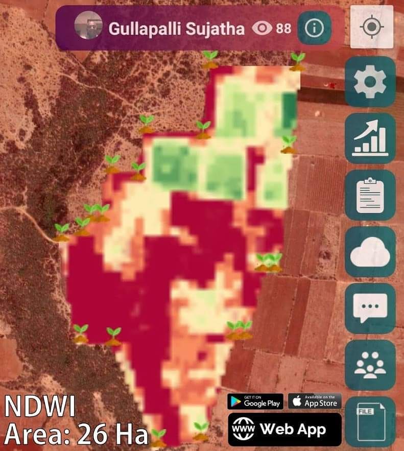
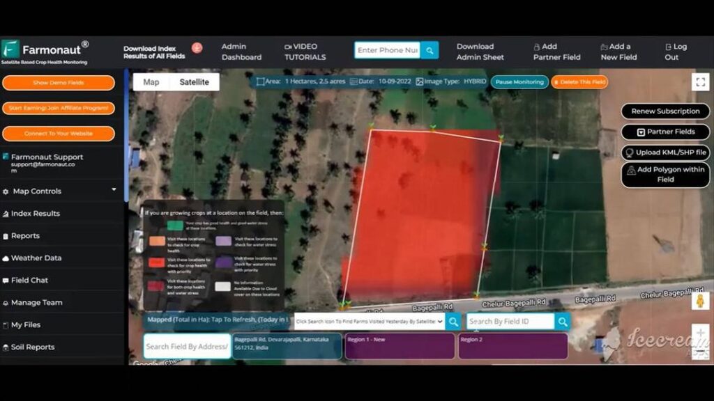
To address this challenge, we’ve developed a groundbreaking colorblind visualization of satellite data, currently available on our web app. This new feature renders data using only black and white, eliminating the reliance on color differentiation without compromising the depth and meaning of the information provided.
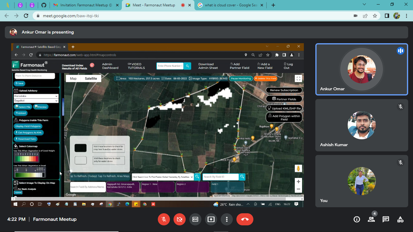
Key features of our colorblind visualization include:
- High Contrast Imagery: By using black and white, we ensure maximum contrast for easy interpretation of data.
- Texture-Based Differentiation: Different patterns and textures are used to represent various data points, replacing color-based distinctions.
- Comprehensive Legend: A detailed legend accompanies each image, explaining the meaning behind different shades and patterns.
- Scalable Design: The visualization is designed to work across different screen sizes and resolutions, ensuring accessibility on various devices.
Mr. Rajan’s feedback on this new feature was overwhelmingly positive. He stated, “Even if someone is not colorblind, this interpretation is giving us an immediate picture.” This comment highlights the universal benefit of our approach, potentially improving data interpretation for all users, not just those with color vision deficiencies.
The Impact of Inclusive Design in Agritech
The introduction of colorblind-friendly satellite data visualization is more than just a feature update; it’s a step towards a more inclusive agricultural technology landscape. By making our platform accessible to colorblind users, we’re not only expanding our user base but also ensuring that more farmers can benefit from precision agriculture techniques.
The impact of this inclusive approach extends beyond individual farmers. It has implications for:
- Agricultural Cooperatives: Enabling all members to participate equally in data-driven decision-making.
- Agricultural Education: Making learning materials and agricultural data more accessible to students with color vision deficiencies.
- Policy Making: Ensuring that agricultural policies based on satellite data consider the needs of all farmers.
- Research and Development: Encouraging the development of more inclusive technologies in the agritech sector.
The Technology Behind Farmonaut’s Satellite System
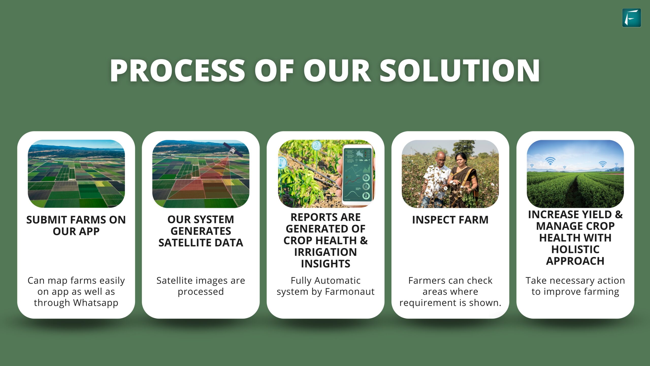
At the core of our colorblind visualization feature is our advanced Satellite system. This cutting-edge technology leverages the power of remote sensing to provide detailed, accurate, and timely information about agricultural lands.
Key aspects of our Satellite system include:
- High-Resolution Imagery: Our system utilizes the latest in satellite technology to capture detailed images of farmland.
- Multispectral Analysis: By analyzing various spectral bands, we can extract a wealth of information about crop health, soil conditions, and more.
- Frequent Updates: Regular satellite passes ensure that farmers have access to up-to-date information about their fields.
- AI-Powered Interpretation: Advanced algorithms process the raw satellite data, transforming it into actionable insights for farmers.
- Customizable Alerts: Farmers can set up personalized alerts for various conditions, such as potential pest infestations or irrigation needs.
The integration of our Satellite system with the new colorblind visualization feature represents a significant advancement in making remote sensing technology truly accessible to all farmers.
Farmonaut’s Commitment to Smart Farming
Our colorblind visualization feature is just one aspect of our broader commitment to smart farming. At Farmonaut, we believe that technology should empower farmers, not complicate their lives. Our suite of smart farming tools is designed to be intuitive, powerful, and accessible to farmers of all backgrounds.

Some of the key components of our smart farming approach include:
- AI-Powered Crop Monitoring: Our system uses artificial intelligence to analyze satellite data and provide insights on crop health, potential issues, and yield predictions.
- Precision Agriculture Tools: We offer a range of tools for precise application of fertilizers, pesticides, and irrigation, helping farmers optimize resource use.
- Weather Integration: Our platform incorporates local weather data and forecasts to help farmers make informed decisions about planting, harvesting, and crop management.
- Mobile Accessibility: All our tools are available through our mobile app, allowing farmers to access critical information from anywhere in the field.
- Data-Driven Decision Support: We provide actionable recommendations based on the analysis of historical and real-time data, helping farmers make informed decisions.
Comparing Farmonaut’s Satellite System with Drone and IoT-based Farm Monitoring
While drones and IoT devices have their place in modern agriculture, Farmonaut’s satellite-based system offers several unique advantages. Here’s a comparison table highlighting the benefits of our approach:
| Feature | Farmonaut Satellite System | Drone-based Monitoring | IoT-based Monitoring |
|---|---|---|---|
| Coverage Area | Entire farm in a single image | Limited by flight time and regulations | Limited by number and placement of sensors |
| Frequency of Updates | Regular updates based on satellite passes | Dependent on manual flights | Real-time, but limited to sensor locations |
| Initial Setup Cost | Low – No hardware required | High – Drone purchase and training needed | Medium to High – Sensors and network setup required |
| Maintenance | Minimal – Software updates only | Regular drone maintenance required | Sensor maintenance and battery replacements needed |
| Scalability | Highly scalable – No additional hardware needed for larger farms | Limited by drone capabilities and regulations | Requires additional sensors for larger areas |
| Weather Independence | Can penetrate cloud cover with certain spectral bands | Limited by weather conditions | Generally weather-independent, but may be affected by extreme conditions |
| Data Analysis | Advanced AI-powered analysis of multispectral data | Requires separate software for analysis | Limited to sensor capabilities |
| Legal Compliance | No special permits required | Subject to drone flight regulations | May require permits for certain types of sensors |
As the table illustrates, Farmonaut’s satellite-based system offers a comprehensive, scalable, and cost-effective solution for farm monitoring, particularly suitable for medium to large-scale operations.
The Future of Inclusive Agritech
The launch of our colorblind visualization feature is just the beginning. At Farmonaut, we’re committed to continually improving our platform to meet the diverse needs of all farmers. Some of our future plans include:
- Enhanced Accessibility Features: We’re exploring additional ways to make our platform more accessible, including voice-controlled interfaces and haptic feedback for mobile devices.
- Expanded Data Visualization Options: We plan to offer more customizable visualization options, allowing users to tailor the display to their specific needs and preferences.
- Integration with Assistive Technologies: We’re working on making our platform compatible with various assistive technologies to further improve accessibility.
- Community-Driven Development: We’ll continue to actively seek and incorporate user feedback to drive our development process.
Join the Farmonaut Community
We invite farmers, agronomists, and agricultural enthusiasts to join the Farmonaut community and experience the power of inclusive, satellite-based precision agriculture. Whether you’re managing a small family farm or overseeing large-scale agricultural operations, our platform has the tools you need to optimize your farming practices.
To get started with Farmonaut:
- Visit our web app: https://farmonaut.com/app_redirect
- Explore our API documentation: https://sat.farmonaut.com/api
- Download our mobile app:
- Android: Google Play Store
- iOS: App Store
- Learn about our Weather API: Farmonaut Satellite Weather API Docs
Subscribe to Farmonaut
Frequently Asked Questions (FAQ)
- Q: What is colorblind satellite data visualization?
A: Colorblind satellite data visualization is a feature that renders satellite imagery using only black and white, making it accessible to users with color vision deficiencies. It uses patterns and textures to represent different data points typically shown through color in standard visualizations. - Q: How does Farmonaut’s satellite system compare to drone-based monitoring?
A: Farmonaut’s satellite system offers wider coverage, more frequent updates, and lower initial and maintenance costs compared to drone-based monitoring. It’s also not limited by weather conditions or flight regulations. - Q: Can I use Farmonaut’s platform if I’m not colorblind?
A: Absolutely! Our colorblind visualization feature can benefit all users by providing clear, high-contrast imagery that’s easy to interpret. - Q: How often is the satellite data updated?
A: The frequency of updates depends on satellite passes over your area, but we typically provide new data every few days. - Q: Is Farmonaut’s platform suitable for small farms?
A: Yes, our platform is designed to be scalable and can benefit farms of all sizes, from small family operations to large commercial farms. - Q: How accurate is the satellite data?
A: Our Satellite 2.2 system provides high-resolution imagery and uses advanced AI algorithms to ensure high accuracy in data interpretation. - Q: Can I integrate Farmonaut’s data with my existing farm management software?
A: Yes, we offer API access that allows for integration with various farm management systems. Check our API documentation for more details. - Q: Is training required to use Farmonaut’s platform?
A: While our platform is designed to be user-friendly, we offer comprehensive documentation and customer support to help you get the most out of our tools. - Q: How does Farmonaut protect user data?
A: We take data security seriously and employ industry-standard encryption and security measures to protect all user data. - Q: Can Farmonaut’s system help with precision agriculture practices?
A: Yes, our platform is designed to support precision agriculture by providing detailed insights on crop health, soil conditions, and other critical factors that influence farm management decisions.
At Farmonaut, we’re committed to making precision agriculture accessible to all farmers. Our colorblind satellite data visualization is just one step in our ongoing journey to revolutionize farming through technology. We invite you to join us in this exciting journey towards more inclusive, efficient, and sustainable agriculture.
Happy Farming!


