Table of Contents
- Introduction
- Harnessing the Power of Satellite Data
- Adding More Months of Satellite Monitoring
- Pausing Satellite Monitoring
- Resuming Satellite Monitoring
- The Impact on Agriculture
- Conclusion
- FAQs
Introduction
In today’s rapidly evolving agricultural landscape, staying ahead of the curve is crucial for farmers and agtech companies alike. Farmonaut’s free satellite imagery API offers a game-changing solution for efficient farm management. This powerful tool allows you to seamlessly add, pause, and resume satellite monitoring for your fields, ensuring you get the most out of your subscription while optimizing crop health and yield.
Harnessing the Power of Satellite Data
Satellite imagery has revolutionized agriculture, providing invaluable insights into crop health, soil conditions, and overall farm productivity. With Farmonaut’s free satellite imagery API, you can tap into this wealth of data to make informed decisions about your farming operations.
According to recent studies, farmers who utilize satellite data can increase their crop yields by up to 10% and reduce input costs by 15%. This technology is no longer reserved for large agricultural corporations – now, even small-scale farmers can leverage the power of satellite imagery to optimize their operations.
Adding More Months of Satellite Monitoring
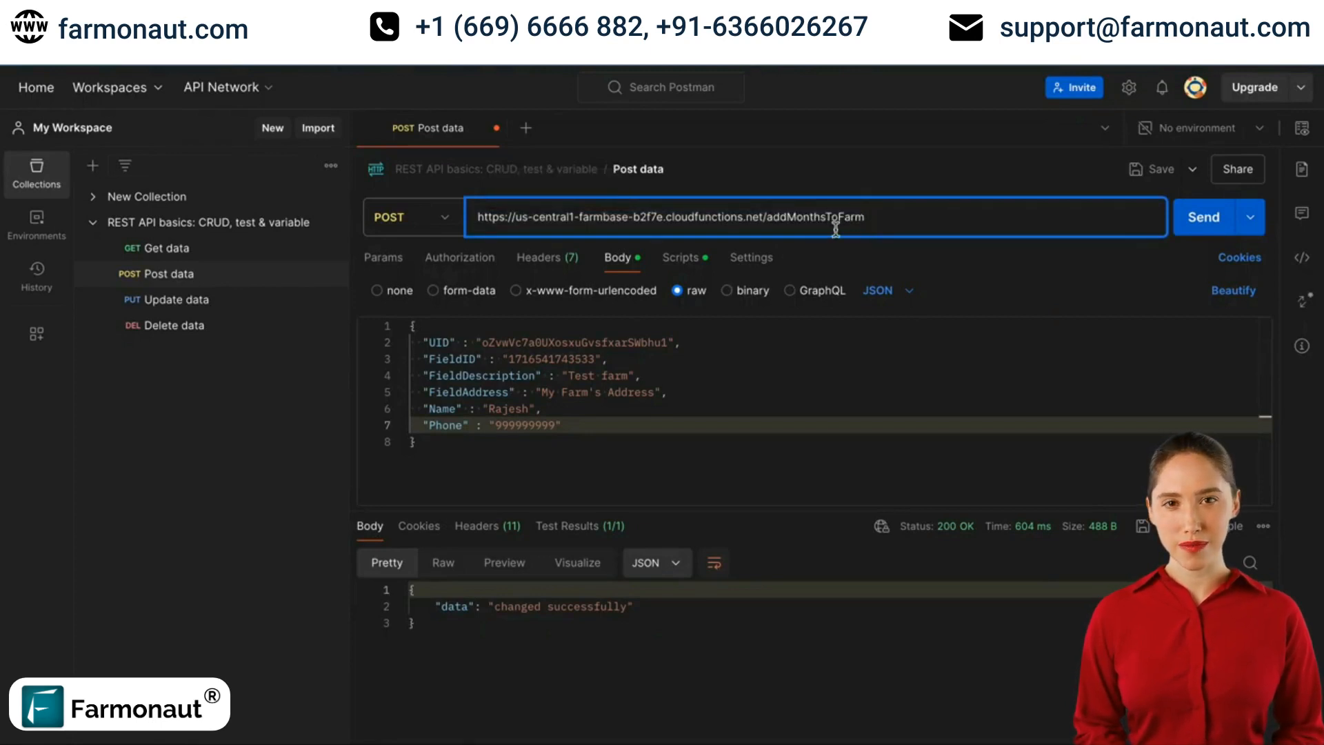
One of the key features of Farmonaut’s satellite data API is the ability to extend your monitoring period. Here’s how you can add extra months to your existing satellite monitoring subscription:
- Locate the “add extra months” endpoint in the API documentation.
- Use a POST request to the endpoint URL.
- Provide the required details in the request object: UID, field ID, and number of months.
- Send the request to increase the monitoring period.
This flexibility allows you to adapt your monitoring schedule to your specific crop cycles and farming needs, ensuring you’re not paying for unnecessary coverage.
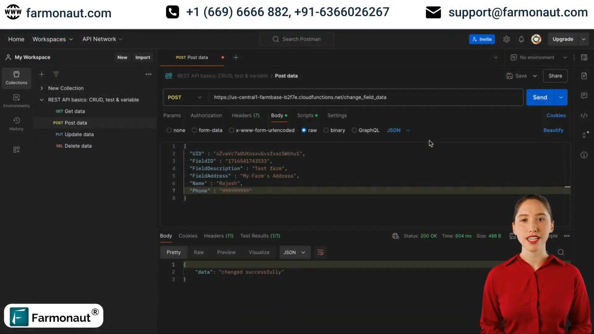
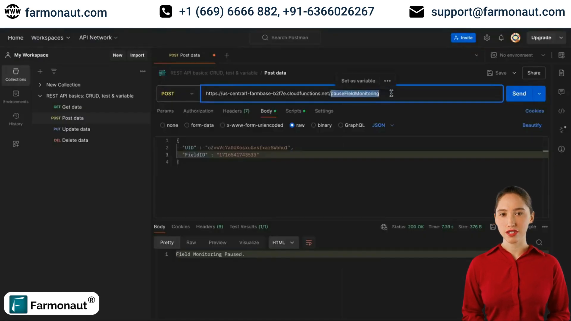
Pausing Satellite Monitoring
Sometimes, you may need to temporarily halt your satellite monitoring. Farmonaut’s satellite images API makes this process simple:
- Find the “pause monitoring” endpoint in the API documentation.
- Use a POST request with the endpoint URL.
- Include the necessary data: UID and field ID.
- Send the request to pause the monitoring.
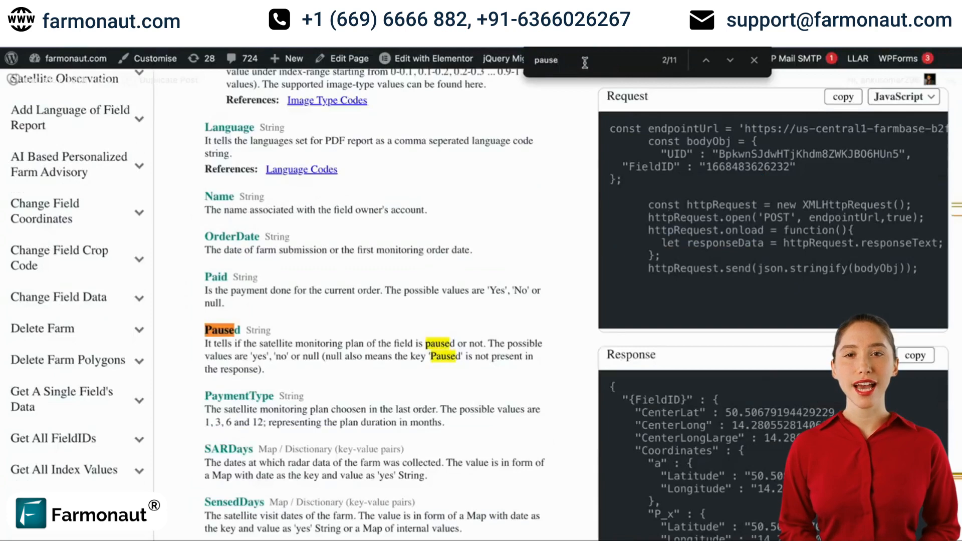
This feature is particularly useful for seasonal crops or during fallow periods, allowing you to conserve your subscription and resume monitoring when needed.
Resuming Satellite Monitoring
When you’re ready to start monitoring your fields again, Farmonaut’s satellite imagery API has got you covered:
- Locate the “resume monitoring” endpoint in the API documentation.
- Use a POST request with the endpoint URL.
- Provide the required data: UID and field ID.
- Send the request to resume the monitoring.
This seamless process ensures that you can quickly reactivate your monitoring when your crops are back in the ground or when you need to start tracking field conditions again.
The Impact on Agriculture
The flexibility offered by Farmonaut’s free satellite imagery API is transforming how farmers manage their operations. By allowing users to easily adjust their monitoring schedules, this technology addresses one of the main challenges in agriculture: the dynamic nature of crop cycles and seasonal variations.
For example, a wheat farmer in Kansas can now pause monitoring during the winter months and resume in spring, optimizing their subscription and ensuring they have access to crucial data during the growing season. This level of control not only saves money but also allows for more targeted and effective farm management strategies.
Conclusion
Farmonaut’s free satellite imagery API is more than just a tool – it’s a revolution in farm management. By providing the ability to add, pause, and resume satellite monitoring, it offers unparalleled flexibility and control over your agricultural data.
Whether you’re a small family farm or a large agribusiness, integrating this satellite data API into your operations can lead to significant improvements in crop yield, resource management, and overall farm productivity. Embrace the future of farming with Farmonaut’s innovative solution and stay ahead in the competitive world of agriculture.
FAQs
Q: How often is satellite imagery updated using Farmonaut’s API?
A: Satellite imagery is typically updated every 3-5 days, depending on weather conditions and satellite availability.
Q: Can I use this API for multiple fields?
A: Yes, you can manage satellite monitoring for multiple fields using unique field IDs for each.
Q: Is there a limit to how many times I can pause and resume monitoring?
A: There are no set limits, but it’s recommended to use these features judiciously to maintain consistent data collection.
Q: How does this API integrate with other farm management software?
A: Farmonaut’s API is designed to be easily integrated with most farm management software through standard API calls.
Q: What type of satellite data is provided through this API?
A: The API provides various types of data including NDVI (Normalized Difference Vegetation Index), soil moisture levels, and crop health indicators.
