API vs WMS: Best InSAR Data Access for Agriculture
Table of Contents
- Introduction
- Understanding InSAR in Modern Agriculture
- Why API vs WMS: Best Ways to Access InSAR Data for Large-Scale Projects?
- API Access: Unlocking InSAR Data for Agriculture
- WMS Access: Leveraging InSAR Maps in Agricultural Systems
- Comparative Feature Table: API vs WMS for InSAR in Agriculture
- Choosing the Most Efficient InSAR Data Access Methods for Large-Scale Operations
- Farmonaut’s Role: Advanced InSAR Data Access in Agriculture
- Real-World InSAR Use Cases in Agriculture (2025 & Beyond)
- FAQ: API vs WMS for InSAR Data in Agriculture
- Conclusion: Accessing InSAR Data for Sustainable Agriculture
- Try Farmonaut: InSAR Apps & Services
- Farmonaut API Subscription Plans
Introduction
In the context of modern agriculture, seamless access to timely, accurate geospatial data has become crucial for keeping productivity high and resources managed sustainably. Among the emerging tools in agricultural monitoring, Interferometric Synthetic Aperture Radar (InSAR) stands out as a powerful technology that offers critical insights into soil moisture variations, crop stress, and land deformation over large areas.
However, with InSAR data often spanning hundreds or even thousands of hectares for large-scale agricultural projects, the efficiency of data access methods becomes a pivot – it can mean the difference between streamlined farm management and missed opportunities for yield and resource optimization.
Two prominent approaches have emerged:
API (Application Programming Interface) and WMS (Web Map Service). But which is the best way to access InSAR data for large-scale projects in the ever-evolving landscape of agriculture 2025 and beyond?
In this blog, we’ll provide a comprehensive, side-by-side comparison of API vs WMS: Best Ways to Access InSAR Data for Large-Scale Projects, evaluating their strengths, limitations, integration methods, and automation possibilities, with a focus on their use in agriculture.
Whether you’re an agronomist, farm manager, or technology professional, this guide will help you make informed decisions and unlock the full value of your InSAR data.
Understanding InSAR in Modern Agriculture
What is InSAR?
Interferometric Synthetic Aperture Radar (InSAR) is an advanced radar-based remote sensing technology that uses signals from satellites to detect and measure minute changes in land elevation or surface deformation by analyzing phase differences between repeated radar images of the same region.
- Radar signals: Penetrate vegetation and even soil, unaffected by clouds – ideal for continuous monitoring.
- Sensitive detection: Detects changes of just a few millimeters, making it invaluable for agriculture where irrigation-induced soil changes and subsidence impact crop and land health.
InSAR: Advantages for the Modern Farm
- Early detection of ground subsidence or irrigation-driven shifts before visible crop damage emerges.
- Measure soil moisture variations and water retention—key to optimizing irrigation and yield.
- Monitor root zone stability and identify terrain shifts that may affect crop health.
- Track long-term land deformation for sustainability and infrastructure planning.
With more farming operations stretching across large areas, the need to efficiently access, analyze, and act on InSAR data is greater than ever.
Modern farm management systems, such as those used by major agricultural businesses across continents, now rely on automated data pipelines and near real-time insights. The right methods and platforms for retrieving and integrating InSAR datasets determine whether organizations stay ahead in a competitive, technology-driven landscape.
Why API vs WMS: Best Ways to Access InSAR Data for Large-Scale Projects?
Understanding how API and WMS fit into agricultural projects is the first step toward maximizing the benefits of satellite-driven insights.
- API (Application Programming Interface): Provides direct, programmatic access to raw data and value-added InSAR datasets. Enables custom integration, automation, and advanced analysis.
- WMS (Web Map Service): Delivers InSAR data as visual layers (images/maps) for use within GIS platforms—ideal for rapid visualization, overlays, and field assessments.
Both APIs and WMS have strengths and limitations. Choosing the optimal approach—or blending both—allows agricultural professionals to harness the full advantage of InSAR data for improved productivity, risk management, and sustainability.
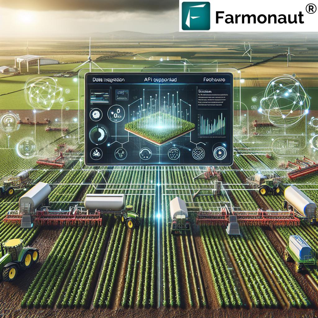
API Access: Unlocking InSAR Data for Agriculture
APIs form the backbone of advanced data-driven agricultural operations in 2025. Through custom APIs, users can interact with vast repositories of raw or processed InSAR data—enabling flexible, automated, and scalable data access methods tailored to each farm’s or project’s unique needs.
How APIs Work for InSAR Data Access
- Programmatic Interfaces: APIs enable applications and users (with or without technical programming expertise by using appropriate software) to query, filter, and retrieve specific InSAR datasets directly from the source.
- Data Formats: Commonly delivered as GeoTIFF, NetCDF, or JSON – ideal for integration with GIS software, farm management platforms, or machine learning models.
- Automation and Integration: APIs can be part of automated workflows—feeding real-time analysis to decision support systems, irrigation controllers, and crop health monitoring solutions.
API Advantages in Agricultural Management
- Scalability & Flexibility: Bulk retrieval of InSAR data for large-scale agricultural projects (spanning hundreds to thousands of hectares).
- Customization: Fine-tune queries based on regions, timeframes, radar passes, or specific phenomena (e.g., only significant soil deformation events).
- Advanced analytics: Feed high-resolution datasets into ML models, custom analysis scripts, or GIS platforms for in-depth trend analysis, anomaly detection, or yield prediction.
- Automation and Integration: Link satellite-based insights to farm management systems, irrigation controls, and crop advisory software for seamless, real-time decisions.
- Raw and Processed Data: Retrieve data in raw or custom-processed forms—supporting both GIS professionals and business analysts.
API Challenges and Considerations
- Technical Expertise: API usage often requires basic programming skills or specialized software to automate and process requests.
- Data Volume & Storage: Retrieving large datasets (including raw radar images and analytical maps) demands adequate storage and sometimes server infrastructure for processing.
If your organization is ready to invest in automation, data-driven decision making, and custom integration, APIs are the preferred pathway for large-scale agricultural operations seeking to optimize yields, resource use, and sustainability.
When to Use APIs:
- Extensive, multi-farm or multi-region monitoring
- Custom analytics and in-house platforms for managing farm operations
- Real-time, automated workflows for irrigation, crop health, or yield planning
- Integration with external soil, weather, or financial systems
Explore Farmonaut’s Developer API Documentation for integration details and advanced guidance.
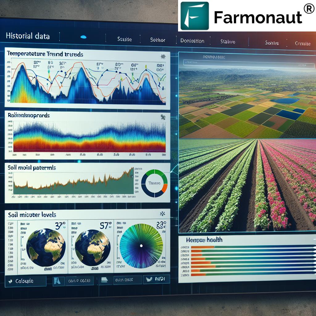
WMS Access: Leveraging InSAR Maps in Agricultural Systems
For agronomists and farm managers who prioritize ease of use and visualization, the Web Map Service (WMS) offers a streamlined way to access InSAR data—without extensive programming or infrastructure investments.
How WMS Works for InSAR Data Visualization
-
Standardized Service: WMS delivers pre-rendered map layers (e.g., PNG, JPEG images) displaying InSAR-derived patterns—such as deformation, soil moisture, or risk indexes—
straight into your preferred GIS software or web viewer. - Layer Overlays: Easily combine InSAR maps with other spatial layers (e.g., crop type, irrigation lines, elevation) for rapid spatial assessments.
- No Programming Required: Access maps via a simple WMS link, without technical expertise—ideal for field teams and non-technical users.
Advantages of WMS for Agricultural Use
- Rapid Visualization: Instantly display large-scale deformation or risk maps for multiple fields – perfect for quick assessments.
- User-Friendly: Accessible to anyone using popular GIS platforms (ArcGIS, QGIS) or browser map viewers, with no coding required.
- Lightweight: Served as images so it reduces storage, download time, and bandwidth compared to raw datasets.
WMS Challenges and Limitations
- Limited Analysis: WMS layers mean users can see the pattern, but cannot access detailed numeric data for statistical or ML analysis.
- Less Automation: Integrating WMS into automated systems is complex compared to APIs.
- Service Reliability: WMS depends on the provider’s server—outages or slowdowns can affect timely decision-making during critical agricultural periods.
When to Use WMS:
- Field assessments—overlaying InSAR data with parcel maps for various regions
- Sharing actionable visual insights with large farm teams or decision-makers
- Cases where technical expertise or advanced software is lacking
Tip: In large-scale operations, WMS layers are often used for initial surveys or dissemination, before moving to API-driven workflows for analysis and integration.
Comparative Feature Table: API vs WMS for InSAR in Agriculture
| Criteria | API | WMS |
|---|---|---|
| Data Access Speed | Near Real-time (typically < 5 min latency) | On-demand Rendering (seconds to minutes, depends on server load) |
| Integration Complexity | Moderate (basic programming or software knowledge required) | Low (simply input WMS URL in GIS or browser app) |
| Supported Applications | Custom Dashboards, Automated Systems, Analytics Pipelines, App Integrations | GIS Platforms (e.g., ArcGIS, QGIS), Web Map Viewers |
| Visualization Flexibility | High (raw data for custom visualizations, analytics, overlays) | Medium (pre-rendered layers, limited custom styling) |
| Scalability for Large Projects | Excellent – supports bulk, automated, multi-region retrieval (hundreds of fields/regions) | Good – can visualize multiple large farms but not optimized for mass raw data extraction |
| Typical Data Download Size | High (100–500+ MB per field/region for raw data) | Low (5–25 MB per visual layer image) |
| Cost Efficiency | $$ (depends on volume and API subscription) | $ (charged per rendered maps/layers, generally less for basic needs) |
| Data Manipulation | Full access for advanced analytics & custom reports | Limited, image-only (no access to underlying pixel values) |
| Automation Possibilities | Excellent (can schedule, trigger, and feed data into any digital workflow) | Minimal (primarily manual step for map display) |
Choosing the Most Efficient InSAR Data Access Methods for Large-Scale Operations
The ideal data access method for extensive agricultural projects hinges on your project scale, technical resources, and desired level of automation.
-
For deep, automated analytics and detailed management:
APIs are best for large-scale farms managing hundreds of fields, integrating with decision support systems, irrigation platforms, and advanced business tools. -
For accessible mapping and rapid field assessments:
WMS is the practical approach for visual insights—allowing agronomists to overlay InSAR layers with other GIS information without dealing with raw data or programming.
Increasingly, hybrid approaches combine both strengths—using WMS for initial visualization and outreach, then API integration for operational decision-making and data-driven automation.
Farmonaut’s Role: Advanced InSAR Data Access in Agriculture
At Farmonaut, we believe that advanced satellite data access should be affordable, scalable, and simple-to-integrate—empowering farmers, agronomists, and agricultural businesses worldwide.
- Our platform supports both API and visual map access (web, Android, iOS apps), so users can choose the best fit for their needs and technical capabilities.
- For power users and tech-driven agricultural entities, our API enables robust InSAR data automation, integration with farm management systems, and scalable analytics across vast projects.
- Our application interfaces (Android/iOS/web) leverage WMS-style layers and interactive visualization for easy-assessment and actionable views without programming.
Whether you’re seeking soil monitoring, real-time field mapping, or blockchain-based crop traceability, our solutions let you efficiently access InSAR datasets, make informed decisions, and manage resources sustainably.
Explore specialized Farmonaut solutions:
- Large-scale Farm Management Platform – Manage, monitor, and analyze hundreds of farm fields with InSAR, NDVI, and other satellite indices. Integrates directly with our APIs for enterprise-level applications.
- Blockchain-Based Product Traceability – Ensure transparency from field to fork with satellite-verified supply chain authentication, leveraging both map and data-driven verification tools.
- Satellite-Backed Crop Loan and Insurance Verification – Aid agricultural financing and risk mitigation with real-time InSAR-based monitoring of crops and lands.
- Carbon Footprinting for Agriculture – Monitor, report, and optimize your farm’s carbon emissions using multi-sensor earth observation data (including InSAR).
- Fleet Management in Agriculture – Combine spatial farm data with logistics optimization for machinery, reducing operational costs and emissions.
Our API documentation helps users, developers, and researchers quickly integrate Farmonaut InSAR data and geospatial services into their own workflows and platforms.
Real-World InSAR Use Cases in Agriculture (2025 & Beyond)
1. Soil Deformation and Irrigation Monitoring
By monitoring ground deformation with InSAR, large-scale farms can anticipate soil subsidence caused by over-irrigation or excessive groundwater extraction. APIs allow for automatic alerts and integration with irrigation management systems, streamlining risk mitigation.
2. Crop Health and Stress Detection
Detect areas of terrain shifts or water retention changes that may signal early crop disease or root stress. API-driven analytics offer customizable statistical maps to overlay with other indices (e.g., NDVI).
3. Field Mapping and Resource Planning
Use WMS visualization to rapidly assess surface changes across a region of 10,000+ hectares. Useful for field teams making on-the-ground resource allocation decisions.
4. Advanced Risk Assessment for Insurance and Financing
Automated API integration supports crop loan and insurance verification—delivering transparent, satellite-backed risk evaluations to lenders and insurers across large agricultural portfolios.
5. Environmental Compliance and Sustainable Management
Combine InSAR data (from APIs or WMS) with carbon footprinting tools to monitor and report sustainability metrics required by governments and industry bodies.
The future of agricultural management demands the capacity to analyze, automate, and communicate large volumes of geospatial data – making the choice of API vs WMS access more critical than ever.
FAQ: API vs WMS for InSAR Data in Agriculture
Q1: What is the difference between API and WMS for accessing InSAR data?
API offers direct, programmatic access to raw or processed datasets, suitable for automation, advanced analysis, and integration within custom management systems. WMS delivers visual map layers (images) for use in GIS tools, perfect for quick field visualization but limited in data manipulation and automation.
Q2: Which method is better for large-scale agricultural projects?
For large, data-driven projects with in-house technical expertise, API is often considered the best way due to its scalability and integration capability. For rapid map assessments or when technical resources are limited, WMS is effective for visualization.
Q3: Can I combine API and WMS in my agricultural operations?
Yes, many organizations use both: WMS for initial spatial surveys and dissemination, and API for automated, detailed analysis and operational decisions.
Q4: What are the main technical challenges in handling API-accessed InSAR data?
The primary challenges include data volume management (large downloads), programming expertise, and ensuring appropriate storage and processing power for raw datasets.
Q5: How does Farmonaut help with advanced InSAR data access?
We provide both a robust API for automated and integrated analytics as well as easy-to-use applications (web, Android, iOS) for visualization and field management—backed by satellite, AI, and blockchain technologies.
Try Farmonaut: InSAR Apps & Services
Begin accessing advanced InSAR data for your agricultural projects today. Use our apps for visualization or our API for programmatic integration.


Conclusion: Accessing InSAR Data for Sustainable Agriculture
As we move further into the era of technology-driven agriculture, API vs WMS: Best Ways to Access InSAR Data for Large-Scale Projects is no longer just a technical choice – it’s a strategic imperative for maximizing crop productivity, resource use, and sustainable practices.
APIs remain the top choice for advanced, automated, and custom-integrated farm management across vast territories—enabling data-rich approaches that push the boundaries of modern agriculture. WMS, meanwhile, democratizes access to InSAR data by empowering all users—even without programming or geospatial expertise—to overlay, assess, and share vital radar insights at speed.
By understanding both approaches and aligning them with your project scale and management systems, you can effectively harness InSAR data for a thriving, future-ready agricultural operation.
Ready to experience the future of sustainable, tech-powered farming?
Access Farmonaut’s InSAR-powered agricultural solutions today.
Farmonaut API Subscription Plans